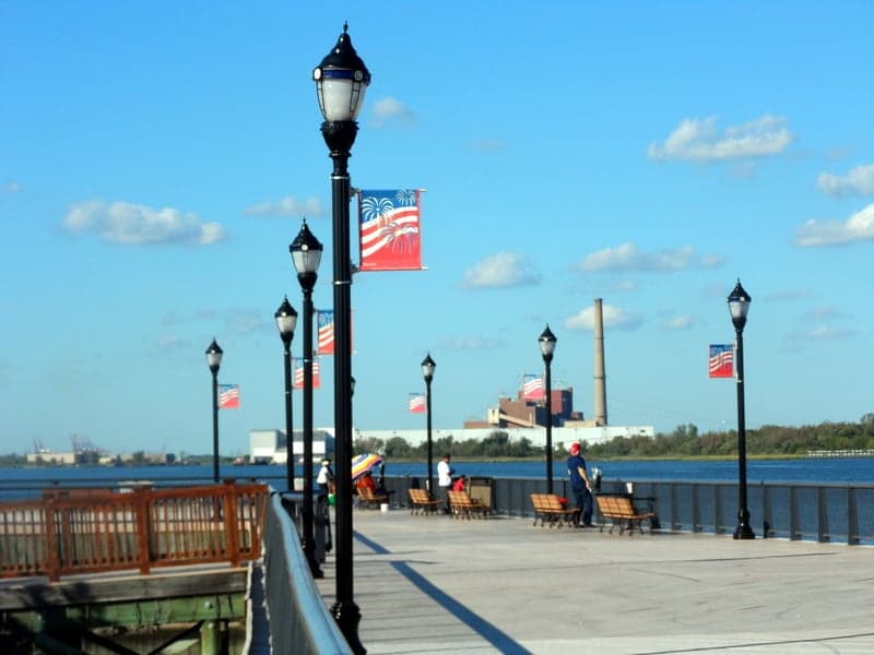
Photo: Wikipedia
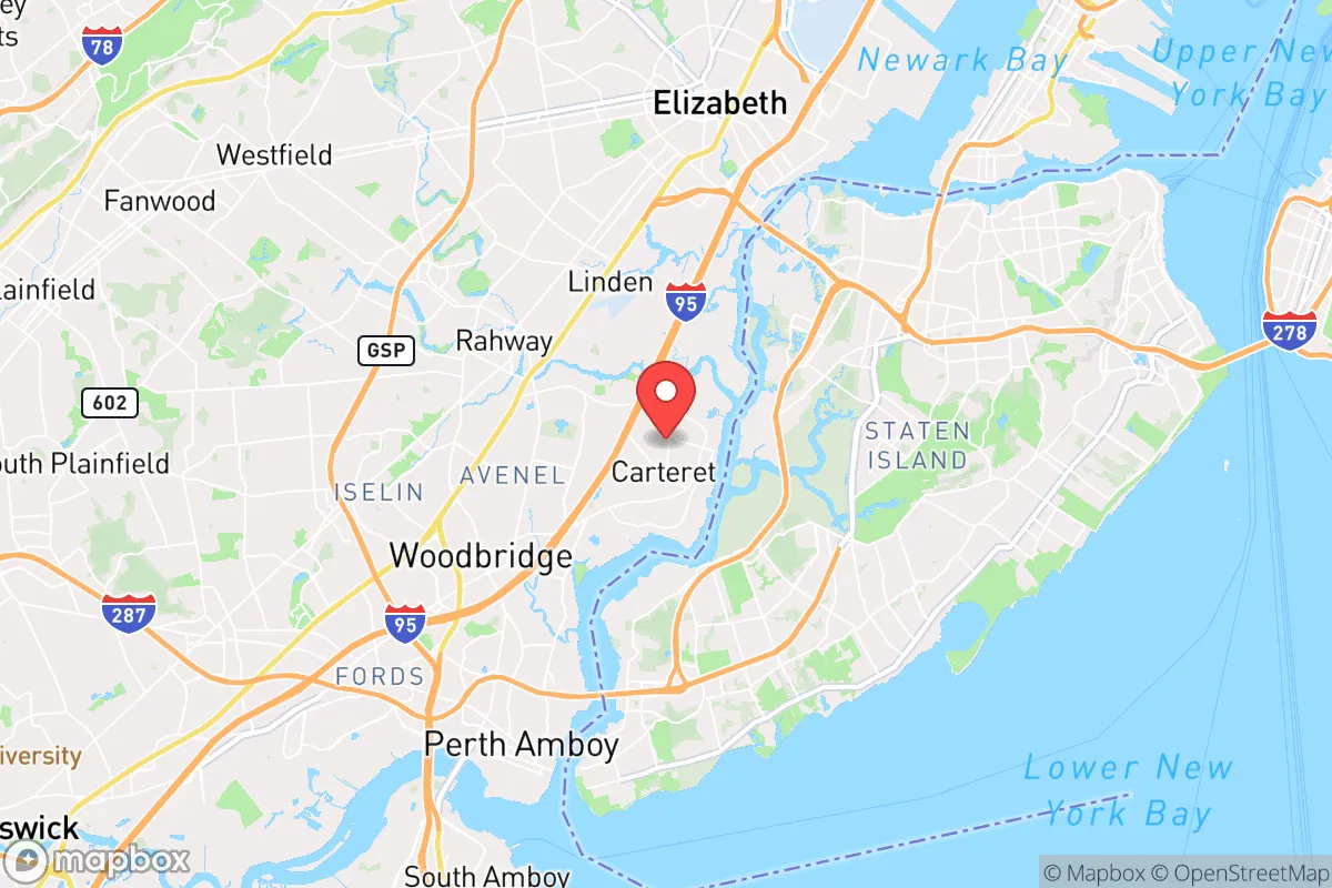
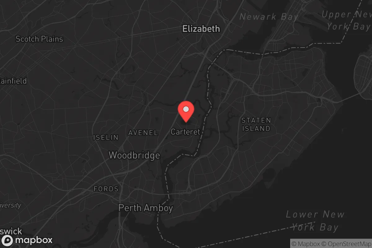
Strategic Assessment of Carteret, NJ
High tactical risk. This location is likely close to major population centers, strategic targets, or sits in a high-disaster corridor. A retreat property and careful exit planning is required.
What does the Strategic Assessment tell us?
Our Strategic Assessment grades tactical survivability of an area. Major population centers, military targets, fallout zones, natural disasters, and border exposure all drive risk — lower exposure means a more defensible position in a crisis.
This is heavily inspired by Joel Skousen's Strategic Relocation book. Highly recommended you checkout the book ($)What does this tell us?
Our Strategic Assessment grades tactical survivability of an area. Major population centers, military targets, fallout zones, natural disasters, and border exposure all drive risk — lower exposure means a more defensible position in a crisis.
This is heavily inspired by Joel Skousen's Strategic Relocation book. Highly recommended you checkout the book ($)Strategic Pillars

Key Distances
Regional Safe Places
Below is our recommended "safe zones" in New Jersey and the surrounding area based on our strategic heuristics. For most people, it's unrealistic to live in a “safe zone” full-time due to work, family or other personal reasons. They tend to be more rural. However, many of these areas are perfect for second homes and retreat properties that double as a vacation home or even a short-term rental.


Important Note: For informational purposes only. This does not mean nothing bad ever happens in the green zones. Please use common sense. This is based on public data and modeled with AI. We tried to take a conservative approach but mistakes happen. We update this regularly as new information becomes available.
Solar Generator Recommendations
Backup power matters more here than in safer locations. We've picked three solar generators across budgets and capacity tiers — start with the budget unit if you only need a few essentials, or step up if you want to run a fridge and HVAC for days at a time.

Jackery Portable Power Station Explorer 300
Budget OptionPower on the Go: Weighing only 11 lbs, it's convenient to set up and store with book-sized foldable solar panels

BLUETTI Portable Power Station AC180
Designed for both indoor and outdoor scenarios, AC180 is highly capable as it has a robost capacity and continuous output power.

EF ECOFLOW DELTA Pro Ultra Power Station
Upgraded PickEcoFlow DELTA Pro Ultra is a whole-home energy system designed to grow with your family. Integrated with the Smart Home Panel 2, it scales to meet your evolving energy needs — keeping your home powered, intelligent, and secure through every stage of life.
We earn a commission, at no additional cost to you.
Strategic Assessment Analysis
Carteret, New Jersey, sits in a precarious but potentially strategic position for those serious about resilience. Its location along the Arthur Kill waterway and within the New York metropolitan area presents a paradox: proximity to immense resources and infrastructure, but also to the highest-concentration target zone on the Eastern Seaboard. For a relocator with a prepper mindset, the calculus here is about leveraging the area's industrial and logistical strengths while fully acknowledging the risks that come with being a stone's throw from Newark, Elizabeth, and the Port of New York and New Jersey. The key question isn't whether Carteret is a bunker—it's not—but whether its specific advantages can be exploited before the balloon goes up.
Geographic position and natural advantages for a prepper
Carteret's geography is defined by its waterfront on the Arthur Kill, a tidal strait separating New Jersey from Staten Island. This waterway is a double-edged sword: it provides a potential evacuation route by boat (if you have the means and the tide is right) and access to the Raritan Bay and the Atlantic beyond. The area is flat, coastal plain, which means no natural high-ground defensibility, but it does offer decent drainage compared to inland swampy zones. The soil is sandy loam, which is workable for gardening if you can secure a plot away from the industrial corridors. The real natural advantage is the proximity to the Raritan River and the Arthur Kill's tidal marshes, which could serve as a source of fish and shellfish in a prolonged disruption—though you'd want to test for heavy metals and industrial runoff before relying on them. The climate is temperate, with four distinct seasons, meaning you can grow cool-weather crops in spring and fall, but you'll need to plan for winter food storage. The area's flat terrain also makes it relatively easy to move on foot or by bicycle if fuel becomes scarce, but it offers zero concealment from aerial observation or ground-based threats.
Risks, exposures, and proximity to fallout-relevant landmarks
This is where the analysis gets sobering. Carteret is less than 5 miles from Newark Liberty International Airport and the Port Newark–Elizabeth Marine Terminal, the busiest container port on the East Coast. In a major conflict or terrorist event, these are Tier-1 targets. A single nuclear detonation at the port would put Carteret well within the lethal fallout zone, depending on wind direction. The nearby Bayway Refinery in Linden (one of the largest oil refineries on the East Coast) and the Linden Cogeneration Plant are also high-value industrial targets. A conventional attack or sabotage at these facilities could release toxic clouds or cause cascading fires. Furthermore, Carteret lies directly under the approach path to Newark Liberty, meaning any airborne threat (drones, missiles, hijacked aircraft) would pass overhead. The Arthur Kill itself is a major shipping channel for hazardous materials, including LNG and chemicals, making a maritime accident or deliberate blockage a real concern. For a prepper, the concentration of critical infrastructure within a 10-mile radius is a liability, not an asset. The only mitigating factor is that Carteret is not a primary population center itself—it's a small borough of about 25,000 people—so it might be overlooked in a first-strike scenario, but the secondary effects from nearby targets would be unavoidable.
Practical resilience for a relocator: food, water, energy, and defensibility
Let's get tactical. Water: Carteret's municipal water comes from the Elizabethtown Water Company, which draws from the Raritan River and the Delaware & Raritan Canal. In a grid-down scenario, that supply is vulnerable to contamination and pump failure. The Arthur Kill is brackish and polluted, not potable without reverse osmosis or distillation. You would need to secure a private well or have a robust rainwater catchment system—and even then, the industrial air quality means you'd want to filter for particulates. Food: The area has some community gardens and small farms in neighboring Woodbridge and Edison, but Carteret itself is mostly residential and industrial. You'd need to establish a home garden or join a local CSA, but the soil quality is questionable due to historical industrial use. Energy: The grid is reliable in normal times, but the area is prone to nor'easters and occasional hurricane remnants that can knock out power for days. Solar panels are viable (the area gets about 200 sunny days per year), but you'd need battery storage and a generator backup for winter storms. Defensibility: This is the weak point. Carteret is a dense, flat, suburban grid with no natural chokepoints. The streets are laid out in a standard pattern, making it easy for outsiders to navigate. The New Jersey Turnpike (I-95) and Route 1/9 run right through the area, meaning any mass evacuation from New York or Newark would funnel traffic directly past your front door. In a civil unrest scenario, you'd be on the main artery of movement. The best you can do is fortify a single-family home with reinforced doors, window bars, and a secure perimeter, and have a pre-planned bug-out route south or west toward less populated areas like the Pine Barrens or the Delaware Water Gap. The local police force is small (about 50 officers), so you cannot rely on them for sustained protection in a breakdown.
The overall strategic picture for Carteret is one of calculated risk. It offers genuine logistical advantages—access to water transport, proximity to major highways and rail lines, and a position within a dense economic zone that could be leveraged for barter and supply in the early stages of a crisis. But those same advantages make it a high-probability secondary target and a chokepoint for human traffic during any evacuation or unrest. For a single individual or a family willing to invest heavily in hardening a home, maintaining a low profile, and having a solid bug-out plan, Carteret could work as a temporary base—especially if you have a boat and can use the Arthur Kill as an escape route. But for anyone seeking long-term, self-sufficient resilience away from population centers and critical infrastructure, this is not the place. The conservative prepper's verdict: passable as a staging area, but not a final redoubt. If you're serious about riding out the storm, look further inland, away from the ports, refineries, and the shadow of Newark's runways.
* Values derived from national, state, county, city and local statistics and may differ in a specific area. Last updated: 2026-04-24T20:23:10.000Z
Narrative content on this page is AI-generated and may contain mistakes. Verify any details that matter before acting on them.
ReloMaps may earn a commission from affiliate links at no extra cost to you.