Photo: Wikipedia
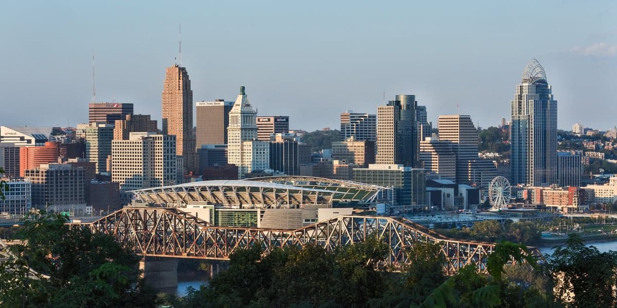
Strategic Assessment of Cincinnati, OH
Multiple tactical vulnerabilities. Population density, target proximity, or disaster risk are likely compounding. A retreat property and exit planning is required.
What does the Strategic Assessment tell us?
Our Strategic Assessment grades tactical survivability of an area. Major population centers, military targets, fallout zones, natural disasters, and border exposure all drive risk — lower exposure means a more defensible position in a crisis.
This is heavily inspired by Joel Skousen's Strategic Relocation book. Highly recommended you checkout the book ($)What does this tell us?
Our Strategic Assessment grades tactical survivability of an area. Major population centers, military targets, fallout zones, natural disasters, and border exposure all drive risk — lower exposure means a more defensible position in a crisis.
This is heavily inspired by Joel Skousen's Strategic Relocation book. Highly recommended you checkout the book ($)Strategic Pillars

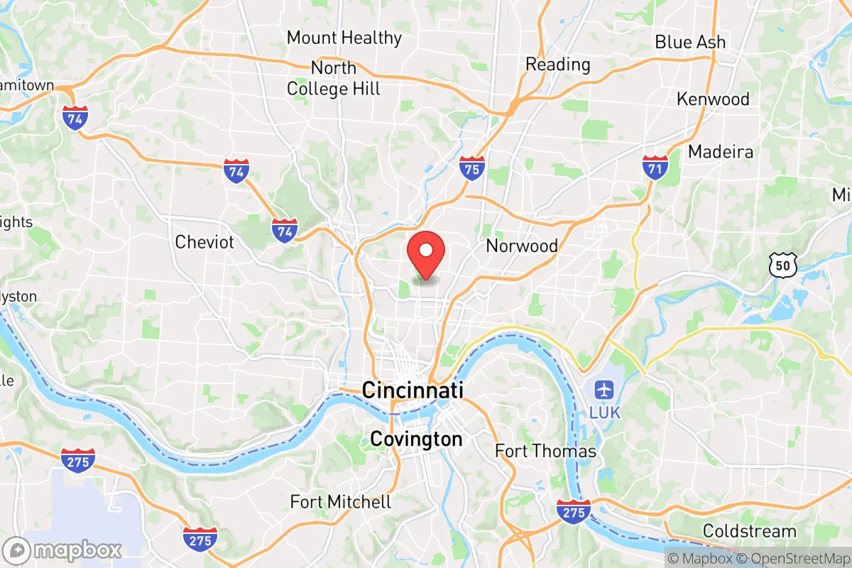
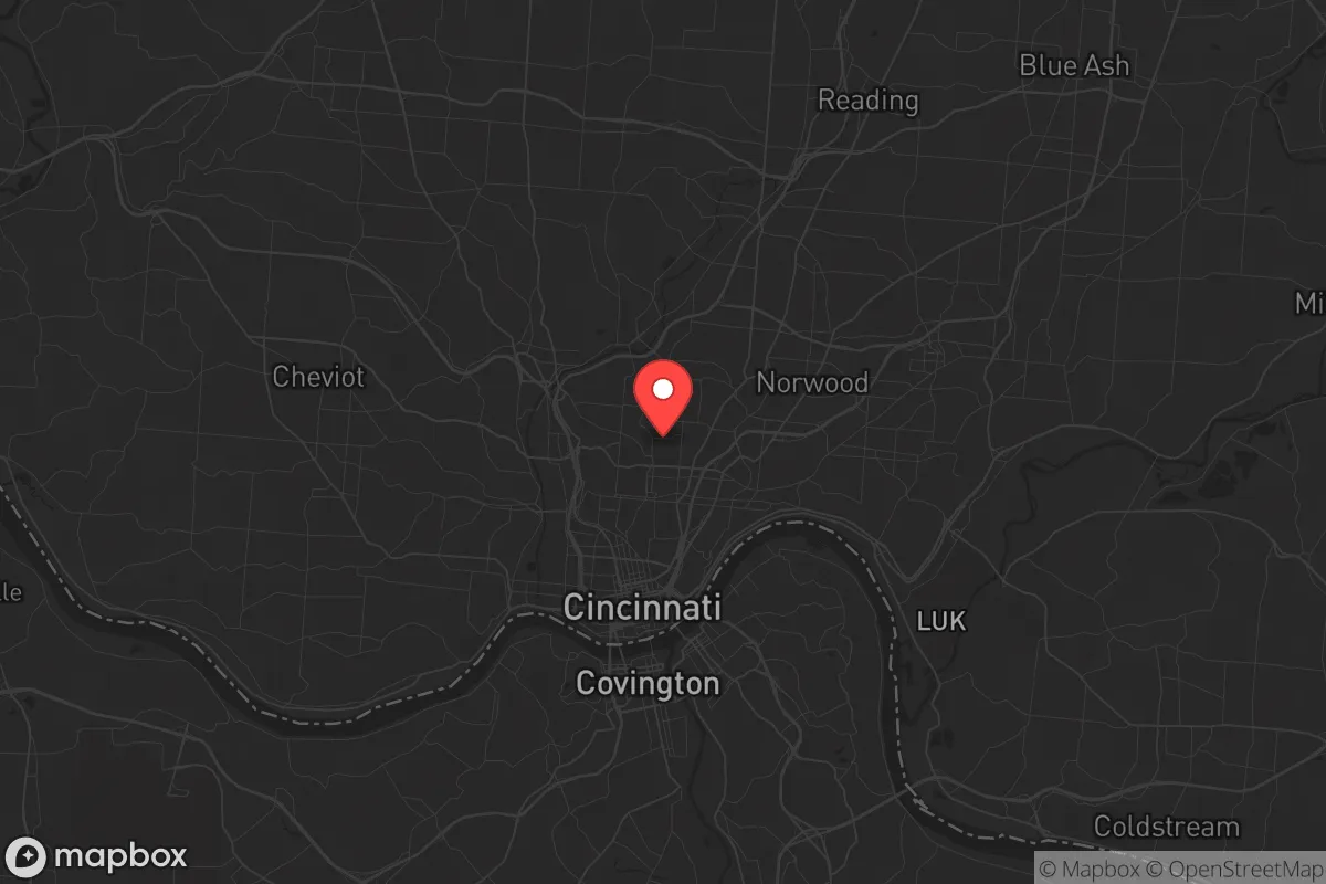
Key Distances
Regional Safe Places
Below is our recommended "safe zones" in Ohio and the surrounding area based on our strategic heuristics. For most people, it's unrealistic to live in a “safe zone” full-time due to work, family or other personal reasons. They tend to be more rural. However, many of these areas are perfect for second homes and retreat properties that double as a vacation home or even a short-term rental.

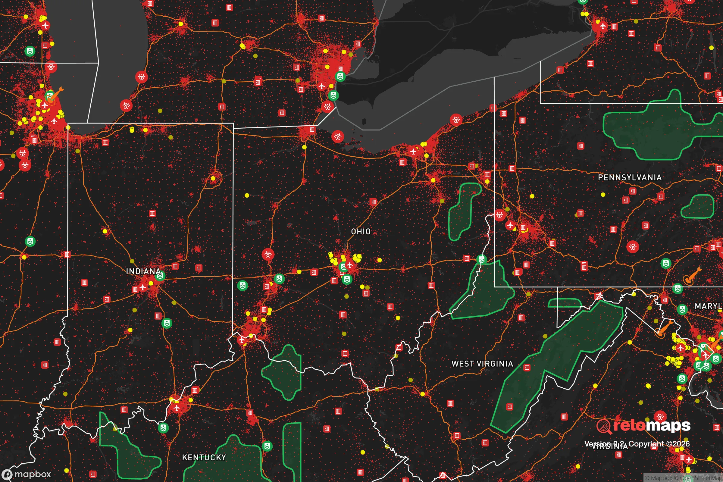
Important Note: For informational purposes only. This does not mean nothing bad ever happens in the green zones. Please use common sense. This is based on public data and modeled with AI. We tried to take a conservative approach but mistakes happen. We update this regularly as new information becomes available.
Solar Generator Recommendations
Backup power matters more here than in safer locations. We've picked three solar generators across budgets and capacity tiers — start with the budget unit if you only need a few essentials, or step up if you want to run a fridge and HVAC for days at a time.

Jackery Portable Power Station Explorer 300
Budget OptionPower on the Go: Weighing only 11 lbs, it's convenient to set up and store with book-sized foldable solar panels

BLUETTI Portable Power Station AC180
Designed for both indoor and outdoor scenarios, AC180 is highly capable as it has a robost capacity and continuous output power.

EF ECOFLOW DELTA Pro Ultra Power Station
Upgraded PickEcoFlow DELTA Pro Ultra is a whole-home energy system designed to grow with your family. Integrated with the Smart Home Panel 2, it scales to meet your evolving energy needs — keeping your home powered, intelligent, and secure through every stage of life.
We earn a commission, at no additional cost to you.
Strategic Assessment Analysis
Cincinnati, Ohio, occupies a strategic position that balances Midwestern stability with access to critical infrastructure, but its proximity to major population centers and industrial targets introduces significant vulnerabilities for those focused on long-term preparedness. The city sits along the Ohio River, a natural barrier and transportation artery, while its location in southwestern Ohio places it roughly equidistant from Chicago, Indianapolis, Columbus, and Louisville—making it a potential hub for both supply chains and evacuation routes. However, for the survival-minded relocator, the real question isn't just about convenience; it's about whether this area offers genuine resilience against the cascading failures of civil unrest, economic collapse, or mass casualty events. The answer is mixed: Cincinnati has real advantages in water access and regional food production, but it also carries risks tied to its industrial legacy and proximity to high-value targets that could draw fallout or secondary chaos.
Geographic position and natural advantages for long-term survival
Cincinnati's geography is defined by the Ohio River, which provides a reliable, year-round freshwater source—a critical asset when municipal water systems fail or become contaminated. The surrounding region sits atop the Ohio River Valley Aquifer, one of the more productive groundwater systems in the Midwest, and the area's rolling hills and limestone bedrock offer natural drainage and defensible terrain. The city itself is built on a series of hills—Mount Adams, Price Hill, Mount Auburn—which provide elevated vantage points and natural chokepoints for anyone needing to control movement or observe surroundings. The climate is temperate, with four distinct seasons, meaning growing seasons are long enough for serious gardening or small-scale farming, and the region receives about 40 inches of rainfall annually, reducing reliance on irrigation. For a relocator thinking about food security, the surrounding counties—Clermont, Warren, and Brown—are still agricultural, with corn, soybeans, and livestock operations that could be tapped in a crisis. The Ohio River also connects to the Mississippi River system, offering a potential waterborne trade or escape route that avoids congested highways.
Risks, exposures, and proximity to fallout-relevant landmarks
The biggest liability for Cincinnati is its industrial and military proximity. The city is within 50 miles of the Portsmouth Gaseous Diffusion Plant (a former uranium enrichment site) and within 100 miles of the Fernald Preserve (a former uranium processing facility), both of which are legacy Cold War sites that could become secondary targets or contamination zones in a major conflict. The Cincinnati/Northern Kentucky International Airport (CVG) is a major cargo hub for Amazon and DHL, making it a likely target for disruption or attack during widespread unrest. The city itself hosts the Procter & Gamble global headquarters, multiple chemical plants along the Ohio River, and the University of Cincinnati Medical Center—a Level I trauma center that would become a magnet for casualties and chaos during a mass casualty event. Interstate highways I-71, I-75, and I-74 converge here, creating natural chokepoints that could be blocked by civil unrest or military checkpoints. The Brent Spence Bridge, a critical Ohio River crossing, is functionally obsolete and a single-point failure for north-south evacuation. For the prepper, the risk isn't just direct attack—it's that Cincinnati's role as a regional logistics hub means it will be a focal point for government response, refugee flows, and resource competition during any national emergency.
Practical resilience for a relocator: food, water, energy, and defensibility
For someone actually moving here with a preparedness mindset, the practical picture is about choosing the right location within the metro area. The urban core—downtown, Over-the-Rhine, Covington—is a liability: dense population, limited green space, and heavy reliance on grid infrastructure. The suburbs and exurbs to the east and north offer better options. Areas like Milford, Loveland, and Lebanon sit on higher ground with more acreage, and many older homes have basements, wells, and septic systems that reduce dependency on municipal services. The region's electricity comes primarily from coal and natural gas plants (Duke Energy), with some nuclear from the nearby William H. Zimmer Station—a mix that is relatively stable but vulnerable to grid-wide failures. For off-grid energy, the area gets about 200 sunny days per year, making solar viable but not optimal; small-scale wind is possible on ridgetops but not in valleys. Water is the strong suit: the Ohio River is a massive resource, but it's also heavily polluted from industrial runoff and upstream sewage, meaning any surface water collection requires robust filtration (reverse osmosis or distillation). The local food scene is decent for a Midwestern city—there are dozens of farmers' markets, and the Ohio Valley is known for heirloom produce and livestock—but the growing season is only about 170 days, so cold storage and canning are essential for winter. Defensibility varies by neighborhood: the hilltop communities offer natural observation points, but the river valleys create funnel points for movement. A rural property in Brown County or Clermont County, with a well, a garden, and a woodlot, is the most defensible option within a 45-minute drive of the city's resources.
The overall strategic picture for Cincinnati is one of calculated trade-offs. It is not a remote survivalist paradise—it is a major Midwestern city with all the vulnerabilities that entails. But for someone who wants to stay connected to regional infrastructure while maintaining a prepared lifestyle, the surrounding counties offer a rare combination of water abundance, agricultural land, and defensible terrain that is hard to find in other metro areas of similar size. The key is to avoid the urban core and the industrial riverfront, and instead focus on the hilltop exurbs where you can establish a self-sufficient property within striking distance of medical care, hardware stores, and trade networks. Cincinnati's resilience comes from its geography and its people—a historically pragmatic, working-class population that is less likely to panic than coastal elites—but its risks are real and tied directly to its role as a logistics and industrial hub. If you're looking for a place to ride out the coming storms while still having access to a functioning economy, Cincinnati is worth a serious look. Just don't buy a house within sight of the Brent Spence Bridge.
* Values derived from national, state, county, city and local statistics and may differ in a specific area. Last updated: 2026-04-21T22:54:56.000Z
Narrative content on this page is AI-generated and may contain mistakes. Verify any details that matter before acting on them.
ReloMaps may earn a commission from affiliate links at no extra cost to you.