Photo: Wikipedia
Strategic Assessment of Claremont, NH
Meaningful friction. Expect exposure to either population pressure, blast zones, or natural disaster risk. Consider buying a retreat property.
What does the Strategic Assessment tell us?
Our Strategic Assessment grades tactical survivability of an area. Major population centers, military targets, fallout zones, natural disasters, and border exposure all drive risk — lower exposure means a more defensible position in a crisis.
This is heavily inspired by Joel Skousen's Strategic Relocation book. Highly recommended you checkout the book ($)What does this tell us?
Our Strategic Assessment grades tactical survivability of an area. Major population centers, military targets, fallout zones, natural disasters, and border exposure all drive risk — lower exposure means a more defensible position in a crisis.
This is heavily inspired by Joel Skousen's Strategic Relocation book. Highly recommended you checkout the book ($)Strategic Pillars

Key Distances
Regional Safe Places
Below is our recommended "safe zones" in New Hampshire and the surrounding area based on our strategic heuristics. For most people, it's unrealistic to live in a “safe zone” full-time due to work, family or other personal reasons. They tend to be more rural. However, many of these areas are perfect for second homes and retreat properties that double as a vacation home or even a short-term rental.


Important Note: For informational purposes only. This does not mean nothing bad ever happens in the green zones. Please use common sense. This is based on public data and modeled with AI. We tried to take a conservative approach but mistakes happen. We update this regularly as new information becomes available.
Solar Generator Recommendations
Backup power matters more here than in safer locations. We've picked three solar generators across budgets and capacity tiers — start with the budget unit if you only need a few essentials, or step up if you want to run a fridge and HVAC for days at a time.

Jackery Portable Power Station Explorer 300
Budget OptionPower on the Go: Weighing only 11 lbs, it's convenient to set up and store with book-sized foldable solar panels

BLUETTI Portable Power Station AC180
Designed for both indoor and outdoor scenarios, AC180 is highly capable as it has a robost capacity and continuous output power.

EF ECOFLOW DELTA Pro Ultra Power Station
Upgraded PickEcoFlow DELTA Pro Ultra is a whole-home energy system designed to grow with your family. Integrated with the Smart Home Panel 2, it scales to meet your evolving energy needs — keeping your home powered, intelligent, and secure through every stage of life.
We earn a commission, at no additional cost to you.
Strategic Assessment Analysis
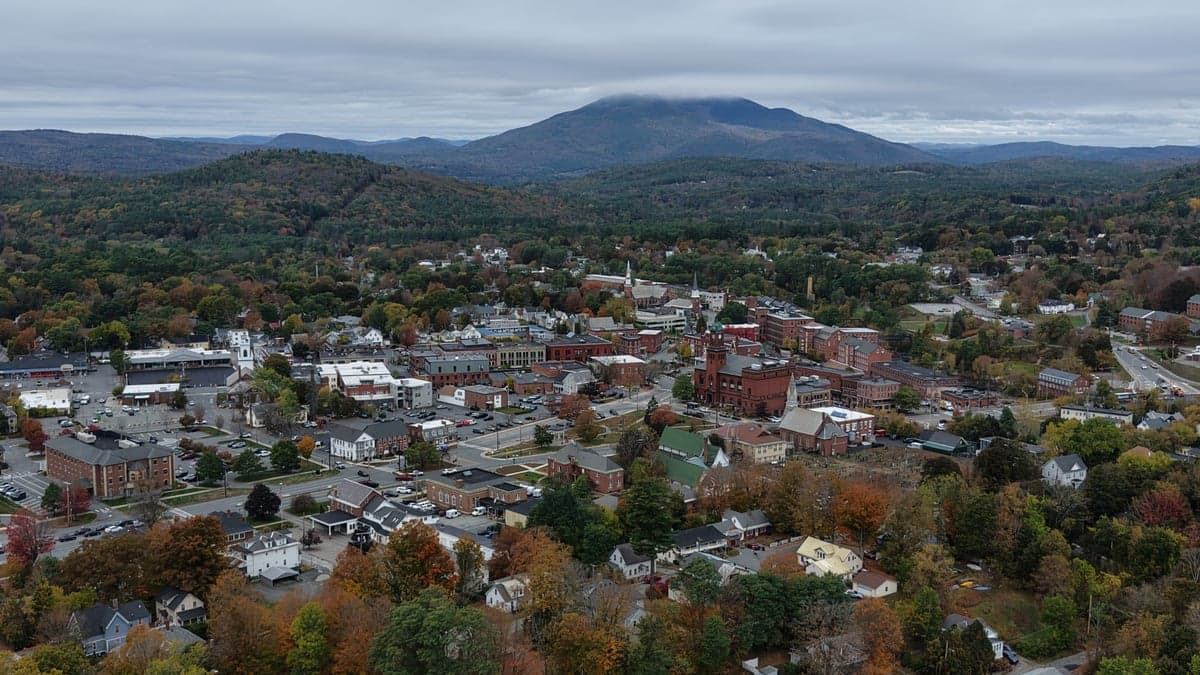
Claremont, New Hampshire, sits in a sweet spot that few relocation analysts fully appreciate: close enough to the economic spine of the Northeast to matter, but far enough from the blast zones and population centers that most preppers rightly avoid. This former mill town on the Connecticut River offers a blend of geographic insulation, water access, and low-density living that makes it a serious candidate for anyone thinking about long-term resilience. The key question isn't whether Claremont can survive a crisis — it's whether you can build a life there that works before one hits.
Geographic position and natural advantages for long-term stability
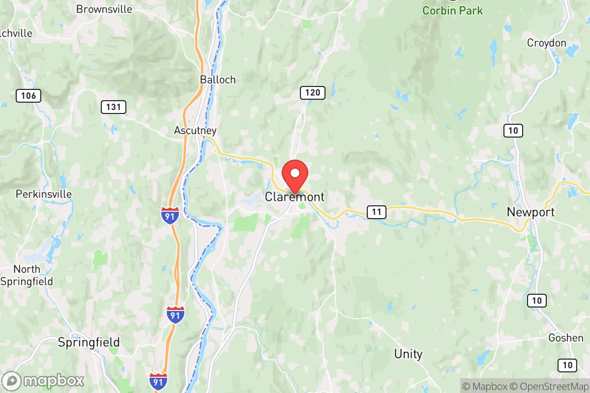
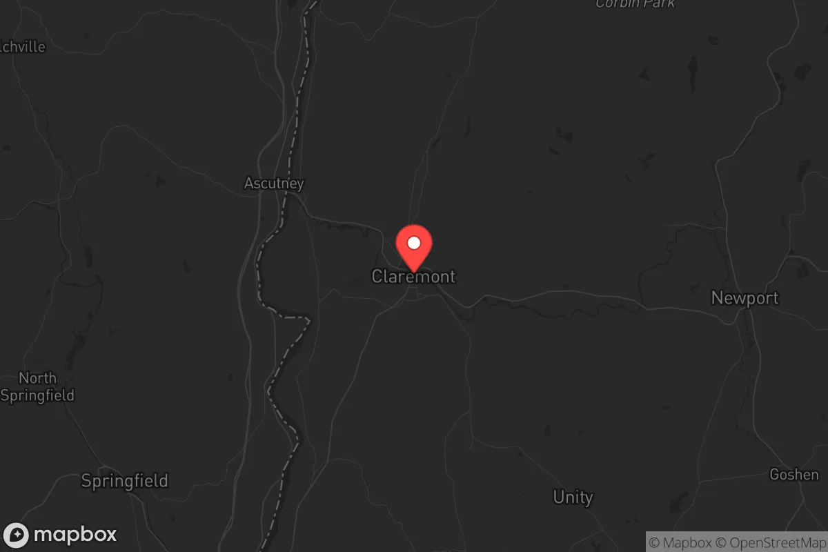
Claremont’s location is its strongest card. It sits in Sullivan County, roughly 40 miles northwest of Concord and 50 miles south of the White Mountain National Forest. The Connecticut River forms its western border, providing a reliable freshwater source that doesn't depend on municipal infrastructure alone. The surrounding terrain is a mix of rolling hills, second-growth forest, and small farms — not the dramatic peaks of the Whites, but enough elevation and tree cover to offer natural screening and defensible positions. The area sits outside the 50-mile radius of any major city that would be a primary target in a national security scenario. Boston is about 100 miles southeast; Manchester is 50 miles east; no major military installations, nuclear plants, or government continuity sites are within immediate fallout range. The soil is thin but workable in the river valley, and the growing season runs roughly May through September — short, but sufficient for cold-hardy crops like potatoes, squash, and root vegetables. The region's history as a self-sufficient mill town means the bones of local industry (water power, rail access, machine shops) still exist, even if the textile mills themselves are long gone.
Risks, exposures, and proximity to fallout-relevant landmarks
No location is risk-free, and Claremont has vulnerabilities that a serious relocator needs to weigh. The most obvious is the Connecticut River itself: while it provides water, it also creates a floodplain. The 2023 flooding from heavy rains caused significant damage in parts of Claremont and neighboring towns, and climate models suggest more intense precipitation events are likely. That means any property purchase should be above the 100-year flood line, and road access should have multiple egress routes that don't depend on a single bridge. The second risk is the I-91 corridor on the Vermont side of the river. That highway is a major north-south artery, and in a crisis, it could become a chokepoint or a vector for displaced populations moving away from Boston and Hartford. Claremont itself sits at the junction of NH Route 12 and 103, which are two-lane roads — easy to block, hard to bypass if you don't know the back routes. On the positive side, there are no nuclear power plants within 75 miles (the closest is Vermont Yankee, decommissioned and defueled, about 30 miles north). No major military bases, no ICBM silos, no federal continuity-of-government bunkers. The nearest significant target would be the Portsmouth Naval Shipyard, about 100 miles east, or the Boston metro area. Fallout risk from a limited exchange is low, but not zero — prevailing winds would carry fallout from a Boston strike eastward, not toward Claremont. The bigger concern is secondary effects: refugees, supply chain collapse, and the breakdown of regional medical infrastructure.
Practical resilience for a relocator: food, water, energy, and defensibility
For someone serious about self-sufficiency, Claremont offers a realistic baseline. Water is the easiest win: the Connecticut River is a year-round source, and the water table is high enough that a shallow well (30-60 feet) is feasible on most properties outside the downtown area. Municipal water comes from a reservoir system fed by local streams, but a prepper should never rely on municipal treatment in a crisis. A hand pump or solar-powered well pump, plus a Berkey or similar gravity filter, covers the basics. Food is more complicated. The growing season is short, and the soil in the hills is rocky and acidic. Raised beds, greenhouses, and soil amendment are necessary for serious production. The local agricultural scene is small but present: there are a handful of CSAs, farmers' markets, and small livestock operations within a 15-minute drive. For long-term storage, the dry climate (relative to coastal New England) helps, but humidity in the river valley can be an issue in summer. A root cellar or insulated basement is a smart investment. Energy is a mixed picture. Claremont is on the Eversource grid, which is reliable by rural standards but vulnerable to ice storms and wind events. Solar potential is moderate — about 4.2 peak sun hours per day, comparable to much of New England. A grid-tied system with battery backup (or a generator for winter) is the standard recommendation. Wood heat is the real ace in the hole: the surrounding forests provide ample fuel, and a wood stove or outdoor boiler can handle heating and cooking without grid dependence. Defensibility is about terrain and community, not walls. The hills and winding roads make it hard for large groups to move through the area quickly. The local population is roughly 13,000, with a median age around 43 — not a young, transient crowd, but a mix of long-term residents, retirees, and working-class families. That demographic tends to be self-reliant and suspicious of outsiders, which is a double-edged sword: you'll be left alone, but you won't get help unless you've built relationships. The local police department is small (about 20 officers), and the county sheriff's office covers the rural areas. In a prolonged crisis, law enforcement presence would thin out fast. Your security plan should rely on your own perimeter, not on a 911 call.
The overall strategic picture for Claremont is one of moderate risk and moderate reward. It's not a bug-out location in the remote wilderness sense — you can't disappear into the woods and live off the land indefinitely. But it's also not a suburban trap where you're dependent on a grocery store and a gas station. What Claremont offers is a defensible, water-rich position with enough local infrastructure to support a transition to self-sufficiency, provided you put in the work before things go sideways. The biggest wildcard is the community itself: it's a working-class town with a history of economic struggle, and that creates both resilience (people know how to fix things and make do) and friction (drug problems, limited healthcare, aging housing stock). For a conservative-leaning relocator who values independence, low taxes, and a no-nonsense culture, Claremont is worth a serious look. Just don't expect it to save you — expect it to give you a fighting chance.
* Values derived from national, state, county, city and local statistics and may differ in a specific area. Last updated: 2026-04-19T05:08:20.000Z
Narrative content on this page is AI-generated and may contain mistakes. Verify any details that matter before acting on them.
ReloMaps may earn a commission from affiliate links at no extra cost to you.