
Photo: Wikipedia
Strategic Assessment of Clarksburg, WV
Meaningful friction. Expect exposure to either population pressure, blast zones, or natural disaster risk. Consider buying a retreat property.
What does the Strategic Assessment tell us?
Our Strategic Assessment grades tactical survivability of an area. Major population centers, military targets, fallout zones, natural disasters, and border exposure all drive risk — lower exposure means a more defensible position in a crisis.
This is heavily inspired by Joel Skousen's Strategic Relocation book. Highly recommended you checkout the book ($)What does this tell us?
Our Strategic Assessment grades tactical survivability of an area. Major population centers, military targets, fallout zones, natural disasters, and border exposure all drive risk — lower exposure means a more defensible position in a crisis.
This is heavily inspired by Joel Skousen's Strategic Relocation book. Highly recommended you checkout the book ($)Strategic Pillars

Key Distances
Regional Safe Places
Below is our recommended "safe zones" in West Virginia and the surrounding area based on our strategic heuristics. For most people, it's unrealistic to live in a “safe zone” full-time due to work, family or other personal reasons. They tend to be more rural. However, many of these areas are perfect for second homes and retreat properties that double as a vacation home or even a short-term rental.


Important Note: For informational purposes only. This does not mean nothing bad ever happens in the green zones. Please use common sense. This is based on public data and modeled with AI. We tried to take a conservative approach but mistakes happen. We update this regularly as new information becomes available.
Solar Generator Recommendations
Backup power matters more here than in safer locations. We've picked three solar generators across budgets and capacity tiers — start with the budget unit if you only need a few essentials, or step up if you want to run a fridge and HVAC for days at a time.

Jackery Portable Power Station Explorer 300
Budget OptionPower on the Go: Weighing only 11 lbs, it's convenient to set up and store with book-sized foldable solar panels

BLUETTI Portable Power Station AC180
Designed for both indoor and outdoor scenarios, AC180 is highly capable as it has a robost capacity and continuous output power.

EF ECOFLOW DELTA Pro Ultra Power Station
Upgraded PickEcoFlow DELTA Pro Ultra is a whole-home energy system designed to grow with your family. Integrated with the Smart Home Panel 2, it scales to meet your evolving energy needs — keeping your home powered, intelligent, and secure through every stage of life.
We earn a commission, at no additional cost to you.
Strategic Assessment Analysis
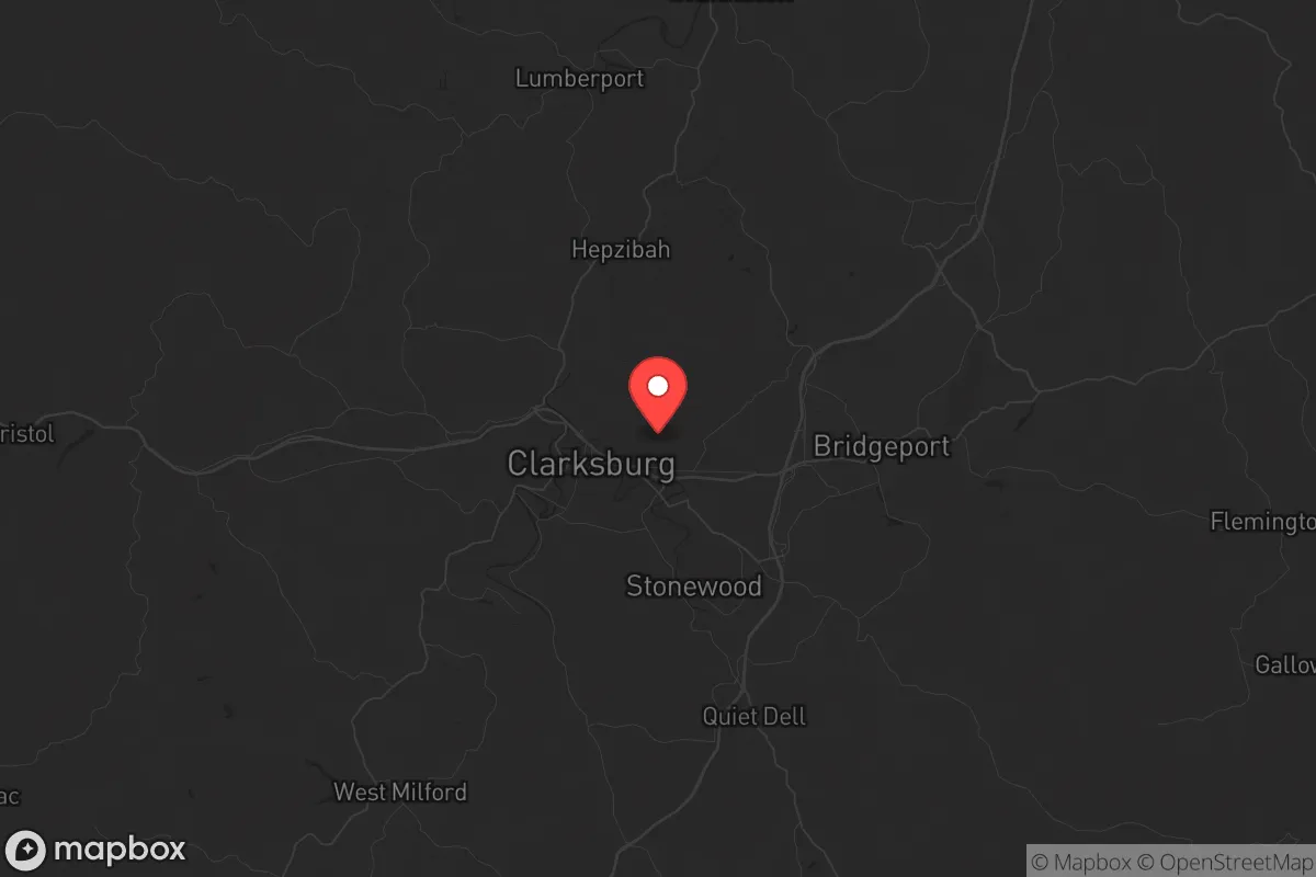
Clarksburg, West Virginia, sits in a geographic sweet spot that offers genuine strategic depth for those thinking seriously about long-term resilience. Tucked into the Appalachian foothills along the I-79 corridor, this small city of roughly 16,000 people provides a rare combination: meaningful distance from major population centers, robust infrastructure from its energy and manufacturing history, and a topography that naturally filters both threats and access. For a relocator weighing civic unrest, supply chain disruptions, or large-scale disasters, Clarksburg presents a defensible base of operations that doesn't require going completely off-grid to maintain a decent quality of life.
Geographic position and natural advantages for long-term security
Clarksburg's location is its primary strategic asset. It sits roughly 90 miles south of Pittsburgh and 120 miles north of Charleston, placing it well outside the blast radius and immediate fallout zones of any major city target. The surrounding terrain is rolling hills and narrow valleys, which naturally limit line-of-sight and create chokepoints on the few major roads—I-79 and US-50. This makes the area inherently more defensible than flat, open country. The region sits atop the Appalachian Plateau, with abundant groundwater and numerous small creeks and rivers feeding into the West Fork River. The local climate is temperate, with four distinct seasons and annual rainfall around 45 inches, which supports reliable agriculture without the extreme weather risks of the Plains or Gulf Coast. The area's elevation—roughly 1,000 feet—keeps it above most floodplain concerns while still being low enough to avoid the harsh winters of higher Appalachian peaks. For a prepper, this means a workable growing season, manageable heating costs, and natural water sources that don't require deep drilling.
Risks, exposures, and proximity to fallout-relevant landmarks
No location is without vulnerabilities, and Clarksburg has a few that demand attention. The most obvious is the presence of the FBI's Criminal Justice Information Services (CJIS) Division, a massive data center and training facility just south of town. While this brings federal employment and economic stability, it also makes Clarksburg a potential target for any adversary seeking to disrupt U.S. law enforcement infrastructure. The facility is hardened, but the surrounding area could see secondary effects from a directed attack. Additionally, the I-79 corridor connects Clarksburg directly to Pittsburgh and Morgantown, home to West Virginia University and a major medical complex. In a mass casualty event or pandemic scenario, this corridor could become a funnel for refugees or a vector for disease spread. The local hospital, WVU Medicine United Hospital Center, is a solid regional facility but would be overwhelmed quickly in a major incident. On the plus side, Clarksburg is far from any nuclear power plants (the nearest is Beaver Valley in Pennsylvania, about 80 miles north), and there are no major chemical or refining facilities nearby. The biggest natural risk is flooding in low-lying areas along the West Fork River, but most residential areas sit on higher ground. Earthquake risk is negligible.
Practical resilience for a relocator: food, water, energy, and defensibility
For someone serious about self-sufficiency, Clarksburg offers a workable foundation. The surrounding county, Harrison, has a strong agricultural base with active farms producing hay, cattle, poultry, and some row crops. The local farmers' market operates seasonally, and there are several small-scale producers within a 20-minute drive who sell meat, eggs, and produce directly. For water, the municipal supply comes from the West Fork River and is treated at the Clarksburg Water Board plant, but a well is a realistic option on most properties outside the city limits—typical depths run 100-200 feet with decent yields. The area's coal and natural gas history means energy infrastructure is robust; the local grid is fed by multiple transmission lines, and natural gas is widely available for heating. For off-grid power, the region gets about 200 sunny days per year, making solar viable with battery backup, and the wooded terrain provides ample biomass for heating. Defensibility is good: the hills and hollows create natural barriers, and the low population density means you can have meaningful acreage without being isolated. The local gun culture is strong, with several ranges and gun shops in the area, and West Virginia has constitutional carry and strong self-defense laws. The sheriff's office response times in rural parts of the county can be 20-30 minutes, so personal security is a practical necessity, not a theoretical concern.
The overall strategic picture for Clarksburg is one of balanced resilience. It's not a hardened bunker location, nor is it a remote wilderness retreat. What it offers is a middle path: a small city with enough infrastructure to maintain a normal life, embedded in a region that provides natural security and room to maneuver. The proximity to Pittsburgh and Morgantown is a double-edged sword—it gives access to major medical and supply networks, but also introduces risk vectors. For a conservative-leaning relocator who wants to be prepared without living in a constant state of alert, Clarksburg provides a solid base. The key is to buy property with good water access, establish local supply chains with farmers and tradesmen, and maintain situational awareness of the I-79 corridor. Do that, and you've got a position that can weather most storms—both literal and societal.
* Values derived from national, state, county, city and local statistics and may differ in a specific area. Last updated: 2026-04-23T06:06:02.000Z
Narrative content on this page is AI-generated and may contain mistakes. Verify any details that matter before acting on them.
ReloMaps may earn a commission from affiliate links at no extra cost to you.