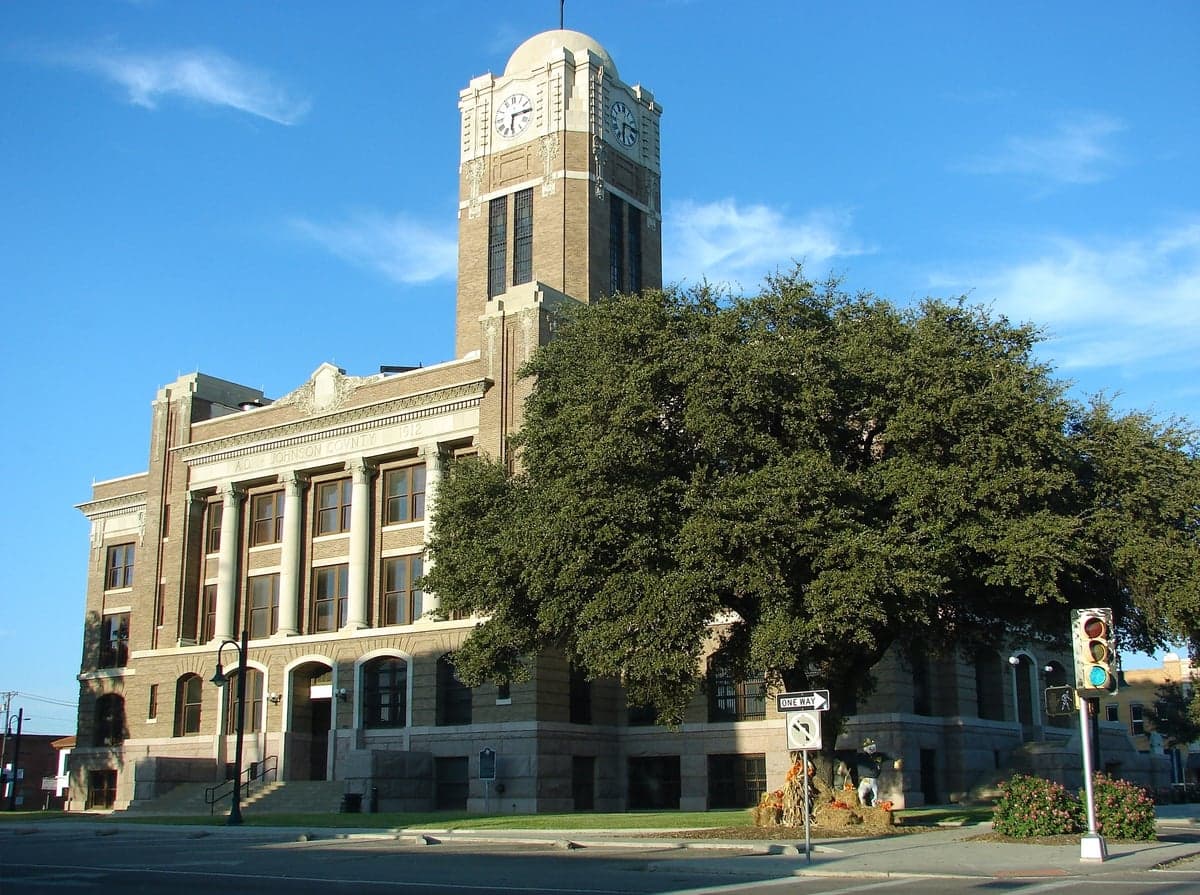
Photo: Wikipedia
Strategic Assessment of Cleburne, TX
Meaningful friction. Expect exposure to either population pressure, blast zones, or natural disaster risk. Consider buying a retreat property.
What does the Strategic Assessment tell us?
Our Strategic Assessment grades tactical survivability of an area. Major population centers, military targets, fallout zones, natural disasters, and border exposure all drive risk — lower exposure means a more defensible position in a crisis.
This is heavily inspired by Joel Skousen's Strategic Relocation book. Highly recommended you checkout the book ($)What does this tell us?
Our Strategic Assessment grades tactical survivability of an area. Major population centers, military targets, fallout zones, natural disasters, and border exposure all drive risk — lower exposure means a more defensible position in a crisis.
This is heavily inspired by Joel Skousen's Strategic Relocation book. Highly recommended you checkout the book ($)Strategic Pillars

Key Distances
Regional Safe Places
Below is our recommended "safe zones" in Texas and the surrounding area based on our strategic heuristics. For most people, it's unrealistic to live in a “safe zone” full-time due to work, family or other personal reasons. They tend to be more rural. However, many of these areas are perfect for second homes and retreat properties that double as a vacation home or even a short-term rental.


Important Note: For informational purposes only. This does not mean nothing bad ever happens in the green zones. Please use common sense. This is based on public data and modeled with AI. We tried to take a conservative approach but mistakes happen. We update this regularly as new information becomes available.
Solar Generator Recommendations
Backup power matters more here than in safer locations. We've picked three solar generators across budgets and capacity tiers — start with the budget unit if you only need a few essentials, or step up if you want to run a fridge and HVAC for days at a time.

Jackery Portable Power Station Explorer 300
Budget OptionPower on the Go: Weighing only 11 lbs, it's convenient to set up and store with book-sized foldable solar panels

BLUETTI Portable Power Station AC180
Designed for both indoor and outdoor scenarios, AC180 is highly capable as it has a robost capacity and continuous output power.

EF ECOFLOW DELTA Pro Ultra Power Station
Upgraded PickEcoFlow DELTA Pro Ultra is a whole-home energy system designed to grow with your family. Integrated with the Smart Home Panel 2, it scales to meet your evolving energy needs — keeping your home powered, intelligent, and secure through every stage of life.
We earn a commission, at no additional cost to you.
Strategic Assessment Analysis
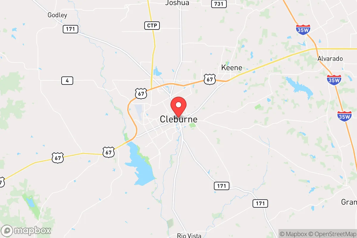
Cleburne, Texas, sits about 30 miles south of Fort Worth in Johnson County, offering a strategic blend of rural buffer and practical access that makes it a serious contender for those prioritizing resilience and self-sufficiency. Its position along the I-35W corridor provides a quick escape route north or south, while the surrounding farmland and rolling hills create natural separation from the denser, more volatile urban cores of Dallas-Fort Worth. For a relocator thinking in terms of long-term stability, Cleburne’s location is not just convenient—it’s defensible, with enough distance from major metro fallout zones to buy critical time in a crisis.
Geographic position and natural advantages for long-term stability
Cleburne sits on the edge of the Cross Timbers region, a transition zone between the Blackland Prairie and the more rugged Hill Country to the south. This geography matters for resilience: the area has decent groundwater access via the Trinity Aquifer, and the nearby Brazos River watershed provides a reliable surface water source, though you’ll want to verify well depths and local water rights before buying. The terrain is gently rolling, with enough tree cover for concealment and windbreaks, but not so rugged that it impedes travel or construction. The climate is typical North Texas—hot summers, occasional ice storms in winter, and a tornado risk that’s real but manageable with a proper storm shelter. Cleburne’s elevation (roughly 770 feet) gives it a slight advantage over lower-lying areas to the east when it comes to flood risk and drainage. The city’s historic downtown sits on a ridge, which also offers decent line-of-sight for observation points if you’re thinking in tactical terms.
Risks, exposures, and proximity to fallout-relevant landmarks
The biggest vulnerability for Cleburne is its proximity to the Dallas-Fort Worth metroplex, a primary target for any large-scale conflict or terrorist event. Cleburne is roughly 30 miles from the core of Fort Worth and about 50 miles from Dallas—close enough that a major detonation or EMP event in the metro would have significant secondary effects. The I-35W corridor would become a choke point for evacuation or supply movement, and the city itself sits within the fallout plume radius for a ground burst at DFW Airport or the major military installations in the region. On the plus side, Cleburne is not near any obvious high-value targets like nuclear power plants (the closest is Comanche Peak, about 60 miles southwest) or major military bases (Naval Air Station Joint Reserve Base Fort Worth is about 35 miles north). The Cleburne Municipal Airport is a general aviation field, not a strategic asset, so it’s unlikely to be a target. The biggest day-to-day risk is actually natural: the area lies in Tornado Alley, and Johnson County has seen its share of severe weather. Flooding along the Nolan River and nearby creeks is a concern for low-lying properties, so check FEMA flood maps before committing to land.
Practical resilience for a relocator: food, water, energy, and defensibility
For someone serious about self-sufficiency, Cleburne offers a workable foundation. Water is the first concern, and the city’s municipal supply comes from Lake Pat Cleburne and the Trinity Aquifer. If you’re on city water, you’re vulnerable to infrastructure failure; a well on your own property is the gold standard here, and many rural parcels outside city limits have them. The soil is a mix of clay and loam, suitable for gardening with amendments, and the growing season runs from March to November—long enough for two crop cycles. Energy resilience is mixed: the local grid is part of the ERCOT system, which has proven unreliable during winter storms (see 2021’s Uri). Solar is viable, with roughly 220 sunny days per year, but you’ll need battery storage and a backup generator for the cloudy stretches. Natural gas is available in town, but rural properties often rely on propane. For defensibility, Cleburne’s layout is a double-edged sword. The city itself is spread out, with single-family homes on large lots in many neighborhoods, which makes perimeter security easier than in dense suburbs. The surrounding unincorporated areas offer even more buffer, with 5- to 20-acre parcels common in places like Rio Vista and Godley. However, the flat to gently rolling terrain means there are few natural chokepoints or high ground positions. A well-placed property with a long driveway, good sightlines, and a reinforced structure is the ideal setup. Local law enforcement is the Johnson County Sheriff’s Office, which covers a large rural area—response times in a crisis could be slow, so community networks and personal preparedness are non-negotiable.
The overall strategic picture for Cleburne is one of cautious optimism for the prepper-minded relocator. It’s not a remote bunker location, but it’s far enough from the metroplex to avoid the worst of a collapse scenario while still being close enough to access resources and medical care in normal times. The trade-off is clear: you trade absolute isolation for practical convenience, and you accept a moderate risk profile in exchange for a lower cost of entry and a more established community infrastructure. Cleburne works best as a base for those who plan to harden a specific property—dig a well, install solar, stock supplies, and build local relationships—rather than as a bug-out location you’ll only visit in emergencies. If you’re willing to put in the work, it’s a solid bet for weathering the next decade’s uncertainties without going completely off-grid. Just don’t expect to be invisible; the I-35 corridor is a highway of potential trouble, and Cleburne sits right on its edge.
* Values derived from national, state, county, city and local statistics and may differ in a specific area. Last updated: 2026-04-18T19:45:08.000Z
Narrative content on this page is AI-generated and may contain mistakes. Verify any details that matter before acting on them.
ReloMaps may earn a commission from affiliate links at no extra cost to you.