Photo: Wikipedia
Strategic Assessment of Cresson, TX
Meaningful friction. Expect exposure to either population pressure, blast zones, or natural disaster risk. Consider buying a retreat property.
What does the Strategic Assessment tell us?
Our Strategic Assessment grades tactical survivability of an area. Major population centers, military targets, fallout zones, natural disasters, and border exposure all drive risk — lower exposure means a more defensible position in a crisis.
This is heavily inspired by Joel Skousen's Strategic Relocation book. Highly recommended you checkout the book ($)What does this tell us?
Our Strategic Assessment grades tactical survivability of an area. Major population centers, military targets, fallout zones, natural disasters, and border exposure all drive risk — lower exposure means a more defensible position in a crisis.
This is heavily inspired by Joel Skousen's Strategic Relocation book. Highly recommended you checkout the book ($)Strategic Pillars

Key Distances
Regional Safe Places
Below is our recommended "safe zones" in Texas and the surrounding area based on our strategic heuristics. For most people, it's unrealistic to live in a “safe zone” full-time due to work, family or other personal reasons. They tend to be more rural. However, many of these areas are perfect for second homes and retreat properties that double as a vacation home or even a short-term rental.


Important Note: For informational purposes only. This does not mean nothing bad ever happens in the green zones. Please use common sense. This is based on public data and modeled with AI. We tried to take a conservative approach but mistakes happen. We update this regularly as new information becomes available.
Solar Generator Recommendations
Backup power matters more here than in safer locations. We've picked three solar generators across budgets and capacity tiers — start with the budget unit if you only need a few essentials, or step up if you want to run a fridge and HVAC for days at a time.

Jackery Portable Power Station Explorer 300
Budget OptionPower on the Go: Weighing only 11 lbs, it's convenient to set up and store with book-sized foldable solar panels

BLUETTI Portable Power Station AC180
Designed for both indoor and outdoor scenarios, AC180 is highly capable as it has a robost capacity and continuous output power.

EF ECOFLOW DELTA Pro Ultra Power Station
Upgraded PickEcoFlow DELTA Pro Ultra is a whole-home energy system designed to grow with your family. Integrated with the Smart Home Panel 2, it scales to meet your evolving energy needs — keeping your home powered, intelligent, and secure through every stage of life.
We earn a commission, at no additional cost to you.
Strategic Assessment Analysis
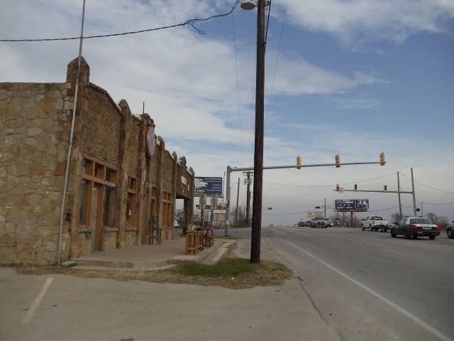
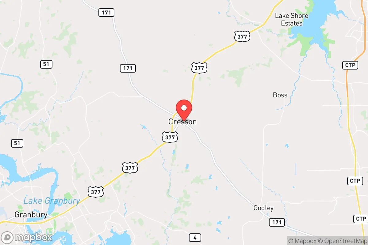
Cresson, Texas, sits in a strategic sweet spot that resilience-minded relocators should take seriously. Located at the intersection of Johnson, Hood, and Parker counties, roughly 30 miles southwest of Fort Worth and 40 miles west of downtown Dallas, this unincorporated community offers genuine distance from major metro centers while remaining close enough to access critical supplies and medical care when needed. The area’s low population density—estimated at under 1,000 residents—combined with its position outside the immediate blast and fallout zones of DFW’s potential targets, makes it a compelling option for those prioritizing long-term survivability over convenience. Cresson’s location along US Highway 377 provides a practical evacuation corridor toward the Hill Country and West Texas, while the surrounding ranchland offers natural buffers against the chaos that would likely engulf urban centers during a crisis.
Geographic position and natural advantages for long-term survival
Cresson’s geography works in its favor on multiple fronts. The area sits on the eastern edge of the Cross Timbers region, characterized by rolling hills, oak and juniper woodlands, and limestone bedrock—terrain that provides natural cover and defensible positions compared to the flat, exposed plains to the west. The elevation hovers around 900 feet, offering slight vantage points over the surrounding countryside without being mountainous enough to hinder travel. Water access is a genuine asset: the Brazos River runs roughly 10 miles to the west, and several smaller creeks and stock ponds dot the private ranches in the area. While Cresson itself lacks a municipal water system, most properties rely on private wells, which means residents aren’t dependent on fragile city infrastructure during a grid-down scenario. The soil is rocky but workable for small-scale food production, and the growing season stretches from March to November, allowing for two planting cycles of staple crops like corn, beans, and squash. For those willing to invest in rainwater catchment and greywater systems, the region’s average 35 inches of annual rainfall provides a renewable water source that many preppers overlook.
Risks, exposures, and proximity to fallout-relevant landmarks
No location is without vulnerabilities, and Cresson has several that demand honest assessment. The most obvious risk is its proximity to the Dallas-Fort Worth metroplex, a high-value target for any adversary capable of launching a nuclear or EMP attack. While Cresson sits outside the likely blast radius for a ground burst on DFW, fallout patterns depend heavily on wind direction. A prevailing southwesterly wind would carry radioactive debris directly over the area within hours. The nearby Naval Air Station Joint Reserve Base Fort Worth (about 25 miles northeast) is a Tier 1 target, as is the Lockheed Martin plant in Fort Worth where F-35s are assembled. Both would likely be hit early in a conflict, creating a secondary hazard zone. Additionally, the Barnett Shale natural gas fields that underpin the local economy mean numerous wellheads, pipelines, and processing facilities scattered across the landscape—any of which could become ignition sources or contamination points during a disaster. The proximity to Interstate 20 (10 miles south) and US 377 also means Cresson would see heavy refugee traffic from Dallas and Fort Worth during an evacuation, potentially turning the area into a chokepoint for desperate, resource-depleted crowds. Flooding is a lesser but real concern along the Brazos River floodplain, particularly during spring storms.
Practical resilience for a relocator: food, water, energy, and defensibility
For a single individual or family serious about self-sufficiency, Cresson offers a workable foundation with some important caveats. Water is the first priority: most properties rely on electric well pumps, which become useless during a prolonged grid outage. A hand pump or solar-powered backup pump is essential, as is a minimum 2,000-gallon rainwater storage system for dry spells. The local water table sits at about 100-200 feet, making hand-pumping feasible but labor-intensive. Food production is viable but requires effort—the rocky soil needs amendment with compost and raised beds, and deer pressure is high, so fencing is non-negotiable. The area supports free-range chickens, goats, and even a few head of cattle on larger parcels, but feed costs and drought risk must be factored in. Energy resilience is achievable: the region averages 220 sunny days per year, making solar a solid investment, though battery storage is necessary for nighttime and cloudy periods. Propane is widely available for backup generation and cooking. Defensibility is mixed—the rolling terrain and tree cover provide concealment, but the lack of natural chokepoints and the presence of multiple access roads (US 377, FM 1189, FM 2331) make it hard to secure a perimeter without significant manpower. A property set back from main roads with a long, gated driveway offers the best chance of controlling access. The local sheriff’s office (Hood County) is small but responsive, though response times would stretch to 30+ minutes during a widespread event. Building a mutual assistance network with neighbors is not optional—it’s survival math.
The overall strategic picture for Cresson is cautiously favorable for the prepared relocator. It offers genuine distance from the worst of urban collapse scenarios while retaining access to the supply chains and medical infrastructure of the DFW area during normal times. The natural water availability, workable growing conditions, and defensible terrain give it a solid baseline for long-term self-sufficiency. But the risks are real: proximity to high-value military and industrial targets, vulnerability to fallout depending on wind patterns, and the likelihood of being overrun by refugees during a mass evacuation. Cresson is not a bug-out location for the weekend warrior—it’s a place for someone willing to invest in deep infrastructure, build community relationships, and accept that no location in the lower 48 is truly safe from the cascading effects of a national crisis. For the conservative-minded relocator who values independence, preparedness, and a buffer from the chaos of the cities, Cresson deserves a serious look, but only with eyes wide open to its limitations.
* Values derived from national, state, county, city and local statistics and may differ in a specific area. Last updated: 2026-04-28T20:26:09.000Z
Narrative content on this page is AI-generated and may contain mistakes. Verify any details that matter before acting on them.
ReloMaps may earn a commission from affiliate links at no extra cost to you.