 Popular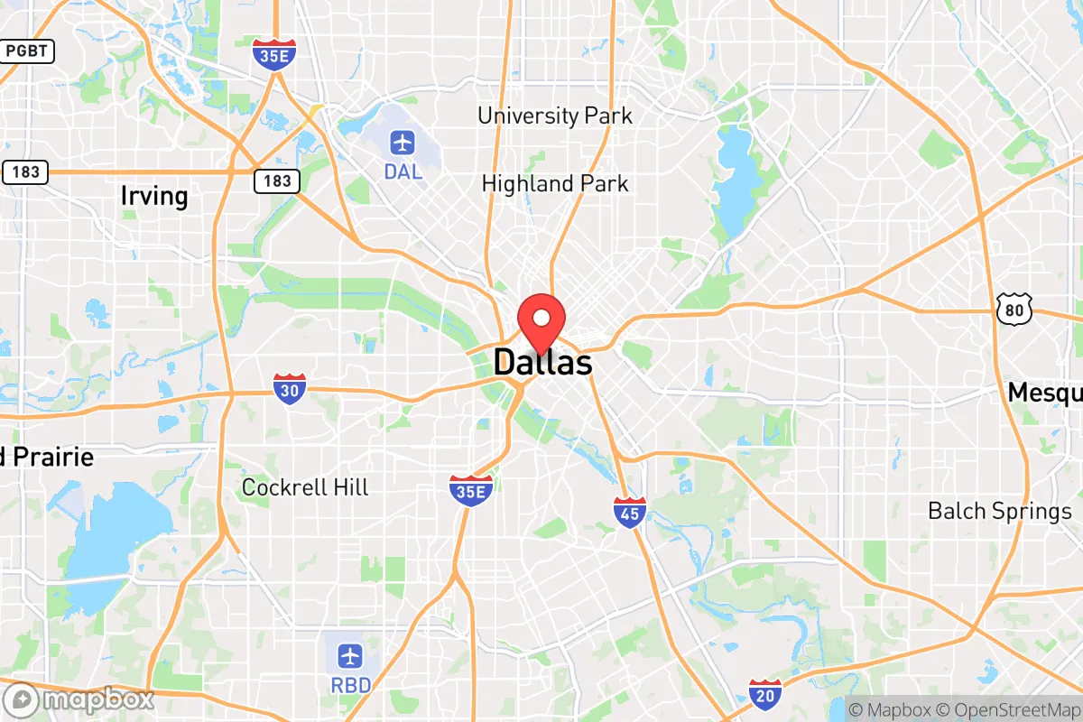
Photo by Ryan Duffy on Unsplash
Strategic Assessment of Dallas, TX
Multiple tactical vulnerabilities. Population density, target proximity, or disaster risk are likely compounding. A retreat property and exit planning is required.
What does the Strategic Assessment tell us?
Our Strategic Assessment grades tactical survivability of an area. Major population centers, military targets, fallout zones, natural disasters, and border exposure all drive risk — lower exposure means a more defensible position in a crisis.
This is heavily inspired by Joel Skousen's Strategic Relocation book. Highly recommended you checkout the book ($)What does this tell us?
Our Strategic Assessment grades tactical survivability of an area. Major population centers, military targets, fallout zones, natural disasters, and border exposure all drive risk — lower exposure means a more defensible position in a crisis.
This is heavily inspired by Joel Skousen's Strategic Relocation book. Highly recommended you checkout the book ($)Strategic Pillars

Key Distances
Regional Safe Places
Below is our recommended "safe zones" in Texas and the surrounding area based on our strategic heuristics. For most people, it's unrealistic to live in a “safe zone” full-time due to work, family or other personal reasons. They tend to be more rural. However, many of these areas are perfect for second homes and retreat properties that double as a vacation home or even a short-term rental.

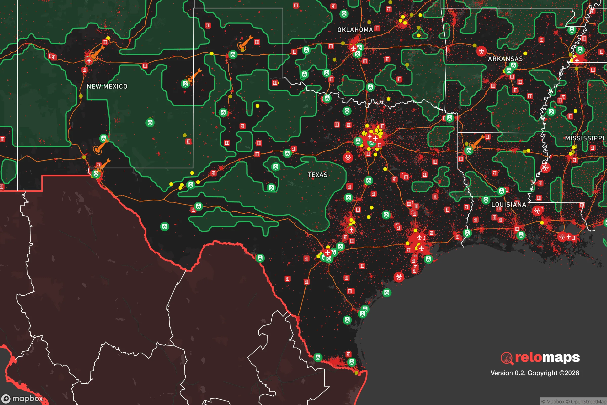


Important Note: For informational purposes only. This does not mean nothing bad ever happens in the green zones. Please use common sense. This is based on public data and modeled with AI. We tried to take a conservative approach but mistakes happen. We update this regularly as new information becomes available.
Solar Generator Recommendations
Backup power matters more here than in safer locations. We've picked three solar generators across budgets and capacity tiers — start with the budget unit if you only need a few essentials, or step up if you want to run a fridge and HVAC for days at a time.

Jackery Portable Power Station Explorer 300
Budget OptionPower on the Go: Weighing only 11 lbs, it's convenient to set up and store with book-sized foldable solar panels

BLUETTI Portable Power Station AC180
Designed for both indoor and outdoor scenarios, AC180 is highly capable as it has a robost capacity and continuous output power.

EF ECOFLOW DELTA Pro Ultra Power Station
Upgraded PickEcoFlow DELTA Pro Ultra is a whole-home energy system designed to grow with your family. Integrated with the Smart Home Panel 2, it scales to meet your evolving energy needs — keeping your home powered, intelligent, and secure through every stage of life.
We earn a commission, at no additional cost to you.
Strategic Assessment Analysis
Dallas, Texas, presents a mixed strategic picture for the relocation-minded reader focused on resilience and self-sufficiency. While its inland location and robust economic base offer genuine advantages, the city’s sheer size, density, and proximity to critical infrastructure create significant vulnerabilities that a serious prepper or disaster-ready family must weigh carefully. The area’s resilience is less about natural isolation and more about the depth of its logistical and economic networks—but those same networks are also primary targets in a major disruption.
Geographic position and natural advantages for long-term stability
Dallas sits in the North Texas region, roughly 250 miles from the Gulf of Mexico and over 600 miles from either coast, which provides a meaningful buffer against hurricane storm surge and sea-level rise—a clear advantage over Houston or coastal cities. The area’s elevation, averaging around 450 feet above sea level, and its position on the Blackland Prairie mean that catastrophic flooding is rare compared to flood-prone zones along the Trinity River bottoms, though flash flooding does occur in developed areas. The climate is continental, with hot summers and occasional winter ice storms, but it lacks the seismic risks of the West Coast or the hurricane landfall risks of the Gulf Coast. For a relocator, the fundamental geographic takeaway is that Dallas is not exposed to the most common natural catastrophes—no earthquakes, no wildfires of the California scale, and no direct hurricane hits. However, this relative safety comes with a trade-off: the region is prone to severe thunderstorms, hail, and tornadoes, particularly in the spring. The Dallas-Fort Worth metroplex sits in the heart of Tornado Alley, and while direct hits are statistically unlikely for any single property, the risk is real and should factor into home construction choices and insurance planning.
Risks, exposures, and proximity to fallout-relevant landmarks
The most significant resilience concern for Dallas is not nature—it is the man-made and infrastructure risks that come with being a major metropolitan hub. Dallas is home to a major Federal Reserve Bank, a large concentration of defense contractors (including Lockheed Martin in nearby Fort Worth), and critical transportation nodes like Dallas/Fort Worth International Airport (DFW), one of the busiest in the world. In a conflict scenario or major grid-down event, these landmarks make the metroplex a high-priority target. The city also sits near the Barnett Shale natural gas fields, and while that provides local energy, it also means pipelines and processing facilities are part of the landscape. For the resilience-minded relocator, proximity to these assets is a net negative: the area’s economic strength is also its strategic liability. Additionally, Dallas’s population density—over 1.3 million within the city and nearly 8 million in the metro—means that any major disruption would trigger rapid resource depletion and civil unrest. The city’s water supply, primarily from the Trinity River and a network of reservoirs like Lewisville Lake and Lake Ray Hubbard, is vulnerable to contamination or sabotage, and the grid, managed by ERCOT, has already shown fragility during Winter Storm Uri in 2021. A relocator should understand that while Dallas is not on a coastline, it is very much on the map for anyone thinking about strategic vulnerability.
Practical resilience for a relocator: food, water, energy, and defensibility
For a family or individual serious about self-sufficiency, Dallas offers a mixed bag. On the positive side, the region has deep agricultural roots: within a 50-mile radius, you’ll find working farms, ranches, and a strong local food system anchored by the Dallas Farmers Market and numerous CSAs. The growing season is long—roughly 230 days—meaning a determined homesteader can produce a significant portion of their own food, though water availability is a constraint. The area averages about 37 inches of rain annually, but droughts are common, and municipal water restrictions are frequent. For off-grid water, a well is feasible in many outlying areas, but the water table depth varies and drilling costs can be high. Energy resilience is a bright spot: Texas has a deregulated electricity market, and solar adoption is growing, though net metering policies are less favorable than in some states. Natural gas is abundant and cheap, making dual-fuel generators a practical backup. However, the ERCOT grid’s isolation from the rest of the country means that during a statewide event, there is no external power to draw on—a critical weakness. Defensibility is the hardest factor for Dallas itself. The city is flat, sprawling, and has no natural chokepoints. For a relocator, the practical advice is to look at the exurbs—towns like Waxahachie, McKinney, or Granbury—where property sizes increase, neighbors are fewer, and access to water and land for food production improves dramatically. Within the city limits, a high-rise apartment or dense subdivision offers little in the way of long-term survivability without a well-stocked pantry and a solid community network.
Overall, Dallas is not a resilience stronghold in the way that, say, the rural Hill Country or the Panhandle might be. Its value lies in its economic opportunity and logistical depth—if you need to stockpile supplies, access specialized medical care, or maintain a professional income while building your preparedness, Dallas provides the infrastructure to do so. But the trade-off is exposure: the same factors that make it a thriving city make it a target and a potential pressure cooker during a crisis. For the relocator who is serious about disaster readiness, the smart play is to live within commuting distance of Dallas for work and resources, but to have a retreat or a well-prepared home in a lower-density, less strategically significant area within a two-hour drive. That dual-location strategy—urban access with a rural fallback—is the most realistic path to resilience in the Dallas context. The city itself is not a bunker, but it can be a very effective base of operations if you plan accordingly.

* Values derived from national, state, county, city and local statistics and may differ in a specific area. Last updated: 2026-09-23T21:08:41.000Z
Narrative content on this page is AI-generated and may contain mistakes. Verify any details that matter before acting on them.
ReloMaps may earn a commission from affiliate links at no extra cost to you.

