Photo: Wikipedia
Strategic Assessment of Dekalb, IL
Meaningful friction. Expect exposure to either population pressure, blast zones, or natural disaster risk. Consider buying a retreat property.
What does the Strategic Assessment tell us?
Our Strategic Assessment grades tactical survivability of an area. Major population centers, military targets, fallout zones, natural disasters, and border exposure all drive risk — lower exposure means a more defensible position in a crisis.
This is heavily inspired by Joel Skousen's Strategic Relocation book. Highly recommended you checkout the book ($)What does this tell us?
Our Strategic Assessment grades tactical survivability of an area. Major population centers, military targets, fallout zones, natural disasters, and border exposure all drive risk — lower exposure means a more defensible position in a crisis.
This is heavily inspired by Joel Skousen's Strategic Relocation book. Highly recommended you checkout the book ($)Strategic Pillars

Key Distances
Regional Safe Places
Below is our recommended "safe zones" in Illinois and the surrounding area based on our strategic heuristics. For most people, it's unrealistic to live in a “safe zone” full-time due to work, family or other personal reasons. They tend to be more rural. However, many of these areas are perfect for second homes and retreat properties that double as a vacation home or even a short-term rental.
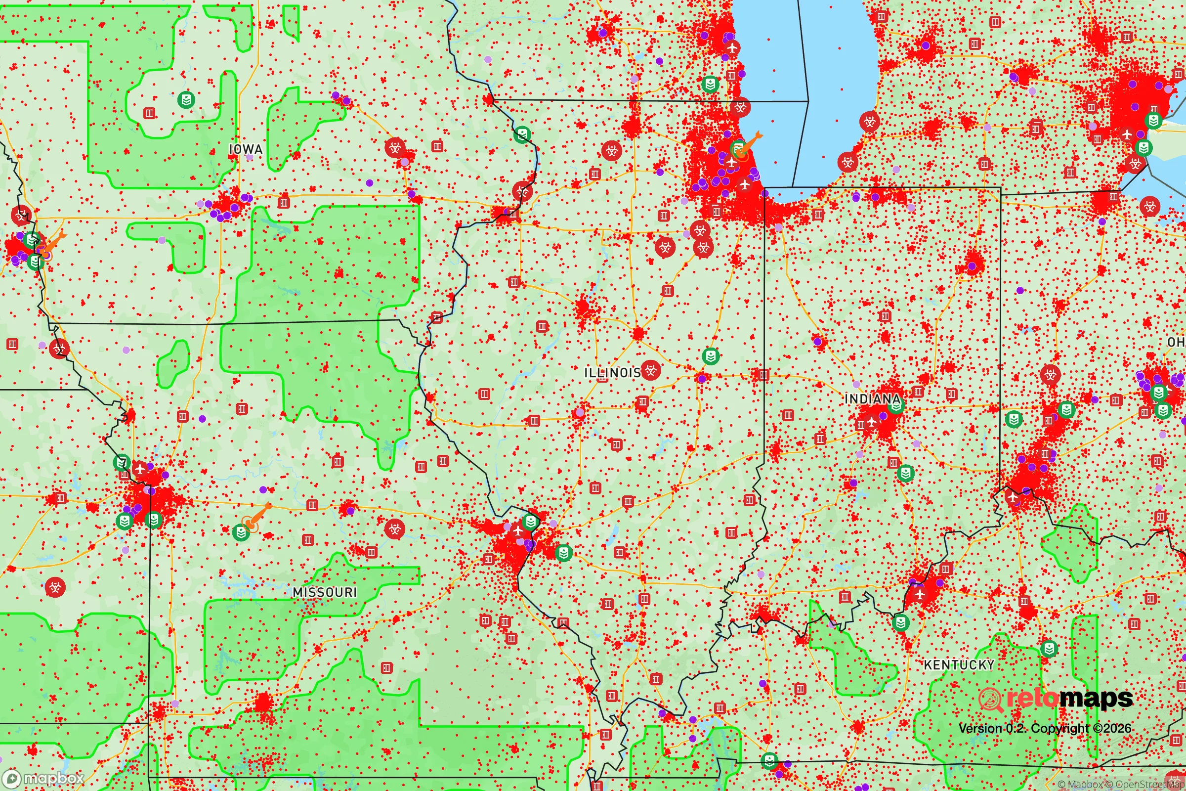
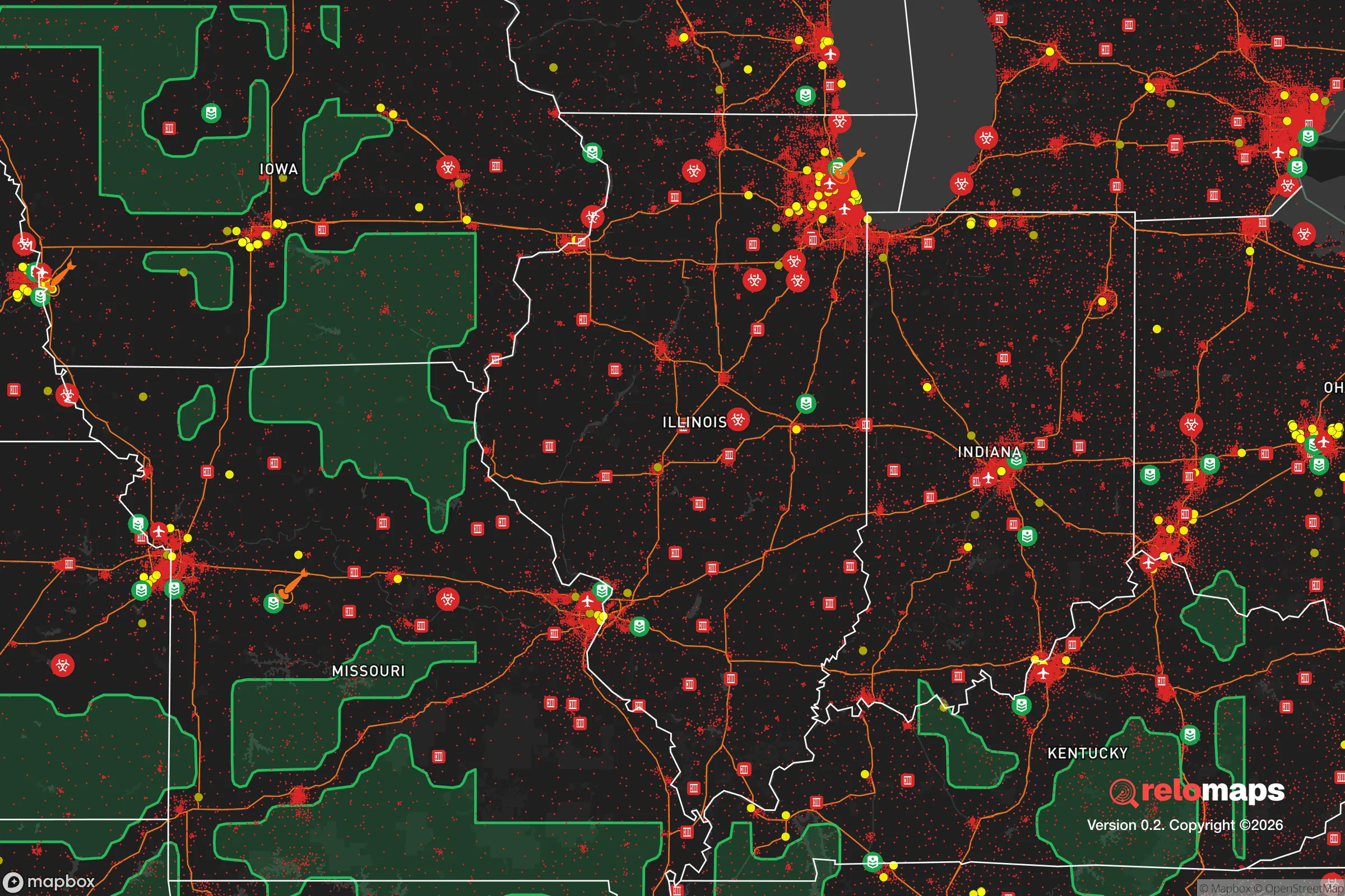
Important Note: For informational purposes only. This does not mean nothing bad ever happens in the green zones. Please use common sense. This is based on public data and modeled with AI. We tried to take a conservative approach but mistakes happen. We update this regularly as new information becomes available.
Solar Generator Recommendations
Backup power matters more here than in safer locations. We've picked three solar generators across budgets and capacity tiers — start with the budget unit if you only need a few essentials, or step up if you want to run a fridge and HVAC for days at a time.

Jackery Portable Power Station Explorer 300
Budget OptionPower on the Go: Weighing only 11 lbs, it's convenient to set up and store with book-sized foldable solar panels

BLUETTI Portable Power Station AC180
Designed for both indoor and outdoor scenarios, AC180 is highly capable as it has a robost capacity and continuous output power.

EF ECOFLOW DELTA Pro Ultra Power Station
Upgraded PickEcoFlow DELTA Pro Ultra is a whole-home energy system designed to grow with your family. Integrated with the Smart Home Panel 2, it scales to meet your evolving energy needs — keeping your home powered, intelligent, and secure through every stage of life.
We earn a commission, at no additional cost to you.
Strategic Assessment Analysis
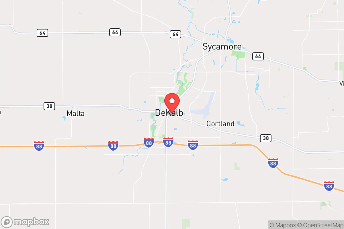
DeKalb, Illinois, sits in a precarious but potentially advantageous position for those prioritizing resilience and strategic relocation. Its location roughly 60 miles west of Chicago offers a buffer from the immediate chaos of a major metropolitan collapse, while still providing access to critical infrastructure and supply chains. The city’s identity as a college town—home to Northern Illinois University—and an agricultural hub gives it a dual character: a population that swells and contracts with the academic calendar, and a surrounding landscape that could support local food production in a crisis. For a conservative-leaning prepper, DeKalb represents a middle-ground option—close enough to urban resources to be useful, far enough to avoid the worst of a breakdown.
Geographic position and natural advantages for long-term survival
DeKalb’s geography is defined by the flat, fertile plains of the Kishwaukee River valley, which cuts through the city and provides a natural water source. The surrounding DeKalb County is predominantly agricultural, with vast fields of corn and soybeans that could, in theory, be repurposed for subsistence farming if industrial supply chains falter. The area sits on the edge of the Wisconsin glaciation plain, meaning the soil is rich and the water table is relatively high—both assets for drilling a well or maintaining a garden. The city itself is laid out on a grid, with major arteries like Illinois Route 38 and Interstate 88 providing east-west connectivity, but the lack of natural barriers (hills, forests, rivers wide enough to impede movement) means defensibility is limited. The flat terrain makes it easy to traverse but also easy to surveil, which is a double-edged sword in a security scenario. The nearest significant natural feature is the Kishwaukee River, which runs through the city and offers a renewable water source, though it’s not large enough to serve as a serious defensive moat. The region’s climate is typical of the Midwest—cold winters with snow, hot summers with thunderstorms—which means any prepper setup must account for temperature extremes and the risk of tornadoes, which are common in this part of Illinois.
Risks, exposures, and proximity to fallout-relevant landmarks
The most glaring risk for DeKalb is its proximity to Chicago, a city that, in a major crisis, would become a massive source of refugees, violence, and resource competition. At 60 miles, a determined group on foot could reach DeKalb in two to three days, and by vehicle in under an hour. The interstate highway system (I-88 and I-39) that makes DeKalb accessible also makes it a natural funnel for people fleeing the city. Additionally, DeKalb is within 100 miles of the Byron Nuclear Generating Station (about 50 miles northwest) and the Dresden Nuclear Power Plant (about 70 miles east). A meltdown or sabotage at either facility could render large swaths of the region uninhabitable due to fallout, with prevailing winds likely carrying contamination eastward—potentially sparing DeKalb from the worst, but not guaranteeing safety. The city also sits near the Union Pacific Railroad mainline, which carries freight including hazardous materials; a derailment or attack on a chemical train could disrupt the area for weeks. On the political front, DeKalb County leans left, with the city itself being a Democratic stronghold due to the university population. This could create friction in a post-collapse scenario where conservative-minded preppers might find themselves at odds with local governance or community norms. The presence of NIU also means a large, transient population of young adults who may lack survival skills and could become a drain on resources in a prolonged emergency.
Practical resilience for a relocator: food, water, energy, and defensibility
For a relocator focused on practical resilience, DeKalb offers a mixed bag. Water is the strongest asset: the Kishwaukee River runs through town, and the shallow aquifer means private wells are viable in the surrounding rural areas. However, the river is subject to agricultural runoff, so filtration and boiling would be essential. Food production is feasible given the agricultural land, but the soil is heavily dependent on industrial farming inputs; transitioning to organic, small-scale farming would require significant effort and time. The city has a few farmers’ markets and local food co-ops, but these are not robust enough to sustain the population in a crisis. Energy infrastructure is a vulnerability: DeKalb relies on the regional grid, which is prone to outages during storms (common in the Midwest). Solar potential is moderate—the area gets about 4.5 peak sun hours per day on average—but winter cloud cover can reduce output significantly. Natural gas is available in the city, but rural properties may rely on propane, which requires a supply chain that could break down. Defensibility is poor due to the flat terrain and grid street layout. A rural property on the outskirts, with a long driveway and clear sightlines, would be far more defensible than a home in town. The nearest police presence is the DeKalb Police Department and the DeKalb County Sheriff’s Office, but in a widespread collapse, these would be overwhelmed. The local hospital, Northwestern Medicine Kishwaukee Hospital, is a Level II trauma center, which is a plus for medical emergencies, but it would be a target for looters and desperate people. The best strategy for a relocator would be to secure a property outside the city limits, ideally with a well, septic system, and enough land for a garden and small livestock. The proximity to rural farm supply stores (like DeKalb County Farm Bureau) is a practical advantage for obtaining seeds, tools, and animal feed.
The overall strategic picture for DeKalb is one of calculated risk. It is not a hardened redoubt like a mountain compound, nor is it a total loss like a dense urban core. It is a transitional zone—close enough to Chicago to benefit from its resources (medical, industrial, informational) in the early stages of a crisis, but far enough to avoid the initial wave of chaos. The agricultural base is a genuine asset for long-term sustainability, but the lack of natural defenses and the presence of a large, potentially unstable university population are serious liabilities. For a conservative prepper who values community and self-reliance, DeKalb could work if you are willing to invest in hardening a rural property, building relationships with like-minded neighbors, and maintaining a low profile. The key is to avoid being caught in the city itself when things go south—the grid, the river, and the farmland are your friends, but the flat, open terrain and the refugee funnel from Chicago are your enemies. If you can secure a spot on the outskirts, with a well, solar panels, and a garden, DeKalb offers a viable middle ground for weathering the storm. Just don’t expect it to be a fortress—it’s a farm town with a college, and in a collapse, that college could become a liability.
* Values derived from national, state, county, city and local statistics and may differ in a specific area. Last updated: 2026-04-29T23:57:08.000Z
Narrative content on this page is AI-generated and may contain mistakes. Verify any details that matter before acting on them.
ReloMaps may earn a commission from affiliate links at no extra cost to you.