
Photo: Wikipedia
Strategic Assessment of Dothan, AL
Meaningful friction. Expect exposure to either population pressure, blast zones, or natural disaster risk. Consider buying a retreat property.
What does the Strategic Assessment tell us?
Our Strategic Assessment grades tactical survivability of an area. Major population centers, military targets, fallout zones, natural disasters, and border exposure all drive risk — lower exposure means a more defensible position in a crisis.
This is heavily inspired by Joel Skousen's Strategic Relocation book. Highly recommended you checkout the book ($)What does this tell us?
Our Strategic Assessment grades tactical survivability of an area. Major population centers, military targets, fallout zones, natural disasters, and border exposure all drive risk — lower exposure means a more defensible position in a crisis.
This is heavily inspired by Joel Skousen's Strategic Relocation book. Highly recommended you checkout the book ($)Strategic Pillars

Key Distances
Regional Safe Places
Below is our recommended "safe zones" in Alabama and the surrounding area based on our strategic heuristics. For most people, it's unrealistic to live in a “safe zone” full-time due to work, family or other personal reasons. They tend to be more rural. However, many of these areas are perfect for second homes and retreat properties that double as a vacation home or even a short-term rental.
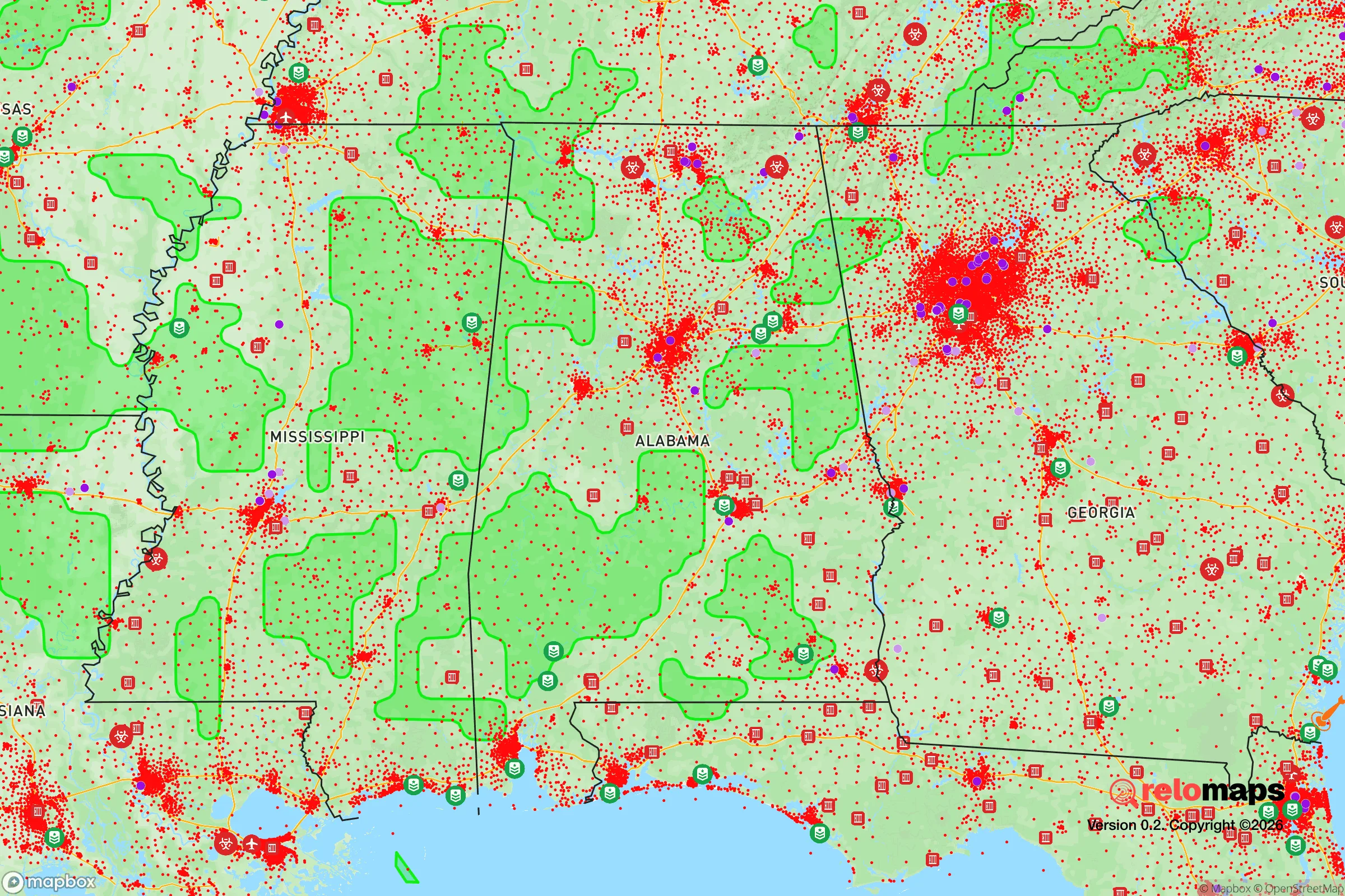
Important Note: For informational purposes only. This does not mean nothing bad ever happens in the green zones. Please use common sense. This is based on public data and modeled with AI. We tried to take a conservative approach but mistakes happen. We update this regularly as new information becomes available.
Solar Generator Recommendations
Backup power matters more here than in safer locations. We've picked three solar generators across budgets and capacity tiers — start with the budget unit if you only need a few essentials, or step up if you want to run a fridge and HVAC for days at a time.

Jackery Portable Power Station Explorer 300
Budget OptionPower on the Go: Weighing only 11 lbs, it's convenient to set up and store with book-sized foldable solar panels

BLUETTI Portable Power Station AC180
Designed for both indoor and outdoor scenarios, AC180 is highly capable as it has a robost capacity and continuous output power.

EF ECOFLOW DELTA Pro Ultra Power Station
Upgraded PickEcoFlow DELTA Pro Ultra is a whole-home energy system designed to grow with your family. Integrated with the Smart Home Panel 2, it scales to meet your evolving energy needs — keeping your home powered, intelligent, and secure through every stage of life.
We earn a commission, at no additional cost to you.
Strategic Assessment Analysis
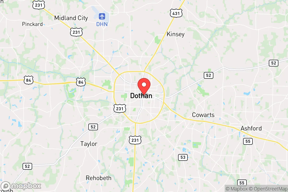
Dothan, Alabama, sits in a sweet spot that few relocation analysts talk about openly: far enough from the major hurricane landfall zones to avoid the worst, but close enough to the Gulf Coast to tap into supply chains and evacuation routes if things go sideways. The city anchors the Wiregrass region, a 100-mile-wide agricultural and industrial corridor that runs from the Florida Panhandle up into southeast Alabama, and its location at the intersection of four major highways—US 231, US 431, US 84, and AL 52—gives it a logistical advantage that matters when you’re thinking about long-term stability. For a conservative-leaning relocator who’s watching the national picture deteriorate, Dothan offers a combination of geographic isolation from coastal surge zones, a working-class economic base that doesn’t depend on government contracts, and a population density low enough that you’re not competing with a million other people for the same resources when things get tight.
Geographic position and natural advantages for long-term stability
Dothan’s real strategic value comes from what it isn’t near. It sits 85 miles inland from the Gulf of Mexico, which puts it outside the storm-surge zone for Category 4 or 5 hurricanes—the kind that flatten coastal cities and disrupt power grids for weeks. The elevation here averages around 320 feet above sea level, so flash flooding from tropical systems is rare, and the underlying geology is mostly sandy loam over limestone, which means groundwater drains fast and septic systems work reliably. The city is surrounded by thousands of square miles of pine forests and farmland—peanuts, cotton, corn, and timber—so local food production is a real thing, not a hypothetical. The Chattahoochee River runs about 30 miles east, and the Choctawhatchee River is 20 miles west, both providing secondary water sources if municipal systems get compromised. For someone thinking about a bug-out location or a permanent relocation, Dothan’s position in the Wiregrass means you’ve got multiple escape vectors: south to the coast (if you need to evacuate by sea), north toward Montgomery and I-85, or east into Georgia’s less-populated rural counties.
Risks, exposures, and proximity to fallout-relevant landmarks
No place is perfect, and Dothan has two exposure points that a prepper needs to account for. First, the city is roughly 90 miles from Fort Rucker (now Fort Novosel), the Army’s primary aviation training base. That’s a double-edged sword: it means military traffic and occasional helicopter noise, but it also means a significant federal presence that could become a target during civil unrest or a mass-casualty event. Second, Dothan sits about 70 miles from the Dothan Regional Airport, which handles cargo and general aviation but also serves as a staging point for FEMA and National Guard operations during hurricane season. If a major disaster triggers a federal response, that airport becomes a chokepoint—and chokepoints attract crowds, checkpoints, and potential conflict. The city itself has no nuclear power plants within 100 miles (the closest is Farley in Alabama, about 110 miles northwest), and no major chemical storage facilities that would create a Bhopal-style risk. The biggest industrial hazards are the peanut-processing plants and a few fertilizer depots on the outskirts, which are manageable if you know where they are and avoid downwind areas during a fire. For a conservative relocator worried about societal collapse, the real risk here isn’t a single catastrophic event—it’s that Dothan’s relative safety will attract a wave of refugees from Mobile, Panama City, and Tallahassee if those cities get hit hard. That population surge could strain local resources for 6-12 months before things stabilize.
Practical resilience for a relocator: food, water, energy, and defensibility
Dothan’s practical resilience is where it shines for someone who’s serious about self-sufficiency. The city draws its municipal water from the Chattahoochee River via the Dothan Water System, which has backup wells and a 30-million-gallon storage capacity—enough for about 10 days at normal consumption. But the real advantage is that most homes in the surrounding county (Houston County) have private wells or access to rural water co-ops, so you’re not dependent on a single municipal system. The local power grid is served by Alabama Power, which has a decent track record for storm restoration, but the region’s tree canopy means outages from ice storms or hurricanes can last 3-5 days. Solar is viable here—the area gets about 215 sunny days per year, above the national average—and zoning in the unincorporated areas around Dothan allows for ground-mounted panels, rainwater catchment, and even small-scale livestock without a fight from the county. Food resilience is strong: the Wiregrass is one of the top peanut-producing regions in the country, and there are dozens of small farms within a 20-minute drive that sell direct to consumers. The Dothan Farmers Market operates year-round, and the local extension office at Auburn University’s Wiregrass Research and Extension Center offers free classes on canning, gardening, and livestock management. Defensibility is a mixed bag. Dothan itself is a spread-out city of about 71,000 people, with a downtown grid that’s easy to navigate but hard to secure. The real defensible positions are the rural subdivisions and farmsteads 10-15 miles outside the city limits, where you’ve got standoff distance, natural tree cover, and neighbors who are likely armed and aware. Houston County has a strong gun culture—concealed carry is common, and the sheriff’s office is pro-Second Amendment—so if you’re worried about civil unrest, you’re not going to be the only one on your street with a rifle.
The overall strategic picture for Dothan is that it’s a solid B+ location for a conservative relocator who wants to be prepared without living in a bunker. It’s not the most remote place in the South—you’re still within a day’s drive of Atlanta, Birmingham, and the Florida coast—but that accessibility is also what makes it viable for a normal life while you’re waiting for things to go sideways. The local economy is anchored by healthcare (Southeast Health and Flowers Hospital are the two largest employers), agriculture, and a growing aerospace sector tied to Fort Novosel, so you’re not dependent on a single industry that could collapse overnight. The political climate is reliably conservative—Houston County voted +38 points for Trump in 2020—and the local culture is built around church, family, and self-reliance, which means you’ll find like-minded neighbors without having to explain why you’re stockpiling water or building a root cellar. The downsides are real: summer humidity is brutal, the job market for high-skill professionals is thin, and you’ll need to drive 30-45 minutes for anything beyond basic shopping. But if your priority is a place where you can hunker down, grow your own food, and avoid the chaos of coastal evacuation zones or urban collapse zones, Dothan deserves a hard look. It’s not a secret, but it’s not on most people’s radar either—and that’s exactly the kind of place you want to be when the news gets bad.
* Values derived from national, state, county, city and local statistics and may differ in a specific area. Last updated: 2026-04-19T18:48:30.000Z
Narrative content on this page is AI-generated and may contain mistakes. Verify any details that matter before acting on them.
ReloMaps may earn a commission from affiliate links at no extra cost to you.