Photo: Wikipedia
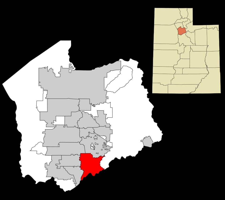
Strategic Assessment of Draper, UT
Workable tactical position. Some exposure to population density or targets, but generally defensible in a crisis.
What does the Strategic Assessment tell us?
Our Strategic Assessment grades tactical survivability of an area. Major population centers, military targets, fallout zones, natural disasters, and border exposure all drive risk — lower exposure means a more defensible position in a crisis.
This is heavily inspired by Joel Skousen's Strategic Relocation book. Highly recommended you checkout the book ($)What does this tell us?
Our Strategic Assessment grades tactical survivability of an area. Major population centers, military targets, fallout zones, natural disasters, and border exposure all drive risk — lower exposure means a more defensible position in a crisis.
This is heavily inspired by Joel Skousen's Strategic Relocation book. Highly recommended you checkout the book ($)Strategic Pillars

Key Distances
Regional Safe Places
Below is our recommended "safe zones" in Utah and the surrounding area based on our strategic heuristics. For most people, it's unrealistic to live in a “safe zone” full-time due to work, family or other personal reasons. They tend to be more rural. However, many of these areas are perfect for second homes and retreat properties that double as a vacation home or even a short-term rental.


Important Note: For informational purposes only. This does not mean nothing bad ever happens in the green zones. Please use common sense. This is based on public data and modeled with AI. We tried to take a conservative approach but mistakes happen. We update this regularly as new information becomes available.
Solar Generator Recommendations
Backup power matters more here than in safer locations. We've picked three solar generators across budgets and capacity tiers — start with the budget unit if you only need a few essentials, or step up if you want to run a fridge and HVAC for days at a time.

Jackery Portable Power Station Explorer 300
Budget OptionPower on the Go: Weighing only 11 lbs, it's convenient to set up and store with book-sized foldable solar panels

BLUETTI Portable Power Station AC180
Designed for both indoor and outdoor scenarios, AC180 is highly capable as it has a robost capacity and continuous output power.

EF ECOFLOW DELTA Pro Ultra Power Station
Upgraded PickEcoFlow DELTA Pro Ultra is a whole-home energy system designed to grow with your family. Integrated with the Smart Home Panel 2, it scales to meet your evolving energy needs — keeping your home powered, intelligent, and secure through every stage of life.
We earn a commission, at no additional cost to you.
Strategic Assessment Analysis
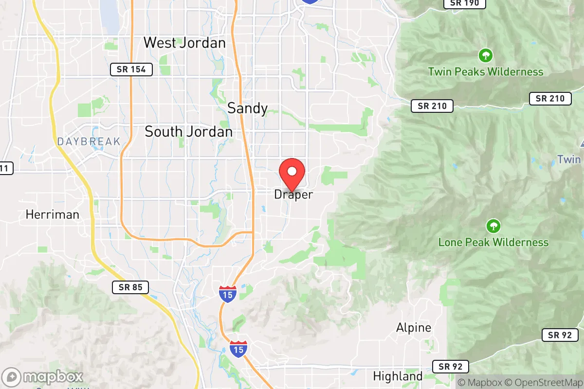
Draper, Utah, positioned at the southern end of the Salt Lake Valley, offers a surprisingly resilient strategic footprint for those prioritizing preparedness and long-term stability. Its location at the mouth of several mountain canyons, combined with a higher elevation and a more conservative local governance structure than its northern neighbors, creates a buffer zone that is both physically and culturally distinct. For a relocator concerned with civic unrest, mass casualty events, or natural disasters, Draper presents a compelling mix of defensible geography and community cohesion that is increasingly rare in the Intermountain West.
Geographic position and natural advantages for long-term stability
Draper’s primary strategic asset is its geography. Sitting at roughly 4,500 feet in elevation, the city is perched above the valley floor, providing natural observation points and a degree of separation from the urban core of Salt Lake City, which lies about 20 miles north. The Wasatch Front’s mountain ranges to the east offer immediate escape routes into the Uinta-Wasatch-Cache National Forest, a vast, sparsely populated wilderness that could serve as a fallback zone. The city’s position at the base of Corner Canyon and Suncrest gives residents access to multiple canyon exits, a critical advantage if the valley’s main north-south arteries (I-15 and State Street) become compromised. This natural funneling effect means that Draper is not a dead-end; it has egress options that many valley-floor suburbs lack. The local water supply is also a plus: Draper draws from a mix of mountain watersheds and deep aquifers, and the nearby Jordanelle Reservoir and Deer Creek Reservoir provide regional water security that is superior to areas reliant solely on the Great Salt Lake’s shrinking levels. For a prepper, the ability to retreat uphill into national forest land while maintaining a defensible home base in a community that values self-reliance is a significant advantage over flatter, more exposed suburbs like West Jordan or Sandy.
Risks, exposures, and proximity to fallout-relevant landmarks
No location is without vulnerabilities, and Draper has several that a strategic relocator must weigh. The most obvious risk is its proximity to the Salt Lake City metropolitan area, a population center of over 1.2 million people. In a scenario involving civil unrest, mass casualty events, or a major disaster, the city could face a surge of evacuees from the north, overwhelming local resources. The I-15 corridor, which runs through Draper’s western edge, is a primary evacuation route and a potential chokepoint. If that highway becomes gridlocked or contested, Draper’s access to supplies and medical care from the north could be cut off. Additionally, the city lies within the Wasatch Fault zone, a major seismic threat. A large earthquake (magnitude 7.0 or greater) would not only damage infrastructure but could also trigger landslides in the steep canyons to the east, blocking those critical escape routes. The nearby Kennecott Copper Mine (Bingham Canyon) to the southwest is a massive industrial site; a catastrophic failure there—like the 2013 landslide—could release toxic dust or disrupt regional logistics. For those concerned with fallout from a larger conflict, Draper’s proximity to Hill Air Force Base (about 40 miles north) and the Tooele Army Depot (about 50 miles west) places it within a potential target zone for a strategic strike, though the city’s mountain shielding offers some protection from blast effects. The key takeaway: Draper is not a remote bunker; it is a semi-urban buffer zone that requires active preparation for both natural and man-made cascading failures.
Practical resilience for a relocator: food, water, energy, and defensibility
For a relocator looking to build a resilient household, Draper offers a mixed but workable environment. Water security is the strongest pillar: the city’s municipal water comes from the Central Utah Project and local mountain streams, and many homes in the higher elevations have access to secondary irrigation water (untreated, for landscaping). A prepper should prioritize a property with a private well or a connection to a secondary water system, as the municipal supply could be compromised in a crisis. Food production is limited but possible: Draper’s soil is rocky and alkaline, typical of the valley, but raised beds and greenhouses can yield vegetables for a family. The city’s zoning allows for backyard chickens and small livestock in most residential areas, and the nearby farming communities of Lehi and American Fork provide access to local produce and bulk grains. Energy resilience is improving: Rocky Mountain Power’s grid is generally reliable, but the area’s frequent winter storms and summer wildfire smoke events can cause outages. Solar adoption is growing, and the state’s net metering policies are favorable. A generator or battery backup is a wise investment, especially for those in the foothills where power lines are more exposed. Defensibility is neighborhood-dependent: The newer developments on the east bench (e.g., Suncrest, The Cove) are built on steep, winding roads that naturally slow vehicle traffic and create a sense of separation. Older neighborhoods near the city center are more accessible but also more integrated into the valley’s grid. For a relocator, the east bench offers the best combination of defensible terrain, egress options, and separation from the valley floor’s potential chaos. The local community is heavily LDS (Mormon), which brings a strong culture of preparedness, food storage, and mutual aid—a significant soft asset for those who can integrate or at least cooperate with neighbors.
The overall strategic picture for Draper is one of calculated advantage. It is not a remote survivalist retreat, but it is one of the better-positioned suburbs along the Wasatch Front for those who want proximity to urban resources without being trapped in the urban core. The city’s conservative governance, strong community networks, and natural buffers make it a viable base for a prepared household. The key is to treat Draper as a forward operating base: invest in water storage, renewable energy, and a vehicle capable of navigating mountain roads. Understand that the I-15 corridor is both a lifeline and a liability. If you can secure a property on the east bench, build relationships with neighbors, and maintain a low profile, Draper offers a rare blend of access and security that is hard to find in the modern American West. The risks are real—earthquake, urban spillover, industrial hazards—but they are manageable with foresight. For a conservative-leaning relocator who values community, self-reliance, and a defensible position, Draper is a strong candidate worth serious consideration.
* Values derived from national, state, county, city and local statistics and may differ in a specific area. Last updated: 2026-05-03T04:57:07.000Z
Narrative content on this page is AI-generated and may contain mistakes. Verify any details that matter before acting on them.
ReloMaps may earn a commission from affiliate links at no extra cost to you.