
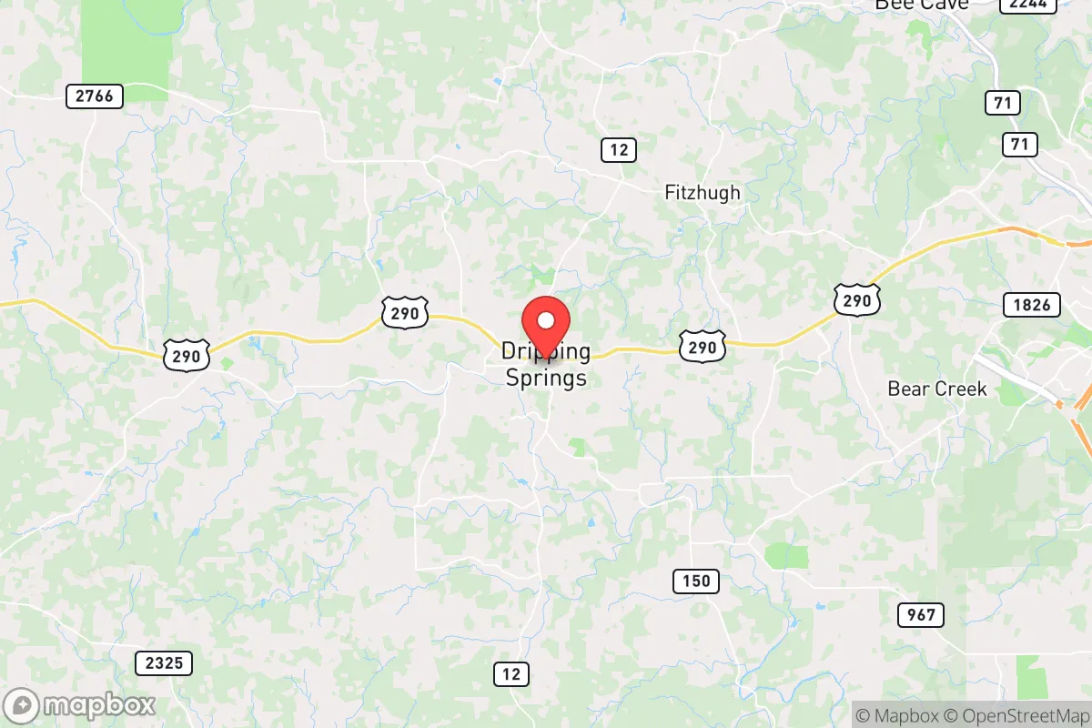
Strategic Assessment of Dripping Springs, TX
Meaningful friction. Expect exposure to either population pressure, blast zones, or natural disaster risk. Consider buying a retreat property.
What does the Strategic Assessment tell us?
Our Strategic Assessment grades tactical survivability of an area. Major population centers, military targets, fallout zones, natural disasters, and border exposure all drive risk — lower exposure means a more defensible position in a crisis.
This is heavily inspired by Joel Skousen's Strategic Relocation book. Highly recommended you checkout the book ($)What does this tell us?
Our Strategic Assessment grades tactical survivability of an area. Major population centers, military targets, fallout zones, natural disasters, and border exposure all drive risk — lower exposure means a more defensible position in a crisis.
This is heavily inspired by Joel Skousen's Strategic Relocation book. Highly recommended you checkout the book ($)Strategic Pillars

Key Distances
Regional Safe Places
Below is our recommended "safe zones" in Texas and the surrounding area based on our strategic heuristics. For most people, it's unrealistic to live in a “safe zone” full-time due to work, family or other personal reasons. They tend to be more rural. However, many of these areas are perfect for second homes and retreat properties that double as a vacation home or even a short-term rental.


Important Note: For informational purposes only. This does not mean nothing bad ever happens in the green zones. Please use common sense. This is based on public data and modeled with AI. We tried to take a conservative approach but mistakes happen. We update this regularly as new information becomes available.
Solar Generator Recommendations
Backup power matters more here than in safer locations. We've picked three solar generators across budgets and capacity tiers — start with the budget unit if you only need a few essentials, or step up if you want to run a fridge and HVAC for days at a time.

Jackery Portable Power Station Explorer 300
Budget OptionPower on the Go: Weighing only 11 lbs, it's convenient to set up and store with book-sized foldable solar panels

BLUETTI Portable Power Station AC180
Designed for both indoor and outdoor scenarios, AC180 is highly capable as it has a robost capacity and continuous output power.

EF ECOFLOW DELTA Pro Ultra Power Station
Upgraded PickEcoFlow DELTA Pro Ultra is a whole-home energy system designed to grow with your family. Integrated with the Smart Home Panel 2, it scales to meet your evolving energy needs — keeping your home powered, intelligent, and secure through every stage of life.
We earn a commission, at no additional cost to you.
Strategic Assessment Analysis
Dripping Springs offers a compelling strategic position for those prioritizing resilience and self-sufficiency, sitting in a sweet spot roughly 25 miles west of downtown Austin but far enough from the urban core to avoid the immediate blast radius of a major event. The area’s rugged Hill Country terrain, limited major highway access, and low population density (around 5,000 residents within the city limits, with the broader 78620 ZIP code at roughly 15,000) create natural buffers against the chaos that would likely engulf larger metro areas. For a conservative-minded relocator concerned with civic unrest, supply chain collapse, or mass casualty events, this location provides a defensible base with reasonable proximity to resources—if you know where to look.
Geographic position and natural advantages for long-term survival
Dripping Springs sits atop the Edwards Plateau, a limestone-rich region that offers several hard-to-replicate advantages. The elevation—roughly 1,100 feet above sea level—means cooler temperatures than the lowlands and less flood risk compared to areas closer to the Colorado River. The surrounding terrain is a mix of live oak savannah and cedar breaks, providing natural cover and limited lines of sight for anyone approaching from the east or south. The area is crisscrossed by spring-fed creeks like Onion Creek and Bear Creek, which historically have provided reliable water sources even during drought years—a critical factor when municipal systems fail. The thin, rocky soil is poor for large-scale agriculture, but it supports native forage and small-scale gardening with proper amendments. For a prepper, this means you’re not sitting on prime farmland that would attract attention, but you can sustain a modest homestead with rainwater catchment and raised beds. The lack of major interstates—US 290 is a two-lane highway through much of the area—means that mass evacuation routes from Austin would clog quickly, but that same bottleneck works in your favor if you need to control access to your property.
Risks, exposures, and proximity to fallout-relevant landmarks
The biggest strategic liability is proximity to Austin’s urban core and its associated targets. Austin is home to the Texas State Capitol, the University of Texas campus, and a growing concentration of federal and tech infrastructure—all potential flashpoints during civil unrest or a coordinated attack. Dripping Springs sits roughly 25 miles from downtown, which puts it outside the likely blast radius of a conventional bomb or small nuclear device, but within the fallout plume zone depending on wind patterns. The area is also within 30 miles of the Austin-Bergstrom International Airport, a likely target for any coordinated disruption. On the plus side, there are no major military bases, chemical plants, or nuclear facilities within 50 miles—the closest significant industrial hazard is the Fayette Power Project (a coal plant) about 40 miles southeast. The 2021 winter storm (Uri) exposed the region’s vulnerability to grid failure, with some areas losing power for over a week. That event is a dry run for what a longer-term collapse would look like: roads impassable due to ice or debris, water systems failing without electricity, and supply chains snapping within 48 hours. The Hays County Emergency Management office is competent but under-resourced for a mass event—expect a 72-hour to one-week gap before any meaningful aid arrives.
Practical resilience for a relocator: food, water, energy, and defensibility
Water is the single most important factor, and Dripping Springs has a mixed picture. The area relies heavily on the Trinity Aquifer, which is generally reliable but has seen declining levels due to population growth. A well is the gold standard here—expect to drill 300-500 feet deep, costing $15,000-$25,000, but you’ll have a private supply that won’t be affected by municipal outages. Rainwater catchment is also viable, with average annual rainfall of 34 inches; a 5,000-gallon tank system can cover basic household needs for a family of four for about two months. For food, the growing season runs from March to November, and local soil amendments (composted manure from nearby ranches) can boost yields. The area has a strong network of small farms and ranches—places like the Dripping Springs Farmers Market (Saturdays year-round) are good for building local supply relationships before things go sideways. Energy is the weak point: the grid is fragile, and natural gas lines are limited. Solar with battery backup is the standard recommendation here—a 10kW system with 30kWh of storage will run $25,000-$35,000 but can keep critical loads running indefinitely if paired with a generator for cloudy stretches. Defensibility is decent but not fortress-level. The terrain offers natural chokepoints: most properties are accessed via narrow, winding roads that can be easily monitored or blocked. The downside is that many lots are large (1-5 acres typical) but not contiguous, meaning you’ll have neighbors within earshot. A rural property with a long driveway, good sightlines, and a backup water source is the ideal. The local sheriff’s office (Hays County) is generally pro-Second Amendment and responsive, but in a grid-down scenario, you’re on your own for the first 72 hours at least.
The overall strategic picture for Dripping Springs is one of calculated trade-offs. You get genuine natural advantages—water access, defensible terrain, distance from primary targets—but you also inherit the risks of being within a day’s walk of a major metro area that could become a humanitarian disaster zone. The area’s rapid growth (population up roughly 40% since 2020) means that the “rural” feel is eroding, and new subdivisions are creeping closer to the traditional ranchland. For a relocator with a prepper mindset, the key is to buy land with a well and good solar exposure, build relationships with neighboring landowners (not just the weekenders), and stockpile for at least 90 days of self-sufficiency. Dripping Springs won’t save you from a direct hit on Austin, but it gives you a fighting chance to ride out the aftermath—provided you’ve done the work before the lights go out.
* Values derived from national, state, county, city and local statistics and may differ in a specific area. Last updated: 2026-04-19T07:23:25.000Z
Narrative content on this page is AI-generated and may contain mistakes. Verify any details that matter before acting on them.
ReloMaps may earn a commission from affiliate links at no extra cost to you.