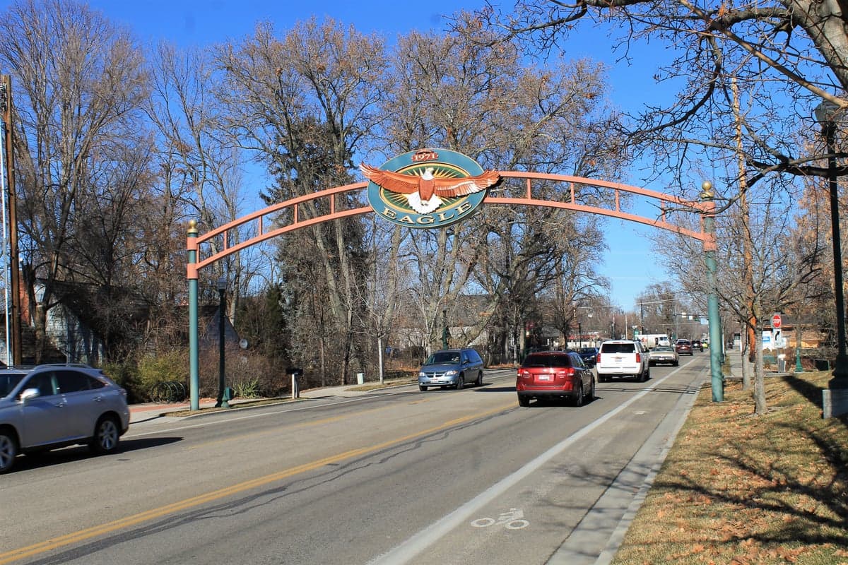
Photo: Wikipedia
Strategic Assessment of Eagle, ID
Workable tactical position. Some exposure to population density or targets, but generally defensible in a crisis.
What does the Strategic Assessment tell us?
Our Strategic Assessment grades tactical survivability of an area. Major population centers, military targets, fallout zones, natural disasters, and border exposure all drive risk — lower exposure means a more defensible position in a crisis.
This is heavily inspired by Joel Skousen's Strategic Relocation book. Highly recommended you checkout the book ($)What does this tell us?
Our Strategic Assessment grades tactical survivability of an area. Major population centers, military targets, fallout zones, natural disasters, and border exposure all drive risk — lower exposure means a more defensible position in a crisis.
This is heavily inspired by Joel Skousen's Strategic Relocation book. Highly recommended you checkout the book ($)Strategic Pillars

Key Distances
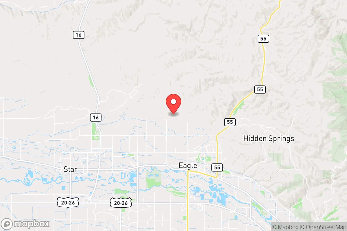
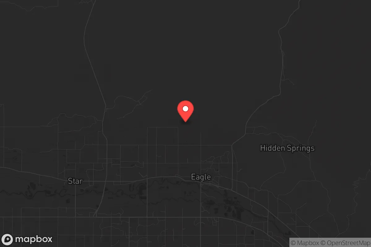
Regional Safe Places
Below is our recommended "safe zones" in Idaho and the surrounding area based on our strategic heuristics. For most people, it's unrealistic to live in a “safe zone” full-time due to work, family or other personal reasons. They tend to be more rural. However, many of these areas are perfect for second homes and retreat properties that double as a vacation home or even a short-term rental.


Important Note: For informational purposes only. This does not mean nothing bad ever happens in the green zones. Please use common sense. This is based on public data and modeled with AI. We tried to take a conservative approach but mistakes happen. We update this regularly as new information becomes available.
Solar Generator Recommendations
Backup power matters more here than in safer locations. We've picked three solar generators across budgets and capacity tiers — start with the budget unit if you only need a few essentials, or step up if you want to run a fridge and HVAC for days at a time.

Jackery Portable Power Station Explorer 300
Budget OptionPower on the Go: Weighing only 11 lbs, it's convenient to set up and store with book-sized foldable solar panels

BLUETTI Portable Power Station AC180
Designed for both indoor and outdoor scenarios, AC180 is highly capable as it has a robost capacity and continuous output power.

EF ECOFLOW DELTA Pro Ultra Power Station
Upgraded PickEcoFlow DELTA Pro Ultra is a whole-home energy system designed to grow with your family. Integrated with the Smart Home Panel 2, it scales to meet your evolving energy needs — keeping your home powered, intelligent, and secure through every stage of life.
We earn a commission, at no additional cost to you.
Strategic Assessment Analysis
Eagle, Idaho, sits in a sweet spot that few relocation analysts can point to with a straight face: close enough to Boise for supply runs and medical access, yet far enough from the urban core to offer genuine strategic depth. The city’s position along the Boise River, nestled against the foothills of the Rocky Mountains, provides natural chokepoints and escape routes that matter when you’re thinking about civic unrest or supply chain disruptions. For a conservative-leaning individual or family looking to plant roots in a place that can weather both political instability and natural disasters, Eagle offers a rare combination of defensible geography, community cohesion, and resource access that most suburban enclaves simply cannot match.
Geographic position and natural advantages for long-term security
Eagle’s location in Ada County, roughly 15 miles northwest of downtown Boise, places it at the western edge of the Treasure Valley, where the Boise River cuts through a broad alluvial plain before rising into the Boise National Forest. This isn’t flat, exposed farmland—Eagle sits on a series of low hills and benches that provide natural observation points and defensible terrain. The Boise River runs through the city’s southern edge, offering a reliable water source that can be tapped with basic filtration or well systems. To the north and east, the foothills rise quickly into public lands—over 2.6 million acres of national forest within a two-hour drive—giving you immediate access to hunting, foraging, and off-grid retreat options if things go sideways. The climate is semi-arid, with annual precipitation around 12 inches, which means less mold, fewer flood risks, and a longer growing season than much of the Pacific Northwest. Winter lows rarely drop below 20°F, and summer highs hover in the low 90s—manageable for both daily life and emergency gardening. The valley’s geography also creates a natural funnel: major roads like Highway 55 and Interstate 84 converge here, but the surrounding mountains limit approach vectors, making it easier to monitor movement and secure a perimeter in a crisis scenario.
Risks, exposures, and proximity to fallout-relevant landmarks
No location is a fortress, and Eagle has vulnerabilities that a serious prepper needs to account for. The most obvious risk is proximity to Boise—roughly 20 minutes by car, which puts you within the blast radius of any major terrorist or state-actor attack targeting the state capital, the National Interagency Fire Center, or the Boise Airport (a key military and cargo hub). A coordinated EMP or cyberattack on the power grid would hit Eagle just as hard as downtown Boise, since the entire valley shares the same substations and transmission lines. The city itself sits in a seismically active region—the Wasatch Fault zone extends into southwestern Idaho, and a 6.5+ magnitude earthquake on the nearby Lost River Fault could disrupt roads, water lines, and natural gas infrastructure for weeks. Wildfire risk is moderate but real: the 2016 Pioneer Fire burned within 30 miles of Eagle, and dry summers combined with suburban sprawl create a dangerous interface. Flooding along the Boise River is a periodic concern, particularly in low-lying neighborhoods near Eagle Road and State Street. On the human threat side, Eagle’s affluence—median household income around $110,000—makes it a target for organized looting or home invasions during a breakdown of civil order. The city’s police force is small (roughly 30 sworn officers), and backup from Ada County Sheriff’s Office could be delayed if multiple jurisdictions are overwhelmed simultaneously.
Practical resilience for a relocator: food, water, energy, and defensibility
For someone serious about self-sufficiency, Eagle delivers on the basics but requires deliberate planning. Water is the strongest asset: the Boise River flows year-round, and the local aquifer is shallow enough that many homes have private wells—check property records for well depth and yield before buying. The city’s municipal water comes from the Boise River and is treated at the Eagle Water Treatment Plant, but a prolonged power outage would shut down pumps within hours. A 1,000-gallon cistern and a hand pump or solar-powered well setup are non-negotiable for any prepper household. Food production is viable: the growing season runs from April to October, and the valley’s volcanic loam soil supports vegetables, fruit trees, and even small grains. Eagle’s zoning allows backyard chickens and goats on lots over half an acre, and several local farms (like Linder Farms and Purple Sage Farms) offer CSA shares that can supplement home production. Energy is a mixed bag: the grid is reliable day-to-day, but Idaho Power’s generation mix is heavily dependent on hydroelectricity (about 50%), which means drought years can trigger rolling blackouts. Solar is a strong play here—Eagle averages 210 sunny days per year, and net metering policies are favorable. A 10kW rooftop system with battery storage can cover most household needs and keep critical loads running through a grid-down event. Defensibility is where Eagle shines compared to flat, open suburbs. The city’s layout—winding roads, cul-de-sacs, and natural ridges—creates multiple layers of perimeter. Homes in the northern foothills (above Floating Feather Road) have clear sightlines over the valley and limited access points. The downside: escape routes are limited. Highway 55 north to McCall is the primary bug-out corridor, and it bottlenecks at the Eagle intersection. A secondary route via Old Horseshoe Bend Road or the gravel roads through the Boise National Forest is worth scouting and mapping before you need it.
The overall strategic picture for Eagle, Idaho, is one of high potential with manageable risk—provided you treat it as a base of operations, not a bunker. The city’s natural advantages—water, defensible terrain, climate, and proximity to public lands—give you a solid foundation for long-term resilience. The vulnerabilities—proximity to Boise, grid dependence, and limited egress—are real but can be mitigated with smart property selection, redundant systems, and a pre-planned bug-out route into the mountains. For a conservative-minded relocator who values community, self-reliance, and a low-tax environment (Idaho has no state corporate tax and a flat 5.8% income tax), Eagle offers a rare balance of comfort and preparedness. It’s not a survivalist compound, but it’s a place where a prepared family can thrive through most scenarios short of a full societal collapse—and even then, the foothills are a short drive away.
* Values derived from national, state, county, city and local statistics and may differ in a specific area. Last updated: 2026-04-21T18:23:50.000Z
Narrative content on this page is AI-generated and may contain mistakes. Verify any details that matter before acting on them.
ReloMaps may earn a commission from affiliate links at no extra cost to you.