Photo: Wikipedia
Strategic Assessment of Elgin, TX
Meaningful friction. Expect exposure to either population pressure, blast zones, or natural disaster risk. Consider buying a retreat property.
What does the Strategic Assessment tell us?
Our Strategic Assessment grades tactical survivability of an area. Major population centers, military targets, fallout zones, natural disasters, and border exposure all drive risk — lower exposure means a more defensible position in a crisis.
This is heavily inspired by Joel Skousen's Strategic Relocation book. Highly recommended you checkout the book ($)What does this tell us?
Our Strategic Assessment grades tactical survivability of an area. Major population centers, military targets, fallout zones, natural disasters, and border exposure all drive risk — lower exposure means a more defensible position in a crisis.
This is heavily inspired by Joel Skousen's Strategic Relocation book. Highly recommended you checkout the book ($)Strategic Pillars

Key Distances
Regional Safe Places
Below is our recommended "safe zones" in Texas and the surrounding area based on our strategic heuristics. For most people, it's unrealistic to live in a “safe zone” full-time due to work, family or other personal reasons. They tend to be more rural. However, many of these areas are perfect for second homes and retreat properties that double as a vacation home or even a short-term rental.


Important Note: For informational purposes only. This does not mean nothing bad ever happens in the green zones. Please use common sense. This is based on public data and modeled with AI. We tried to take a conservative approach but mistakes happen. We update this regularly as new information becomes available.
Solar Generator Recommendations
Backup power matters more here than in safer locations. We've picked three solar generators across budgets and capacity tiers — start with the budget unit if you only need a few essentials, or step up if you want to run a fridge and HVAC for days at a time.

Jackery Portable Power Station Explorer 300
Budget OptionPower on the Go: Weighing only 11 lbs, it's convenient to set up and store with book-sized foldable solar panels

BLUETTI Portable Power Station AC180
Designed for both indoor and outdoor scenarios, AC180 is highly capable as it has a robost capacity and continuous output power.

EF ECOFLOW DELTA Pro Ultra Power Station
Upgraded PickEcoFlow DELTA Pro Ultra is a whole-home energy system designed to grow with your family. Integrated with the Smart Home Panel 2, it scales to meet your evolving energy needs — keeping your home powered, intelligent, and secure through every stage of life.
We earn a commission, at no additional cost to you.
Strategic Assessment Analysis
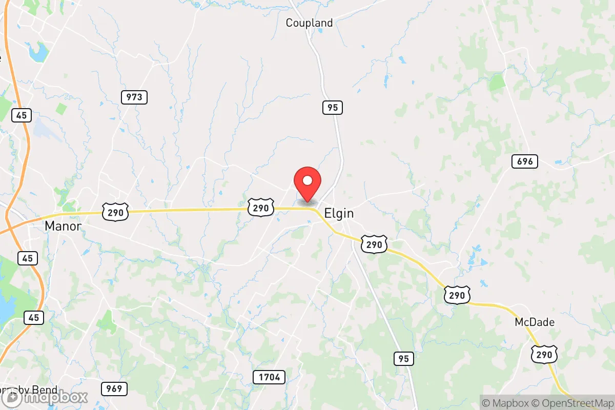
Elgin, Texas, sits in a strategic sweet spot that resilience-minded relocators should take seriously: close enough to Austin’s resources to be useful, far enough to avoid the blast radius of a major urban collapse. Its position along U.S. Highway 290 and near the intersection of State Highways 95 and 21 gives it multiple egress routes, a critical advantage when single-point failures choke most suburban sprawl. The area’s agricultural history, steady water access from the Colorado River basin, and relatively low population density (around 12,000 residents in the city proper, with Bastrop County at roughly 110 people per square mile) make it a viable base for long-term self-sufficiency. For a conservative-leaning individual or family weighing where to plant roots when the world gets shaky, Elgin offers a balance of isolation and connectivity that few Texas towns its size can match.
Geographic position and natural advantages for long-term stability
Elgin’s location in the Blackland Prairie region provides fertile soil for small-scale agriculture, a non-negotiable asset if supply chains falter. The area sits atop the Carrizo-Wilcox Aquifer, one of Texas’s most productive groundwater sources, meaning well-drilling is a realistic option for off-grid water security. The terrain is gently rolling with decent tree cover along creeks and the Little River corridor, offering natural concealment and microclimate moderation—useful for both gardening and staying off the radar. The climate is humid subtropical, with an average 34 inches of rainfall per year, enough to support rain catchment without relying on arid-region tricks. Unlike the parched western half of the state, Elgin’s part of Central Texas rarely faces the kind of multi-year drought that collapses rural water systems. The proximity to the Lost Pines Forest (a 12-mile drive southeast) adds a buffer of dense woodland that could serve as a fallback zone or resource cache area if urban evacuation becomes necessary.
Risks, exposures, and proximity to fallout-relevant landmarks
No location is a fortress, and Elgin has vulnerabilities that a serious prepper must acknowledge. The town lies roughly 25 miles east of Austin’s urban core, putting it within the secondary fallout zone of any major event targeting the state capital—whether a terrorist strike, grid-down scenario, or civil unrest cascade. Interstate 35, a primary north-south corridor, is only 15 miles west, meaning refugee flow from San Antonio and Austin would likely push east along 290 into Elgin’s vicinity. The nearby Austin-Bergstrom International Airport (20 miles west) is a high-value target for any adversary seeking to disrupt national air mobility; a strike there could send debris and panic eastward. Bastrop County’s 2011 and 2015 wildfires, which burned over 34,000 acres combined, serve as a reminder that the area’s pine and juniper stands are dry-season tinderboxes. On the industrial side, the Texas Gulf Coast’s petrochemical complex (roughly 150 miles southeast) is a potential catastrophic release point if hurricanes or sabotage hit refineries, though prevailing winds usually carry that threat east, not west. The biggest exposure is human: Elgin’s growth rate has been above 20% since 2020, bringing new residents who may not share a survivalist mindset, diluting the local knowledge base and increasing competition for resources in a crisis.
Practical resilience for a relocator: food, water, energy, and defensibility
For someone serious about self-reliance, Elgin’s practical infrastructure is a mixed bag with strong upside. Water: The city draws from the Colorado River via the Lower Colorado River Authority, but private wells in the surrounding county tap the Carrizo-Wilcox at depths of 200–400 feet—affordable to drill and reliable. Rainwater harvesting is legal and encouraged; Bastrop County offers a property tax exemption for rainwater catchment systems. Food: The area is surrounded by row-crop farms (corn, cotton, sorghum) and cattle ranches. Elgin’s butcher shops and the local farmers’ market (Saturdays year-round) indicate a food culture that doesn’t depend entirely on trucked-in groceries. Home gardening is viable with the long growing season (March to November), and the local extension office offers soil testing and seed banks. Energy: The Texas grid is its own vulnerability, but Elgin sits in a region with growing solar adoption. Net metering is available through the local electric cooperative (Bluebonnet Electric Cooperative), and off-grid solar setups face few zoning restrictions in unincorporated Bastrop County. Natural gas is piped in, but a prepper should plan for propane backup—tanks are common in rural areas. Defensibility: The town’s layout—a compact historic core with scattered subdivisions—means a perimeter defense is impractical, but individual properties on 5–10 acres offer standoff distance. The local sheriff’s office (Bastrop County) is generally conservative on Second Amendment issues; open carry is legal, and the county has no extra restrictions beyond state law. The Elgin Police Department is small (around 30 officers), so response times in rural parts of the county can exceed 20 minutes—good for privacy, bad for immediate help. Community: The population is predominantly white (60%) and Hispanic (35%), with a strong veteran presence (12% of adults). Churches and volunteer fire departments are the social backbone; joining one of these is the fastest way to build a mutual-aid network. The local school district (Elgin ISD) is rated B by the state, which matters less for preppers than the fact that the community has a history of pulling together during disasters—the 2011 wildfire evacuations were managed largely by local volunteers.
The overall strategic picture for Elgin is one of calculated risk. It is not a remote bunker—you can see the glow of Austin’s skyline on a clear night, and you will hear I-35 traffic from the west. But that proximity is also its strength: you can stock up on supplies in the city today while building a self-sufficient setup in the countryside tomorrow. The land is affordable relative to the Hill Country (average $8,000–$12,000 per acre for raw land), the water table is generous, and the local culture still values independence over compliance. For a conservative relocator who wants to be within striking distance of urban resources but outside the blast radius of a societal collapse, Elgin is a solid base camp—not a fortress, but a defensible position with room to grow your own food, drill your own well, and keep your powder dry. The key is to act before the next wave of growth prices out the very resilience that makes the area attractive.
* Values derived from national, state, county, city and local statistics and may differ in a specific area. Last updated: 2026-04-24T06:20:01.000Z
Narrative content on this page is AI-generated and may contain mistakes. Verify any details that matter before acting on them.
ReloMaps may earn a commission from affiliate links at no extra cost to you.