Photo: Wikipedia
Strategic Assessment of Fort Belvoir, VA
Meaningful friction. Expect exposure to either population pressure, blast zones, or natural disaster risk. Consider buying a retreat property.
What does the Strategic Assessment tell us?
Our Strategic Assessment grades tactical survivability of an area. Major population centers, military targets, fallout zones, natural disasters, and border exposure all drive risk — lower exposure means a more defensible position in a crisis.
This is heavily inspired by Joel Skousen's Strategic Relocation book. Highly recommended you checkout the book ($)What does this tell us?
Our Strategic Assessment grades tactical survivability of an area. Major population centers, military targets, fallout zones, natural disasters, and border exposure all drive risk — lower exposure means a more defensible position in a crisis.
This is heavily inspired by Joel Skousen's Strategic Relocation book. Highly recommended you checkout the book ($)Strategic Pillars

Key Distances
Regional Safe Places
Below is our recommended "safe zones" in Virginia and the surrounding area based on our strategic heuristics. For most people, it's unrealistic to live in a “safe zone” full-time due to work, family or other personal reasons. They tend to be more rural. However, many of these areas are perfect for second homes and retreat properties that double as a vacation home or even a short-term rental.




Important Note: For informational purposes only. This does not mean nothing bad ever happens in the green zones. Please use common sense. This is based on public data and modeled with AI. We tried to take a conservative approach but mistakes happen. We update this regularly as new information becomes available.
Solar Generator Recommendations
Backup power matters more here than in safer locations. We've picked three solar generators across budgets and capacity tiers — start with the budget unit if you only need a few essentials, or step up if you want to run a fridge and HVAC for days at a time.

Jackery Portable Power Station Explorer 300
Budget OptionPower on the Go: Weighing only 11 lbs, it's convenient to set up and store with book-sized foldable solar panels

BLUETTI Portable Power Station AC180
Designed for both indoor and outdoor scenarios, AC180 is highly capable as it has a robost capacity and continuous output power.

EF ECOFLOW DELTA Pro Ultra Power Station
Upgraded PickEcoFlow DELTA Pro Ultra is a whole-home energy system designed to grow with your family. Integrated with the Smart Home Panel 2, it scales to meet your evolving energy needs — keeping your home powered, intelligent, and secure through every stage of life.
We earn a commission, at no additional cost to you.
Strategic Assessment Analysis
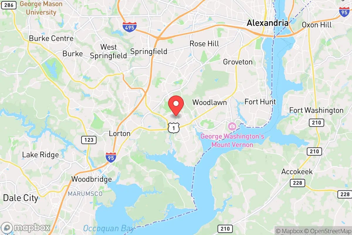
Fort Belvoir, Virginia, occupies a unique strategic position that offers both significant advantages and notable vulnerabilities for the relocation-minded individual or family prioritizing resilience and self-sufficiency. Situated roughly 15 miles south of Washington, D.C., along the Potomac River, the installation and its surrounding communities benefit from robust military infrastructure, established emergency protocols, and a relatively stable local economy. However, its proximity to the nation's capital—a high-value target for any number of man-made threats—introduces risks that must be weighed carefully against its natural and logistical strengths. For the serious preparedness-minded relocator, Fort Belvoir represents a calculated trade-off: a well-supported, defensible enclave within a region that carries inherent strategic liabilities.
Geographic position and natural advantages for long-term stability
Fort Belvoir's location in Fairfax County places it within the Piedmont region, a transitional zone between the coastal plain and the Blue Ridge Mountains. This geography provides several natural advantages. The area sits at a higher elevation than the flood-prone tidal basins of Alexandria and D.C., reducing the risk of catastrophic storm surge from hurricanes or nor'easters. The underlying geology is predominantly hard bedrock, which offers better structural stability than the sandy, marshy soils closer to the Chesapeake Bay. The Potomac River, while a potential contamination vector, also serves as a substantial freshwater source, and the region's annual rainfall of roughly 40 inches supports robust local agriculture and groundwater recharge. The presence of the Occoquan Reservoir, just west of the base, provides a secondary, protected water supply for much of the area. Furthermore, the surrounding Fairfax County park system—including Mason Neck State Park and the Elizabeth Hartwell Mason Neck National Wildlife Refuge—offers significant undeveloped land that could serve as a buffer zone or a source of wild game and forage in a prolonged disruption. The area's temperate climate, with four distinct seasons, avoids the extreme heat or cold that can stress infrastructure and human health, making it a more sustainable long-term location than many other parts of the country.
Risks, exposures, and proximity to fallout-relevant landmarks
The most significant strategic liability of Fort Belvoir is its proximity to Washington, D.C., and the dense urban corridor stretching from Baltimore to Richmond. The installation itself is a major military logistics hub, housing the Defense Logistics Agency, the U.S. Army Intelligence and Security Command, and the DeWitt Army Community Hospital. This concentration of high-value military and federal assets makes the base a potential target for kinetic or cyber attack, and its location within the National Capital Region means it would be directly affected by any major disruption to D.C.'s power grid, transportation networks, or communications infrastructure. In the event of a nuclear detonation in the capital, Fort Belvoir lies within the moderate-to-severe fallout zone, depending on wind patterns. The prevailing winds in the region are from the west and northwest, which would carry fallout from a D.C. strike directly over the base and into southern Maryland. The area is also exposed to the risk of a radiological dispersal device or a chemical release from the many industrial and research facilities along the I-95 corridor. Natural disaster risks are comparatively lower, but the region does experience occasional tornadoes (typically EF-0 to EF-2), severe thunderstorms, and the residual effects of hurricanes. The 2011 derecho, which knocked out power for days across the region, demonstrated the vulnerability of the area's heavily wooded, above-ground power lines. The presence of the Potomac River also introduces a flood risk for low-lying areas near the base, particularly along the river's edge and near the Accotink Creek watershed.
Practical resilience for a relocator: food, water, energy, and defensibility
For a relocator focused on practical self-sufficiency, Fort Belvoir offers a mixed picture. Water security is a relative strength: the Fairfax County Water Authority draws from the Potomac and the Occoquan Reservoir, and the system has backup generators and interconnections with neighboring utilities. However, a prolonged power outage or contamination event would still disrupt supply. A household-level rainwater catchment system or a well (in permitted areas) would be a wise investment. Food security is more challenging. The area is suburban, with limited agricultural land within easy commuting distance. While there are farmers' markets and community-supported agriculture (CSA) programs, the region's food supply is heavily dependent on trucking from the Shenandoah Valley and beyond. A major disruption would strain grocery stores within days. The relocator would need to establish a substantial home garden, consider raising small livestock (chickens are permitted in many parts of Fairfax County), and build a deep pantry. Energy resilience is a critical concern. The grid is reliable under normal conditions, but it is aging and vulnerable to both cyber attack and physical sabotage. Dominion Energy's North Anna nuclear plant, about 60 miles southwest, is a potential target. Solar panels with battery storage are a viable option, though homeowners' associations and county regulations can be restrictive. A backup generator, preferably running on propane or natural gas, is almost essential for any serious preparedness plan. Defensibility is a double-edged sword. The presence of a large military base provides a degree of security and a potential rallying point for organized response. The surrounding area is well-policed, with low violent crime rates. However, the dense suburban layout—with cul-de-sacs, narrow roads, and limited choke points—makes it difficult to control access to a neighborhood. The best strategy for a relocator would be to choose a home on a dead-end road or a property with a single, defensible entrance, ideally with some tree cover for concealment. The nearby Mason Neck peninsula, with its limited road access and state park buffer, offers a more defensible option than the sprawling subdivisions closer to the base.
Overall, Fort Belvoir presents a calculated strategic picture for the preparedness-minded relocator. Its military infrastructure, stable water supply, and lower natural disaster risk are genuine advantages. But the overwhelming proximity to a high-value target like Washington, D.C., and the associated risks of fallout, grid failure, and supply chain disruption cannot be ignored. This is not a location for someone seeking complete isolation or off-grid self-sufficiency. It is, however, a location where a well-prepared individual or family—with a robust home system for water, food, and energy—could ride out many types of disruptions while benefiting from the area's economic and community resources. The key is to treat Fort Belvoir as a base of operations, not a bunker. The relocator must be proactive, not passive, and must accept that the area's greatest strength—its connection to the nation's capital—is also its greatest vulnerability. For the serious strategist, it is a viable option, but only with eyes wide open and a plan that accounts for the worst-case scenarios that come with living in the shadow of power.

* Values derived from national, state, county, city and local statistics and may differ in a specific area. Last updated: 2026-08-25T00:25:02.000Z
Narrative content on this page is AI-generated and may contain mistakes. Verify any details that matter before acting on them.
ReloMaps may earn a commission from affiliate links at no extra cost to you.

