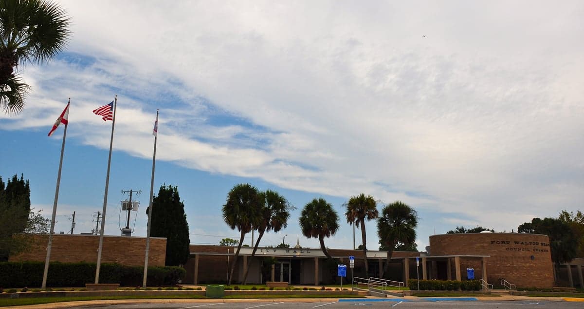
Photo: Wikipedia
Strategic Assessment of Fort Walton Beach, FL
Meaningful friction. Expect exposure to either population pressure, blast zones, or natural disaster risk. Consider buying a retreat property.
What does the Strategic Assessment tell us?
Our Strategic Assessment grades tactical survivability of an area. Major population centers, military targets, fallout zones, natural disasters, and border exposure all drive risk — lower exposure means a more defensible position in a crisis.
This is heavily inspired by Joel Skousen's Strategic Relocation book. Highly recommended you checkout the book ($)What does this tell us?
Our Strategic Assessment grades tactical survivability of an area. Major population centers, military targets, fallout zones, natural disasters, and border exposure all drive risk — lower exposure means a more defensible position in a crisis.
This is heavily inspired by Joel Skousen's Strategic Relocation book. Highly recommended you checkout the book ($)Strategic Pillars

Key Distances
Regional Safe Places
Below is our recommended "safe zones" in Florida and the surrounding area based on our strategic heuristics. For most people, it's unrealistic to live in a “safe zone” full-time due to work, family or other personal reasons. They tend to be more rural. However, many of these areas are perfect for second homes and retreat properties that double as a vacation home or even a short-term rental.

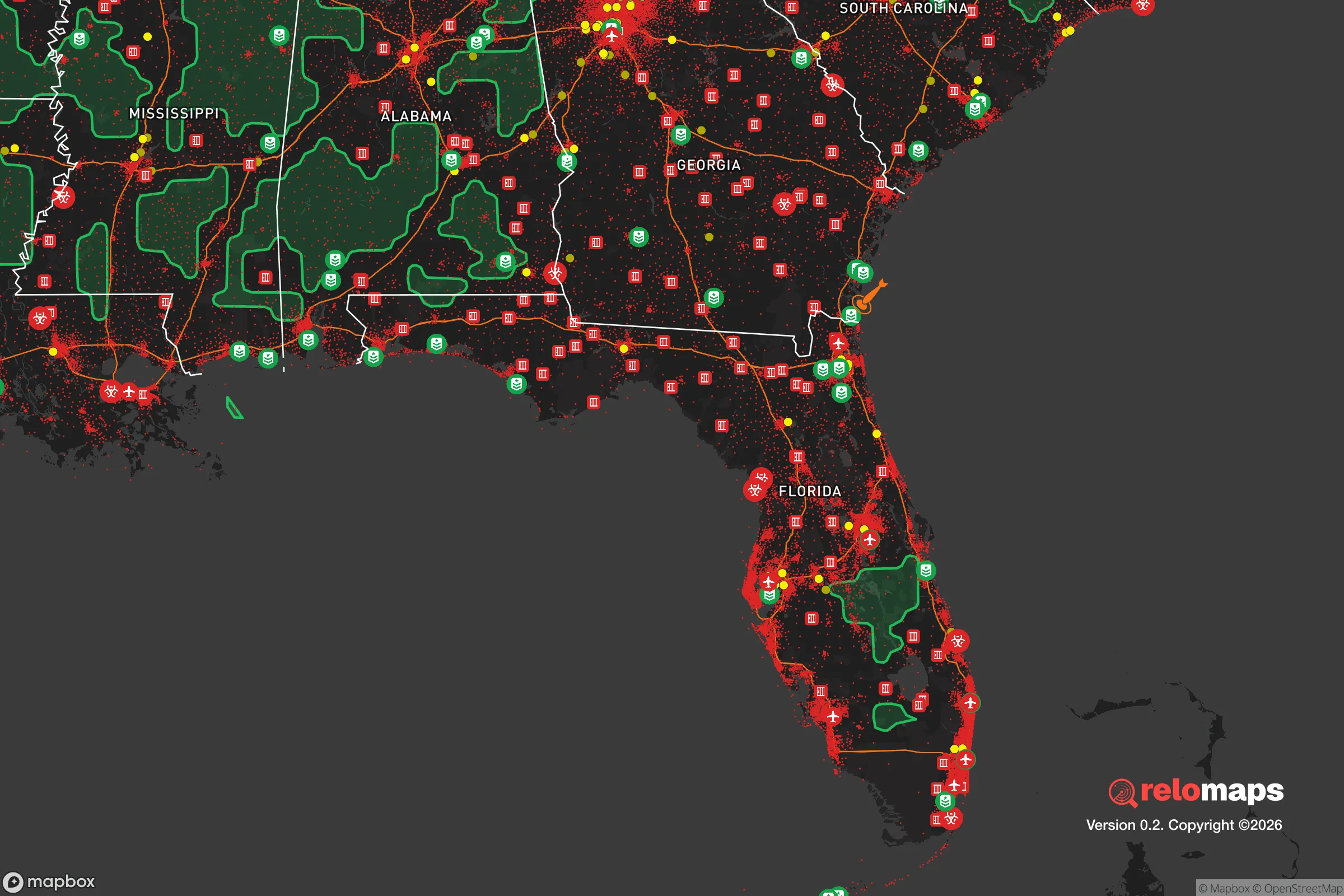
Important Note: For informational purposes only. This does not mean nothing bad ever happens in the green zones. Please use common sense. This is based on public data and modeled with AI. We tried to take a conservative approach but mistakes happen. We update this regularly as new information becomes available.
Solar Generator Recommendations
Backup power matters more here than in safer locations. We've picked three solar generators across budgets and capacity tiers — start with the budget unit if you only need a few essentials, or step up if you want to run a fridge and HVAC for days at a time.

Jackery Portable Power Station Explorer 300
Budget OptionPower on the Go: Weighing only 11 lbs, it's convenient to set up and store with book-sized foldable solar panels

BLUETTI Portable Power Station AC180
Designed for both indoor and outdoor scenarios, AC180 is highly capable as it has a robost capacity and continuous output power.

EF ECOFLOW DELTA Pro Ultra Power Station
Upgraded PickEcoFlow DELTA Pro Ultra is a whole-home energy system designed to grow with your family. Integrated with the Smart Home Panel 2, it scales to meet your evolving energy needs — keeping your home powered, intelligent, and secure through every stage of life.
We earn a commission, at no additional cost to you.
Strategic Assessment Analysis
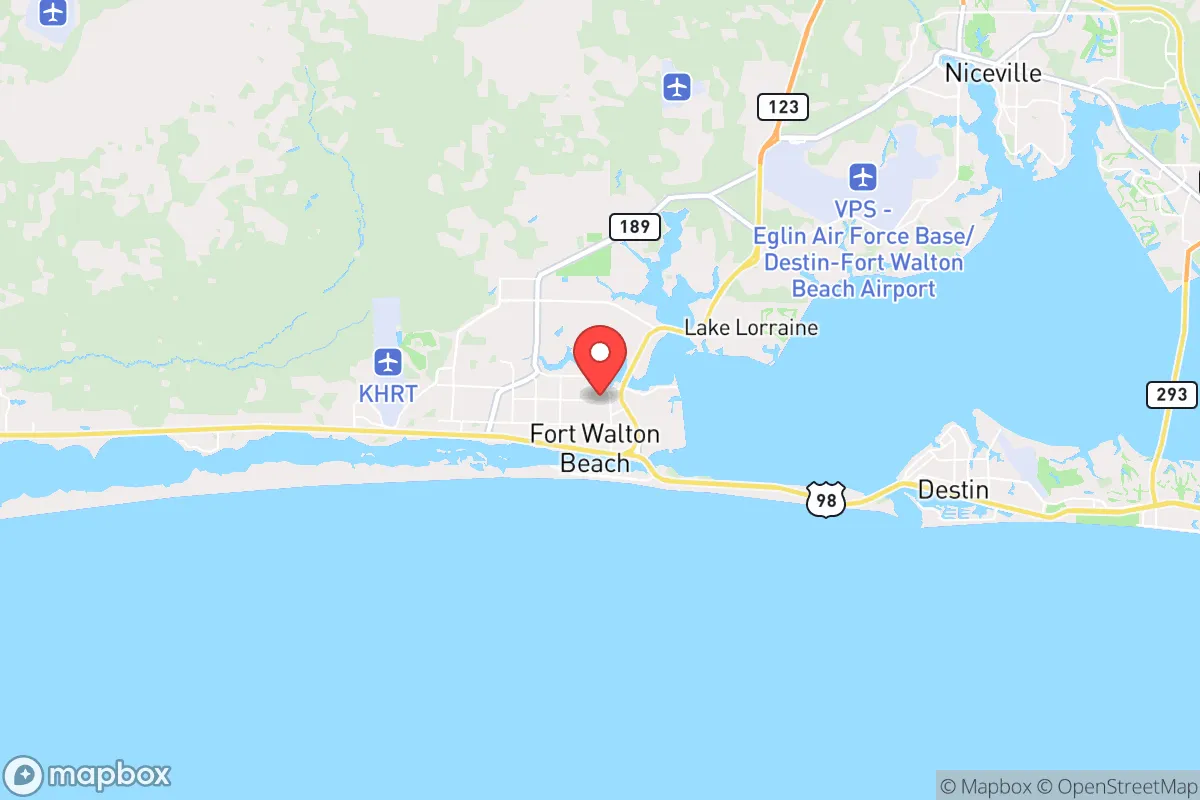
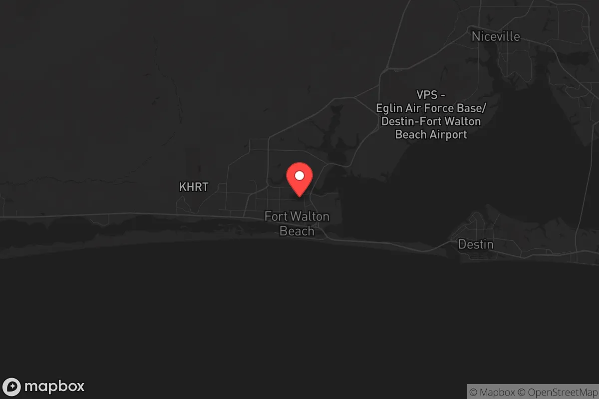
Fort Walton Beach, Florida, sits on a narrow barrier island in the Florida Panhandle, offering a strategic blend of coastal access and relative isolation from major metropolitan chaos. Its location on the Emerald Coast places it roughly 45 miles east of Pensacola and 50 miles west of Panama City, far enough from the urban cores of those cities to avoid the worst of any civil unrest or grid collapse, yet close enough to access their resources if needed. The area’s resilience is anchored by Eglin Air Force Base, a massive military installation that dominates the local economy and infrastructure, providing a stabilizing presence that most civilian towns lack. For a relocator concerned with national instability, mass casualty events, or societal breakdown, Fort Walton Beach offers a unique mix of natural barriers, military-backed security, and practical survival advantages—but it also carries distinct vulnerabilities that demand careful consideration.
Geographic position and natural advantages for long-term survival
Fort Walton Beach’s geography is its strongest asset for a prepper mindset. The city sits on a barrier island, with the Gulf of Mexico to the south and Choctawhatchee Bay to the north, creating a natural moat that limits access points. In a scenario of widespread unrest, the only land routes in and out are via the Brooks Bridge (U.S. 98) and the Mid-Bay Bridge, both of which can be easily monitored or controlled. The surrounding area is sparsely populated compared to Florida’s east coast—Okaloosa County has roughly 210,000 residents, with Fort Walton Beach itself at just over 20,000—meaning fewer people competing for resources in a crisis. The subtropical climate allows for year-round gardening, and the region’s sandy soil, while not ideal, can be amended for food production. Freshwater access is a concern, but the bay and Gulf provide abundant seafood, and the nearby Blackwater River State Forest offers timber, game, and isolation. The presence of Eglin Air Force Base, which spans over 460,000 acres of restricted land, also creates a buffer zone to the north, reducing the risk of urban sprawl and providing a potential fallback area for those with the right connections.
Risks, exposures, and proximity to fallout-relevant landmarks
The most significant risk in Fort Walton Beach is its exposure to hurricane storm surge and catastrophic weather events. The barrier island sits at an average elevation of just 10 feet above sea level, making it vulnerable to Category 3+ hurricanes that could flood the entire city. Hurricane Michael in 2018, which devastated Mexico Beach 70 miles east, serves as a grim reminder that the Panhandle is not immune to direct hits. In a mass casualty event or prolonged grid-down scenario, a hurricane could force evacuation or destroy infrastructure, leaving residents stranded on a narrow strip of land with limited escape routes. Additionally, the city’s proximity to Eglin Air Force Base—while a security asset—also makes it a potential target in a conflict scenario. The base is home to the 96th Test Wing and the 7th Special Forces Group, meaning it could be a primary target for any adversary. The nearby Hurlburt Field, home to the Air Force Special Operations Command, is just 10 miles east. In a national emergency, these installations could become focal points for military activity, drawing unwanted attention or becoming evacuation zones that overwhelm local resources. The city’s reliance on a single major highway (U.S. 98) for evacuation and supply is another vulnerability; a single accident or blockage could cut off the island entirely.
Practical resilience for a relocator: food, water, energy, and defensibility
For a relocator focused on self-sufficiency, Fort Walton Beach presents a mixed picture. Food security is achievable but requires planning: the Gulf offers year-round fishing, crabbing, and shrimping, and the bay provides oysters and clams. Local farmers’ markets and the nearby agricultural areas of DeFuniak Springs (30 miles north) offer sources for seeds, livestock, and bulk goods. However, the sandy soil and salt spray make traditional gardening challenging; raised beds with imported soil or hydroponic systems are more practical. Water is the critical weak point. The city’s drinking water comes from the Sand and Gravel Aquifer, but the island’s shallow water table is susceptible to saltwater intrusion during storms. In a long-term grid-down scenario, rainwater collection and desalination (using solar stills) would be essential, but the latter requires energy. Energy resilience is decent: the region gets abundant sunshine, making solar panels viable year-round, and the Gulf breeze supports small wind turbines. Natural gas is available in most neighborhoods, but a grid failure would cut supply. Defensibility is the area’s strongest suit. The island’s limited access points make it easy to secure a neighborhood or a single property. Many homes are built on stilts, offering elevated sightlines, and the dense canopy of live oaks provides cover. The local population skews older and more conservative, with a strong veteran presence—meaning a higher likelihood of armed, trained neighbors. The Okaloosa County Sheriff’s Office is well-funded and has a reputation for rapid response, but in a widespread crisis, residents would largely be on their own. Medical resilience is a concern: the only major hospital is Fort Walton Beach Medical Center, which could be overwhelmed quickly. Stockpiling trauma supplies and antibiotics is advisable.
The overall strategic picture for Fort Walton Beach is one of calculated trade-offs. It offers a rare combination of natural isolation, military-backed stability, and a like-minded community that values preparedness. The climate supports year-round subsistence, and the access to the Gulf provides a nearly limitless food source if you have the skills to harvest it. But the hurricane risk is real and recurring, and the island’s low elevation and single evacuation route are hard vulnerabilities to mitigate. For a relocator who can invest in storm-hardened infrastructure, water storage, and alternative energy, Fort Walton Beach could serve as a defensible coastal redoubt. For those unwilling to accept the weather risk or the potential for military-related fallout, the inland areas north of the bay—like Crestview or Niceville—offer better elevation and more escape routes while still keeping you within striking distance of the coast’s resources. In a world where the next crisis could be civil, natural, or geopolitical, Fort Walton Beach is not a perfect sanctuary, but it is a viable option for those who understand its limits and prepare accordingly.
* Values derived from national, state, county, city and local statistics and may differ in a specific area. Last updated: 2026-04-19T06:58:07.000Z
Narrative content on this page is AI-generated and may contain mistakes. Verify any details that matter before acting on them.
ReloMaps may earn a commission from affiliate links at no extra cost to you.