Photo: Wikipedia
Strategic Assessment of Douglas County
Meaningful friction. Expect exposure to either population pressure, blast zones, or natural disaster risk. Consider buying a retreat property.
What does the Strategic Assessment tell us?
Our Strategic Assessment grades tactical survivability of an area. Major population centers, military targets, fallout zones, natural disasters, and border exposure all drive risk — lower exposure means a more defensible position in a crisis.
This is heavily inspired by Joel Skousen's Strategic Relocation book. Highly recommended you checkout the book ($)What does this tell us?
Our Strategic Assessment grades tactical survivability of an area. Major population centers, military targets, fallout zones, natural disasters, and border exposure all drive risk — lower exposure means a more defensible position in a crisis.
This is heavily inspired by Joel Skousen's Strategic Relocation book. Highly recommended you checkout the book ($)Strategic Pillars

Key Distances
Strategic Assessment Analysis
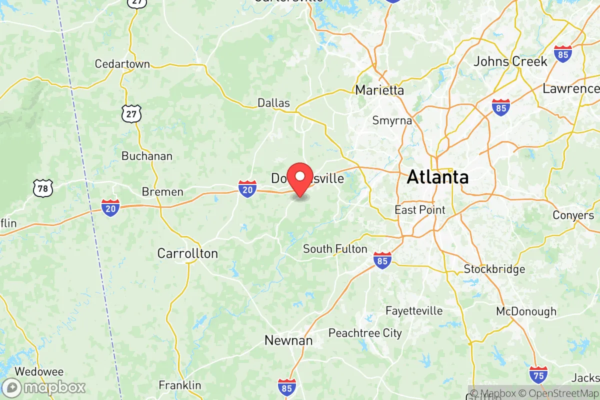
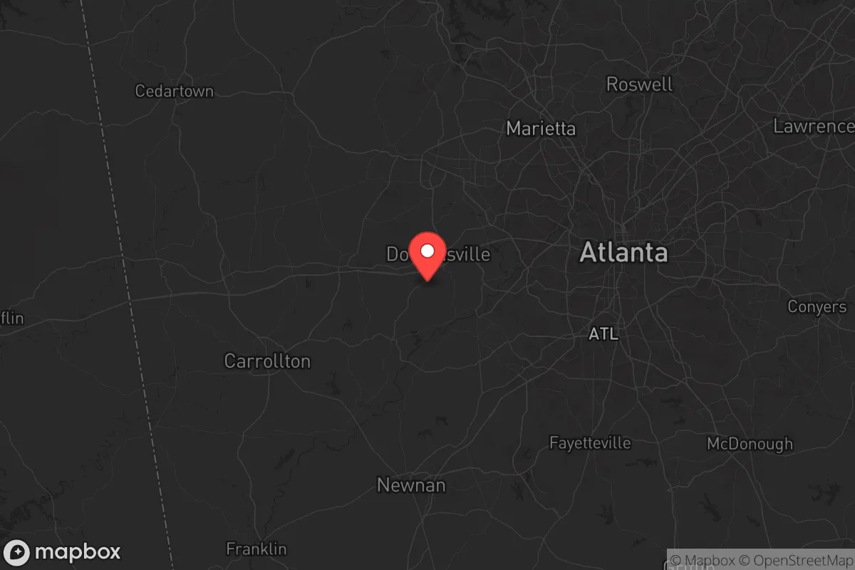
If you're scanning for a resilient pocket in the Southeast that's far enough from the Atlanta blast zone to buy you reaction time, Douglas County, Georgia, deserves a serious look. Tucked along the western edge of the metro sprawl, its position on the Piedmont plateau offers a mix of access and isolation that's rare this close to a Tier-1 urban target. The 2020 census pegged the county at about 145,000 people—enough to maintain commerce but not so dense that a breakdown would descend into Mad Max territory overnight. The real draw here is that you can be in the woods inside twenty minutes while still holding a job in the city until the lights go out.
Geographic position and natural advantages away from the urban core
Douglas County sits roughly 20 miles west of downtown Atlanta, straddling Interstate 20 between the city and the Alabama line. That puts it in a sweet spot: close enough that you can monitor the collapse in real time, far enough that you're not ground zero for the primary shockwave—thermal, nuclear, or civic. The county's topography rolls gently from the Piedmont foothills into the Tallapoosa River basin, giving you natural drainage, wooded ridges, and plenty of places to disappear. The Chattahoochee River forms the northeastern boundary, offering a reliable surface water source and a natural barrier against foot traffic from the city. If you know the backroads around Douglasville and Winston, you can move livestock, supplies, or family members east-west along the I-20 corridor or north-south on Highway 5 without ever touching a major choke point. The climate is humid subtropical, which means growing seasons stretch from March through October, and the average annual rainfall of about 50 inches keeps creeks flowing and gardens producing without heavy irrigation. You're not coastal, so hurricane storm surge is off the table, and the elevation around 1,000 feet reduces flash flooding risk compared to lower-lying parts of the state.
Fallout-relevant landmarks and risk exposure in the Atlanta metro
Let's be blunt: Atlanta is a high-priority target. Hartsfield-Jackson Atlanta International Airport sits 25 miles east of downtown Douglasville—the busiest airport in the world by passenger traffic and a primary node for military logistics, CDC operations, and Federal Reserve shipments. That alone makes the metro region a potential first-strike or civil-unrest epicenter. The CDC headquarters itself is only 30 miles northeast of the county line, and the concentration of corporate HQs, data centers, and fiber trunk lines along the I-75/I-85 corridors turns the entire Atlanta basin into a soft target for EMP, cyber, or physical sabotage. For the relocator, the risk isn't just the blast—it's the refugee flow. I-20 runs straight through the heart of Douglas County, and any major event in the city will send tens of thousands of panicked people west toward Alabama. You need to assume that Douglasville becomes a secondary choke point within 24 hours of a crisis. The county also hosts a major electrical substation near Lithia Springs that feeds the western metro grid; if that goes down, you're relying on backup solar or generator power. On the plus side, there are no oil refineries, nuclear plants, or major military bases inside the county itself—Fort Moore is about 100 miles south and Dobbins Air Reserve Base about 30 miles north—so you're not standing on a primary target. But you're in the shadow of one, and you need to plan your egress routes accordingly.
Practical resilience for a prepper: food, water, energy, and defensibility
The practical question is whether Douglas County lets you sustain life when the systems stop. Water is workable but not effortless. The Chattahoochee River is a reliable source, but you'll need filtration and a plan to reach it without crossing major roads. County-wide, the water table is accessible in many areas—hand-dug wells and driven points are viable on most residential lots of an acre or more, particularly west of Villa Rica and south toward Temple in adjacent Carroll County. Lake Allatoona is about 20 miles north, but that's far enough to be impractical for daily hauling unless you get a bicycle trailer setup. Food-wise, the county retains a surprising amount of agricultural land: about 15% of the acreage is still in pasture or row crops, and there are working farms around Winston and the Dorsett Shoals area where you could barter or buy direct today. The local extension office reports that soil quality is decent for vegetables, berries, and even some orchards if you amend the clay. For energy, solar potential is adequate—Georgia averages about 4.5 peak sun hours per day—but the rolling terrain means you need south-facing slopes or clearings. A solid 5kW ground-mount system with battery backup can run a well pump, lights, and communications indefinitely if you manage draw. Defensibility is mixed: the subdivisions near Douglasville are too dense for a long-term stand, but the rural pockets west of Highway 5 have wooded buffer zones, limited access roads, and enough terrain variance to create natural firing lanes and observation points. Community is the hidden asset here—there are active church networks, farm co-ops, and a political demographic that leans heavily red, meaning you're more likely to find neighbors who share your views on self-reliance and don't expect FEMA to arrive with hot meals.
So where does that leave you? Douglas County isn't a fortress—it's a strategic waypoint with decent defensive terrain, real water access, and enough agricultural capacity to supplement long-term storage. The proximity to Atlanta cuts both ways: you get the economy and resources now, but you'll pay for it in chaos when the city unravels. The smart play is to treat Douglas County as a transition zone—live here while you build skills, cache supplies at a secondary location farther west or south, and maintain a detailed bug-out route that avoids I-20 entirely. For the single relocator or family with a prepper mindset, it offers a practical balance of accessibility and resilience, provided
* Values derived from national, state, county, city and local statistics and may differ in a specific area. Last updated: 2026-06-06T00:27:15.000Z
Narrative content on this page is AI-generated and may contain mistakes. Verify any details that matter before acting on them.
ReloMaps may earn a commission from affiliate links at no extra cost to you.