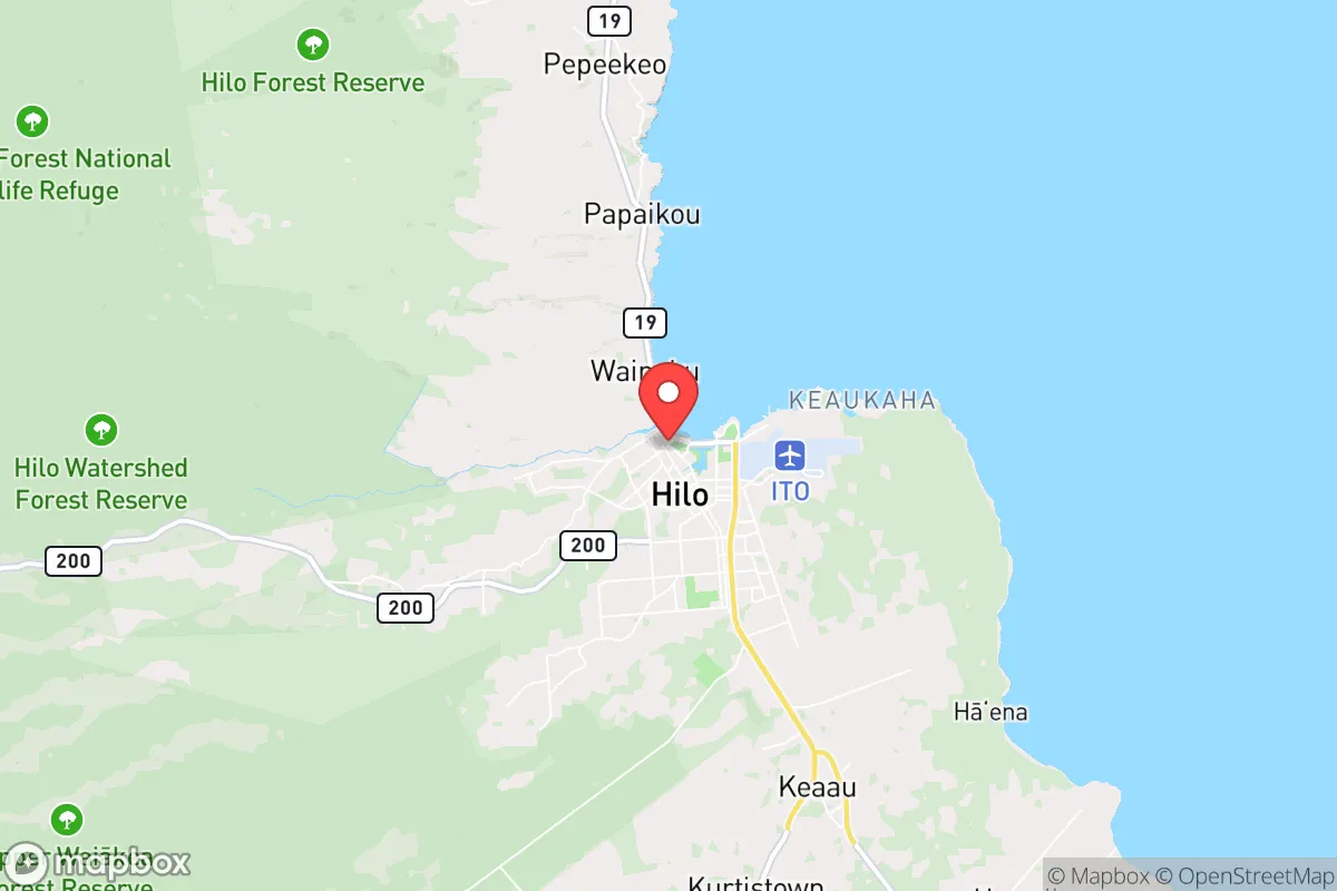
Strategic Assessment of Hilo, HI
Strong survivability profile. Good buffer from population centers, with manageable environmental and tactical risks.
What does the Strategic Assessment tell us?
Our Strategic Assessment grades tactical survivability of an area. Major population centers, military targets, fallout zones, natural disasters, and border exposure all drive risk — lower exposure means a more defensible position in a crisis.
This is heavily inspired by Joel Skousen's Strategic Relocation book. Highly recommended you checkout the book ($)What does this tell us?
Our Strategic Assessment grades tactical survivability of an area. Major population centers, military targets, fallout zones, natural disasters, and border exposure all drive risk — lower exposure means a more defensible position in a crisis.
This is heavily inspired by Joel Skousen's Strategic Relocation book. Highly recommended you checkout the book ($)Strategic Pillars

Key Distances
Regional Safe Places
Below is our recommended "safe zones" in Hawaii and the surrounding area based on our strategic heuristics. For most people, it's unrealistic to live in a “safe zone” full-time due to work, family or other personal reasons. They tend to be more rural. However, many of these areas are perfect for second homes and retreat properties that double as a vacation home or even a short-term rental.


Important Note: For informational purposes only. This does not mean nothing bad ever happens in the green zones. Please use common sense. This is based on public data and modeled with AI. We tried to take a conservative approach but mistakes happen. We update this regularly as new information becomes available.
Solar Generator Recommendations
Backup power matters more here than in safer locations. We've picked three solar generators across budgets and capacity tiers — start with the budget unit if you only need a few essentials, or step up if you want to run a fridge and HVAC for days at a time.

Jackery Portable Power Station Explorer 300
Budget OptionPower on the Go: Weighing only 11 lbs, it's convenient to set up and store with book-sized foldable solar panels

BLUETTI Portable Power Station AC180
Designed for both indoor and outdoor scenarios, AC180 is highly capable as it has a robost capacity and continuous output power.

EF ECOFLOW DELTA Pro Ultra Power Station
Upgraded PickEcoFlow DELTA Pro Ultra is a whole-home energy system designed to grow with your family. Integrated with the Smart Home Panel 2, it scales to meet your evolving energy needs — keeping your home powered, intelligent, and secure through every stage of life.
We earn a commission, at no additional cost to you.
Strategic Assessment Analysis
Hilo, on the Big Island of Hawaii, presents a unique strategic paradox for the conservative prepper: it is simultaneously one of the most resilient and most exposed locations in the United States. Its extreme isolation—over 2,500 miles from the nearest continental landmass—offers a natural buffer against the cascading failures of a collapsing mainland, while its position on the windward side of an active volcanic island introduces a distinct set of survival challenges. For the relocator seeking to escape the dense, target-rich environments of the continental US, Hilo’s remoteness is its primary asset, but it demands a serious, self-reliant mindset that most suburban preppers are not prepared for.
Geographic isolation and natural buffer from mainland collapse
Hilo’s greatest strategic advantage is its location. It sits on the eastern shore of the Big Island, the most isolated landmass of its size on Earth. This distance acts as a de facto moat against the rapid spread of civil unrest, supply chain disruptions, and pandemic vectors that would cripple the mainland. In a scenario of widespread societal breakdown, the logistical challenge of reaching Hilo—requiring either a private vessel capable of a multi-week Pacific crossing or a commercial flight that would be among the first grounded—makes it a low-probability target for organized chaos. The island’s single major port and airport are chokepoints that can be monitored and, if necessary, controlled by a determined community. Furthermore, the Big Island’s sheer size (over 4,000 square miles) means that even if Hilo itself becomes compromised, the interior ranchlands and the remote Puna and Kaʻū districts offer vast, sparsely populated retreat areas. The active volcano, Kīlauea, while a hazard, also provides a natural barrier on the island’s south side, funneling movement and creating defensible terrain.
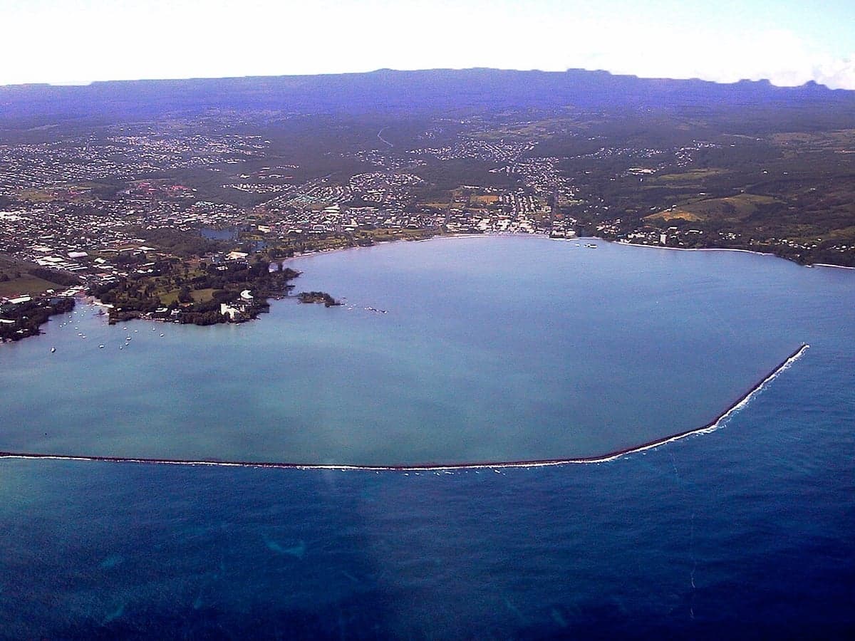
Volcanic, tsunami, and hurricane exposure near critical infrastructure
This isolation comes with a heavy price: Hilo is directly exposed to multiple natural threats that could collapse its infrastructure faster than any mainland crisis. The city lies in the shadow of Mauna Loa and Kīlauea, and while the immediate lava flow risk to downtown Hilo is low, vog (volcanic smog) from Kīlauea’s summit creates chronic respiratory hazards that degrade health and equipment over time. More critically, Hilo’s low-lying coastal areas are at extreme risk from tsunamis. The 1946 and 1960 tsunamis devastated the downtown, and the city’s tsunami evacuation maps are sobering reading for any prepper. A major Pacific earthquake could inundate the entire bayfront, destroying the port, the main highway (Route 19), and the Hilo International Airport—the very lifelines that make the location viable. Hurricanes, though less frequent than in the western Pacific, are a real threat; a direct hit from a Category 4 storm would flatten the city’s aging building stock and disrupt the fragile electrical grid for weeks. For the conservative relocator, the calculus is clear: Hilo’s isolation is a double-edged sword, offering protection from human-caused disasters but demanding a high tolerance for geological and meteorological volatility.
Practical resilience: food, water, energy, and defensibility on the Big Island
For the prepper willing to adapt, Hilo offers a surprisingly robust foundation for long-term self-sufficiency. The area receives over 130 inches of rain annually, meaning fresh water is abundant if you know how to capture and filter it. Rainwater catchment systems are standard in rural subdivisions, and the island’s volcanic aquifers are deep and generally clean. Food resilience is a mixed bag: the rich volcanic soil and year-round growing season allow for prolific fruit and vegetable production (avocado, papaya, citrus, taro, breadfruit), but the island imports roughly 85% of its staple foods, including grains, dairy, and meat. A serious prepper would need to establish a substantial garden and consider small-scale livestock (chickens, goats) to offset this dependency. The local fishing community is active, but nearshore stocks are pressured. Energy is a weak point: the grid is fragile, expensive (electricity costs are among the highest in the US), and heavily dependent on imported oil. Solar is a must, but the persistent cloud cover in Hilo reduces panel efficiency compared to the Kona side. Defensibility is excellent in the rural districts. The dense jungle and winding, unimproved roads make movement difficult for outsiders, and the local culture of “ohana” (family) and neighborly self-reliance aligns well with a prepper ethos. However, theft and property crime are persistent issues in Hilo’s lower-income areas, so a low-profile, hardened homestead is essential, not optional.
The strategic picture: a high-risk, high-reward Pacific redoubt
Hilo is not a bug-out location for the faint of heart or the unprepared. It is a long-term strategic relocation for those who accept that the mainland’s trajectory is toward instability and who are willing to trade the comforts of modern convenience for genuine geographic security. The downsides are real: the cost of living is high, job opportunities are limited to tourism, healthcare, and government, and the constant threat of volcanic or tsunami disruption means you must always have a plan B. But for the conservative individual or family looking to build a life outside the reach of federal overreach, coastal riots, or a cascading grid failure, Hilo offers something rare: a place where the community is small enough to know your neighbors, the land is fertile enough to feed you, and the ocean is wide enough to keep the chaos at bay. The key is to treat Hilo not as a paradise, but as a Pacific outpost—a place where preparation, not convenience, determines your quality of life. If you can handle the rain, the vog, and the isolation, it may be one of the last viable redoubts in the country.
* Values derived from national, state, county, city and local statistics and may differ in a specific area. Last updated: 2026-04-23T22:53:42.000Z
Narrative content on this page is AI-generated and may contain mistakes. Verify any details that matter before acting on them.
ReloMaps may earn a commission from affiliate links at no extra cost to you.