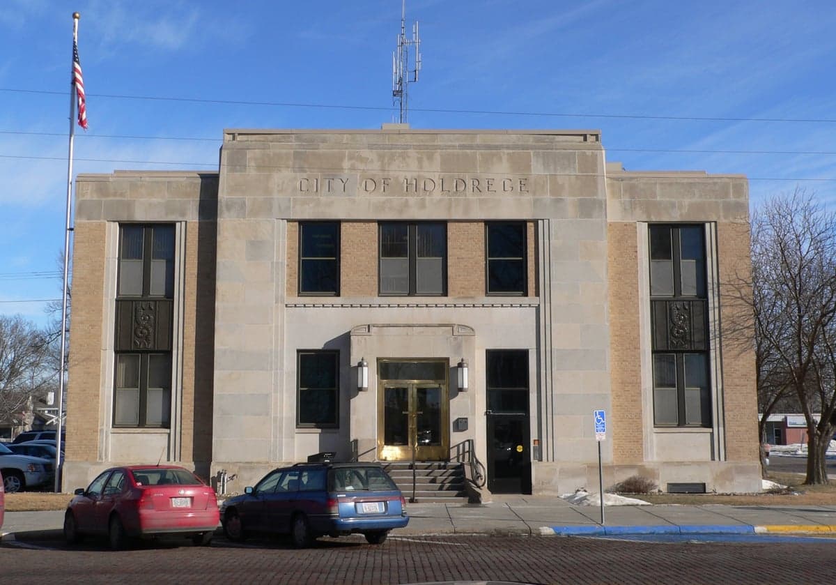
Photo: Wikipedia
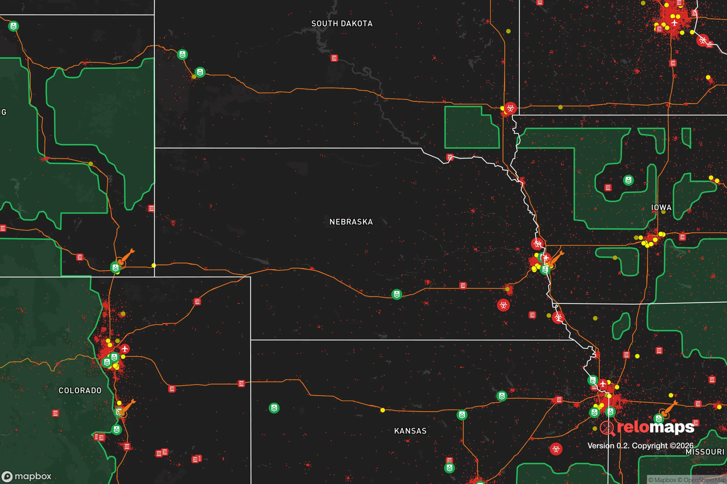
Strategic Assessment of Holdrege, NE
Deep buffer from population centers and strategic targets. Low natural disaster risk and minimal exposure to border or coastal threats.
What does the Strategic Assessment tell us?
Our Strategic Assessment grades tactical survivability of an area. Major population centers, military targets, fallout zones, natural disasters, and border exposure all drive risk — lower exposure means a more defensible position in a crisis.
This is heavily inspired by Joel Skousen's Strategic Relocation book. Highly recommended you checkout the book ($)What does this tell us?
Our Strategic Assessment grades tactical survivability of an area. Major population centers, military targets, fallout zones, natural disasters, and border exposure all drive risk — lower exposure means a more defensible position in a crisis.
This is heavily inspired by Joel Skousen's Strategic Relocation book. Highly recommended you checkout the book ($)Strategic Pillars

Key Distances
Regional Safe Places
Below is our recommended "safe zones" in Nebraska and the surrounding area based on our strategic heuristics. For most people, it's unrealistic to live in a “safe zone” full-time due to work, family or other personal reasons. They tend to be more rural. However, many of these areas are perfect for second homes and retreat properties that double as a vacation home or even a short-term rental.
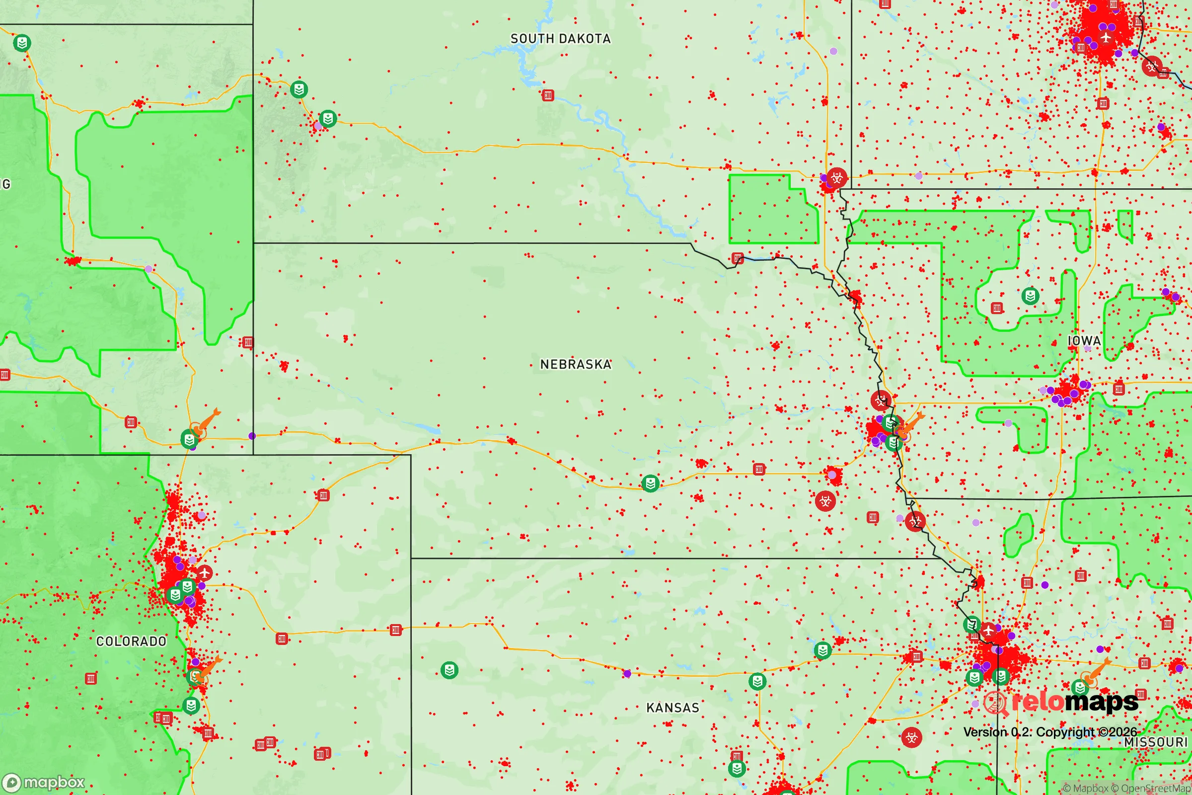
Important Note: For informational purposes only. This does not mean nothing bad ever happens in the green zones. Please use common sense. This is based on public data and modeled with AI. We tried to take a conservative approach but mistakes happen. We update this regularly as new information becomes available.
Solar Generator Recommendations
Backup power matters more here than in safer locations. We've picked three solar generators across budgets and capacity tiers — start with the budget unit if you only need a few essentials, or step up if you want to run a fridge and HVAC for days at a time.

Jackery Portable Power Station Explorer 300
Budget OptionPower on the Go: Weighing only 11 lbs, it's convenient to set up and store with book-sized foldable solar panels

BLUETTI Portable Power Station AC180
Designed for both indoor and outdoor scenarios, AC180 is highly capable as it has a robost capacity and continuous output power.

EF ECOFLOW DELTA Pro Ultra Power Station
Upgraded PickEcoFlow DELTA Pro Ultra is a whole-home energy system designed to grow with your family. Integrated with the Smart Home Panel 2, it scales to meet your evolving energy needs — keeping your home powered, intelligent, and secure through every stage of life.
We earn a commission, at no additional cost to you.
Strategic Assessment Analysis
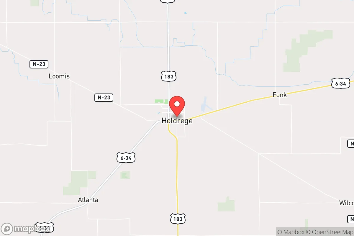
Holdrege, Nebraska, sits at a strategic intersection of agricultural self-sufficiency and geographic isolation that makes it a serious contender for anyone thinking long-term about resilience. Located in Phelps County along the Platte River valley, this town of roughly 5,500 people offers a combination of reliable water access, productive soil, and distance from major population centers that is increasingly rare in the lower 48. For a relocator concerned with civic stability, supply chain disruptions, or mass casualty events, Holdrege provides a baseline of defensibility that most suburban or exurban locations simply cannot match.
Geographic position and natural advantages for long-term stability
Holdrege’s primary strategic asset is its position within the Nebraska Sandhills transition zone, where the Platte River aquifer provides one of the most reliable shallow groundwater sources in the Great Plains. The town sits directly over the Ogallala Aquifer, and the Platte River itself runs just north of the city limits, offering surface water redundancy that many Plains communities lack. This water security is not theoretical—the region has not experienced a significant drought-induced water shortage in recorded history, and the aquifer recharge rate in this stretch of the Platte Valley is among the highest in the state. For a prepper mindset, that means you are not dependent on a single municipal well or a distant reservoir that could be compromised by infrastructure failure or sabotage.
The surrounding agricultural land is Class I and II soil, capable of producing corn, soybeans, and alfalfa without heavy irrigation in normal years. The local economy is anchored by agribusiness—Becton Dickinson has a large medical device plant here, and the area is a major center for seed corn production—but the real value is that the land itself can support a family-scale operation if supply chains ever break down. The nearest city of any size is Kearney, 25 miles east, and Lincoln is 150 miles away. Omaha and Denver are both over 200 miles distant. This buffer means that a major event in a population center—whether a terrorist attack, a pandemic wave, or civil unrest—will not immediately spill over into Holdrege. The town is far enough off the interstate system (I-80 runs 20 miles north) that casual traffic is minimal, but close enough that you can reach medical or supply hubs if needed.
Risks, exposures, and proximity to fallout-relevant landmarks
No location is without vulnerabilities, and Holdrege has several that a serious relocator must weigh. The most obvious is the presence of the Nebraska Public Power District’s Gerald Gentleman Station, a coal-fired power plant located about 30 miles northwest near Sutherland. While not a nuclear facility, it is a large industrial target that could be affected by grid sabotage or a major EMP event. The plant’s coal supply is delivered by rail, meaning the Union Pacific mainline that runs through Holdrege is a potential chokepoint. If that rail line is cut—whether by accident, sabotage, or a coordinated attack—the town’s ability to receive bulk fuel, fertilizer, and manufactured goods would be severely compromised within weeks.
The Platte River itself is a double-edged sword. While it provides water, it also creates a floodplain that could be a liability in a prolonged grid-down scenario where levee maintenance stops. The 2019 floods in central Nebraska demonstrated that even modest river rises can isolate communities for days. Holdrege is not in a high-risk flood zone, but the low-lying areas along the river’s south bank could become impassable if infrastructure fails. Additionally, the town’s proximity to the Kearney Army National Guard facility (about 25 miles east) means that in a major national emergency, military traffic could funnel through the area, potentially drawing unwanted attention. For a survivalist perspective, the ideal is to be invisible, and any military connection reduces that invisibility.
On the positive side, Holdrege has no nuclear power plants within 100 miles, no major chemical storage facilities, and no known targets on any federal critical infrastructure list. The nearest major rail yard is in North Platte (60 miles west), which is a massive Union Pacific hub and a plausible target for sabotage or attack. Holdrege is far enough from that yard to avoid direct fallout, but close enough that a disruption there would affect rail service through the area. The town’s isolation from interstate highways also means it is not a natural route for refugee flows from a collapsed city—most evacuees would stick to I-80, leaving Holdrege off the beaten path.
Practical resilience for a relocator: food, water, energy, and defensibility
For someone serious about self-sufficiency, Holdrege offers a workable baseline that requires effort to exploit but is not dependent on exotic infrastructure. The water situation is excellent: the municipal supply comes from deep wells tapping the Ogallala, and the water table is shallow enough that a private well can be drilled to 100-150 feet with good yield. Most rural properties in the county already have wells, and the local extension office provides free water testing. For food production, the growing season is about 150 days, which is tight but workable for cold-hardy crops like potatoes, winter squash, and grains. The local farmers’ co-op stocks seed, fertilizer, and equipment parts, and there is a strong culture of barter and trade among the agricultural community. In a collapse scenario, a relocator who arrives with skills—welding, veterinary medicine, mechanical repair—will integrate far faster than someone with just supplies.
Energy resilience is a mixed bag. The grid is served by NPPD, which has a good reliability record, but the area is prone to ice storms and blizzards that can knock out power for days. Solar potential is moderate—the region gets about 4.5 peak sun hours per day, which is enough for a modest off-grid system but not for heavy loads like electric heating. Wood heating is viable, as the surrounding farmland has windbreaks and shelterbelts that provide a sustainable fuel source if managed properly. Propane is widely available and stored in bulk at several local suppliers, which is a hedge against grid failure for cooking and heating. Defensibility is good: the town is laid out on a grid with wide streets, and the surrounding farmland provides clear sightlines. There are no natural chokepoints that would make the town easy to surround, but also no terrain that would make it hard to approach. A determined group could secure the town’s perimeter with relatively few people, but the open terrain also means that a hostile force could approach from multiple directions. The local sheriff’s office is well-funded and has good relationships with the community, which is a plus for maintaining order in a crisis.
The overall strategic picture for Holdrege is one of moderate resilience with specific trade-offs. It is not a bug-out location for someone who wants to disappear into the wilderness—there is no national forest, no mountain redoubt, no off-grid community of like-minded preppers. What it offers is a functioning small town with a real economy, real water, and real soil, located far enough from the chaos of the coasts and the big cities to give you a fighting chance at riding out a prolonged disruption. The conservative culture is genuine, not performative: people here are armed, self-reliant, and suspicious of federal overreach, which means that in a crisis, you will be surrounded by neighbors who share your values rather than by people waiting for FEMA to show up. The downsides—rail dependency, flood risk, and the presence of a major power plant—are manageable if you plan ahead and build relationships before the trouble starts. For a single individual or a family willing to put in the work, Holdrege represents a solid B+ option in a country where A+ locations are increasingly hard to find.
* Values derived from national, state, county, city and local statistics and may differ in a specific area. Last updated: 2026-05-03T20:28:44.000Z
Narrative content on this page is AI-generated and may contain mistakes. Verify any details that matter before acting on them.
ReloMaps may earn a commission from affiliate links at no extra cost to you.