Photo: Wikipedia
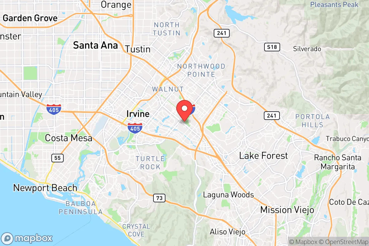
Strategic Assessment of Irvine, CA
High tactical risk. This location is likely close to major population centers, strategic targets, or sits in a high-disaster corridor. A retreat property and careful exit planning is required.
What does the Strategic Assessment tell us?
Our Strategic Assessment grades tactical survivability of an area. Major population centers, military targets, fallout zones, natural disasters, and border exposure all drive risk — lower exposure means a more defensible position in a crisis.
This is heavily inspired by Joel Skousen's Strategic Relocation book. Highly recommended you checkout the book ($)What does this tell us?
Our Strategic Assessment grades tactical survivability of an area. Major population centers, military targets, fallout zones, natural disasters, and border exposure all drive risk — lower exposure means a more defensible position in a crisis.
This is heavily inspired by Joel Skousen's Strategic Relocation book. Highly recommended you checkout the book ($)Strategic Pillars

Key Distances
Regional Safe Places
Below is our recommended "safe zones" in California and the surrounding area based on our strategic heuristics. For most people, it's unrealistic to live in a “safe zone” full-time due to work, family or other personal reasons. They tend to be more rural. However, many of these areas are perfect for second homes and retreat properties that double as a vacation home or even a short-term rental.


Important Note: For informational purposes only. This does not mean nothing bad ever happens in the green zones. Please use common sense. This is based on public data and modeled with AI. We tried to take a conservative approach but mistakes happen. We update this regularly as new information becomes available.
Solar Generator Recommendations
Backup power matters more here than in safer locations. We've picked three solar generators across budgets and capacity tiers — start with the budget unit if you only need a few essentials, or step up if you want to run a fridge and HVAC for days at a time.

Jackery Portable Power Station Explorer 300
Budget OptionPower on the Go: Weighing only 11 lbs, it's convenient to set up and store with book-sized foldable solar panels

BLUETTI Portable Power Station AC180
Designed for both indoor and outdoor scenarios, AC180 is highly capable as it has a robost capacity and continuous output power.

EF ECOFLOW DELTA Pro Ultra Power Station
Upgraded PickEcoFlow DELTA Pro Ultra is a whole-home energy system designed to grow with your family. Integrated with the Smart Home Panel 2, it scales to meet your evolving energy needs — keeping your home powered, intelligent, and secure through every stage of life.
We earn a commission, at no additional cost to you.
Strategic Assessment Analysis
Irvine, California, presents a deeply contradictory picture for the strategic relocator. On one hand, its master-planned design, robust local economy, and high median income create a bubble of order and prosperity that is rare in modern America. On the other, its location in the heart of Orange County, sandwiched between the Pacific Ocean and the sprawling Los Angeles metroplex, places it within the blast radius of some of the most significant strategic vulnerabilities on the West Coast. For a conservative-minded individual or family prioritizing long-term preparedness, civic stability, and self-sufficiency, Irvine offers a few genuine advantages but carries severe, non-negotiable liabilities that must be weighed with cold, hard realism.
Geographic position and natural advantages: A coastal fortress with a glass jaw
Irvine’s geographic position is a study in contradictions. It sits on a coastal plain, roughly 10 miles inland from the Pacific, which provides a moderate Mediterranean climate that is a genuine asset for long-term habitation. There are no brutal winters, no tornadoes, and the risk of hurricanes is effectively zero. This climate stability reduces the strain on infrastructure and housing during normal times, which is a plus for daily life. The city is also ringed by a network of open-space preserves—the Irvine Ranch Open Space, the San Joaquin Wildlife Sanctuary, and the Cleveland National Forest to the east—which provide a buffer of undeveloped land that could, in theory, serve as a natural barrier against urban sprawl and offer limited egress routes. However, this is a double-edged sword. The same geography that provides scenic beauty also funnels all major transportation corridors—Interstates 5, 405, and 405—into a narrow coastal chokepoint. Any major event that closes these arteries, whether a seismic event, a coordinated attack, or civil unrest, would effectively trap the population of Irvine and the entire Orange County basin. The city’s master-planned design, with its carefully separated residential, commercial, and industrial zones, is a boon for quality of life but a nightmare for decentralized survival. You are not in a rural redoubt; you are in a highly engineered, densely populated suburb that depends entirely on just-in-time logistics for food, fuel, and water.
Risks, exposures, and proximity to fallout-relevant landmarks
This is where the analysis turns grim. Irvine’s proximity to high-value, high-risk targets is its single greatest strategic weakness. The city lies roughly 40 miles southeast of downtown Los Angeles and 15 miles from the Ports of Los Angeles and Long Beach—the largest port complex in the Western Hemisphere. In a scenario involving a major geopolitical conflict, a terrorist attack, or a state-sponsored cyber-physical assault, these ports are a tier-one target. A single successful strike on the port complex, or even a major disruption like a bridge collapse or a dirty bomb, would cripple the entire supply chain for the region. Irvine would be directly downwind of any fallout or secondary effects. Furthermore, the city is within 20 miles of Marine Corps Base Camp Pendleton to the south and Joint Forces Training Base Los Alamitos to the northwest. While these are military assets, in a crisis they become magnets for both enemy action and desperate civilian populations seeking security. The presence of the San Onofre Nuclear Generating Station (SONGS), though decommissioned, still holds spent nuclear fuel on site, roughly 25 miles down the coast. A catastrophic event there—whether natural or man-made—would render a significant portion of coastal Orange County uninhabitable for generations. Irvine is also crisscrossed by major natural gas pipelines and high-voltage transmission lines, all of which are vulnerable to sabotage or cascading failure. The city’s very modernity—its reliance on a fragile, interconnected grid—is its Achilles’ heel.
Practical resilience for a relocator: Food, water, energy, and defensibility
For a family or individual looking to establish a resilient household, Irvine presents a steep uphill climb. Water is the most critical issue. The city is entirely dependent on imported water from the Colorado River and the State Water Project, delivered via the California Aqueduct and a network of pumps and canals. A major earthquake on the San Andreas Fault, a prolonged drought, or a cyberattack on the water infrastructure would cut off supply within days. Rainwater harvesting is possible but limited by the region’s semi-arid climate and strict homeowners’ association (HOA) regulations that are notoriously hostile to visible modifications. Most Irvine homes have no well access, and the water table is deep and often contaminated by historical agricultural runoff. Food security is equally challenging. While the city has farmers’ markets and some community gardens, the vast majority of calories consumed in Irvine travel through the same fragile supply chain as the rest of Southern California. Local grocery stores typically hold only 3-5 days of inventory. Energy is a bright spot, relatively speaking. The city has invested in solar and battery storage, and many newer homes come with solar panels. However, the grid itself is vulnerable to Public Safety Power Shutoffs (PSPS) during high winds, and a determined adversary could easily take out the substations that serve the area. Defensibility is the hardest variable. Irvine is a low-density, sprawling suburb with wide streets and many points of entry. There are no natural chokepoints to control access to neighborhoods. The city’s police force is well-funded and professional, but in a widespread collapse scenario, they would be overwhelmed within hours. The HOA structure, while a nuisance in peacetime, actually creates a potential framework for neighborhood-level organization—if you can get your neighbors on board. But the reality is that Irvine is a place you live in because of its schools and safety, not because of its strategic depth.
The overall strategic picture for Irvine is one of a high-functioning, high-risk environment. It is a superb location for a family that values order, education, and economic opportunity in a stable world. But for the prepper or survivalist who is planning for a future of systemic instability, resource scarcity, and potential conflict, Irvine is a trap. Its wealth and order are a thin veneer over a fragile, import-dependent, and geographically exposed position. The city’s greatest strength—its integration into the global economy—is also its greatest vulnerability. If you are committed to staying, your only viable strategy is deep, invisible preparation: a fully off-grid backup system for water and power, a substantial food cache (measured in months, not weeks), and a solid community network of like-minded neighbors. You must also have a pre-planned, practiced evacuation route east into the desert or north into the mountains, because when the system falters, Irvine will not be a fortress—it will be a crowd. For the conservative relocator who wants to ride out the storm, the smarter play is to look inland, toward the high desert or the Sierra foothills, where the population density is lower, the water is more local, and the distance from the primary target zones is measured in hours, not minutes.
* Values derived from national, state, county, city and local statistics and may differ in a specific area. Last updated: 2026-04-24T11:26:41.000Z
Narrative content on this page is AI-generated and may contain mistakes. Verify any details that matter before acting on them.
ReloMaps may earn a commission from affiliate links at no extra cost to you.