Photo: Wikipedia
Strategic Assessment of James Island, SC
Meaningful friction. Expect exposure to either population pressure, blast zones, or natural disaster risk. Consider buying a retreat property.
What does the Strategic Assessment tell us?
Our Strategic Assessment grades tactical survivability of an area. Major population centers, military targets, fallout zones, natural disasters, and border exposure all drive risk — lower exposure means a more defensible position in a crisis.
This is heavily inspired by Joel Skousen's Strategic Relocation book. Highly recommended you checkout the book ($)What does this tell us?
Our Strategic Assessment grades tactical survivability of an area. Major population centers, military targets, fallout zones, natural disasters, and border exposure all drive risk — lower exposure means a more defensible position in a crisis.
This is heavily inspired by Joel Skousen's Strategic Relocation book. Highly recommended you checkout the book ($)Strategic Pillars

Key Distances
Regional Safe Places
Below is our recommended "safe zones" in South Carolina and the surrounding area based on our strategic heuristics. For most people, it's unrealistic to live in a “safe zone” full-time due to work, family or other personal reasons. They tend to be more rural. However, many of these areas are perfect for second homes and retreat properties that double as a vacation home or even a short-term rental.


Important Note: For informational purposes only. This does not mean nothing bad ever happens in the green zones. Please use common sense. This is based on public data and modeled with AI. We tried to take a conservative approach but mistakes happen. We update this regularly as new information becomes available.
Solar Generator Recommendations
Backup power matters more here than in safer locations. We've picked three solar generators across budgets and capacity tiers — start with the budget unit if you only need a few essentials, or step up if you want to run a fridge and HVAC for days at a time.

Jackery Portable Power Station Explorer 300
Budget OptionPower on the Go: Weighing only 11 lbs, it's convenient to set up and store with book-sized foldable solar panels

BLUETTI Portable Power Station AC180
Designed for both indoor and outdoor scenarios, AC180 is highly capable as it has a robost capacity and continuous output power.

EF ECOFLOW DELTA Pro Ultra Power Station
Upgraded PickEcoFlow DELTA Pro Ultra is a whole-home energy system designed to grow with your family. Integrated with the Smart Home Panel 2, it scales to meet your evolving energy needs — keeping your home powered, intelligent, and secure through every stage of life.
We earn a commission, at no additional cost to you.
Strategic Assessment Analysis
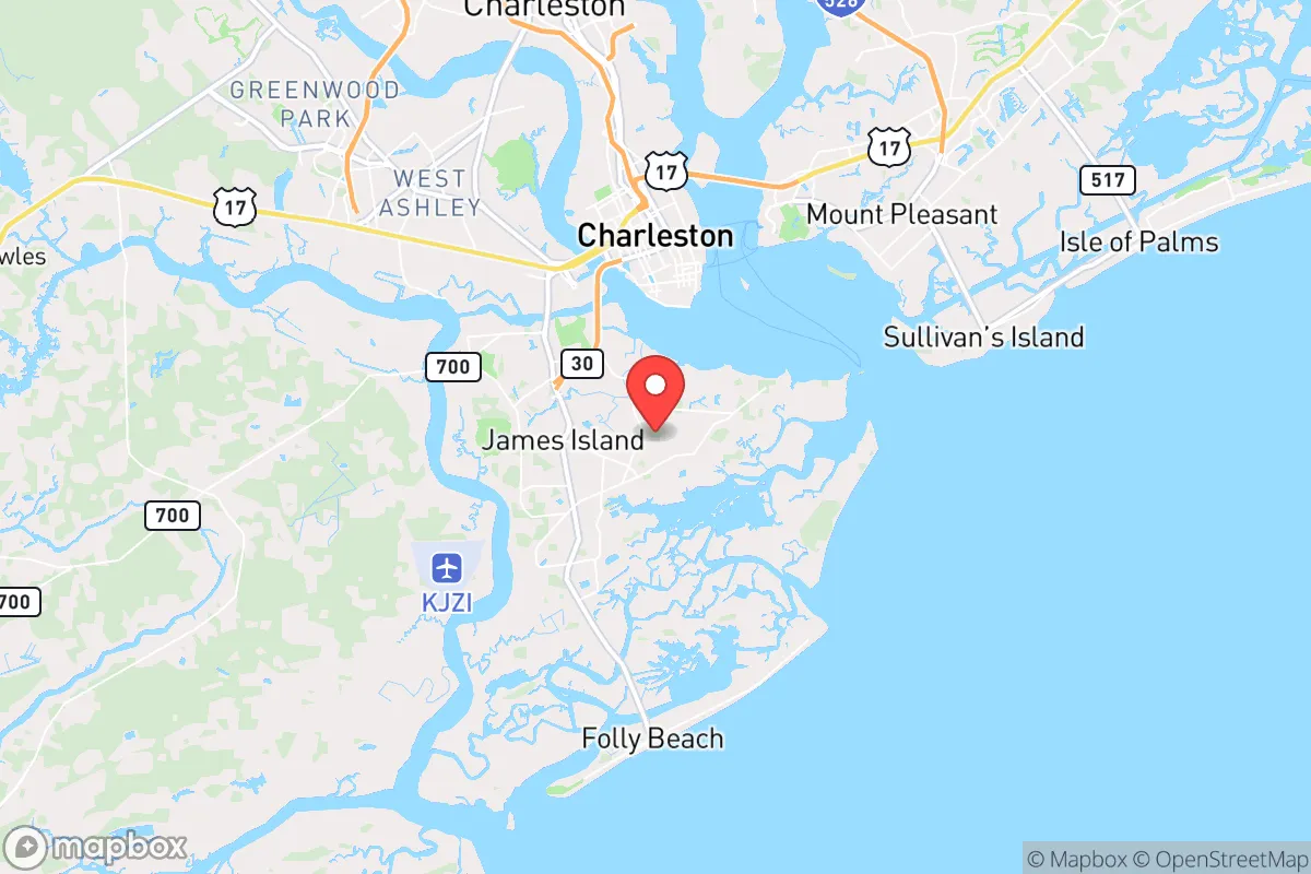
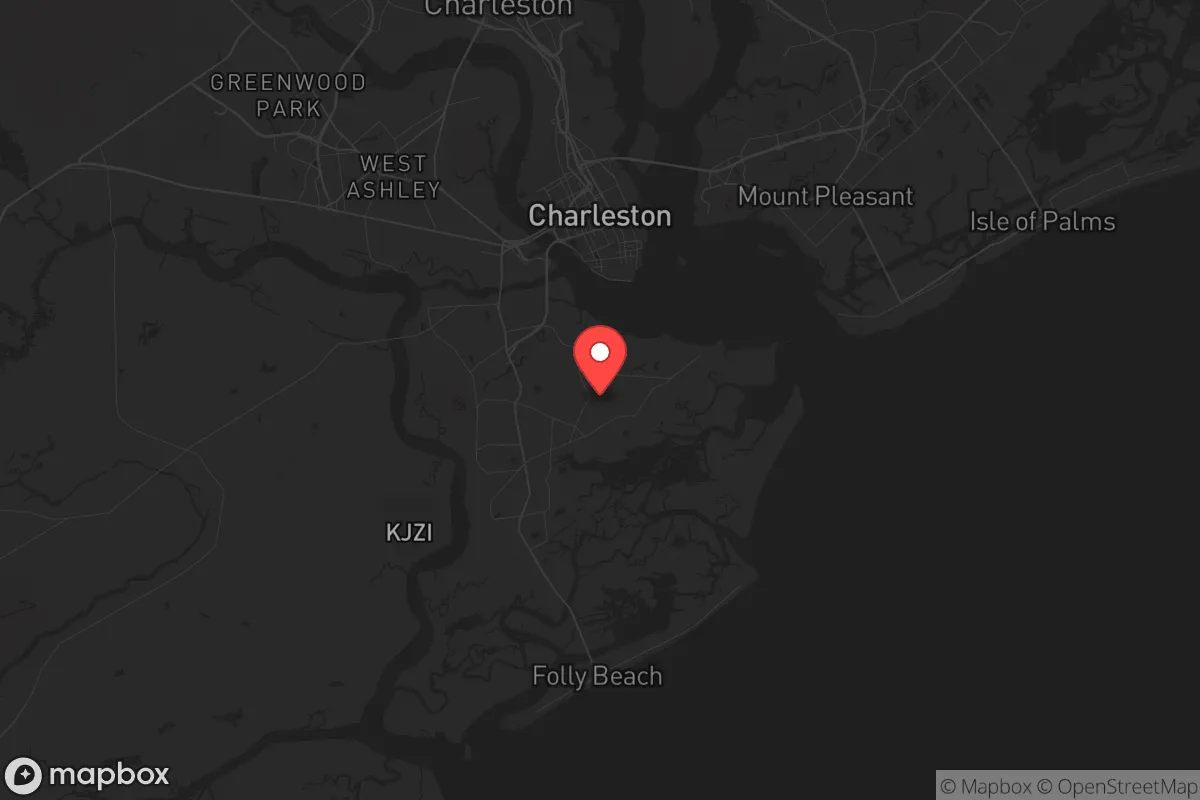
James Island, South Carolina, presents a mixed strategic picture for the conservative prepper or survivalist. Its primary value lies in its immediate access to the Atlantic and the Stono River, offering a potential retreat corridor by water, but its position as a suburban appendage of Charleston introduces severe vulnerabilities. The island’s resilience is fundamentally compromised by its dependence on a single road artery and its proximity to a major metropolitan target, making it a location that demands constant vigilance and a robust, self-sufficient setup rather than a standalone bug-out haven.
Geographic position and natural advantages for a strategic relocation
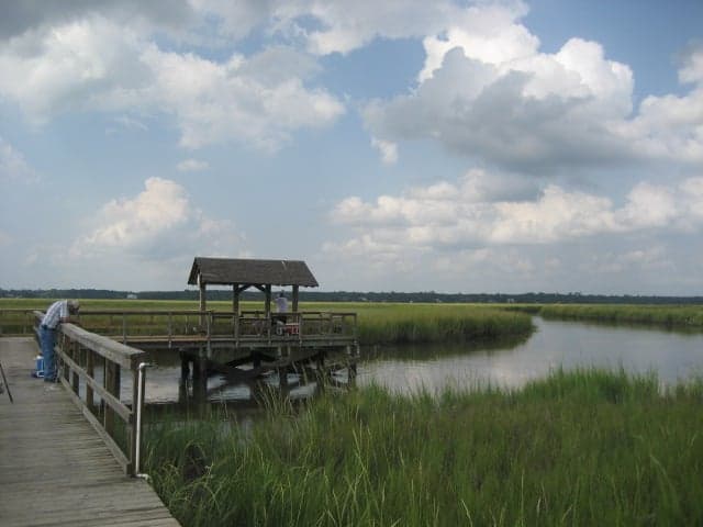
James Island sits roughly four miles southwest of downtown Charleston, bounded by the Stono River to the west and the Wappoo Creek to the north. This insular geography provides a natural moat effect—any approach by land is funneled through a handful of bridges and causeways, most notably the James Island Connector and Folly Road. In a grid-down scenario or during civil unrest, these chokepoints can be monitored and, if necessary, defended by a prepared community. The island’s tidal creeks and marshlands offer limited but viable escape routes by small boat or kayak into the ACE Basin or further up the coast, a significant advantage for those with maritime skills. The local climate is humid subtropical, with mild winters and hot, humid summers, which supports year-round gardening and foraging if you know the edible coastal plants like sea purslane and palmetto berries. However, the same geography that provides a defensive perimeter also makes the island a trap if the bridges are compromised—there is no secondary road egress without crossing water.
Risks, exposures, and proximity to fallout-relevant landmarks
The single greatest strategic liability of James Island is its proximity to Charleston, a major port city, naval base (Joint Base Charleston), and a regional economic hub. In a scenario involving civil unrest, mass casualty events, or a nuclear exchange, Charleston is a high-value target. The Port of Charleston handles a significant volume of container traffic and military cargo, making it a likely point of disruption or attack. James Island sits within the likely fallout plume zone if a device were detonated over the city or the naval weapons station. The island itself has no major hardened infrastructure—no deep bunkers, no military depots, and no redundant power grid. The single substation serving much of the island is vulnerable to both natural disaster and sabotage. Hurricane risk is extreme: the island is in a storm surge zone, and a Category 3 or higher storm would inundate large portions of the low-lying areas, particularly along the Stono River and the marsh edges. Flood insurance is mandatory in many zones, and the cost is a recurring budget line for any relocator. Additionally, the island’s population density (roughly 12,000 residents in a 5-square-mile area) means that in a crisis, the roads will clog quickly, and the bridges will become bottlenecks for both evacuation and resupply.
Practical resilience for a relocator: food, water, energy, and defensibility
For a relocator serious about self-sufficiency, James Island offers a mixed bag. Water is the most critical vulnerability: the island relies entirely on the Charleston Water System, which draws from the Edisto River and the Bushy Park Reservoir. A prolonged power outage or contamination event would cut off municipal supply. A deep well is not feasible on most residential lots due to saltwater intrusion and shallow water tables; rainwater catchment is the only reliable backup, and the average annual rainfall of 48 inches makes this viable if you have adequate storage (at least 500 gallons per person for a 30-day supply). Food production is possible but limited by soil quality—most of the island is built on former marshland and fill, so raised beds or hydroponics are necessary. The growing season is long (March to November), and local farmers’ markets exist, but they disappear in a crisis. Energy resilience is poor: the grid is above-ground and prone to storm damage. Solar panels are a wise investment, but the island’s tree canopy and frequent cloud cover reduce efficiency. A generator with a 50-100 gallon propane tank is a minimum, but fuel resupply after a disaster will be problematic. Defensibility is the island’s strongest card: the limited access points mean a small, organized group can secure the main routes. However, the suburban layout—with many homes on small lots with close neighbors—makes perimeter security difficult. A property on the water or with a private dock offers the best escape option, but such properties command a premium. The local law enforcement presence is the Charleston County Sheriff’s Office, which is professional but will be overwhelmed in a major event. The island has no dedicated police force; it relies on county response, which will prioritize downtown Charleston.
The overall strategic picture for James Island is one of calculated risk. It is not a remote survivalist retreat—it is a suburban bedroom community with a few natural advantages that a prepared individual can exploit. The location’s value hinges on your ability to secure a property with water access, store at least 90 days of supplies, and maintain a low profile. The proximity to Charleston is a double-edged sword: it provides access to medical facilities, hardware stores, and trade networks in normal times, but it makes the island a secondary target in a crisis. For a conservative relocator who wants to stay within striking distance of the coast but is willing to invest heavily in redundancy and community-building, James Island can work—but only if you treat it as a base of operations, not a final sanctuary. The smart play is to have a secondary bug-out location further inland, such as the Midlands or Upstate, and to view James Island as a forward operating position that can be abandoned if the bridges become impassable. In short: it’s a decent option for the prepared, but a death trap for the complacent.
* Values derived from national, state, county, city and local statistics and may differ in a specific area. Last updated: 2026-04-30T04:07:00.000Z
Narrative content on this page is AI-generated and may contain mistakes. Verify any details that matter before acting on them.
ReloMaps may earn a commission from affiliate links at no extra cost to you.