
Photo: Braden Jarvis via Unsplash
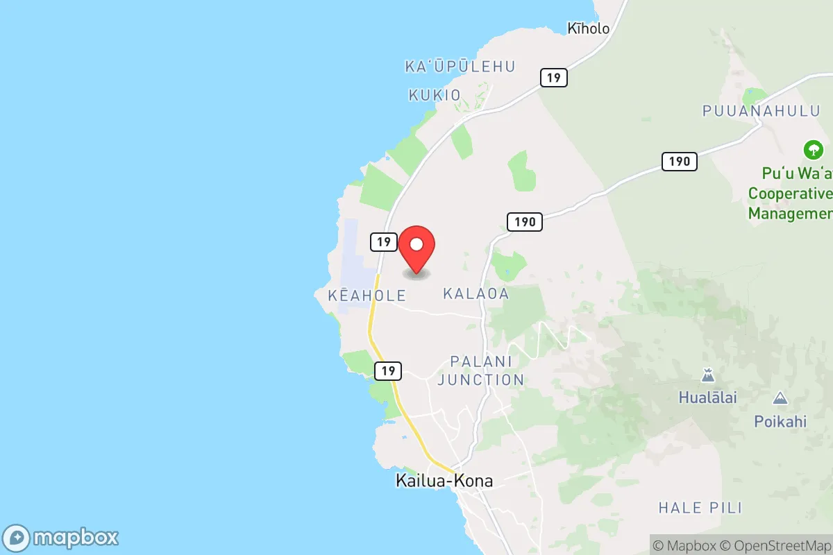
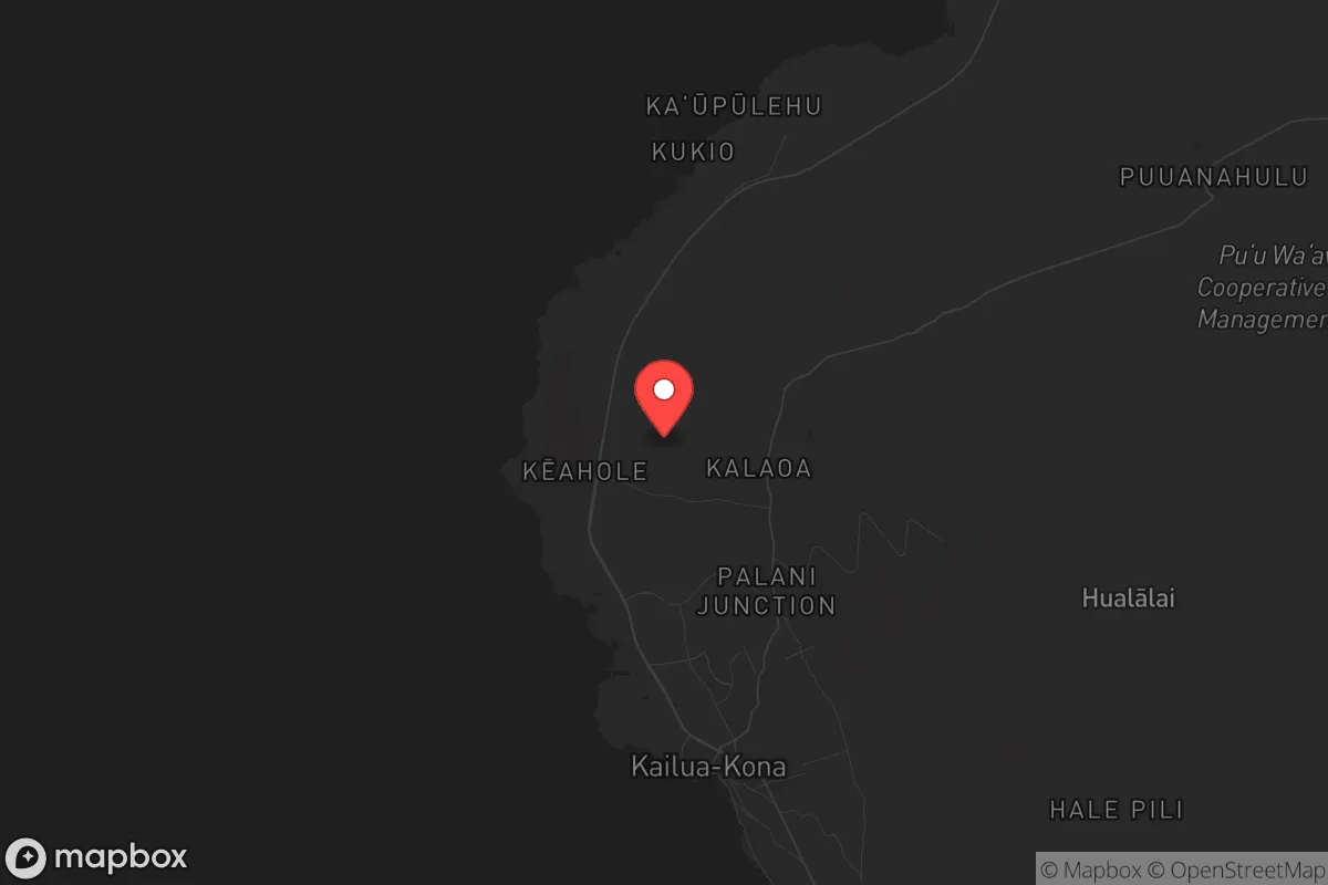
Strategic Assessment of Kaiminani, HI
Strong survivability profile. Good buffer from population centers, with manageable environmental and tactical risks.
What does the Strategic Assessment tell us?
Our Strategic Assessment grades tactical survivability of an area. Major population centers, military targets, fallout zones, natural disasters, and border exposure all drive risk — lower exposure means a more defensible position in a crisis.
This is heavily inspired by Joel Skousen's Strategic Relocation book. Highly recommended you checkout the book ($)What does this tell us?
Our Strategic Assessment grades tactical survivability of an area. Major population centers, military targets, fallout zones, natural disasters, and border exposure all drive risk — lower exposure means a more defensible position in a crisis.
This is heavily inspired by Joel Skousen's Strategic Relocation book. Highly recommended you checkout the book ($)Strategic Pillars

Key Distances
Regional Safe Places
Below is our recommended "safe zones" in Hawaii and the surrounding area based on our strategic heuristics. For most people, it's unrealistic to live in a “safe zone” full-time due to work, family or other personal reasons. They tend to be more rural. However, many of these areas are perfect for second homes and retreat properties that double as a vacation home or even a short-term rental.


Important Note: For informational purposes only. This does not mean nothing bad ever happens in the green zones. Please use common sense. This is based on public data and modeled with AI. We tried to take a conservative approach but mistakes happen. We update this regularly as new information becomes available.
Solar Generator Recommendations
Backup power matters more here than in safer locations. We've picked three solar generators across budgets and capacity tiers — start with the budget unit if you only need a few essentials, or step up if you want to run a fridge and HVAC for days at a time.

Jackery Portable Power Station Explorer 300
Budget OptionPower on the Go: Weighing only 11 lbs, it's convenient to set up and store with book-sized foldable solar panels

BLUETTI Portable Power Station AC180
Designed for both indoor and outdoor scenarios, AC180 is highly capable as it has a robost capacity and continuous output power.

EF ECOFLOW DELTA Pro Ultra Power Station
Upgraded PickEcoFlow DELTA Pro Ultra is a whole-home energy system designed to grow with your family. Integrated with the Smart Home Panel 2, it scales to meet your evolving energy needs — keeping your home powered, intelligent, and secure through every stage of life.
We earn a commission, at no additional cost to you.
Strategic Assessment Analysis
Kaiminani, a master-planned community on the Big Island of Hawaii, offers a unique strategic position for those prioritizing resilience and self-sufficiency in an increasingly uncertain world. Its location on the Kona coast, far from the dense population centers and potential fallout targets of Oahu or the mainland, provides a natural buffer against the cascading effects of civic unrest, supply chain collapse, or mass casualty events. While no place is truly safe, Kaiminani’s relative isolation, stable climate, and access to the ocean and volcanic soils make it a compelling option for a relocator who values preparedness over convenience.
Geographic position and natural advantages for long-term security
Kaiminani sits on the western slope of Hualalai volcano, roughly 10 miles north of Kailua-Kona, the region’s main commercial hub. This positioning offers a critical advantage: you’re close enough to access supplies, medical care, and airport connections when things are stable, but far enough to avoid the immediate chaos of a major urban collapse. The community itself is elevated at about 1,000 feet, which means cooler temperatures, lower humidity, and fewer mosquito-borne diseases than the coast. The surrounding landscape is a mix of lava fields, dry forest, and agricultural land, providing natural defensibility—there are limited road access points, and the terrain is rugged enough to discourage casual trespassing. The Big Island’s sheer size (over 4,000 square miles) means you can spread out, and the Kona side’s leeward position ensures reliable sunshine and rainfall patterns, critical for any long-term food production or water catchment strategy.
Risks, exposures, and proximity to fallout-relevant landmarks
The primary risk in Kaiminani is volcanic and seismic activity. Hualalai is considered active, though its last eruption was in 1801, and the community is outside the highest-risk lava zones. The bigger concern is the island’s isolation: in a nationwide crisis—say, a grid-down event or a pandemic resurgence—Hawaii’s ports and airports would be the first to close, cutting off resupply. That said, this isolation is a double-edged sword. Kaiminani is over 250 miles from Honolulu, the state’s primary economic and military hub, which would be a prime target for any coordinated attack or civil unrest. The nearby Kona International Airport (KOA) is a civilian facility with no major military presence, reducing its likelihood as a fallout target. The closest significant military installation is Pohakuloa Training Area, about 40 miles inland, but it’s a remote training base, not a strategic command center. The real exposure is the island’s dependence on imported food and fuel—over 85% of Hawaii’s food is shipped in, meaning any disruption to shipping would hit Kaiminani hard within weeks. Preppers need to account for this with stored supplies and local food systems.
Practical resilience for a relocator: food, water, energy, and defensibility
Water is the first concern. Kaiminani relies on municipal water from the Kona aquifer, which is generally reliable but vulnerable to pump failures or contamination during a quake. A savvy relocator should install a rainwater catchment system—the area averages 30-40 inches of rain annually, enough to fill a 10,000-gallon tank with proper filtration. For food, the volcanic soil is rich in minerals, but the dry climate limits what grows easily. Avocados, citrus, coffee, and macadamia nuts thrive; staple crops like taro or sweet potatoes require more irrigation. The ocean is a reliable protein source—Kona’s waters are rich in tuna, mahi-mahi, and reef fish, but you’ll need a boat or strong shore-fishing skills. Energy is straightforward: solar is king here. The Big Island gets over 270 sunny days per year on the Kona side, and net metering is available, though grid outages are common during storms. A battery backup (like a Tesla Powerwall or DIY lithium setup) is essential for off-grid capability. Defensibility is decent but not fortress-level. The community is gated in parts, but the surrounding lava fields offer little cover for an intruder—you’d see anyone coming from a mile away. The bigger threat is social: Kaiminani is a mix of retirees, remote workers, and local families, not a hardened prepper enclave. You’ll need to build trust slowly and keep your preparations low-key to avoid drawing attention.
Overall strategic picture for the conservative prepper
Kaiminani is not a bug-out location for a short-term crisis—it’s a long-term homesteading play for someone willing to accept the trade-offs of island life. The isolation that protects you from mainland chaos also makes you vulnerable to supply chain shocks, so self-sufficiency isn’t optional; it’s mandatory. The political climate on the Big Island leans left overall, but Kona is more libertarian-leaning, with a strong independent streak and a live-and-let-live attitude that aligns with conservative values of personal responsibility. The biggest strategic weakness is the lack of a deep community of like-minded preppers—you’ll likely be on your own for the first year or two. But if you can secure a property with a catchment system, solar panels, and a few acres of productive land, Kaiminani offers a defensible, low-profile base that’s far from the fallout zones of the mainland. Just remember: the ocean is your moat, but it’s also your prison if things go sideways. Plan accordingly.
* Values derived from national, state, county, city and local statistics and may differ in a specific area. Last updated: 2026-05-01T01:37:54.000Z
Narrative content on this page is AI-generated and may contain mistakes. Verify any details that matter before acting on them.
ReloMaps may earn a commission from affiliate links at no extra cost to you.