Photo: Wikipedia
Strategic Assessment of Labette County
Strong survivability profile. Good buffer from population centers, with manageable environmental and tactical risks.
What does the Strategic Assessment tell us?
Our Strategic Assessment grades tactical survivability of an area. Major population centers, military targets, fallout zones, natural disasters, and border exposure all drive risk — lower exposure means a more defensible position in a crisis.
This is heavily inspired by Joel Skousen's Strategic Relocation book. Highly recommended you checkout the book ($)What does this tell us?
Our Strategic Assessment grades tactical survivability of an area. Major population centers, military targets, fallout zones, natural disasters, and border exposure all drive risk — lower exposure means a more defensible position in a crisis.
This is heavily inspired by Joel Skousen's Strategic Relocation book. Highly recommended you checkout the book ($)Strategic Pillars

Key Distances
Strategic Assessment Analysis
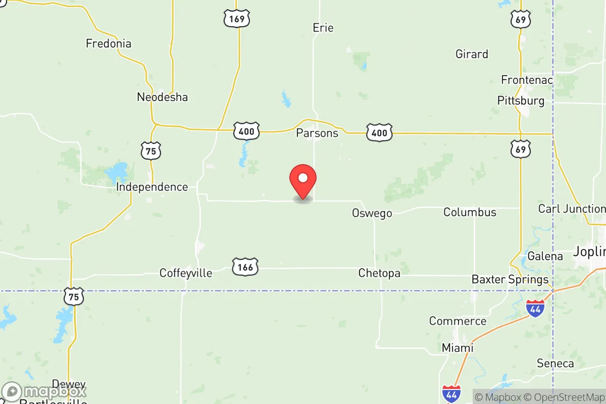
For the relocator prioritizing disaster readiness and self-sufficiency, Labette County, Kansas offers a compelling blend of geographic isolation and practical infrastructure. Located in the southeastern corner of the state, the county is anchored by the city of Parsons (pop. ~10,000) and the smaller town of Oswego, placing it roughly 90 miles from the greater Tulsa metro and over 120 miles from the Kansas City and Wichita urban centers. This positioning creates a natural buffer against the cascading failures and population displacement that would follow a major grid-down event or industrial accident, while still providing access to regional resources via U.S. Highway 59 and U.S. Highway 400.
Geographic position and natural advantages for long-term survival
Labette County sits at the transition zone between the flint hills to the west and the Ozark Plateau to the east, which provides a diverse topography that is rare in the central plains. The Neosho River runs through the county, cutting valleys and providing reliable surface water—a critical advantage for preppers who understand that well access can fail during grid outages. The county’s position at the far southeastern corner of Kansas places it well outside the primary fallout plumes of likely high-priority targets like Whiteman Air Force Base (320 miles northwest) or McConnell Air Force Base (150 miles north). The nearest significant military installation is Fort Riley, over 160 miles northwest, and the population density of the county is low at roughly 20 people per square mile. This sparse settlement pattern means that a pandemic, food shortage, or civil disruption would spread slowly through the region, buying time for well-stocked households. The area’s floodplain soils along the Neosho also support robust gardens and small-scale farming, a major plus for those looking to reduce dependence on the grocery supply chain.
Disaster risks, environmental exposures, and proximity to critical infrastructure
No location is a true fortress, and Labette County has distinct risks. Its primary industrial liability is the Pittsburg & Midway Coal Mining Company’s mine near Hallowell, and the county sits within 30 miles of the Wolf Creek Nuclear Generating Station in adjacent Coffey County. A worst-case release from Wolf Creek would place areas east and southeast of the plant in the primary contamination zone, but prevailing winds blow from the northwest roughly 60% of the time, pushing most radiation away from Labette’s population centers. More immediate day-to-day hazards include the tornado threat that plagues all of eastern Kansas, but the county’s housing stock is heavily tilted toward older single-family homes with basement shelters—roughly 40% of homes in rural Labette County were built before 1960, when basements were standard. The county faces moderate flash-flood risk along the Neosho and its tributaries, especially near the confluence with the Labette Creek in Parsons, so any defensible property should be sited above the 100-year floodplain. On the man-made threat side, the county’s major highways (U.S. 400 and U.S. 59) are not high-volume supply corridors for anything strategic, which means they won’t be targeted for interdiction, but also means that emergency resupply from state or federal assets would not be prioritized.
Practical resilience for the relocator: food, water, energy, and community defense
For the self-sufficient household, Labette County scores well on the fundamentals of long-term survival. Water availability is a standout: the Neosho River basin provides year-round flow, and the county’s municipal water systems in Parsons and Oswego draw from deep well fields that are unlikely to be affected by short-term grid failures. A relocator with a hand pump or a solar-powered well pump on a rural parcel will have a water security advantage that urban dwellers cannot match. Energy infrastructure is mixed: the Westar Energy (Evergy) grid feeds the county, with transmission lines running east-west along the U.S. 400 corridor. These lines are relatively vulnerable to ice storms and scheduled transformer age-outs, but the county’s rural electric cooperatives—specifically Green Country Electric Cooperative—offer net metering for solar, a low-regret investment. Food production is the area’s real strength; the county is within the Kansas Flint Hills grazing region, and the soils in the Neosho Valley are Class I and Class II agricultural land. The Parsons Farmers Market operates seasonally, but more importantly, the local agricultural supply chain is robust—Cargill operates a grain elevator in Parsons, and multiple family-run feed and seed outlets serve the area. Defensibility of a rural property here is high due to the checkered pattern of woodlots and open fields, which provides cover and clear sightlines. A relocator with 10 to 40 acres and a strategic property layout oriented away from the two main highways can achieve a level of physical security that is nearly impossible in the suburbs.
The overall picture for Labette County is that of a low-profile, moderate-disaster environment that rewards preparation without requiring a survivalist’s budget. The county’s greatest strength for the serious relocator is its distance from high-value military targets and its workable agricultural land—two factors that become acute during a food-shortage event or a major economic dislocation. Its weaknesses are the usual Midwestern risks: tornadoes that require a storm shelter, some floodplain exposure, and a local economy that relies heavily on a single employer (Parsons is home to the Parsons State Hospital and Training Center and a small but stable manufacturing base including GSK Pharmaceuticals, now closed, but with a legacy workforce). For a family willing to put in the sweat equity to build on a rural site, Labette County is a location worth serious consideration—a place where the neighbors are likely to know you, the soil will grow food, and the horizon is clear enough to see trouble coming from a long way off.

* Values derived from national, state, county, city and local statistics and may differ in a specific area. Last updated: 2026-09-15T08:26:12.000Z
Narrative content on this page is AI-generated and may contain mistakes. Verify any details that matter before acting on them.
ReloMaps may earn a commission from affiliate links at no extra cost to you.

