Photo: Wikipedia
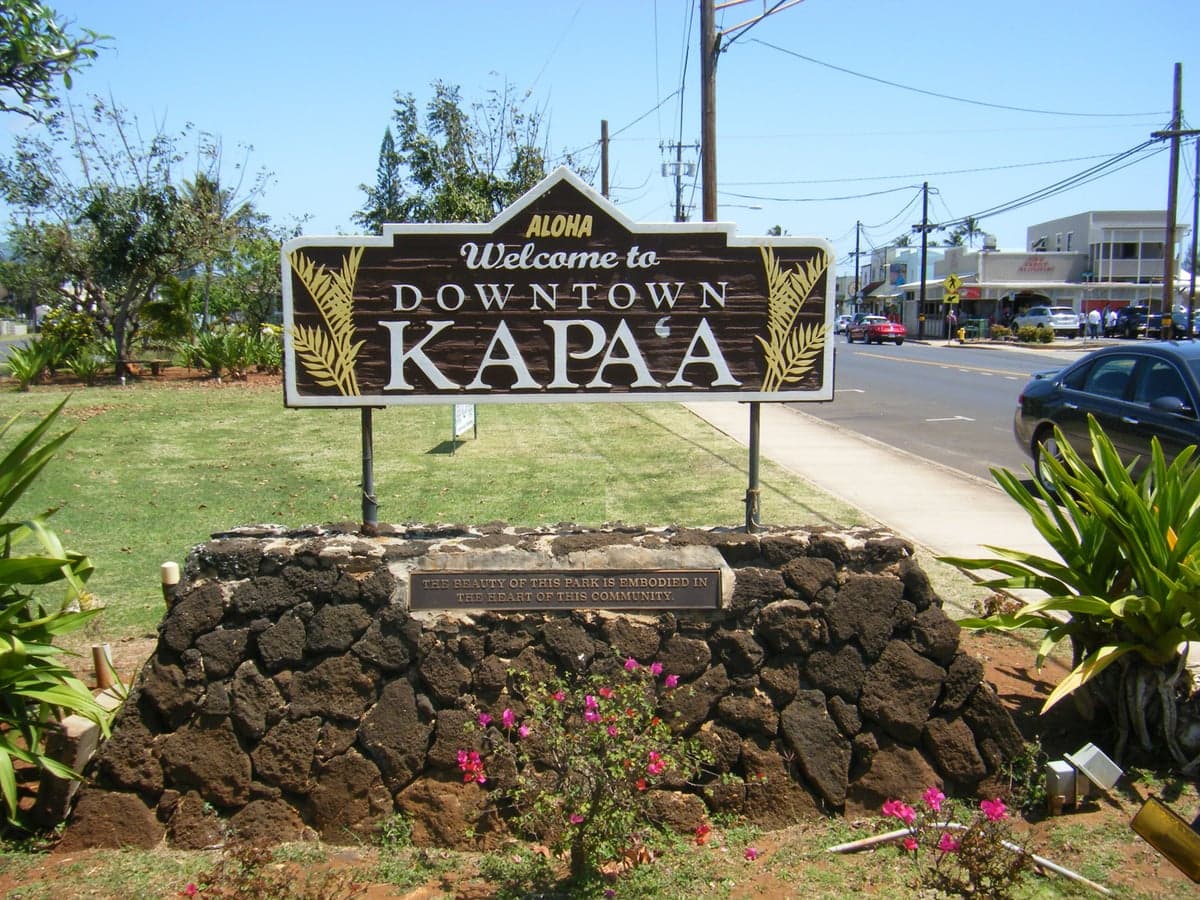
Strategic Assessment of Kapaa, HI
Strong survivability profile. Good buffer from population centers, with manageable environmental and tactical risks.
What does the Strategic Assessment tell us?
Our Strategic Assessment grades tactical survivability of an area. Major population centers, military targets, fallout zones, natural disasters, and border exposure all drive risk — lower exposure means a more defensible position in a crisis.
This is heavily inspired by Joel Skousen's Strategic Relocation book. Highly recommended you checkout the book ($)What does this tell us?
Our Strategic Assessment grades tactical survivability of an area. Major population centers, military targets, fallout zones, natural disasters, and border exposure all drive risk — lower exposure means a more defensible position in a crisis.
This is heavily inspired by Joel Skousen's Strategic Relocation book. Highly recommended you checkout the book ($)Strategic Pillars

Key Distances
Regional Safe Places
Below is our recommended "safe zones" in Hawaii and the surrounding area based on our strategic heuristics. For most people, it's unrealistic to live in a “safe zone” full-time due to work, family or other personal reasons. They tend to be more rural. However, many of these areas are perfect for second homes and retreat properties that double as a vacation home or even a short-term rental.


Important Note: For informational purposes only. This does not mean nothing bad ever happens in the green zones. Please use common sense. This is based on public data and modeled with AI. We tried to take a conservative approach but mistakes happen. We update this regularly as new information becomes available.
Solar Generator Recommendations
Backup power matters more here than in safer locations. We've picked three solar generators across budgets and capacity tiers — start with the budget unit if you only need a few essentials, or step up if you want to run a fridge and HVAC for days at a time.

Jackery Portable Power Station Explorer 300
Budget OptionPower on the Go: Weighing only 11 lbs, it's convenient to set up and store with book-sized foldable solar panels

BLUETTI Portable Power Station AC180
Designed for both indoor and outdoor scenarios, AC180 is highly capable as it has a robost capacity and continuous output power.

EF ECOFLOW DELTA Pro Ultra Power Station
Upgraded PickEcoFlow DELTA Pro Ultra is a whole-home energy system designed to grow with your family. Integrated with the Smart Home Panel 2, it scales to meet your evolving energy needs — keeping your home powered, intelligent, and secure through every stage of life.
We earn a commission, at no additional cost to you.
Strategic Assessment Analysis
Kapaa, on Kauai’s east side, offers a strategic relocation option for those prioritizing resilience and geographic isolation from mainland instability. Its position on the “Garden Isle” provides natural buffers against many cascading failure scenarios, though the trade-offs in logistics and exposure are significant. For a conservative-leaning prepper or survivalist, Kapaa represents a defensible redoubt with serious supply-chain vulnerabilities that demand advance planning.
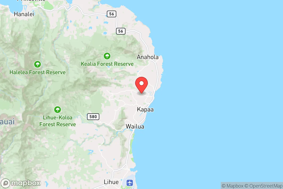
Geographic isolation and natural defensive advantages of Kapaa
Kapaa sits roughly 10 miles north of Lihue Airport and 15 miles from Nawiliwili Harbor, placing it close enough to Kauai’s logistical hubs but far enough to avoid the immediate chaos of a port or airfield disruption. The town is wedged between the Pacific Ocean and the steep slopes of Mount Waialeale, creating a natural chokepoint: Highway 56 is the only paved route in and out of the east side. In a grid-down scenario, this single road becomes both a vulnerability and a defensive asset. Anyone approaching from Lihue or the north shore must pass through Kapaa’s narrow corridor, which could be monitored or blocked with minimal effort. The surrounding terrain—dense jungle, steep ridges, and the 3,000-foot Makaleha Mountains—offers multiple escape routes into the interior for those who know the old trails. Unlike Oahu or Maui, Kauai has no major military bases, no strategic missile silos, and no large-scale industrial targets. The Pacific Missile Range Facility at Barking Sands, 30 miles west, is a radar and testing site, not a primary nuclear target. This reduces the likelihood of Kapaa being a first-wave casualty in a major conflict.
Risks, exposures, and proximity to fallout-relevant landmarks
The primary risk for Kapaa is its dependence on external supply chains. Over 90% of Kauai’s food, fuel, and manufactured goods arrive by barge or air, and the island has only 30 days of food reserves at any given time. A major earthquake, tsunami, or geopolitical event that disrupts Pacific shipping could leave Kapaa’s 11,000 residents in a severe shortage within two weeks. The nearest fallout-relevant landmarks are Pearl Harbor and Hickam Air Force Base on Oahu, 100 miles southeast. While prevailing trade winds blow from the northeast, carrying fallout away from Kauai, a nuclear detonation on Oahu would still produce secondary effects: panic-driven evacuation attempts, communication blackouts, and potential refugee flows. Kapaa’s small airport and single harbor cannot handle mass evacuation, meaning a relocator must plan to shelter in place for weeks. Tsunami risk is real but manageable: Kapaa’s coastal areas (Waipouli, Coconut Marketplace) sit at 10-20 feet elevation, while the main residential neighborhoods climb to 100-200 feet. The 1946 and 1960 tsunamis caused damage here but did not wipe out the town. Volcanic vog from Kilauea is rarely an issue on Kauai due to distance and wind patterns. Hurricanes are the most probable natural threat—Hurricane Iniki (1992) destroyed 1,400 homes on Kauai, and Kapaa saw widespread roof damage and weeks-long power outages. Modern building codes are stronger, but the island’s electrical grid remains vulnerable to wind and salt spray.
Practical resilience for a relocator: food, water, energy, and defensibility
Kapaa’s climate is a prepper’s asset: 80-85 inches of rain annually, year-round growing temperatures, and volcanic soil that supports fruit trees, root vegetables, and leafy greens. A well-sited property with a catchment tank and solar panels can achieve water and energy independence. Many older homes already have catchment systems, and the county permits rainwater collection for potable use with proper filtration. Solar is viable—Kauai gets 5-6 peak sun hours daily—but battery storage is essential because the grid is unreliable after storms. The island’s agricultural history means that even suburban lots often have space for a small orchard or garden. Local farmers markets (Kapaa’s Saturday market is one of the largest) provide a backup food network, but prices are high and supply is seasonal. For protein, fishing from Kapaa’s shoreline or launching a kayak from Lydgate Park yields ulua, papio, and oama. Hunting wild pigs and goats in the Kokee State Forest requires a license but is legal and sustainable. Defensibility is mixed: Kapaa is a linear town along the highway, with many rental condos and tourist-oriented properties that offer poor security. The best options for a relocator are the residential neighborhoods mauka (inland) of the highway, such as Kapahi, Wailua Homesteads, or Olohena Road. These areas have larger lots, mature trees for cover, and multiple unpaved access roads that are hard to surveil. The local population is small and tight-knit; outsiders are noticed quickly, which can be either a security advantage or a social barrier depending on how you integrate. Firearms laws in Hawaii are restrictive—handgun permits require a license, registration, and a 14-day wait, and assault weapons are banned—so a relocator should plan to rely on less-lethal tools or pre-position gear before moving.
Overall strategic picture for Kapaa as a relocation destination
Kapaa is not a bug-out location for a sudden collapse; it is a long-term homesteading play for someone willing to invest years in building local relationships, securing off-grid infrastructure, and learning the island’s rhythms. The isolation that makes it safe from mainland chaos also makes it fragile in the first 30 days of a crisis. A relocator must arrive with at least three months of stored food, medical supplies, and tools, because resupply windows are unpredictable. The conservative values of self-reliance, community, and preparedness align well with Kauai’s rural culture, but the political environment is mixed—the island leans left, and county regulations can be restrictive on building, water rights, and land use. For a single individual or family willing to adapt, Kapaa offers a low-target, high-sustainability option in a world where most strategic choices are getting worse. The key is to treat it as a permanent base, not a temporary refuge, and to accept that the trade-off for safety is a smaller margin for error in logistics.
* Values derived from national, state, county, city and local statistics and may differ in a specific area. Last updated: 2026-04-29T20:03:50.000Z
Narrative content on this page is AI-generated and may contain mistakes. Verify any details that matter before acting on them.
ReloMaps may earn a commission from affiliate links at no extra cost to you.