
Photo: Wikipedia
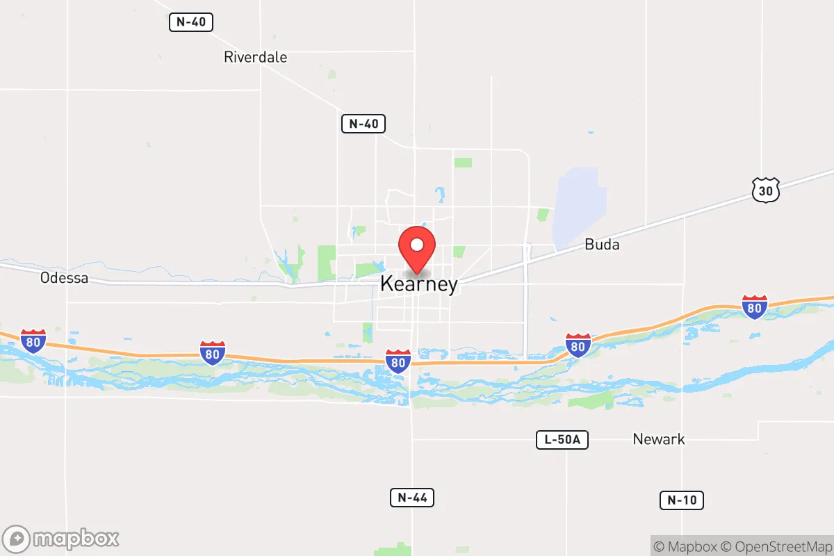
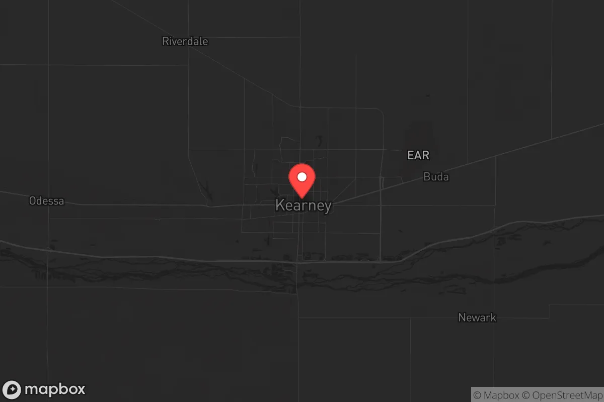
Strategic Assessment of Kearney, NE
Strong survivability profile. Good buffer from population centers, with manageable environmental and tactical risks.
What does the Strategic Assessment tell us?
Our Strategic Assessment grades tactical survivability of an area. Major population centers, military targets, fallout zones, natural disasters, and border exposure all drive risk — lower exposure means a more defensible position in a crisis.
This is heavily inspired by Joel Skousen's Strategic Relocation book. Highly recommended you checkout the book ($)What does this tell us?
Our Strategic Assessment grades tactical survivability of an area. Major population centers, military targets, fallout zones, natural disasters, and border exposure all drive risk — lower exposure means a more defensible position in a crisis.
This is heavily inspired by Joel Skousen's Strategic Relocation book. Highly recommended you checkout the book ($)Strategic Pillars

Key Distances
Regional Safe Places
Below is our recommended "safe zones" in Nebraska and the surrounding area based on our strategic heuristics. For most people, it's unrealistic to live in a “safe zone” full-time due to work, family or other personal reasons. They tend to be more rural. However, many of these areas are perfect for second homes and retreat properties that double as a vacation home or even a short-term rental.
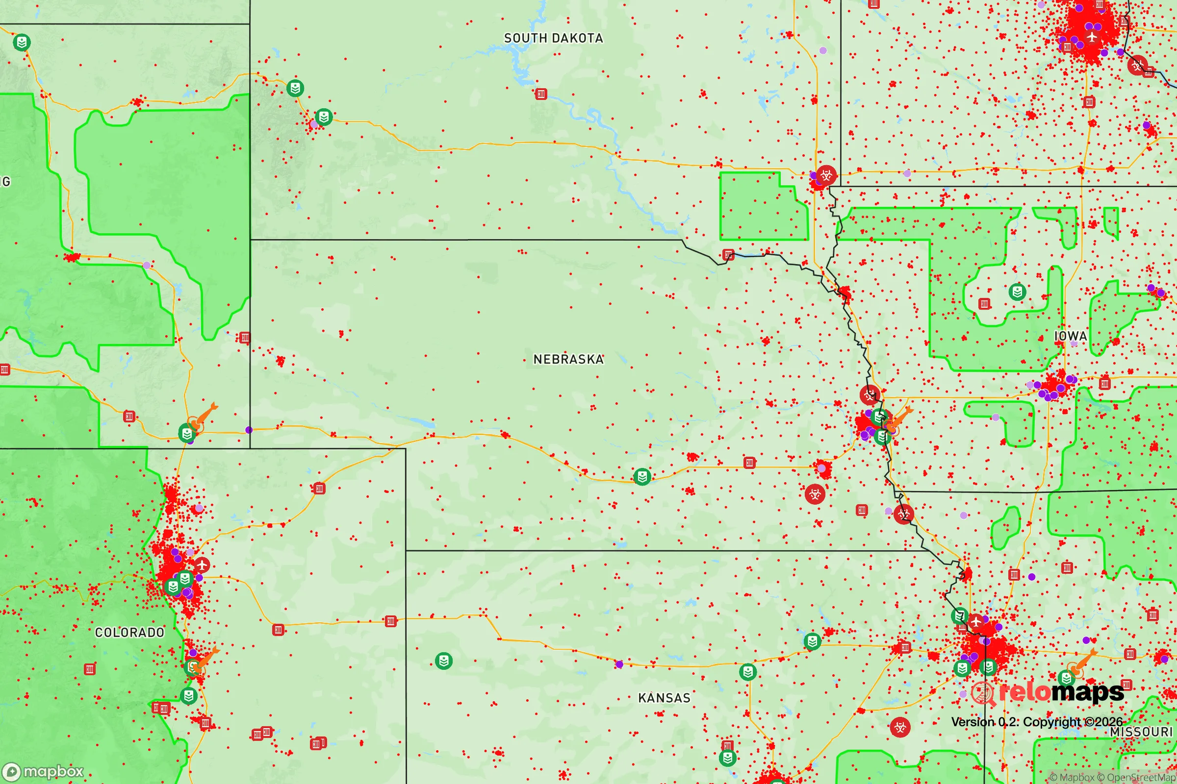
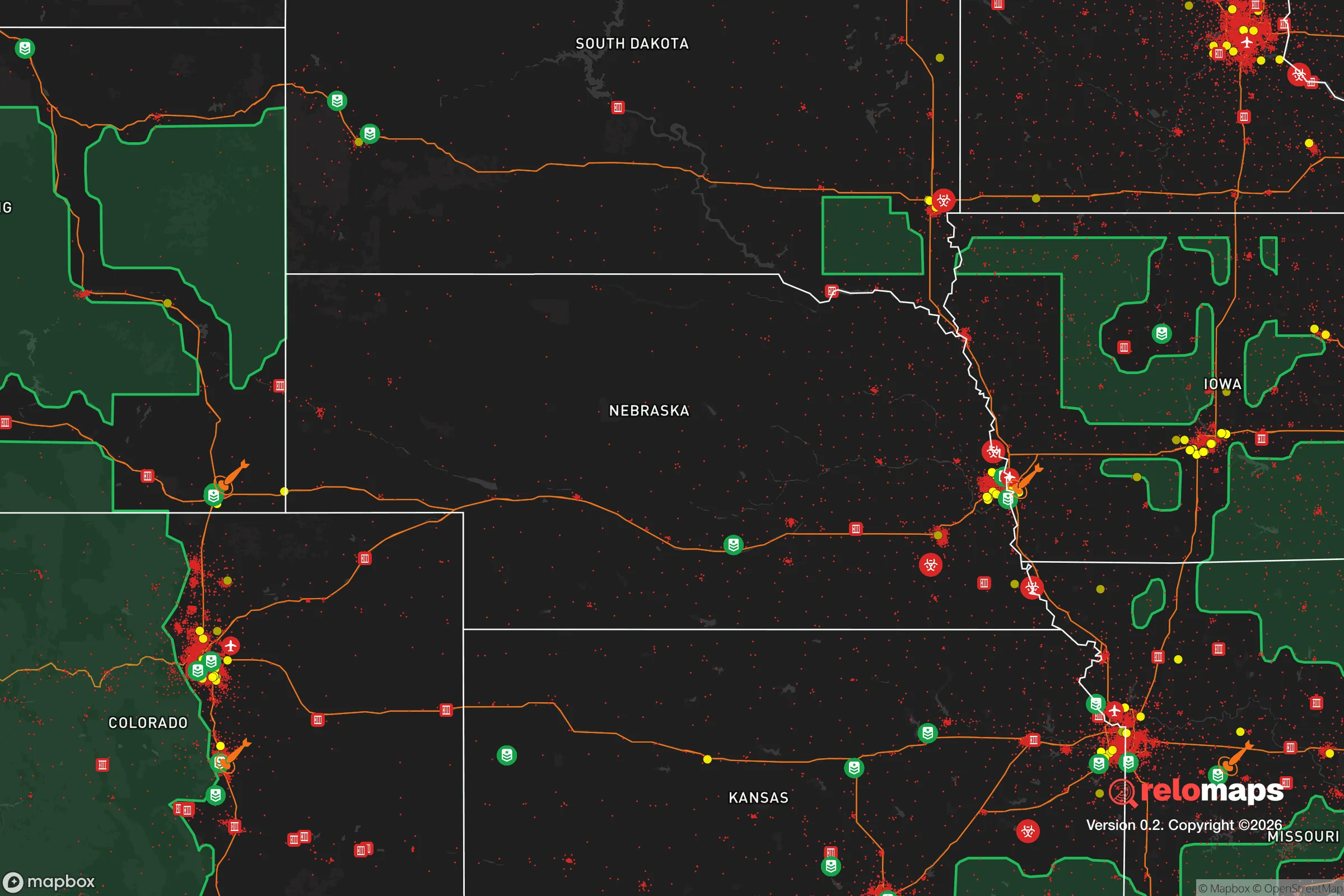
Important Note: For informational purposes only. This does not mean nothing bad ever happens in the green zones. Please use common sense. This is based on public data and modeled with AI. We tried to take a conservative approach but mistakes happen. We update this regularly as new information becomes available.
Solar Generator Recommendations
Backup power matters more here than in safer locations. We've picked three solar generators across budgets and capacity tiers — start with the budget unit if you only need a few essentials, or step up if you want to run a fridge and HVAC for days at a time.

Jackery Portable Power Station Explorer 300
Budget OptionPower on the Go: Weighing only 11 lbs, it's convenient to set up and store with book-sized foldable solar panels

BLUETTI Portable Power Station AC180
Designed for both indoor and outdoor scenarios, AC180 is highly capable as it has a robost capacity and continuous output power.

EF ECOFLOW DELTA Pro Ultra Power Station
Upgraded PickEcoFlow DELTA Pro Ultra is a whole-home energy system designed to grow with your family. Integrated with the Smart Home Panel 2, it scales to meet your evolving energy needs — keeping your home powered, intelligent, and secure through every stage of life.
We earn a commission, at no additional cost to you.
Strategic Assessment Analysis
Kearney, Nebraska, sits in a sweet spot that few relocation analysts fully appreciate: far enough from the nation’s political and economic pressure points to avoid the worst of cascading failures, yet connected enough to sustain a functional post-disruption life. Its position along the Platte River Valley and the I-80 corridor gives it a logistical backbone without the choke-point vulnerabilities of a Denver or Omaha. For a relocator thinking in terms of decades rather than election cycles, Kearney offers a rare combination of agricultural self-sufficiency, low population density, and geographic insulation that makes it a serious candidate for a long-term strategic base.
Geographic position and natural advantages for long-term stability
Kearney’s primary asset is its location in the central Platte River Valley, a region that has historically served as a natural travel and trade corridor but remains sparsely populated relative to the coasts. The city sits roughly 180 miles west of Omaha and 200 miles east of Denver, placing it outside the immediate blast radius or fallout plume of any major metropolitan target. The surrounding terrain is flat to gently rolling, with deep alluvial soils that support intensive row-crop agriculture—corn, soybeans, and alfalfa—within a 20-mile radius. This is not marginal land; it’s some of the most productive non-irrigated farmland in the country. The Platte River itself provides a reliable surface water source, and the underlying Ogallala Aquifer, though deeper here than in the southern High Plains, still offers groundwater reserves that could sustain a reduced population for generations. The climate is continental, with cold winters and hot summers, but the growing season (roughly 150 frost-free days) is long enough for staple crops and most garden vegetables. Tornado risk is real—Nebraska sits in the heart of Tornado Alley—but the flat terrain also means warning times are generally adequate, and the lack of dense tree cover reduces the risk of wildfire. For a prepper, the key takeaway is that Kearney’s natural environment is forgiving enough to support subsistence agriculture without requiring advanced technology, yet resilient enough to recover from the occasional severe weather event.
Risks, exposures, and proximity to fallout-relevant landmarks
No location is risk-free, and Kearney has its share of exposures that a strategic relocator must weigh. The most obvious is its position along I-80, a major east-west interstate that would become a primary evacuation route in any national emergency. In the event of a major disaster on the coasts—whether nuclear, pandemic, or economic collapse—Kearney could see a surge of refugees from both directions. The city’s population of roughly 34,000 could double or triple within days, straining food, water, and medical resources. The University of Nebraska at Kearney (UNK) and the regional medical center would become focal points for aid distribution, but also potential targets for looting or civil unrest. Additionally, Kearney is within 100 miles of the Nebraska National Guard’s Camp Ashland training site and the U.S. Strategic Command at Offutt Air Force Base near Omaha. While Offutt is a primary nuclear command-and-control center and thus a high-value target, the fallout pattern from a ground burst there would likely drift eastward, away from Kearney, given prevailing westerlies. Still, any major conflict involving strategic assets in the Great Plains would create secondary risks—disrupted supply chains, military checkpoints, and potential radiation plumes from damaged reactors at the Cooper Nuclear Station near Brownville (about 150 miles southeast). The bottom line: Kearney is not a zero-risk haven, but its risks are manageable with proper planning, and they are far lower than those faced by anyone living within 50 miles of a major city, military base, or nuclear plant.
Practical resilience for a relocator: food, water, energy, and defensibility
For a family or individual looking to establish a self-sufficient homestead, Kearney’s practical resilience metrics are strong. Food security is the standout: the surrounding region is one of the most productive agricultural zones in the world. Within a 30-minute drive, you can find direct-from-farm sources for beef, pork, poultry, eggs, grains, and fresh produce. The Kearney Farmers Market operates from May through October, but year-round supply is available through local meat lockers and co-ops. The city itself has multiple grocery stores, but a prepper should plan to establish relationships with farmers outside town—those connections are what matter when the supply chain breaks. Water is less of a concern than in the arid West. The Platte River flows year-round, and the water table is high enough that shallow wells (30-60 feet) are common in rural areas. The city’s municipal water comes from groundwater wells, and the system has backup generators, but a private well with a hand pump or solar-powered pump is a prudent investment. Energy is a mixed bag. Nebraska is the only state with a fully public power system, which means rates are low and infrastructure is well-maintained, but the grid is still vulnerable to cascading failures. Natural gas is widely available for heating, and propane is common in rural areas. Solar potential is decent—the region gets about 220 sunny days per year—but winter cloud cover can reduce output for weeks at a time. A wood-burning stove or multi-fuel generator is a wise backup. Defensibility is where Kearney shines for the prepared relocator. The city itself is not defensible in any military sense—it’s a flat, open grid—but the surrounding countryside offers numerous options for a rural homestead with good lines of sight, limited access points, and natural barriers like the river and irrigation canals. The local culture is still heavily influenced by farming and hunting, meaning firearms ownership is common and law enforcement is generally supportive of responsible gun owners. The Buffalo County Sheriff’s Office and Kearney Police Department are professional and well-funded, but in a prolonged crisis, rural residents would largely be on their own—which is exactly the mindset a strategic relocator should have.
The overall strategic picture for Kearney is one of moderate risk with high upside for those who plan ahead. It is not a bug-out location for a weekend warrior; it is a place to build a life that can withstand the shocks of the next decade. The city’s economic base—agriculture, logistics, education, and healthcare—is stable enough to survive most disruptions, yet diversified enough to avoid a single point of failure. The political culture in central Nebraska leans conservative, with a strong emphasis on self-reliance, community mutual aid, and limited government interference. For a relocator who values those principles and is willing to put in the work—digging a well, planting a garden, learning to hunt, storing supplies—Kearney offers a realistic foundation for long-term resilience. The key is to arrive before the crisis, not during it, and to treat the move as a permanent investment in a different way of life, not a temporary escape. If you’re looking for a place where you can still buy a modest acreage for under $200,000, grow most of your own food, and be far enough from the chaos to breathe, Kearney deserves a serious look.
* Values derived from national, state, county, city and local statistics and may differ in a specific area. Last updated: 2026-05-03T20:31:43.000Z
Narrative content on this page is AI-generated and may contain mistakes. Verify any details that matter before acting on them.
ReloMaps may earn a commission from affiliate links at no extra cost to you.