
Photo: Wikipedia
Strategic Assessment of Hardin County
Workable tactical position. Some exposure to population density or targets, but generally defensible in a crisis.
What does the Strategic Assessment tell us?
Our Strategic Assessment grades tactical survivability of an area. Major population centers, military targets, fallout zones, natural disasters, and border exposure all drive risk — lower exposure means a more defensible position in a crisis.
This is heavily inspired by Joel Skousen's Strategic Relocation book. Highly recommended you checkout the book ($)What does this tell us?
Our Strategic Assessment grades tactical survivability of an area. Major population centers, military targets, fallout zones, natural disasters, and border exposure all drive risk — lower exposure means a more defensible position in a crisis.
This is heavily inspired by Joel Skousen's Strategic Relocation book. Highly recommended you checkout the book ($)Strategic Pillars

Key Distances
Strategic Assessment Analysis
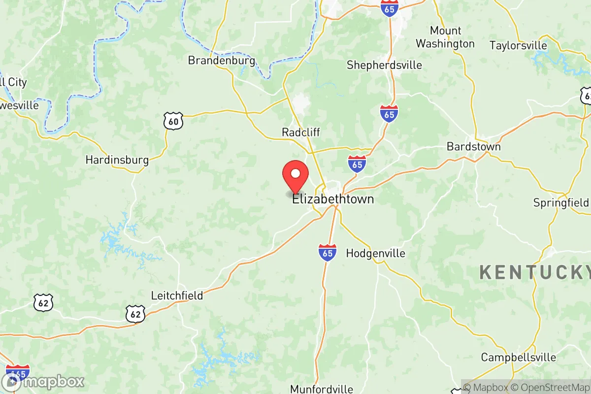
Hardin County, Kentucky offers a compelling mix of strategic depth and everyday livability for those who take long-term preparedness seriously without wanting to live off the grid entirely. Centered around Elizabethtown and Radcliff, this region sits at the critical juncture of I-65 and the Western Kentucky Parkway, roughly 45 miles south of Louisville — close enough to access urban resources but far enough to avoid the immediate fallout and civil unrest that would likely engulf a major city in a crisis. Its anchor, Fort Knox, gives the area a built-in defensive and logistical infrastructure, but as you will read, that same asset carries a serious targeting risk in a broader conflict or collapse scenario.
Geographic position and natural advantages for long-term stability
Hardin County’s location in the knobs region of Kentucky provides more defensive terrain than the open farm country to the west. Rolling hills, dense hardwood forests, and limestone bedrock offer both natural barriers and practical resources. The county is bisected by the Nolin River and bordered by the Rough River, giving serious water security compared to counties reliant on municipal systems. Nolin River Lake, just west of the county line, provides a reliable surface water source and fishing stock that could sustain a family long-term if power and supply chains falter. The local climate supports a solid 200-day growing season, and the soils in the southern half of the county are better suited to truck farming than many realize. For a relocator thinking about food independence, this is not prime corn country, but a well-sited property with a pond and a south-facing slope can produce enough vegetables, poultry, and small livestock to cut reliance on grocery chains significantly. From a prepper’s standpoint, Hardin County also sits far from seismic zones, hurricane storm-surge paths, and the worst of the Ohio River floodplain — less natural disaster churn than most of the Midwest.
Fallout risks and exposure from military and infrastructure targets
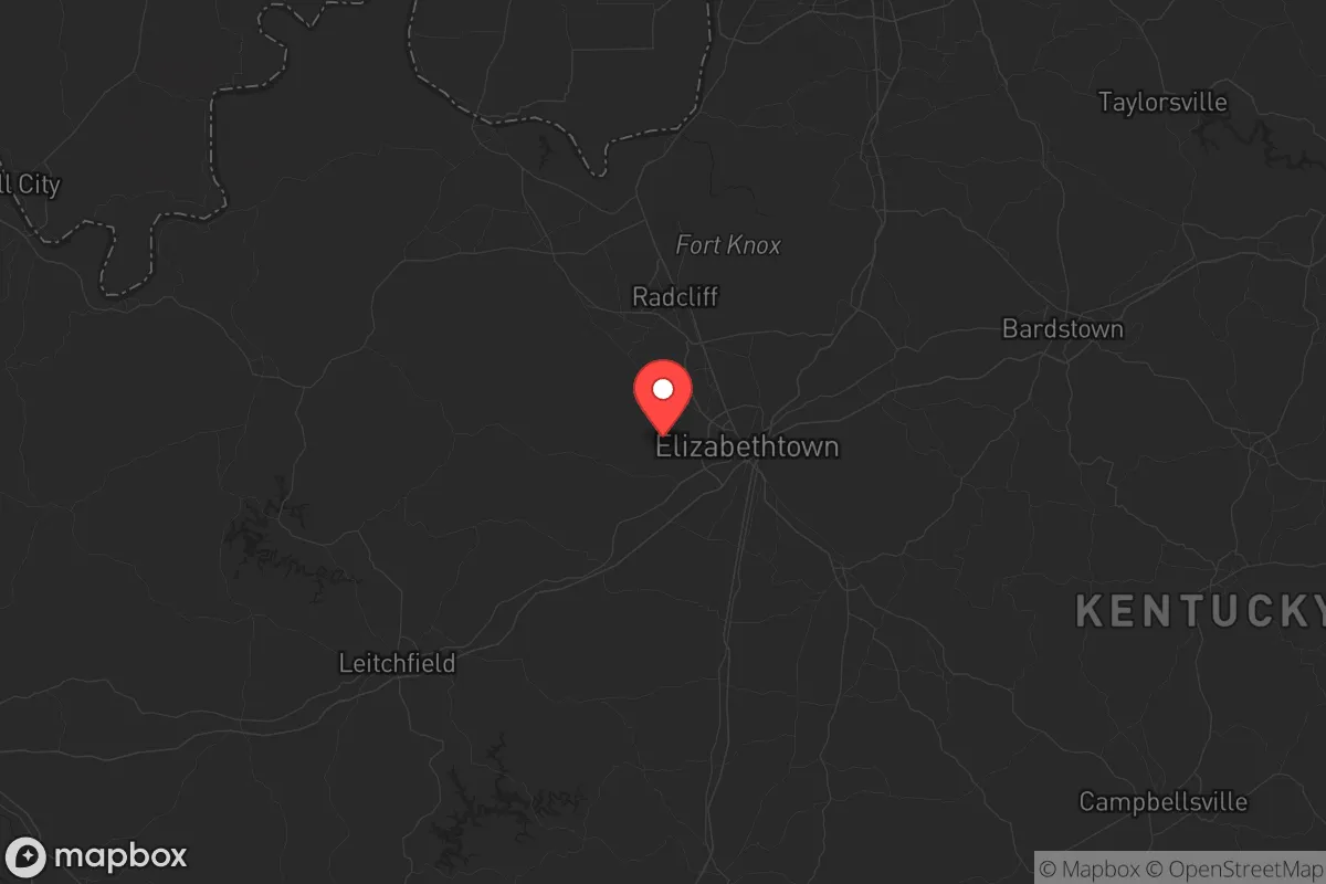
Here is where the analysis gets real. Fort Knox is a double-edged sword. It houses the United States Bullion Depository and the Army’s Human Resources Command, plus armor and engineering schools. In any large-scale conflict, economic collapse, or civil breakdown, that gold and those command functions make it one of the highest-value targets east of the Mississippi. A kinetic strike, EMP event, or even a determined domestic siege would place much of northern Hardin County — Radcliff, Vine Grove, and the areas along U.S. 31W — inside a dangerous blast or fallout zone. You need to be honest with yourself about this: if you buy within five miles of the Knox main gate, you are betting your family’s safety on that installation never being hit. That is a bet many preppers are unwilling to lay. Beyond the base, the county’s other exposure is its location on the I-65 corridor, a primary north-south evacuation route from the Gulf Coast and the Midwest. In a mass casualty event or urban exodus from Louisville (population 630,000+), this highway would become a parking lot and a choke point. Refugees and looters filtering west from I-65 into Elizabethtown and Radcliff is a realistic scenario. The Blue Grass Army Depot, about 90 minutes east in Richmond, stores chemical munitions — a secondary indirect risk if targeting spreads across the state. And while Fort Knox is the main concern, Bowman Field and Louisville Muhammad Ali International Airport are within plausible artillery or drone range if domestic conflict escalates. Bottom line: the northern third of Hardin County carries unacceptable targeting risk for a serious survival relocation; the southern and rural areas offer better standoff.
Food, water, energy, and defensibility for relocators
For the practical prepper, the southern half of Hardin County — think areas south of Elizabethtown toward Upton, Sonora, and the Hart County line — is where the real strategic value lies. Groundwater is accessible via shallow wells in most of the limestone-underlaid areas, and many older farm properties still have hand-dug wells or springs that function without grid power. Surface water from Nolin River Lake, the Rough River, and smaller creeks provides backup for stock and irrigation. The local energy grid is served by Nolin RECC (a rural electric cooperative), which tends to be more responsive in outages than investor-owned utilities, but any survival plan should include solar and battery backup because rural co-ops still go dark in ice storms and cyber attacks. Defensibility is possible if you choose a site with good sight lines and a single access road; the hill-and-hollow terrain makes it relatively easy to set up a perimeter without neighbors being able to see your operations. Elizabethtown has two large grocery chains (Walmart, Kroger) and a thriving farmers market, but for long-term stockpiling, you will want to establish relationships with farmers in the southern part of the county and in adjacent LaRue and Hart counties — they are less likely to be stripped bare in a panic. The local health-care infrastructure is decent for a rural hub: Hardin Memorial Health in Elizabethtown provides a trauma center, but a major event would overwhelm it within hours, so medical self-sufficiency and remote first-aid training are non-negotiable for anyone planning to ride out a crisis here.
The overall strategic picture for Hardin County is one of real potential tempered by a hard trade-off. Southern and southeastern Hardin rates as one of the better prepper relocation zones in the Ohio Valley for water availability, defensible terrain, and agricultural viability. The northern zone, anchored by Fort Knox and Elizabethtown's dense suburban footprint, offers convenience and community but carries a target risk that conservative-minded survivors should not ignore. For a family willing to buy property south of Elizabethtown, establish water independence, and keep a low profile while maintaining access to the I-65 corridor for supply runs and medical services, this county gives you a realistic platform for weathering a decade of instability. Just do not kid yourself about the Knox radar signature — plan your perimeter accordingly.
* Values derived from national, state, county, city and local statistics and may differ in a specific area. Last updated: 2026-06-01T15:00:15.000Z
Narrative content on this page is AI-generated and may contain mistakes. Verify any details that matter before acting on them.
ReloMaps may earn a commission from affiliate links at no extra cost to you.