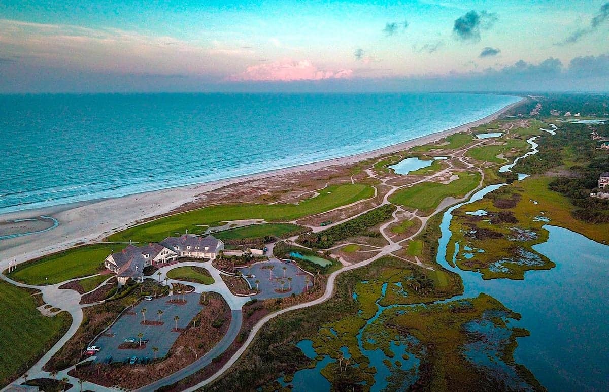
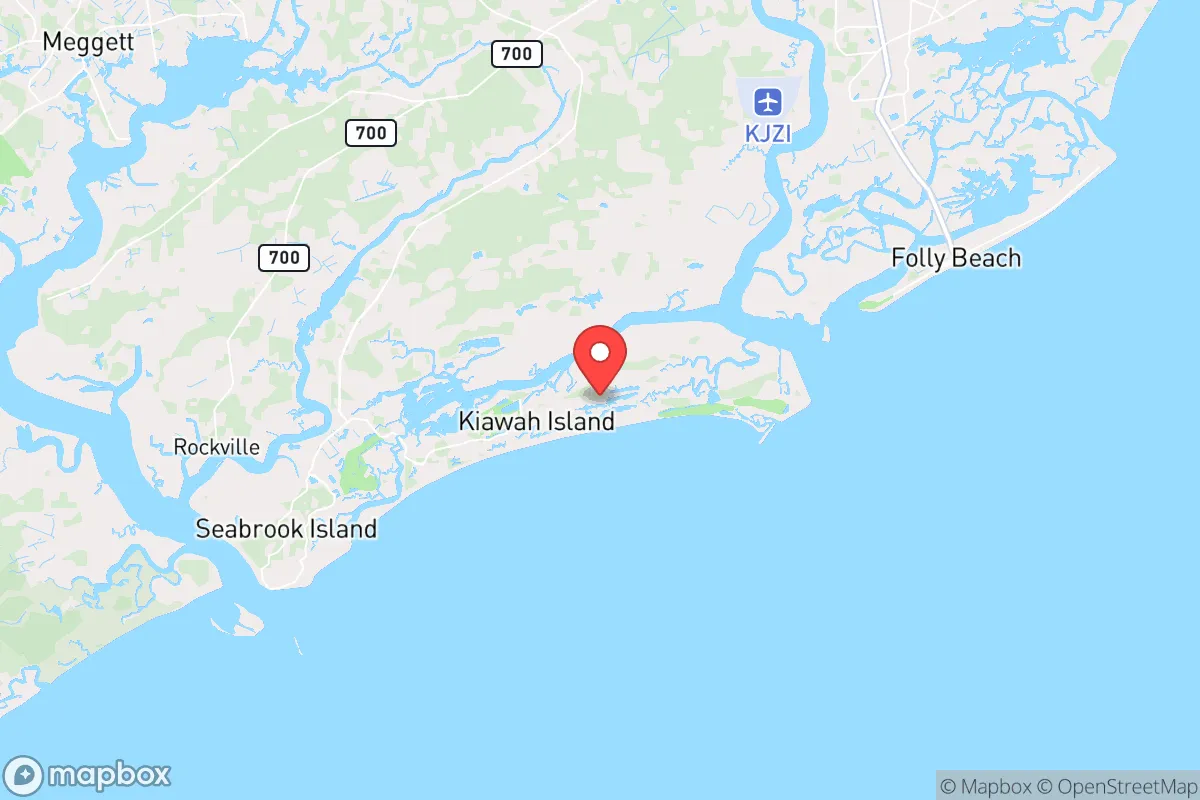
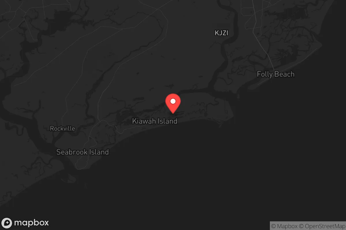
Strategic Assessment of Kiawah Island, SC
Meaningful friction. Expect exposure to either population pressure, blast zones, or natural disaster risk. Consider buying a retreat property.
What does the Strategic Assessment tell us?
Our Strategic Assessment grades tactical survivability of an area. Major population centers, military targets, fallout zones, natural disasters, and border exposure all drive risk — lower exposure means a more defensible position in a crisis.
This is heavily inspired by Joel Skousen's Strategic Relocation book. Highly recommended you checkout the book ($)What does this tell us?
Our Strategic Assessment grades tactical survivability of an area. Major population centers, military targets, fallout zones, natural disasters, and border exposure all drive risk — lower exposure means a more defensible position in a crisis.
This is heavily inspired by Joel Skousen's Strategic Relocation book. Highly recommended you checkout the book ($)Strategic Pillars

Key Distances
Regional Safe Places
Below is our recommended "safe zones" in South Carolina and the surrounding area based on our strategic heuristics. For most people, it's unrealistic to live in a “safe zone” full-time due to work, family or other personal reasons. They tend to be more rural. However, many of these areas are perfect for second homes and retreat properties that double as a vacation home or even a short-term rental.


Important Note: For informational purposes only. This does not mean nothing bad ever happens in the green zones. Please use common sense. This is based on public data and modeled with AI. We tried to take a conservative approach but mistakes happen. We update this regularly as new information becomes available.
Solar Generator Recommendations
Backup power matters more here than in safer locations. We've picked three solar generators across budgets and capacity tiers — start with the budget unit if you only need a few essentials, or step up if you want to run a fridge and HVAC for days at a time.

Jackery Portable Power Station Explorer 300
Budget OptionPower on the Go: Weighing only 11 lbs, it's convenient to set up and store with book-sized foldable solar panels

BLUETTI Portable Power Station AC180
Designed for both indoor and outdoor scenarios, AC180 is highly capable as it has a robost capacity and continuous output power.

EF ECOFLOW DELTA Pro Ultra Power Station
Upgraded PickEcoFlow DELTA Pro Ultra is a whole-home energy system designed to grow with your family. Integrated with the Smart Home Panel 2, it scales to meet your evolving energy needs — keeping your home powered, intelligent, and secure through every stage of life.
We earn a commission, at no additional cost to you.
Strategic Assessment Analysis
Kiawah Island, South Carolina, offers a unique strategic position for those prioritizing long-term resilience, but it comes with significant trade-offs that demand careful consideration. Located roughly 25 miles southwest of Charleston, this barrier island is accessible only via a single two-lane road (Governor’s Drive) from Johns Island, creating a natural chokepoint that can be controlled. Its geography—bounded by the Atlantic Ocean, the Kiawah River, and extensive salt marshes—provides inherent defensibility against ground-based threats, but that same isolation becomes a liability if supply lines are cut or evacuation is necessary. For a relocator with a prepper mindset, the island’s low population density (roughly 1,800 year-round residents) and lack of major industrial targets are positives, but its proximity to Charleston’s port, military installations, and potential fallout zones requires a sober assessment of risk versus reward.
Geographic position and natural advantages for long-term security
Kiawah’s location on a barrier island offers a rare combination of natural buffers and resource access that appeals to those planning for societal disruption. The surrounding marshlands and waterways create a moat-like effect, making unauthorized approach by land nearly impossible without crossing bridges or shallow tidal creeks—both easily monitored. The island sits within the ACE Basin, one of the largest undeveloped estuaries on the East Coast, which provides abundant fishing, crabbing, and oyster harvesting opportunities for subsistence. Freshwater is a concern: the island relies on a municipal aquifer system, but private wells are rare, and the shallow water table is vulnerable to saltwater intrusion during storm surges. For energy independence, solar panels are viable given the coastal sun exposure, but the island’s strict homeowners’ association (HOA) covenants—enforced by the Town of Kiawah Island—may restrict visible installations. The maritime forest canopy offers natural camouflage and windbreaks, but it also limits open sightlines for security. The island’s single road access means any disruption at the Bohicket Creek bridge or the Johns Island connector effectively traps residents, which is a double-edged sword: it deters outsiders but also complicates resupply or evacuation.
Risks, exposures, and proximity to fallout-relevant landmarks
The most glaring vulnerability for Kiawah is its proximity to Charleston, a major port city with the Naval Weapons Station (Joint Base Charleston) and the Port of Charleston—both high-value targets in a conflict scenario. Charleston is roughly 30 miles northeast, placing Kiawah within the fallout plume radius for a nuclear strike on the city or the base, depending on wind patterns. The Savannah River Site (SRS), a nuclear weapons facility about 100 miles southwest, is another concern: while not a direct target, its history of accidents and the potential for catastrophic release (e.g., a waste tank failure) could contaminate the region’s water and air. Hurricane risk is the most immediate natural threat: Kiawah is in a high-risk zone for storm surge, with Category 3+ storms capable of overtopping the island’s dunes and flooding low-lying areas. The single evacuation route (SC-700 to Maybank Highway) becomes a parking lot during mandatory evacuations, as seen during Hurricane Matthew (2016) and Dorian (2019). For civil unrest, the island’s wealthy, gated character makes it a potential target for looting or opportunistic crime if law enforcement is stretched thin. The Charleston County Sheriff’s Office has a substation on the island, but response times could be delayed during widespread chaos. The nearby Johns Island and Wadmalaw Island communities are more rural and could serve as fallback positions, but they lack the same natural defenses.
Practical resilience for a relocator: food, water, energy, and defensibility
For a relocator serious about self-sufficiency, Kiawah requires proactive planning to address its built-in limitations. Food security is achievable through the surrounding waters—redfish, flounder, shrimp, and blue crabs are plentiful in the tidal creeks—but hunting is restricted on the island (no firearms discharge allowed), so protein from deer or feral hogs would require trips to the Francis Marion National Forest (45 minutes north) or private land on Johns Island. Gardening is possible in raised beds due to sandy soil, but the salt spray and deer population (which is managed by the town) make it challenging without netting and irrigation. Water storage is critical: the municipal supply is treated and reliable, but a prolonged power outage would shut down pumps. A 500-gallon rainwater catchment system with first-flush diverters is a practical investment, though HOA approval may be needed. Energy resilience is best achieved with a propane generator (natural gas is not piped to the island) and a small solar array with battery backup, but again, covenants may limit panel placement. Defensibility is the island’s strongest suit: the single road can be barricaded at the bridge, and the marsh edges provide natural surveillance zones. However, the island’s 10 miles of beach are open to the public, meaning a waterborne approach by small boat is possible—night vision and a marine radio would be prudent. The local police force (Kiawah Island Public Safety) is well-funded and professional, but its primary focus is traffic and property crime, not civil defense. For medical emergencies, the nearest hospital is Roper St. Francis in Charleston (30 minutes without traffic), which is a significant vulnerability in a mass casualty event.
The overall strategic picture for Kiawah Island is one of calculated isolation with clear trade-offs. It offers a defensible, low-profile base for those who can afford the premium real estate and are willing to accept the risks of coastal living and single-point failure. The island’s natural resources—fishing, marsh cover, and limited access—make it a viable retreat for a small, prepared group, but it is not a self-sufficient homestead. The proximity to Charleston’s target-rich environment and the hurricane threat mean that a relocator must have a secondary bug-out location inland (e.g., the Upstate near Greenville or the Sandhills region) and a plan for seasonal evacuation. For a conservative-leaning individual or family prioritizing community cohesion and low crime, Kiawah’s gated, homogeneous environment is appealing, but the HOA restrictions and reliance on external infrastructure (power, water, medical) are potential liabilities in a prolonged crisis. In short, Kiawah works best as a peacetime base with robust preps, not as a standalone survival redoubt. If the goal is to ride out localized unrest or natural disasters while maintaining a comfortable lifestyle, it’s a solid choice. If the scenario involves total societal collapse or nuclear war, the island’s vulnerabilities—especially its water dependence and evacuation bottleneck—make it a risky bet. Weigh your threat model carefully before committing.
* Values derived from national, state, county, city and local statistics and may differ in a specific area. Last updated: 2026-04-23T02:57:04.000Z
Narrative content on this page is AI-generated and may contain mistakes. Verify any details that matter before acting on them.
ReloMaps may earn a commission from affiliate links at no extra cost to you.