
Photo: Wikipedia
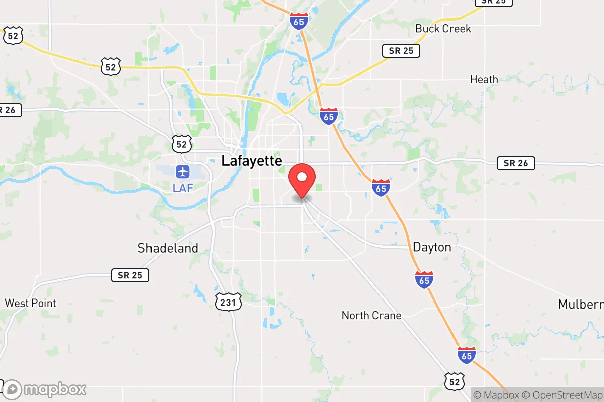
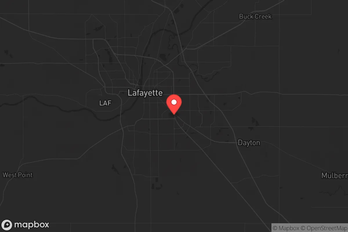
Strategic Assessment of Lafayette, IN
Meaningful friction. Expect exposure to either population pressure, blast zones, or natural disaster risk. Consider buying a retreat property.
What does the Strategic Assessment tell us?
Our Strategic Assessment grades tactical survivability of an area. Major population centers, military targets, fallout zones, natural disasters, and border exposure all drive risk — lower exposure means a more defensible position in a crisis.
This is heavily inspired by Joel Skousen's Strategic Relocation book. Highly recommended you checkout the book ($)What does this tell us?
Our Strategic Assessment grades tactical survivability of an area. Major population centers, military targets, fallout zones, natural disasters, and border exposure all drive risk — lower exposure means a more defensible position in a crisis.
This is heavily inspired by Joel Skousen's Strategic Relocation book. Highly recommended you checkout the book ($)Strategic Pillars

Key Distances
Regional Safe Places
Below is our recommended "safe zones" in Indiana and the surrounding area based on our strategic heuristics. For most people, it's unrealistic to live in a “safe zone” full-time due to work, family or other personal reasons. They tend to be more rural. However, many of these areas are perfect for second homes and retreat properties that double as a vacation home or even a short-term rental.

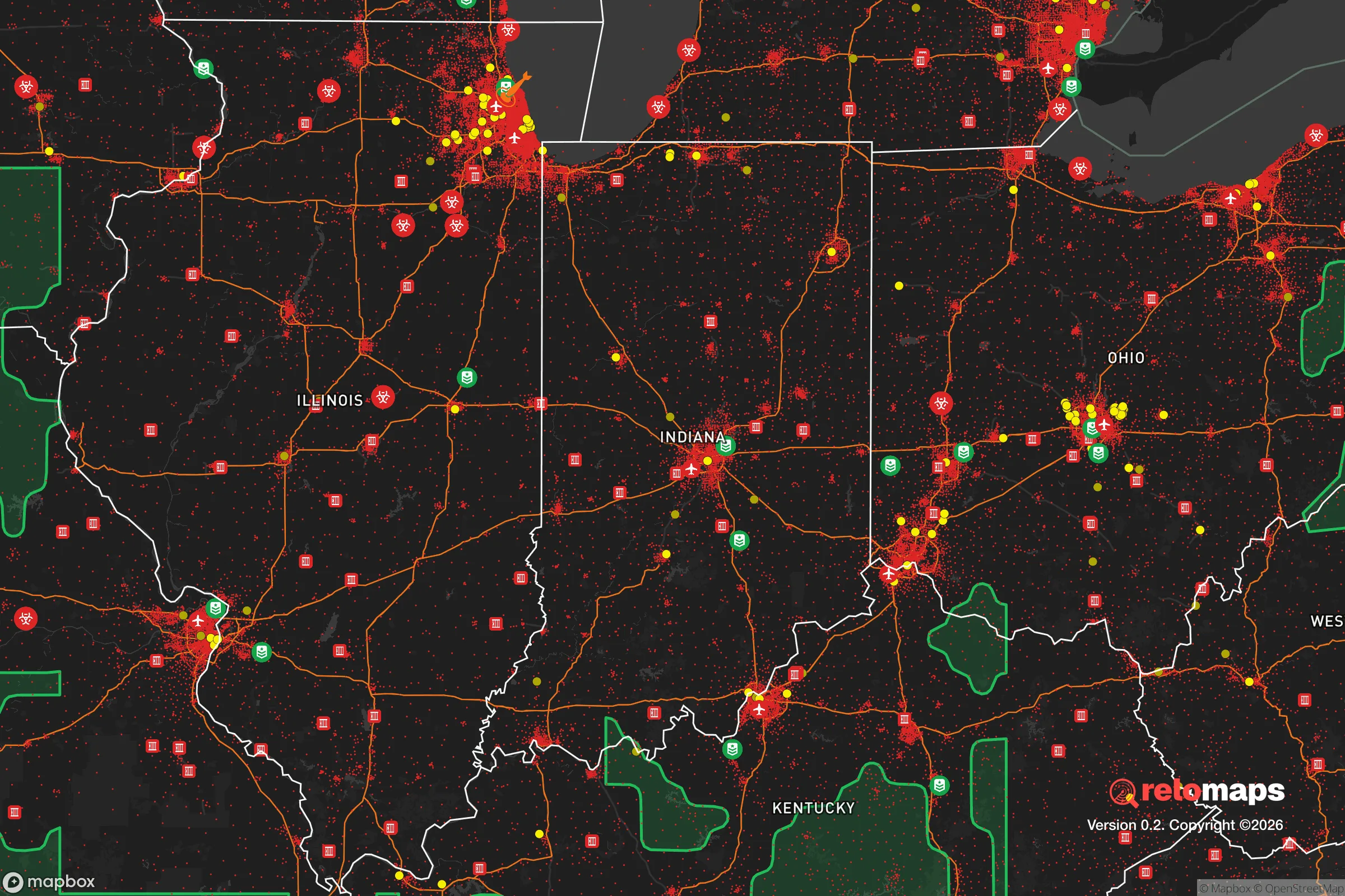
Important Note: For informational purposes only. This does not mean nothing bad ever happens in the green zones. Please use common sense. This is based on public data and modeled with AI. We tried to take a conservative approach but mistakes happen. We update this regularly as new information becomes available.
Solar Generator Recommendations
Backup power matters more here than in safer locations. We've picked three solar generators across budgets and capacity tiers — start with the budget unit if you only need a few essentials, or step up if you want to run a fridge and HVAC for days at a time.

Jackery Portable Power Station Explorer 300
Budget OptionPower on the Go: Weighing only 11 lbs, it's convenient to set up and store with book-sized foldable solar panels

BLUETTI Portable Power Station AC180
Designed for both indoor and outdoor scenarios, AC180 is highly capable as it has a robost capacity and continuous output power.

EF ECOFLOW DELTA Pro Ultra Power Station
Upgraded PickEcoFlow DELTA Pro Ultra is a whole-home energy system designed to grow with your family. Integrated with the Smart Home Panel 2, it scales to meet your evolving energy needs — keeping your home powered, intelligent, and secure through every stage of life.
We earn a commission, at no additional cost to you.
Strategic Assessment Analysis
Lafayette, Indiana, sits in a strategic sweet spot that resilience-minded relocators should take seriously: far enough from major metropolitan chaos to offer breathing room, yet close enough to critical infrastructure to matter. The city anchors the Wabash River Valley, roughly 60 miles northwest of Indianapolis and 120 miles south of Chicago, placing it outside the immediate blast radius of any high-value target while still within a day’s drive of supply chains and medical hubs. For someone weighing civic unrest, grid collapse, or mass casualty scenarios, Lafayette’s position offers a rare blend of isolation and access—provided you understand the trade-offs.
Geographic position and natural advantages for long-term security
Lafayette’s geography is its first line of defense. The Wabash River cuts through the city, providing a reliable freshwater source that doesn’t depend on municipal pumps alone—critical if the grid goes dark. The surrounding Tippecanoe County is flat, fertile farmland, part of the Corn Belt’s breadbasket, meaning local food production is not a hypothetical; it’s the region’s economic backbone. The area sits on the Tipton Till Plain, a glacial deposit that yields deep, arable soil and ample groundwater. For a prepper, that translates to year-round growing seasons for staple crops and aquifer access that can sustain a well-drilled homestead. The terrain offers no natural chokepoints like mountain passes, but the open landscape also means no easy ambush routes for organized threats—visibility is high, and the flat ground favors defensive observation. Winters are cold but manageable, with average January lows around 18°F, which is harsh enough to discourage transient populations but not severe enough to collapse a well-prepared household. The absence of major fault lines, hurricane zones, or wildfire corridors means natural disasters are rare; the biggest weather risk is the occasional tornado, which is survivable with a basement or storm shelter.
Risks, exposures, and proximity to fallout-relevant landmarks
Here’s where the analysis gets sobering. Lafayette’s greatest vulnerability is its proximity to two high-consequence targets: Indianapolis (60 miles southeast) and Chicago (120 miles northeast). In a nuclear exchange or large-scale terrorist event, both cities are prime targets—Indianapolis for its FedEx hub, interstate junctions, and state government; Chicago for its financial district, O’Hare, and Great Lakes naval infrastructure. Fallout patterns depend on wind direction, but prevailing westerlies mean Lafayette could see contamination from a Chicago strike within hours. The city itself hosts Purdue University’s main campus in neighboring West Lafayette, a research powerhouse with ties to defense contracts and biolabs—a potential secondary target for asymmetric attacks. Interstate 65 runs directly through Lafayette, making it a natural evacuation corridor for Indianapolis refugees, which could turn the city into a chokepoint during mass displacement. The Tippecanoe County landfill and wastewater treatment plants are within city limits, meaning a grid-down scenario could create sanitation crises quickly. On the plus side, the area has no nuclear power plants within 50 miles (the closest is Cook Nuclear Plant in Michigan, ~90 miles north), and no major military bases nearby—Fort Wayne’s Air National Guard base is 90 miles east, reducing the chance of collateral targeting.
Practical resilience for a relocator: food, water, energy, and defensibility
For a single individual or family looking to hunker down, Lafayette offers concrete advantages. Water security is strong: the Wabash River is perennial, and the city’s water utility draws from both surface and groundwater sources. A private well drilled into the Silurian aquifer can yield 10-20 gallons per minute at depths of 100-200 feet, enough for a household and small garden. Food production is viable: the county has over 1,500 farms, with corn, soybeans, and livestock dominating. Local farmers’ markets operate year-round in Lafayette, and the Purdue Extension office provides free workshops on canning, seed saving, and livestock management. For energy, the grid is served by Duke Energy Indiana, which relies on coal (60%), natural gas (25%), and renewables (15%). Solar potential is moderate—about 4.5 peak sun hours per day—but battery storage is advisable given winter cloud cover. Defensibility is mixed: the city’s layout is a typical Midwestern grid, with residential neighborhoods like Highland Park and Columbian Park offering tree cover and cul-de-sacs that can be secured. Rural properties in counties like Warren or White to the west provide better standoff distance but require vehicle dependency. The local gun culture is robust—Indiana is a constitutional carry state, and Tippecanoe County has a strong hunting tradition—meaning neighbors are likely armed and capable. Medical infrastructure is adequate: Franciscan Health Lafayette and IU Health Arnett provide two hospitals with emergency rooms, but trauma care for gunshot wounds or severe burns may require helicopter evacuation to Indianapolis, a 45-minute flight. Stockpiling antibiotics, trauma kits, and prescription refills is non-negotiable.
The overall strategic picture for Lafayette is one of calculated risk. It’s not a remote bunker—it’s a working Midwestern city with real exposure to urban fallout and refugee flows. But for a relocator who values affordable land (median home price ~$220,000), abundant freshwater, and a community that doesn’t look sideways at a stocked pantry, it’s a solid base of operations. The key is to buy outside the I-65 corridor—look at properties in Battle Ground, West Point, or along the Wabash south of town—and invest in a well, solar panels, and a root cellar. Lafayette won’t save you from a direct hit on Chicago, but it gives you the time and resources to make a rational decision when the sirens sound. That’s more than most places can offer.
* Values derived from national, state, county, city and local statistics and may differ in a specific area. Last updated: 2026-04-22T10:29:40.000Z
Narrative content on this page is AI-generated and may contain mistakes. Verify any details that matter before acting on them.
ReloMaps may earn a commission from affiliate links at no extra cost to you.