
Photo: Wikipedia
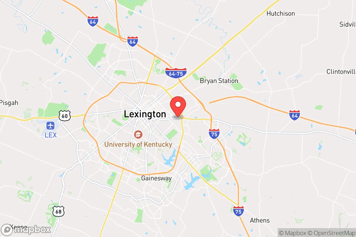
Strategic Assessment of Lexington, KY
Multiple tactical vulnerabilities. Population density, target proximity, or disaster risk are likely compounding. A retreat property and exit planning is required.
What does the Strategic Assessment tell us?
Our Strategic Assessment grades tactical survivability of an area. Major population centers, military targets, fallout zones, natural disasters, and border exposure all drive risk — lower exposure means a more defensible position in a crisis.
This is heavily inspired by Joel Skousen's Strategic Relocation book. Highly recommended you checkout the book ($)What does this tell us?
Our Strategic Assessment grades tactical survivability of an area. Major population centers, military targets, fallout zones, natural disasters, and border exposure all drive risk — lower exposure means a more defensible position in a crisis.
This is heavily inspired by Joel Skousen's Strategic Relocation book. Highly recommended you checkout the book ($)Strategic Pillars

Key Distances
Regional Safe Places
Below is our recommended "safe zones" in Kentucky and the surrounding area based on our strategic heuristics. For most people, it's unrealistic to live in a “safe zone” full-time due to work, family or other personal reasons. They tend to be more rural. However, many of these areas are perfect for second homes and retreat properties that double as a vacation home or even a short-term rental.


Important Note: For informational purposes only. This does not mean nothing bad ever happens in the green zones. Please use common sense. This is based on public data and modeled with AI. We tried to take a conservative approach but mistakes happen. We update this regularly as new information becomes available.
Solar Generator Recommendations
Backup power matters more here than in safer locations. We've picked three solar generators across budgets and capacity tiers — start with the budget unit if you only need a few essentials, or step up if you want to run a fridge and HVAC for days at a time.

Jackery Portable Power Station Explorer 300
Budget OptionPower on the Go: Weighing only 11 lbs, it's convenient to set up and store with book-sized foldable solar panels

BLUETTI Portable Power Station AC180
Designed for both indoor and outdoor scenarios, AC180 is highly capable as it has a robost capacity and continuous output power.

EF ECOFLOW DELTA Pro Ultra Power Station
Upgraded PickEcoFlow DELTA Pro Ultra is a whole-home energy system designed to grow with your family. Integrated with the Smart Home Panel 2, it scales to meet your evolving energy needs — keeping your home powered, intelligent, and secure through every stage of life.
We earn a commission, at no additional cost to you.
Strategic Assessment Analysis
Lexington, Kentucky, offers a surprisingly resilient strategic position for those prioritizing self-reliance and distance from the most volatile urban and military targets, though it is not without its own vulnerabilities. The city sits in the heart of the Bluegrass region, roughly 80 miles south of Cincinnati and 75 miles east of Louisville, placing it within a day's drive of several major population centers while remaining far enough removed to avoid the immediate blast zones and initial chaos of a major metropolitan collapse. Its location along Interstate 75 and the presence of Blue Grass Airport provide decent logistical connectivity, but the surrounding rural landscape and agricultural base give it a distinct advantage for long-term sustainability compared to more densely populated areas.
Geographic position and natural advantages for long-term sustainability
Lexington’s primary strategic asset is its location within the fertile Inner Bluegrass region, an area renowned for its limestone-filtered water and deep, phosphate-rich soil. This is not just a scenic selling point; it translates directly into a high carrying capacity for local food production. The region is a major producer of tobacco, corn, soybeans, and hay, and the abundance of horse farms means a deep reservoir of agricultural knowledge and infrastructure. For a relocator, this means that even in a disrupted supply chain scenario, the local capacity to produce calories and protein is significantly higher than in most suburban or exurban areas. The climate is temperate, with four distinct seasons and an average annual rainfall of around 45 inches, which supports reliable crop yields without the extreme drought or flood risks seen in other parts of the country. The underlying karst topography, while creating some water quality concerns, also means a vast network of underground aquifers, providing a more resilient water source than surface reservoirs alone. The rolling hills and numerous creeks and rivers, including the Kentucky River to the west, offer multiple options for off-grid water collection and small-scale hydropower, though the terrain is not mountainous enough to provide significant natural defensive barriers.
Risks, exposures, and proximity to fallout-relevant landmarks
The most significant strategic drawback of Lexington is its proximity to several high-value targets that could become focal points during a major conflict or collapse scenario. The city is roughly 100 miles from the Blue Grass Army Depot in Richmond, Kentucky, a major chemical weapons storage and destruction facility. While the depot is actively destroying its stockpile, any accident or attack could release toxic agents that would affect the region. More concerning for a prepper is the city’s location along the I-75 corridor, a primary north-south evacuation route. In a mass casualty event or civil unrest scenario, Lexington would likely see a massive influx of refugees from Cincinnati, Louisville, and even as far as Detroit and Atlanta, overwhelming local resources. The city itself is home to the University of Kentucky, a major research institution with a large student population that could become a focal point for unrest or resource competition. Additionally, the Toyota Motor Manufacturing plant in Georgetown, just north of Lexington, is a critical piece of national infrastructure that could be a target for sabotage or become a choke point for supply chains. The presence of the Blue Grass Airport, which also hosts an Air National Guard base, adds another layer of risk as a potential military target. For a survivalist, the key takeaway is that while Lexington is not a primary target like Washington D.C. or New York, it sits within the secondary ring of disruption and would be heavily affected by any major event.
Practical resilience for a relocator: food, water, energy, and defensibility
For a single individual or family looking to establish a resilient homestead, Lexington offers a mixed bag. The local food system is robust, with multiple farmers' markets, a strong local food co-op (Good Foods Co-op), and a network of small-scale producers that could be tapped into for barter and trade. The soil quality is exceptional, meaning a well-placed property with a few acres can become largely self-sufficient in produce and small livestock within a couple of growing seasons. Water is generally accessible via wells, but the limestone bedrock can make drilling expensive and unpredictable. Rainwater catchment is a viable supplement, but the karst geology means surface water can be contaminated quickly, so filtration and testing are non-negotiable. Energy resilience is a weak point. The local grid is dependent on Kentucky Utilities and the larger regional grid, which has shown vulnerability to extreme weather events, including ice storms and heat waves. Solar is viable, with the region averaging around 200 sunny days per year, but tree cover in the more desirable rural areas can limit panel efficiency. Natural gas is widely available in the city, but rural properties often rely on propane or heating oil, which are subject to supply chain disruptions. Defensibility is the hardest factor to assess. The terrain is open and rolling, with few natural chokepoints. A rural property with a long driveway, good sightlines, and a perimeter fence would be far more defensible than a suburban subdivision, but the overall region is not easily sealed off. The best strategy is to locate in a small, tight-knit community like Midway or Versailles, where social cohesion and mutual aid can compensate for the lack of natural barriers. Avoid properties directly on major highways or near the interstate interchanges, as those will become the primary routes for fleeing populations.
Overall, Lexington represents a calculated risk for the strategic relocator. It offers a genuine agricultural advantage and a relatively stable climate, but it sits too close to major population centers and critical infrastructure to be considered a true retreat. The best use of this area is as a staging ground or a long-term base of operations where you can build skills, stockpile resources, and establish a local network, while maintaining a secondary, more remote property for actual collapse scenarios. The local political climate is a mix of university liberalism and rural conservatism, which can create friction but also provides a diverse community that is less likely to descend into a single ideological echo chamber. For the single individual or family willing to put in the work, Lexington offers a viable path to resilience, but it demands constant situational awareness and a plan for when the I-75 corridor becomes a liability rather than an asset.
* Values derived from national, state, county, city and local statistics and may differ in a specific area. Last updated: 2026-05-07T10:56:38.000Z
Narrative content on this page is AI-generated and may contain mistakes. Verify any details that matter before acting on them.
ReloMaps may earn a commission from affiliate links at no extra cost to you.