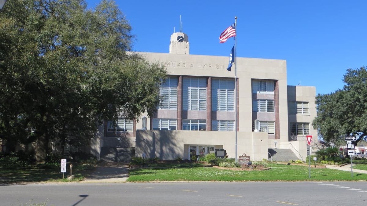
Photo: Wikipedia
Strategic Assessment of Acadia County
Workable tactical position. Some exposure to population density or targets, but generally defensible in a crisis.
What does the Strategic Assessment tell us?
Our Strategic Assessment grades tactical survivability of an area. Major population centers, military targets, fallout zones, natural disasters, and border exposure all drive risk — lower exposure means a more defensible position in a crisis.
This is heavily inspired by Joel Skousen's Strategic Relocation book. Highly recommended you checkout the book ($)What does this tell us?
Our Strategic Assessment grades tactical survivability of an area. Major population centers, military targets, fallout zones, natural disasters, and border exposure all drive risk — lower exposure means a more defensible position in a crisis.
This is heavily inspired by Joel Skousen's Strategic Relocation book. Highly recommended you checkout the book ($)Strategic Pillars

Key Distances
Strategic Assessment Analysis
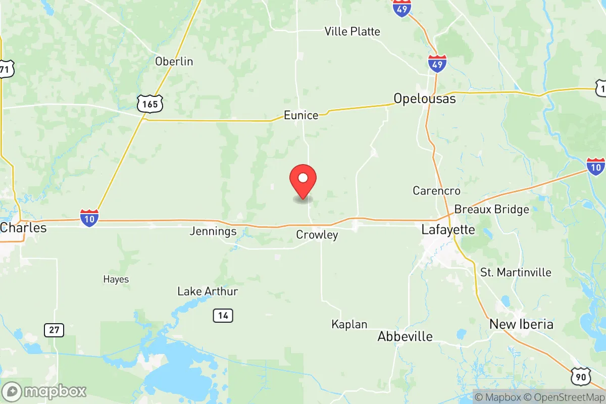
Acadia County, Louisiana, offers a strategic relocation option for those prioritizing disaster readiness and self-sufficiency, balancing rural resilience with access to essential infrastructure. Located in the heart of Cajun country, the parish sits roughly 30 miles west of Lafayette and 140 miles west of New Orleans, placing it outside the immediate blast and fallout zones of major urban centers while still providing reasonable access to medical and supply hubs. The area’s low population density—around 62,000 residents spread across 657 square miles—combined with its agricultural economy and distance from high-value military or industrial targets, makes it a defensible and sustainable choice for families and individuals serious about long-term preparedness.
Geographic position and natural advantages for disaster readiness
Acadia County’s location offers several inherent resilience advantages. The parish sits on the southwestern Louisiana prairie, a flat, open landscape that provides clear sightlines and limited natural cover for potential threats, but also allows for easy cultivation and water management. The Mermentau River and Bayou Plaquemine Brule run through the area, offering natural water sources and drainage. The region’s primary city, Crowley (population ~13,000), serves as the parish seat and a practical hub for supplies, while smaller towns like Rayne, Church Point, and Iota provide decentralized population centers that reduce vulnerability to a single-point failure. The area’s distance from the Mississippi River corridor—a likely target for both natural disasters and man-made disruptions—means it avoids the worst of riverine flooding and industrial fallout risks. The Gulf of Mexico is about 40 miles south, providing access to coastal resources without the direct hurricane storm surge exposure that plagues coastal parishes. This positioning gives Acadia County a moderate climate with long growing seasons, supporting year-round food production—a critical factor for self-sufficiency planning.
Risks, exposures, and proximity to fallout-relevant landmarks
While Acadia County avoids the highest-risk zones, it is not without vulnerabilities. The primary natural threat is hurricanes: the parish lies within 50 miles of the Gulf Coast, meaning Category 3+ storms can bring damaging winds, heavy rainfall, and localized flooding. Hurricane Laura (2020) and Hurricane Rita (2005) both caused significant damage in the area, with power outages lasting weeks in some rural pockets. Flooding is a secondary concern, particularly in low-lying areas near the Mermentau River and its tributaries. For man-made risks, the most notable nearby landmark is the ExxonMobil Baton Rouge Refinery (about 90 miles east), one of the largest refineries in the U.S., and the Port of Lake Charles (about 50 miles west), a major petrochemical hub. While these are not within immediate fallout range, a catastrophic event at either could produce secondary effects like supply chain disruptions or airborne contaminants depending on wind patterns. The Fort Johnson (formerly Fort Polk) military base is about 100 miles northwest, a moderate-risk target for conventional or asymmetric threats. More concerning is the Chennault International Airport in Lake Charles (45 miles west), which hosts military and industrial operations. However, Acadia County’s lack of high-value infrastructure—no major military bases, no nuclear plants, no major ports within its borders—makes it a low-priority target compared to Houston’s refinery corridor or New Orleans’ port complex. The parish’s agricultural character (primarily rice, soybeans, and crawfish farming) means fewer industrial hazards and a dispersed population that is harder to disrupt.
Practical resilience for a relocator: food, water, energy, and defensibility
For a relocator focused on self-sufficiency, Acadia County offers strong practical foundations. Food security is a standout: the parish is part of Louisiana’s rice belt, with numerous family farms and local markets. The Acadiana region is known for its food culture, meaning home gardening, livestock raising, and hunting (deer, waterfowl) are common skills. The Crowley Farmers Market and local co-ops provide fresh produce year-round, and the area’s long growing season (March to November) allows for substantial home food production. Water access is excellent: the Mermentau River and Bayou Plaquemine Brule offer surface water, and the Chicot Aquifer provides reliable groundwater for wells. Most rural properties have private wells, reducing dependence on municipal systems. Energy resilience is moderate: the region is part of the Entergy Louisiana grid, which has improved storm hardening since 2020, but rural areas still experience frequent outages. Solar potential is good (average 5.2 peak sun hours per day), and many residents already use generators or solar panels. The flat terrain makes wind turbine installation feasible for larger properties. Defensibility is a mixed picture: the open prairie offers limited natural cover, but the low population density and dispersed settlement pattern make it difficult for any threat to concentrate. The parish has a strong hunting culture, meaning firearms ownership is common, and the local sheriff’s office (Acadia Parish Sheriff’s Office) maintains a visible presence. The Iota area and Church Point offer particularly rural, defensible properties with good road access for evacuation if needed. The main practical challenge is transportation: Interstate 10 runs through the northern part of the parish, providing a major evacuation route, but it can become congested during hurricane evacuations. Secondary roads (US 90, LA 13) offer alternatives but are less maintained.
Overall, Acadia County presents a balanced strategic picture for the disaster-conscious relocator. It avoids the highest-risk zones of coastal Louisiana and major industrial corridors while offering genuine self-sufficiency advantages in food, water, and community resilience. The trade-offs are real: hurricane risk is present but manageable with proper building standards and a generator, and the lack of high-value targets means lower likelihood of direct man-made threats. For a family or individual willing to invest in storm hardening, well water, and solar power, the parish provides a defensible, sustainable base with a strong local culture of preparedness. The proximity to Lafayette (30 miles) ensures access to hospitals, supplies, and professional services without the vulnerability of living in a major city. For those serious about long-term resilience in a low-key, agricultural setting, Acadia County deserves serious consideration.

* Values derived from national, state, county, city and local statistics and may differ in a specific area. Last updated: 2026-08-08T15:01:42.000Z
Narrative content on this page is AI-generated and may contain mistakes. Verify any details that matter before acting on them.
ReloMaps may earn a commission from affiliate links at no extra cost to you.

