

Photo: Wikipedia
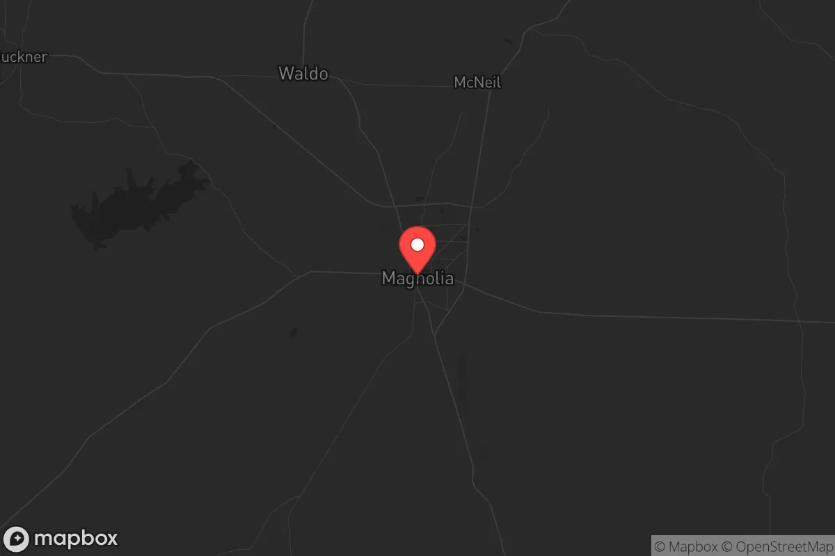
Strategic Assessment of Magnolia, AR
Workable tactical position. Some exposure to population density or targets, but generally defensible in a crisis.
What does the Strategic Assessment tell us?
Our Strategic Assessment grades tactical survivability of an area. Major population centers, military targets, fallout zones, natural disasters, and border exposure all drive risk — lower exposure means a more defensible position in a crisis.
This is heavily inspired by Joel Skousen's Strategic Relocation book. Highly recommended you checkout the book ($)What does this tell us?
Our Strategic Assessment grades tactical survivability of an area. Major population centers, military targets, fallout zones, natural disasters, and border exposure all drive risk — lower exposure means a more defensible position in a crisis.
This is heavily inspired by Joel Skousen's Strategic Relocation book. Highly recommended you checkout the book ($)Strategic Pillars

Key Distances
Regional Safe Places
Below is our recommended "safe zones" in Arkansas and the surrounding area based on our strategic heuristics. For most people, it's unrealistic to live in a “safe zone” full-time due to work, family or other personal reasons. They tend to be more rural. However, many of these areas are perfect for second homes and retreat properties that double as a vacation home or even a short-term rental.


Important Note: For informational purposes only. This does not mean nothing bad ever happens in the green zones. Please use common sense. This is based on public data and modeled with AI. We tried to take a conservative approach but mistakes happen. We update this regularly as new information becomes available.
Solar Generator Recommendations
Backup power matters more here than in safer locations. We've picked three solar generators across budgets and capacity tiers — start with the budget unit if you only need a few essentials, or step up if you want to run a fridge and HVAC for days at a time.

Jackery Portable Power Station Explorer 300
Budget OptionPower on the Go: Weighing only 11 lbs, it's convenient to set up and store with book-sized foldable solar panels

BLUETTI Portable Power Station AC180
Designed for both indoor and outdoor scenarios, AC180 is highly capable as it has a robost capacity and continuous output power.

EF ECOFLOW DELTA Pro Ultra Power Station
Upgraded PickEcoFlow DELTA Pro Ultra is a whole-home energy system designed to grow with your family. Integrated with the Smart Home Panel 2, it scales to meet your evolving energy needs — keeping your home powered, intelligent, and secure through every stage of life.
We earn a commission, at no additional cost to you.
Strategic Assessment Analysis
Magnolia, Arkansas offers a surprisingly resilient strategic position for those prioritizing self-sufficiency and distance from major population centers, though it is not without its own vulnerabilities. Located in Columbia County in the southwestern corner of the state, this town of roughly 11,000 people sits far from the chaos of major interstate corridors and the political flashpoints of the coasts. Its advantages lie in a combination of geographic isolation, a strong local agricultural base, and a community that still largely values self-reliance—traits that are increasingly rare and valuable in an era of potential civic unrest and supply chain fragility.
Geographic isolation and natural buffer zones: why Magnolia avoids the worst of the fallout
Magnolia’s primary strategic asset is its location. It is roughly 90 miles from Shreveport, Louisiana, 120 miles from Little Rock, and over 200 miles from Dallas or Memphis. This distance from major metropolitan areas—each a potential epicenter for civil unrest, grid collapse, or disease outbreak—provides a critical buffer. The town is not on any major interstate; the closest is I-30, about 45 miles north near Texarkana. This means that in a crisis, Magnolia is unlikely to be a primary destination for fleeing urban populations, who will naturally clog the major highways. The surrounding landscape is a mix of pine forests, farmland, and the edges of the Gulf Coastal Plain, offering ample natural cover and multiple potential retreat routes into the Ouachita National Forest to the north or the less-populated areas of southern Arkansas. The local geography is not mountainous, but the dense timber and network of rural roads provide significant defensibility and concealment from casual observation.
Risks, exposures, and proximity to fallout-relevant landmarks: what a prepper must watch
No location is a fortress, and Magnolia has its share of strategic liabilities. The most immediate concern is the El Dorado Chemical plant (a major ammonium nitrate facility) located about 30 miles to the northeast in El Dorado, AR. While not a nuclear target, a catastrophic accident or sabotage at this facility could produce a toxic cloud or a significant explosion, with prevailing winds potentially carrying fallout toward Magnolia. Additionally, the region is crisscrossed by natural gas pipelines and has a history of oil and gas extraction, meaning a localized industrial accident is a non-zero risk. On a broader scale, Magnolia is within a few hundred miles of the Dallas-Fort Worth metroplex, a high-value target for any state-level adversary, and the Louisiana Chemical Corridor along the Mississippi River, which includes numerous refineries and chemical plants that are prime targets for disruption. While Magnolia is far enough to avoid direct blast effects, a major event at either location could trigger a massive refugee flow or a regional economic collapse that would ripple into the local supply chain. The town itself has no major military bases or critical infrastructure that would make it a primary target, which is a net positive.
Practical resilience for a relocator: food, water, energy, and defensibility on the ground
For the individual or family looking to establish a sustainable base, Magnolia offers several concrete advantages. Water is abundant. The town sits atop the Sparta Aquifer, one of the most productive groundwater sources in the region, and the nearby Ouachita River and Lake Columbia provide surface water options. A well-drilled property outside city limits is a realistic and affordable proposition. Food production is viable year-round. The growing season in southern Arkansas is long (typically March through October), and the soil, while requiring amendment, is suitable for gardens, orchards, and small livestock. The local agricultural economy is dominated by poultry (Tyson Foods has a significant presence), timber, and row crops, meaning that even in a supply chain disruption, barter and local food networks are likely to persist longer than in suburban areas. Energy is a mixed bag. The grid is served by South Arkansas Electric Cooperative, which is generally reliable but vulnerable to ice storms and summer thunderstorms. Solar potential is moderate—the region gets about 60% of possible sunshine—but a backup generator or a small solar array with battery storage is a wise investment. Defensibility is decent. The town itself is compact, with a historic downtown and residential areas that are not easily defensible from a determined mob. However, the surrounding rural properties—many with long driveways, tree cover, and distance from main roads—offer excellent standoff and early warning. The local sheriff's office is small but community-oriented, and the general culture of gun ownership and hunting is strong, meaning that a prepared individual will not stand out.
The overall strategic picture: a quiet, low-signature base with manageable trade-offs
Magnolia, Arkansas is not a prepper fantasy of a mountain redoubt, but it is a practical, low-signature location for those who want to be out of the blast radius of national collapse. Its greatest strength is its obscurity and the self-reliant character of its people. Its greatest weakness is its proximity to the chemical and energy infrastructure of the Ark-La-Tex region, which could become a secondary crisis zone. For a single individual or a family willing to invest in a well, a garden, and a good set of neighbors, Magnolia offers a realistic path to resilience without the extreme isolation or high cost of the Rockies or the Pacific Northwest. The key is to be prepared for the local risks—ice storms, the occasional tornado, and the potential for a chemical incident—while enjoying the strategic benefit of being far from the places that will burn first. If you are looking for a place to ride out the storm without being a target, Magnolia deserves a serious look.
* Values derived from national, state, county, city and local statistics and may differ in a specific area. Last updated: 2026-04-19T12:03:07.000Z
Narrative content on this page is AI-generated and may contain mistakes. Verify any details that matter before acting on them.
ReloMaps may earn a commission from affiliate links at no extra cost to you.