
Photo: Wikipedia
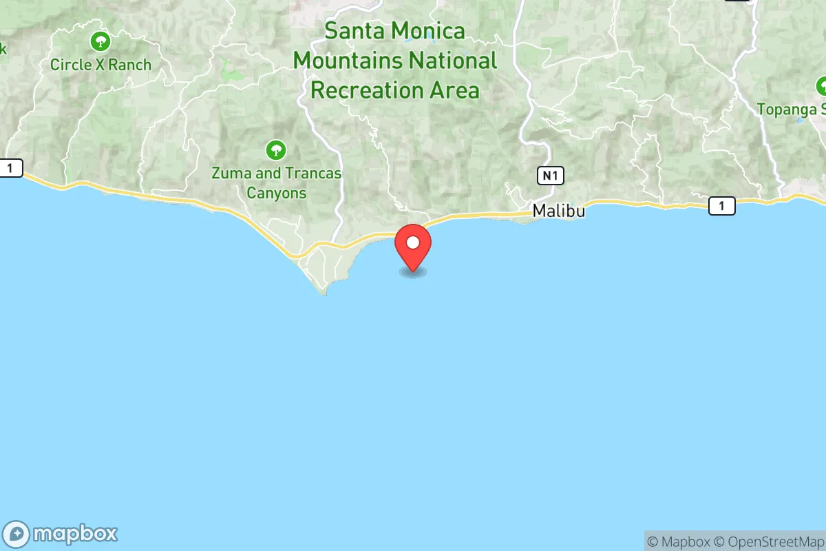
Strategic Assessment of Malibu, CA
Multiple tactical vulnerabilities. Population density, target proximity, or disaster risk are likely compounding. A retreat property and exit planning is required.
What does the Strategic Assessment tell us?
Our Strategic Assessment grades tactical survivability of an area. Major population centers, military targets, fallout zones, natural disasters, and border exposure all drive risk — lower exposure means a more defensible position in a crisis.
This is heavily inspired by Joel Skousen's Strategic Relocation book. Highly recommended you checkout the book ($)What does this tell us?
Our Strategic Assessment grades tactical survivability of an area. Major population centers, military targets, fallout zones, natural disasters, and border exposure all drive risk — lower exposure means a more defensible position in a crisis.
This is heavily inspired by Joel Skousen's Strategic Relocation book. Highly recommended you checkout the book ($)Strategic Pillars

Key Distances
Regional Safe Places
Below is our recommended "safe zones" in California and the surrounding area based on our strategic heuristics. For most people, it's unrealistic to live in a “safe zone” full-time due to work, family or other personal reasons. They tend to be more rural. However, many of these areas are perfect for second homes and retreat properties that double as a vacation home or even a short-term rental.


Important Note: For informational purposes only. This does not mean nothing bad ever happens in the green zones. Please use common sense. This is based on public data and modeled with AI. We tried to take a conservative approach but mistakes happen. We update this regularly as new information becomes available.
Solar Generator Recommendations
Backup power matters more here than in safer locations. We've picked three solar generators across budgets and capacity tiers — start with the budget unit if you only need a few essentials, or step up if you want to run a fridge and HVAC for days at a time.

Jackery Portable Power Station Explorer 300
Budget OptionPower on the Go: Weighing only 11 lbs, it's convenient to set up and store with book-sized foldable solar panels

BLUETTI Portable Power Station AC180
Designed for both indoor and outdoor scenarios, AC180 is highly capable as it has a robost capacity and continuous output power.

EF ECOFLOW DELTA Pro Ultra Power Station
Upgraded PickEcoFlow DELTA Pro Ultra is a whole-home energy system designed to grow with your family. Integrated with the Smart Home Panel 2, it scales to meet your evolving energy needs — keeping your home powered, intelligent, and secure through every stage of life.
We earn a commission, at no additional cost to you.
Strategic Assessment Analysis
Malibu, California, presents a paradox for the disaster-conscious relocator: it offers world-class natural barriers and a low-density footprint, yet sits within striking distance of the densest urban and strategic targets on the West Coast. Its resilience profile is defined by extreme geography—a narrow coastal strip backed by the Santa Monica Mountains—which simultaneously provides defensible terrain and severe exposure to wildfire, landslide, and tsunami hazards. For a single individual or family prioritizing self-sufficiency and strategic positioning, Malibu demands a clear-eyed trade-off: you gain isolation and natural resources, but you accept a high-risk environment and a single-point-of-failure access route.
Geographic position and natural advantages for self-sufficiency
Malibu’s primary strategic asset is its location along the Pacific Coast Highway (PCH), sandwiched between the Pacific Ocean and the rugged, sparsely populated Santa Monica Mountains. This geography creates a natural buffer zone: the mountains rise sharply to over 2,000 feet, limiting overland approaches from the San Fernando Valley and making the area inherently defensible against ground-level threats. The city spans 21 miles of coastline, with most development concentrated in narrow canyons and coastal flats, meaning population density is extremely low—roughly 100 people per square mile compared to Los Angeles’ 8,300. For a relocator, this translates to fewer neighbors, less competition for resources, and a built-in perimeter of undeveloped public land (including Topanga State Park and Point Mugu State Park) that can serve as a buffer or a source of wild game and forage. The ocean provides a reliable water source—though desalination is energy-intensive—and the Mediterranean climate allows for year-round food cultivation in protected microclimates. The area’s prevailing westerly winds also mean that airborne contaminants from the Los Angeles basin are typically blown away from Malibu, a minor but real advantage for air quality during a regional event.
Risks, exposures, and proximity to fallout-relevant landmarks
The same geography that provides isolation also creates severe vulnerabilities. Malibu is one of the most wildfire-prone communities in the United States, with the Woolsey Fire (2018) destroying over 1,600 structures and forcing the evacuation of the entire city. The combination of steep canyons, dry chaparral, and seasonal Santa Ana winds creates a fire regime that can turn a small ignition into a city-wide threat within hours. Landslides and mudslides are annual risks during winter rains, particularly along PCH and in canyon neighborhoods, and the entire coastline is subject to tsunami inundation from a Cascadia subduction zone event—though the risk is lower than in coastal Oregon or Washington. More critically for the strategic-minded relocator, Malibu lies approximately 30 miles west of downtown Los Angeles, a high-value target for both conventional and unconventional threats. The Port of Los Angeles/Long Beach complex, the region’s major military installations (Vandenberg SFB to the north, Naval Base Ventura County to the west), and the dense urban core of LA are all within a 45-minute drive. In a major disruption—whether natural, economic, or security-related—Malibu would face an influx of evacuees from the east, overwhelming PCH and the limited secondary routes (Topanga Canyon Boulevard, Malibu Canyon Road, and Kanan Dume Road). These canyon roads are narrow, winding, and prone to closure from fire or debris flows, creating a potential trap for residents who cannot evacuate early. The single-point-of-failure nature of PCH is the area’s most glaring strategic weakness: if the highway is blocked, the only overland exit is through the mountains, which are themselves vulnerable to the same hazards.
Practical resilience for a relocator: food, water, energy, and defensibility
For a relocator serious about self-sufficiency, Malibu offers a mixed bag. Water is the most critical resource: the city relies on a combination of local groundwater (from the Malibu Creek watershed) and imported water from the State Water Project and Los Angeles Aqueduct. During a prolonged disruption, local wells and springs in the canyon areas could provide a limited supply, but most residential properties are on municipal water that depends on electric pumps. A private well with a hand pump or solar-powered backup is a significant advantage, but drilling costs in the rocky terrain can exceed $20,000. Food production is feasible in the coastal microclimate—avocados, citrus, vegetables, and herbs grow well—but the limited flat land and fire risk make large-scale gardening challenging. The ocean provides a reliable protein source (fishing, shellfish), but requires knowledge of local regulations and contamination risks from urban runoff after rains. Energy is a bright spot: Malibu has high solar insolation, and many homes already have solar panels and battery storage (common after the 2018 fire and subsequent Public Safety Power Shutoffs). Off-grid solar with a robust battery bank is practical, and the coastal winds can support small wind turbines, though permitting is restrictive. Defensibility is the area’s strongest suit: the low density, limited access points, and natural mountain barriers make it relatively easy to secure a property against opportunistic threats. However, the same features make it difficult to defend against wildfire—defensible space (clearing brush, using fire-resistant materials) is not optional but mandatory. The city’s building codes now require Class A fire-rated roofs, ember-resistant vents, and non-combustible siding for new construction, and existing homes are strongly encouraged to retrofit. For a relocator, buying a post-2018 rebuilt home with modern fire-hardening is a practical baseline.
The overall strategic picture for Malibu is one of high reward paired with high risk. It offers a rare combination of natural isolation, defensible terrain, and access to ocean resources that few coastal communities in Southern California can match. But that isolation comes with a single-threaded transportation network, extreme wildfire exposure, and proximity to a major urban center that could become a liability in a crisis. For a single individual or family willing to invest in fire-hardening, off-grid water and power, and a well-stocked emergency cache, Malibu can function as a resilient retreat—provided you are prepared to evacuate early and often. It is not a location for those seeking low-maintenance security; it is a location for those who treat disaster readiness as a lifestyle, not an insurance policy. If you can manage the fire risk and accept the access constraints, Malibu’s natural advantages make it one of the more strategically sound options within the Los Angeles orbit. If you cannot, the same features that make it beautiful will make it a trap.
* Values derived from national, state, county, city and local statistics and may differ in a specific area. Last updated: 2026-06-08T04:57:00.000Z
Narrative content on this page is AI-generated and may contain mistakes. Verify any details that matter before acting on them.
ReloMaps may earn a commission from affiliate links at no extra cost to you.