
Photo: Wikipedia
Strategic Assessment of Matthews, NC
Multiple tactical vulnerabilities. Population density, target proximity, or disaster risk are likely compounding. A retreat property and exit planning is required.
What does the Strategic Assessment tell us?
Our Strategic Assessment grades tactical survivability of an area. Major population centers, military targets, fallout zones, natural disasters, and border exposure all drive risk — lower exposure means a more defensible position in a crisis.
This is heavily inspired by Joel Skousen's Strategic Relocation book. Highly recommended you checkout the book ($)What does this tell us?
Our Strategic Assessment grades tactical survivability of an area. Major population centers, military targets, fallout zones, natural disasters, and border exposure all drive risk — lower exposure means a more defensible position in a crisis.
This is heavily inspired by Joel Skousen's Strategic Relocation book. Highly recommended you checkout the book ($)Strategic Pillars

Key Distances
Regional Safe Places
Below is our recommended "safe zones" in North Carolina and the surrounding area based on our strategic heuristics. For most people, it's unrealistic to live in a “safe zone” full-time due to work, family or other personal reasons. They tend to be more rural. However, many of these areas are perfect for second homes and retreat properties that double as a vacation home or even a short-term rental.


Important Note: For informational purposes only. This does not mean nothing bad ever happens in the green zones. Please use common sense. This is based on public data and modeled with AI. We tried to take a conservative approach but mistakes happen. We update this regularly as new information becomes available.
Solar Generator Recommendations
Backup power matters more here than in safer locations. We've picked three solar generators across budgets and capacity tiers — start with the budget unit if you only need a few essentials, or step up if you want to run a fridge and HVAC for days at a time.

Jackery Portable Power Station Explorer 300
Budget OptionPower on the Go: Weighing only 11 lbs, it's convenient to set up and store with book-sized foldable solar panels

BLUETTI Portable Power Station AC180
Designed for both indoor and outdoor scenarios, AC180 is highly capable as it has a robost capacity and continuous output power.

EF ECOFLOW DELTA Pro Ultra Power Station
Upgraded PickEcoFlow DELTA Pro Ultra is a whole-home energy system designed to grow with your family. Integrated with the Smart Home Panel 2, it scales to meet your evolving energy needs — keeping your home powered, intelligent, and secure through every stage of life.
We earn a commission, at no additional cost to you.
Strategic Assessment Analysis
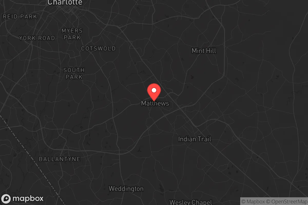
Matthews, North Carolina, offers a strategic paradox for the conservative prepper: it sits just 15 miles southeast of Charlotte, a major urban center that is both a threat vector and a logistical asset, while retaining a small-town character that provides a degree of social cohesion and geographic buffer. The town’s location along the CSX rail line and I-485 outer loop gives it solid supply-chain access, but its proximity to Charlotte Douglas International Airport (a prime target for a mass-casualty event or EMP strike) and the city’s sprawling suburbs means you are within the blast-radius of any major urban disruption. For a relocator prioritizing resilience, Matthews is a calculated compromise—close enough to tap resources, far enough to avoid the worst of the initial chaos, provided you have a plan to bug in or bug out quickly.
Geographic position and natural advantages for long-term survival
Matthews sits in the Piedmont region, a rolling plateau that offers moderate defensibility compared to the flat coastal plain or the rugged, isolated mountains. The terrain is a mix of hardwood forests, small creeks, and low hills, which provides natural cover and some concealment for a retreat property. The town’s elevation averages around 700 feet, which is low enough to avoid severe winter weather but high enough to reduce flood risk from the nearby Catawba River basin. The climate is humid subtropical, with hot summers and mild winters—good for year-round gardening and foraging, but also a breeding ground for ticks and mosquitoes that can complicate off-grid living. The area’s natural advantages include reliable rainfall (averaging 43 inches per year) and a long growing season (roughly 210 days), which means a well-planned food plot can yield multiple harvests. However, the soil is heavy clay, requiring raised beds or significant amendment for serious agriculture. The nearby Uwharrie National Forest, about 45 minutes east, offers a public-land buffer zone for hunting and timber, but it’s not a true wilderness—it’s fragmented by roads and private parcels. For a prepper, the key natural advantage is the abundance of surface water (creeks like McAlpine and Fourmile) and the proximity to Lake Wylie and Lake Norman, which can serve as emergency water sources if municipal supplies are compromised. But don’t count on those lakes being uncontested—they’re heavily developed and will be a magnet for refugees during a crisis.
Risks, exposures, and proximity to fallout-relevant landmarks
The biggest risk for a Matthews-based prepper is its location within the Charlotte metropolitan statistical area, home to over 2.6 million people. In a mass-casualty event—whether a terrorist attack, a grid-down scenario, or a biological outbreak—the I-485 and I-77 corridors will become chokepoints for panicked evacuees. Matthews is directly downstream of Charlotte’s primary fallout zone: Charlotte Douglas International Airport is a high-value target for any adversary, and the city’s banking sector (Bank of America, Truist) makes it a symbolic target for civil unrest. The town itself has a population of about 32,000, but it’s surrounded by dense suburbs like Mint Hill, Indian Trail, and Stallings, meaning you’re never more than a few miles from a strip mall or a subdivision. That density creates a “cascade failure” risk: if the power grid goes down, the gas stations will empty in hours, the grocery stores in days, and the local police force (Matthews PD has about 50 officers) will be overwhelmed. The McGuire Nuclear Station, located about 25 miles northwest on Lake Norman, is a specific concern—a sabotage or accident there could force a mandatory evacuation of the entire region, including Matthews. The prevailing winds blow from the west, so a radiological release would push contamination toward the town. Additionally, the CSX rail line running through Matthews carries hazardous materials (chlorine, ammonia, propane) that could cause a local chemical event. For a relocator, the takeaway is clear: Matthews is not a bug-out location; it’s a bug-in location with a low threshold for becoming a danger zone. You need a hardened home with a year’s worth of supplies and a secondary retreat at least 100 miles away.
Practical resilience for a relocator: food, water, energy, and defensibility
For a single individual or a family looking to set up a resilient homestead, Matthews offers a mixed bag. The town’s water supply comes from Charlotte Water, which draws from the Catawba River—a single-point-of-failure system vulnerable to contamination or pump failure. A prepper should install a 1,500-gallon rainwater catchment system and a Berkey or similar gravity filter as a baseline. The local water table is high (around 20-30 feet), so a shallow well is feasible on larger lots, but most Matthews homes are on quarter-acre plots with HOA restrictions that may prohibit drilling. Food security is the bigger challenge: the town has a few farmers’ markets (Matthews Community Farmers’ Market runs seasonally) and some small farms in the surrounding Union County, but the area is not agricultural—it’s suburban sprawl. You’ll need to grow your own, and that means converting lawn space into raised beds or a greenhouse. The HOA culture in Matthews is strong (many neighborhoods have strict covenants), so you’ll need to buy in an unincorporated part of Union County or a neighborhood with looser rules to avoid conflict over chickens, solar panels, or a woodpile. Energy resilience is achievable: the grid is stable but aging, and Duke Energy has a mixed record on outage response. Solar panels with battery storage (a 10kW system with a Tesla Powerwall or similar) can cover a home’s basic needs, but the area’s tree cover can limit sun exposure. A backup generator running on propane or natural gas is a more practical first step. Defensibility is the weakest link: Matthews is a grid-pattern suburb with multiple entry points, no natural barriers, and a police force that will be stretched thin. Your best defense is obscurity—a home set back from the road, with a fence and a dog, and a low profile. Avoid homes on main thoroughfares (like Matthews-Mint Hill Road or Independence Boulevard) and prioritize cul-de-sacs or dead-end streets. The local gun culture is moderate (North Carolina is a shall-issue state for concealed carry, and Matthews has a few gun shops), but you’ll need to join a private range or find a rural friend’s land for serious training.
The overall strategic picture for Matthews is that of a “gray zone” location—not safe enough to be a primary retreat, but not so dangerous that it’s a write-off. For a conservative relocator who works in Charlotte and needs to stay within commuting distance, it’s a viable base of operations, provided you treat it as a stepping stone rather than a final destination. The town’s schools are solid (Union County Public Schools are well-regarded), the crime rate is low (violent crime is about half the national average), and the local government is competent but not overbearing. But in a crisis, Matthews will become a pressure cooker: too many people, too few resources, and too close to a major target. The smart play is to buy a property here, harden it, and use it as a forward operating base while you acquire a secondary retreat in the mountains (Ashe County or the Smokies) or the coastal plains (the Sandhills region). Matthews is a place to live, not a place to survive. If you’re serious about long-term resilience, you’ll use it as a launchpad for a more defensible, self-sufficient property within a two-hour drive. The town’s best feature is its location—close enough to Charlotte to earn a living, far enough to buy time when the balloon goes up. But time is all it buys you. Plan accordingly.
* Values derived from national, state, county, city and local statistics and may differ in a specific area. Last updated: 2026-05-03T20:27:11.000Z
Narrative content on this page is AI-generated and may contain mistakes. Verify any details that matter before acting on them.
ReloMaps may earn a commission from affiliate links at no extra cost to you.