Photo: Wikipedia
Strategic Assessment of McGregor, TX
Meaningful friction. Expect exposure to either population pressure, blast zones, or natural disaster risk. Consider buying a retreat property.
What does the Strategic Assessment tell us?
Our Strategic Assessment grades tactical survivability of an area. Major population centers, military targets, fallout zones, natural disasters, and border exposure all drive risk — lower exposure means a more defensible position in a crisis.
This is heavily inspired by Joel Skousen's Strategic Relocation book. Highly recommended you checkout the book ($)What does this tell us?
Our Strategic Assessment grades tactical survivability of an area. Major population centers, military targets, fallout zones, natural disasters, and border exposure all drive risk — lower exposure means a more defensible position in a crisis.
This is heavily inspired by Joel Skousen's Strategic Relocation book. Highly recommended you checkout the book ($)Strategic Pillars

Key Distances
Regional Safe Places
Below is our recommended "safe zones" in Texas and the surrounding area based on our strategic heuristics. For most people, it's unrealistic to live in a “safe zone” full-time due to work, family or other personal reasons. They tend to be more rural. However, many of these areas are perfect for second homes and retreat properties that double as a vacation home or even a short-term rental.


Important Note: For informational purposes only. This does not mean nothing bad ever happens in the green zones. Please use common sense. This is based on public data and modeled with AI. We tried to take a conservative approach but mistakes happen. We update this regularly as new information becomes available.
Solar Generator Recommendations
Backup power matters more here than in safer locations. We've picked three solar generators across budgets and capacity tiers — start with the budget unit if you only need a few essentials, or step up if you want to run a fridge and HVAC for days at a time.

Jackery Portable Power Station Explorer 300
Budget OptionPower on the Go: Weighing only 11 lbs, it's convenient to set up and store with book-sized foldable solar panels

BLUETTI Portable Power Station AC180
Designed for both indoor and outdoor scenarios, AC180 is highly capable as it has a robost capacity and continuous output power.

EF ECOFLOW DELTA Pro Ultra Power Station
Upgraded PickEcoFlow DELTA Pro Ultra is a whole-home energy system designed to grow with your family. Integrated with the Smart Home Panel 2, it scales to meet your evolving energy needs — keeping your home powered, intelligent, and secure through every stage of life.
We earn a commission, at no additional cost to you.
Strategic Assessment Analysis
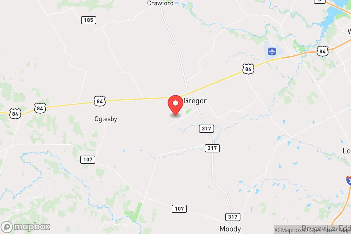
McGregor, Texas, sits at a strategic crossroads that offers a rare blend of isolation and accessibility, making it a serious contender for anyone prioritizing long-term resilience. Located in McLennan County, roughly 20 miles west of Waco and 90 miles south of the Dallas-Fort Worth metroplex, this town of around 5,000 people provides a buffer from the chaos of major urban centers while still being within a reasonable drive of essential infrastructure. The area’s agricultural roots, low population density, and position along the I-35 corridor give it a unique advantage: you’re close enough to tap into regional resources when things are stable, but far enough that a cascading collapse in a major city won’t immediately wash over your doorstep. For a conservative-leaning relocator thinking about the next decade, McGregor offers a foundation that’s hard to beat—provided you understand both its strengths and its blind spots.
Geographic position and natural advantages for long-term stability
McGregor’s geography is its first line of defense. The town sits on the eastern edge of the Texas Hill Country, where the terrain transitions from flat blackland prairie to rolling limestone hills. This means you get decent drainage—flash flooding is rare compared to low-lying areas near the Brazos River—and the soil is fertile enough for small-scale agriculture. The local water table is reliable, with the Edwards Aquifer and several minor aquifers providing groundwater access for those who drill a private well. Annual rainfall averages around 35 inches, which is enough to sustain gardens, orchards, and livestock without the constant drought pressure seen further west. The climate is hot and humid in summer, but that same heat supports a long growing season (roughly 230 days) for food production. From a prepper standpoint, the land here is forgiving: you can raise chickens, goats, or a few head of cattle on a modest acreage, and the lack of severe wildfire risk (compared to, say, California or Colorado) means your property isn’t a tinderbox. The nearest major military installation is Fort Cavazos (formerly Fort Hood) about 30 miles southwest, which provides a degree of regional stability and emergency response capability—though it also means you’re within the blast radius of a potential target, something we’ll address shortly.
Risks, exposures, and proximity to fallout-relevant landmarks
No location is a fortress, and McGregor has its share of vulnerabilities. The most glaring is its proximity to I-35, a major north-south artery that funnels traffic from the border to the Great Lakes. In a crisis—whether a pandemic, civil unrest, or a supply chain disruption—that highway becomes a liability. Refugees from Waco, Austin, or Dallas could pour through McGregor, and the town’s small police force (roughly a dozen officers) would be overwhelmed. The Waco metropolitan area, with its 140,000 people, is close enough that a riot or disease outbreak there could spill over within hours. More concerning is the presence of the Texas A&M University System’s RELLIS campus and the nearby Waco Regional Airport, which could be secondary targets in a conflict scenario. The biggest elephant in the room is the proximity to Fort Cavazos. While the base provides a military presence, it’s also a prime target for any adversary looking to cripple U.S. ground forces. A conventional strike or a dirty bomb detonated there would put McGregor in the fallout zone, depending on wind direction. Additionally, the town sits within 100 miles of the nuclear power plant at Comanche Peak (near Glen Rose) and the chemical plants along the Gulf Coast—both potential targets for sabotage or accident. For a survivalist, these risks are manageable if you have a bug-out plan and a secondary location further west (e.g., the Permian Basin or the Davis Mountains), but they’re real enough that you shouldn’t ignore them.
Practical resilience for a relocator: food, water, energy, and defensibility
On the ground, McGregor offers a solid baseline for self-sufficiency. The local economy is anchored by agriculture—cotton, corn, and hay are the main crops—and there are several feed stores, farm supply outlets, and a small but functional farmers’ market. For water, most rural properties rely on private wells, and drilling a new well runs about $10,000 to $15,000 for a 200-foot depth. The city water supply comes from Lake Waco, which is managed by the Brazos River Authority and has held up well during recent droughts, but a prolonged grid failure would leave municipal users high and dry. Solar is viable here: the area gets about 220 sunny days per year, and net metering is available through the local co-op (McLennan County Electric Cooperative). Battery storage is recommended, as the grid is prone to outages during ice storms (like the 2021 freeze) and summer heat waves. For defensibility, the terrain is mostly flat with scattered tree lines, so a rural property with a clear line of sight and a gravel road approach gives you an advantage. The local gun culture is strong—there are multiple shooting ranges within 30 minutes, and the sheriff’s office is generally supportive of Second Amendment rights. That said, the town itself is not a gated community; you’ll need to harden your own perimeter with fencing, cameras, and a plan for neighborhood watch. Food storage is straightforward: the nearest Costco is in Waco, and there are several bulk grocery stores in the area, but you’ll want to stockpile at least three months of supplies given the risk of supply chain hiccups. Healthcare is a weak point—the only hospital is a small critical-access facility in McGregor (Baylor Scott & White), and serious trauma cases require a 30-minute drive to Waco. If you have chronic conditions, plan accordingly.
The overall strategic picture for McGregor is one of cautious optimism. It’s not a bunker—it’s a working-class Texas town with real exposure to the vulnerabilities of the I-35 corridor and nearby military and industrial targets. But for a relocator who values land, water, and community over the false security of a suburban subdivision, it’s a solid bet. The key is to treat McGregor as a base of operations, not a final redoubt. Build your well, your solar array, and your food stores. Get to know your neighbors—the local Baptist church and the VFW post are good places to start. And keep a bug-out vehicle gassed up and pointed west. If you do that, you’ll be better positioned than 90% of Americans to weather whatever comes down the pike. The town’s biggest strength is that it’s still affordable enough to buy land outright, and its biggest weakness is that it’s close enough to the chaos to feel it. That’s a trade-off you’ll have to weigh for yourself, but for a conservative-minded prepper, McGregor is worth a serious look.
* Values derived from national, state, county, city and local statistics and may differ in a specific area. Last updated: 2026-05-31T21:02:02.000Z
Narrative content on this page is AI-generated and may contain mistakes. Verify any details that matter before acting on them.
ReloMaps may earn a commission from affiliate links at no extra cost to you.