
Photo: Wikipedia
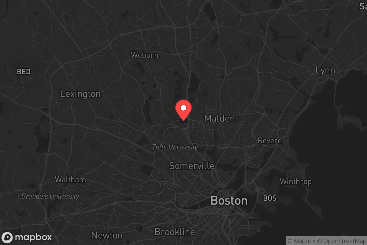
Strategic Assessment of Medford, MA
High tactical risk. This location is likely close to major population centers, strategic targets, or sits in a high-disaster corridor. A retreat property and careful exit planning is required.
What does the Strategic Assessment tell us?
Our Strategic Assessment grades tactical survivability of an area. Major population centers, military targets, fallout zones, natural disasters, and border exposure all drive risk — lower exposure means a more defensible position in a crisis.
This is heavily inspired by Joel Skousen's Strategic Relocation book. Highly recommended you checkout the book ($)What does this tell us?
Our Strategic Assessment grades tactical survivability of an area. Major population centers, military targets, fallout zones, natural disasters, and border exposure all drive risk — lower exposure means a more defensible position in a crisis.
This is heavily inspired by Joel Skousen's Strategic Relocation book. Highly recommended you checkout the book ($)Strategic Pillars

Key Distances
Regional Safe Places
Below is our recommended "safe zones" in Massachusetts and the surrounding area based on our strategic heuristics. For most people, it's unrealistic to live in a “safe zone” full-time due to work, family or other personal reasons. They tend to be more rural. However, many of these areas are perfect for second homes and retreat properties that double as a vacation home or even a short-term rental.


Important Note: For informational purposes only. This does not mean nothing bad ever happens in the green zones. Please use common sense. This is based on public data and modeled with AI. We tried to take a conservative approach but mistakes happen. We update this regularly as new information becomes available.
Solar Generator Recommendations
Backup power matters more here than in safer locations. We've picked three solar generators across budgets and capacity tiers — start with the budget unit if you only need a few essentials, or step up if you want to run a fridge and HVAC for days at a time.

Jackery Portable Power Station Explorer 300
Budget OptionPower on the Go: Weighing only 11 lbs, it's convenient to set up and store with book-sized foldable solar panels

BLUETTI Portable Power Station AC180
Designed for both indoor and outdoor scenarios, AC180 is highly capable as it has a robost capacity and continuous output power.

EF ECOFLOW DELTA Pro Ultra Power Station
Upgraded PickEcoFlow DELTA Pro Ultra is a whole-home energy system designed to grow with your family. Integrated with the Smart Home Panel 2, it scales to meet your evolving energy needs — keeping your home powered, intelligent, and secure through every stage of life.
We earn a commission, at no additional cost to you.
Strategic Assessment Analysis
Medford, Massachusetts, sits in a precarious strategic position: close enough to Boston to be vulnerable to the cascading effects of a major urban collapse, yet far enough to offer a short-term buffer if you have a solid exit plan. Its location along the Mystic River and its dense suburban fabric mean that in a crisis—whether civil unrest, a grid-down event, or a mass casualty incident—you’re not in a hardened redoubt. You’re in a transitional zone. For a conservative-leaning relocator with a prepper mindset, Medford’s real value isn’t as a long-term survival homestead, but as a staging ground with decent infrastructure resilience and proximity to more defensible terrain in northern Middlesex County or southern New Hampshire. The key is understanding that this is a location of calculated convenience, not isolation.
Geographic position and natural advantages for a crisis scenario
Medford’s geography is a mixed bag. The city sits along the Mystic River, which provides a natural water source, but the river is tidal and brackish in parts, meaning it’s not immediately potable without serious filtration or treatment. The area is part of the Boston Basin, with relatively flat terrain and some modest hills—nothing that offers a commanding defensive position. The Middlesex Fells Reservation, a 2,575-acre state park just north of the city, is the single most important natural feature for a prepper. It offers dense woodland, elevation changes, and a network of trails that could serve as a bug-out route or a temporary cache location. In a grid-down scenario, the Fells could provide cover and limited foraging, but it’s not a sustainable food source—deer are present but heavily pressured by suburban encroachment. The Mystic River also connects to the Charles River and Boston Harbor, which is a double-edged sword: it offers a potential waterway for escape or resupply, but it also means that any contamination event upstream or downstream could affect Medford’s water supply quickly. Groundwater is not a reliable fallback here; the city relies on the Massachusetts Water Resources Authority (MWRA) system, which draws from the Quabbin and Wachusett Reservoirs—a centralized target that, if compromised, would leave the entire metro area dry.
Risks, exposures, and proximity to fallout-relevant landmarks
This is where Medford’s strategic assessment gets sobering. The city is 5 miles from downtown Boston, which puts it inside the blast and fallout radius of any high-yield conventional or nuclear attack on the city’s financial district, government centers, or port facilities. Logan International Airport, a prime target for any adversary, is roughly 6 miles southeast. Medford is also adjacent to the I-93 and Route 16 corridors, which in a mass evacuation would become parking lots—choke points that could trap residents for hours or days. The city itself has no major military installations, but it’s within 10 miles of Hanscom Air Force Base (Bedford) and the U.S. Army’s Soldier Systems Center in Natick, both of which could be secondary targets. For a prepper, the biggest concern is the density of the population: Medford has over 57,000 people in just 8.6 square miles. In a civil unrest scenario, that density means looting, resource competition, and security risks escalate fast. The city’s police force is competent but small—around 80 officers—and would be overwhelmed in a widespread event. There are no hardened fallout shelters or public bunkers; the closest thing is the T station tunnels, which offer only marginal protection. Proximity to the Boston Harbor shipping channels also means that any maritime incident—a chemical spill, a port closure, or a naval engagement—could ripple inland within hours.
Practical resilience for a relocator: food, water, energy, and defensibility
For a single individual or family looking to hunker down in Medford, the practical resilience picture is challenging but not hopeless. Water is the critical vulnerability. The MWRA system is robust but centralized; a long-term power outage would stop pumps within hours. You need at least a 30-day supply of stored water (1 gallon per person per day) and a high-quality Berkey or similar gravity filter for the Mystic River or local ponds like Spot Pond in the Fells. Food storage is easier—Medford has multiple grocery stores (Stop & Shop, Market Basket, Whole Foods) within a 10-minute drive, but in a crisis, those shelves empty in hours. A prepper should maintain a 90-day supply of non-perishables, stored in a basement or a secure interior closet. Energy is a mixed bag. The grid is above-ground and vulnerable to storms and sabotage; a natural gas generator is the best bet for long-term power, but gas lines could be shut off in an earthquake or sabotage event. Solar panels are viable but require battery storage—roof orientation in Medford’s older housing stock is often suboptimal. Defensibility is the weakest link. Medford is a dense, walkable suburb with narrow streets and attached homes. A single-family house with a fenced yard offers some perimeter control, but multi-family units and apartments are nearly indefensible. The best bet is a house on a corner lot with good sightlines, or a unit with a basement that can be hardened. Community resilience is a wildcard—Medford has active neighborhood associations and a strong sense of local identity, which could foster mutual aid, but it also means that outsiders (i.e., new relocators) may be slow to integrate. For a conservative prepper, the social environment leans left politically, which could create friction in a crisis if resource-sharing norms differ. Bug-out routes are limited: the best exit is north via Route 93 to I-495 or Route 3 toward New Hampshire, but those roads will clog instantly. A secondary route via Route 28 through Stoneham and Reading is slower but less obvious. A bicycle with panniers is a smart backup—Medford’s flat terrain makes it feasible for a 20-mile ride to a rural cache.
The overall strategic picture for Medford is that it’s a high-risk, moderate-reward location for a prepper. It offers decent access to natural water and green space, but the density, proximity to high-value targets, and reliance on fragile infrastructure make it a place to prepare to leave, not to stay. If you’re a single individual with a solid bug-out plan and a vehicle that can handle a 50-mile retreat to northern Middlesex County or southern New Hampshire, Medford can serve as a base for work and daily life while you build your remote capability. For a family, the calculus is harder—schools, jobs, and community ties may keep you anchored, but the risk of being trapped in a mass evacuation or a secondary event is real. Medford is not a survivalist destination; it’s a place to live strategically, with your eyes open and your go-bag packed. If you’re serious about long-term resilience, treat Medford as a stepping stone, not a final stop. The real value is in the lessons you learn about urban proximity, resource management, and the importance of having a plan that doesn’t depend on the goodwill of a stressed-out city government.
* Values derived from national, state, county, city and local statistics and may differ in a specific area. Last updated: 2026-05-01T06:30:28.000Z
Narrative content on this page is AI-generated and may contain mistakes. Verify any details that matter before acting on them.
ReloMaps may earn a commission from affiliate links at no extra cost to you.