

Photo: Wikipedia
Strategic Assessment of Montpelier, VT
Meaningful friction. Expect exposure to either population pressure, blast zones, or natural disaster risk. Consider buying a retreat property.
What does the Strategic Assessment tell us?
Our Strategic Assessment grades tactical survivability of an area. Major population centers, military targets, fallout zones, natural disasters, and border exposure all drive risk — lower exposure means a more defensible position in a crisis.
This is heavily inspired by Joel Skousen's Strategic Relocation book. Highly recommended you checkout the book ($)What does this tell us?
Our Strategic Assessment grades tactical survivability of an area. Major population centers, military targets, fallout zones, natural disasters, and border exposure all drive risk — lower exposure means a more defensible position in a crisis.
This is heavily inspired by Joel Skousen's Strategic Relocation book. Highly recommended you checkout the book ($)Strategic Pillars

Key Distances
Regional Safe Places
Below is our recommended "safe zones" in Vermont and the surrounding area based on our strategic heuristics. For most people, it's unrealistic to live in a “safe zone” full-time due to work, family or other personal reasons. They tend to be more rural. However, many of these areas are perfect for second homes and retreat properties that double as a vacation home or even a short-term rental.


Important Note: For informational purposes only. This does not mean nothing bad ever happens in the green zones. Please use common sense. This is based on public data and modeled with AI. We tried to take a conservative approach but mistakes happen. We update this regularly as new information becomes available.
Solar Generator Recommendations
Backup power matters more here than in safer locations. We've picked three solar generators across budgets and capacity tiers — start with the budget unit if you only need a few essentials, or step up if you want to run a fridge and HVAC for days at a time.

Jackery Portable Power Station Explorer 300
Budget OptionPower on the Go: Weighing only 11 lbs, it's convenient to set up and store with book-sized foldable solar panels

BLUETTI Portable Power Station AC180
Designed for both indoor and outdoor scenarios, AC180 is highly capable as it has a robost capacity and continuous output power.

EF ECOFLOW DELTA Pro Ultra Power Station
Upgraded PickEcoFlow DELTA Pro Ultra is a whole-home energy system designed to grow with your family. Integrated with the Smart Home Panel 2, it scales to meet your evolving energy needs — keeping your home powered, intelligent, and secure through every stage of life.
We earn a commission, at no additional cost to you.
Strategic Assessment Analysis
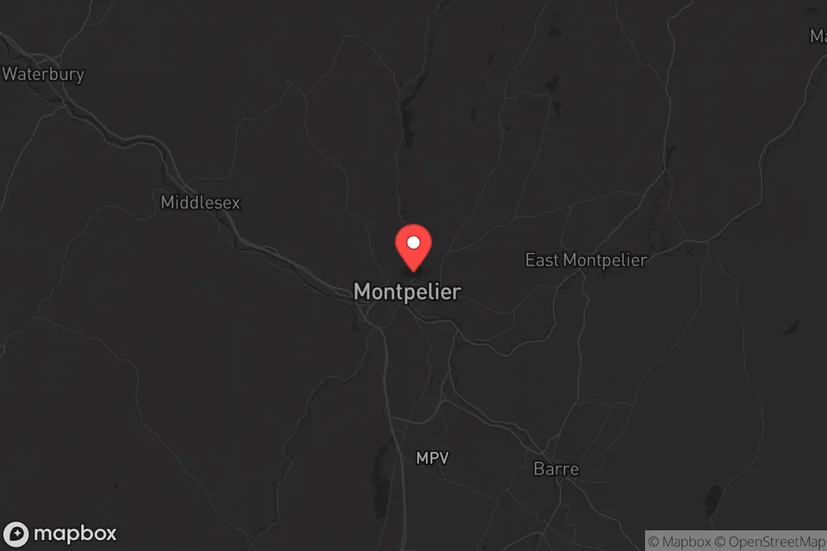
Montpelier, Vermont, presents a paradox for the strategic relocator: it is the smallest state capital in the U.S., with a population under 8,000, yet it sits within a region that offers genuine geographic insulation from the cascading failures of a collapsing urban core. Its location in the Winooski River Valley, surrounded by the Green Mountains, provides natural barriers that slow movement and limit exposure to the worst of coastal fallout. For a prepper or survivalist looking to avoid the immediate blast zones of major cities, Montpelier’s low population density and distance from Boston (about 160 miles) and New York City (over 300 miles) are significant advantages. However, the same topography that offers seclusion also creates choke points and flood risks, and the state’s political climate is a sharp contrast to the conservative values many in this audience hold. This assessment weighs those trade-offs with a clear-eyed view of what it means to hunker down in a place that is both a government hub and a rural outpost.
Geographic position and natural advantages for long-term survival
Montpelier’s primary strategic asset is its position within the Vermont Piedmont, a region of rolling hills and dense forests that naturally limits access. The city is nestled at the confluence of the Winooski and North Branch rivers, but the surrounding terrain—steep slopes, narrow valleys, and limited road networks—makes it a natural fortress against large-scale movement. The Green Mountains to the east and the Worcester Range to the west create a bowl-like setting that would be difficult to approach without being seen or heard. For a relocator concerned with civil unrest, this means that any organized threat would have to funnel through a handful of routes: Interstate 89 from the south or north, and Vermont Route 12 from the east. These are easily monitored and, in a worst-case scenario, could be blocked with minimal effort. The area’s elevation—around 500 feet above sea level—keeps it above the worst of valley fog and provides decent line-of-sight for observation. The surrounding forests are primarily mixed hardwoods and conifers, offering ample cover, firewood, and building materials. Water is abundant: the Winooski River runs year-round, and the city’s municipal water supply comes from the Berlin Pond and the North Branch, both of which are gravity-fed and less reliant on pumps. For a prepper, the ability to source water without electricity is a non-negotiable advantage.
Risks, exposures, and proximity to fallout-relevant landmarks
The most glaring risk for Montpelier is its status as the state capital. While it is small, it houses the Vermont State House, the Supreme Court, and various state agencies. In a scenario of mass civil unrest or a coordinated attack on government infrastructure, this makes it a symbolic target. The city’s downtown is compact—roughly a square mile—and the state government buildings are clustered near the river, making them vulnerable to a single well-placed explosive or a coordinated riot. Additionally, Montpelier is located just 35 miles from the Vermont Yankee nuclear power plant site in Vernon, which, while decommissioned, still holds spent fuel in dry casks. A catastrophic event at that site—whether from sabotage or natural disaster—could release radioactive material that would drift northward along the Connecticut River Valley, directly affecting Montpelier’s water and air. The city is also within 100 miles of the Burlington International Airport, a potential staging ground for federal forces or a target for airborne attacks. For the survivalist, the proximity to these landmarks is a liability. The Winooski River itself is a flood risk: the 2011 Tropical Storm Irene caused catastrophic flooding in Montpelier, with water reaching the first floors of downtown buildings. Climate models suggest that such events will become more frequent, meaning any long-term setup must account for periodic inundation. Finally, the city’s reliance on a single major highway (I-89) for resupply and evacuation is a vulnerability—if that route is compromised, the only alternatives are winding state roads that can be easily blocked by snow or debris.
Practical resilience for a relocator: food, water, energy, and defensibility
For a relocator serious about self-sufficiency, Montpelier offers a mixed bag. The growing season is short—roughly 120 days between the last and first frost—but the soil in the surrounding valleys is fertile, and there is a strong local culture of small-scale agriculture. The Montpelier Farmers Market and the nearby Vermont Foodbank provide some redundancy, but a prepper should plan on establishing a personal garden and root cellar. The city’s energy grid is vulnerable: most power comes from Hydro-Québec and Entergy, with transmission lines that run through heavily forested areas prone to ice storms and wind damage. A backup generator or solar array with battery storage is essential, as outages can last days or weeks. Water is a strength: the municipal supply is gravity-fed from Berlin Pond, meaning it can flow without pumps, but the system is old and prone to leaks. A private well or a rainwater catchment system with a Berkey filter is a wise investment. Defensibility is where Montpelier shines. The city’s layout—with the state capitol at the center and residential areas radiating outward on hills—means that a small group could establish a perimeter using the natural elevation. The surrounding woods provide cover for caches and escape routes. However, the city’s population is overwhelmingly liberal and urban-oriented, which could create cultural friction for a conservative relocator. The local government is likely to enforce strict gun control measures (Vermont has a red-flag law and a ban on magazines over 10 rounds), so a prepper should be prepared to operate discreetly. The nearest gun-friendly community is Barre, about 10 miles south, which has a more working-class, independent streak.
In the overall strategic picture, Montpelier is a viable but not ideal location for a survivalist seeking long-term resilience. Its strengths—low population, abundant water, natural barriers, and a strong local food network—are real, but they are offset by the risks of being a state capital, the flood danger, and the political hostility to the kind of preparedness many in this audience prioritize. For a single individual or a small family willing to live quietly, maintain a low profile, and invest in off-grid infrastructure, Montpelier could serve as a solid base of operations. But for those who want a truly defensible, politically aligned, and low-risk retreat, the more remote towns in Vermont’s Northeast Kingdom—like Newport or Island Pond—offer better isolation. Montpelier is a compromise: close enough to resources to be practical, far enough from major threats to be survivable, but not so remote that you can ignore the world. If you’re looking for a place to ride out the storm while still having access to a functioning government (however flawed), it’s worth a look. Just don’t expect to be welcomed with open arms if you fly the Gadsden flag.
* Values derived from national, state, county, city and local statistics and may differ in a specific area. Last updated: 2026-05-02T00:47:26.000Z
Narrative content on this page is AI-generated and may contain mistakes. Verify any details that matter before acting on them.
ReloMaps may earn a commission from affiliate links at no extra cost to you.