Photo: Wikipedia
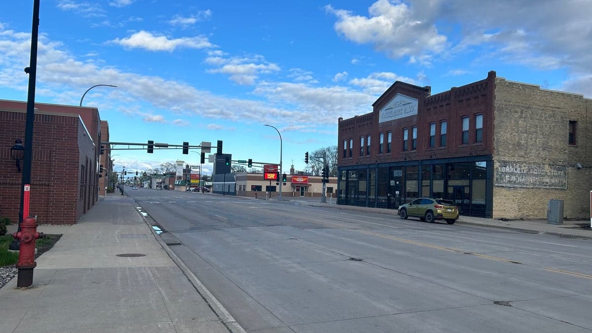
Strategic Assessment of Moorhead, MN
Workable tactical position. Some exposure to population density or targets, but generally defensible in a crisis.
What does the Strategic Assessment tell us?
Our Strategic Assessment grades tactical survivability of an area. Major population centers, military targets, fallout zones, natural disasters, and border exposure all drive risk — lower exposure means a more defensible position in a crisis.
This is heavily inspired by Joel Skousen's Strategic Relocation book. Highly recommended you checkout the book ($)What does this tell us?
Our Strategic Assessment grades tactical survivability of an area. Major population centers, military targets, fallout zones, natural disasters, and border exposure all drive risk — lower exposure means a more defensible position in a crisis.
This is heavily inspired by Joel Skousen's Strategic Relocation book. Highly recommended you checkout the book ($)Strategic Pillars

Key Distances
Regional Safe Places
Below is our recommended "safe zones" in Minnesota and the surrounding area based on our strategic heuristics. For most people, it's unrealistic to live in a “safe zone” full-time due to work, family or other personal reasons. They tend to be more rural. However, many of these areas are perfect for second homes and retreat properties that double as a vacation home or even a short-term rental.


Important Note: For informational purposes only. This does not mean nothing bad ever happens in the green zones. Please use common sense. This is based on public data and modeled with AI. We tried to take a conservative approach but mistakes happen. We update this regularly as new information becomes available.
Solar Generator Recommendations
Backup power matters more here than in safer locations. We've picked three solar generators across budgets and capacity tiers — start with the budget unit if you only need a few essentials, or step up if you want to run a fridge and HVAC for days at a time.

Jackery Portable Power Station Explorer 300
Budget OptionPower on the Go: Weighing only 11 lbs, it's convenient to set up and store with book-sized foldable solar panels

BLUETTI Portable Power Station AC180
Designed for both indoor and outdoor scenarios, AC180 is highly capable as it has a robost capacity and continuous output power.

EF ECOFLOW DELTA Pro Ultra Power Station
Upgraded PickEcoFlow DELTA Pro Ultra is a whole-home energy system designed to grow with your family. Integrated with the Smart Home Panel 2, it scales to meet your evolving energy needs — keeping your home powered, intelligent, and secure through every stage of life.
We earn a commission, at no additional cost to you.
Strategic Assessment Analysis
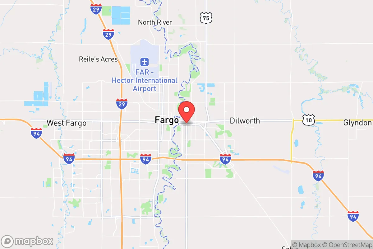
Moorhead, Minnesota, sits in a unique strategic pocket that offers genuine resilience advantages for those thinking long-term about safety and self-sufficiency. Its position on the North Dakota border, directly across the Red River from Fargo, places it in a region that is politically stable, geographically insulated from major coastal threats, and far enough from the nation's most volatile population centers to offer a meaningful buffer. For a conservative-leaning relocator concerned with civic unrest, supply chain disruptions, or large-scale disasters, this area presents a compelling mix of agricultural self-sufficiency, low population density, and a culture that still values neighborly preparedness.
Geographic position and natural advantages for long-term security
Moorhead's primary strategic asset is its location in the Red River Valley, one of the most productive agricultural regions in the world. The flat, fertile land means that local food production is not just possible but abundant—a critical factor if national supply chains falter. The area sits roughly 250 miles from the nearest major metropolitan chaos zone (Minneapolis-St. Paul), which is far enough to avoid the immediate fallout of urban unrest but close enough to monitor national trends. The region's low population density—Clay County has about 65,000 people spread over 1,000 square miles—means that in a crisis, competition for resources would be far less intense than in suburban sprawl. The Red River itself provides a reliable freshwater source, and the area's aquifer systems are robust. Winters are harsh, which acts as a natural deterrent to transient populations and forces residents to develop genuine survival skills like food storage, heating redundancy, and vehicle preparedness. The flat terrain also means no natural choke points for evacuation, but it does offer clear lines of sight and easy movement for those with four-wheel-drive vehicles.
Risks, exposures, and proximity to fallout-relevant landmarks
No location is without vulnerabilities, and Moorhead has several that a prepper must acknowledge. The most obvious is the Red River's history of severe flooding—major floods occurred in 1997, 2009, and 2011, with the 1997 event causing over $3.5 billion in damage across the region. While flood control infrastructure has improved, a catastrophic flood during a concurrent crisis (like a power grid failure) would be a compounding disaster. The area is also within 200 miles of the Minot Air Force Base in North Dakota, which houses nuclear-capable B-52 bombers. In a major conflict, this base could be a target, though the actual fallout risk to Moorhead is low given prevailing wind patterns and distance. More concerning is the proximity to the Bakken oil fields in western North Dakota—about 300 miles away. A major industrial accident or sabotage at pipeline or refinery infrastructure could disrupt fuel supplies, though the region's own agricultural fuel needs are relatively modest. The nearest major population center, Fargo-Moorhead combined, has about 250,000 people, which is small enough to avoid the worst of urban collapse scenarios but large enough that a localized pandemic or civil unrest could spill over. The area's reliance on a single interstate (I-94) for east-west travel is a vulnerability—if that corridor is compromised, movement becomes difficult.
Practical resilience for a relocator: food, water, energy, and defensibility
For a relocator serious about self-sufficiency, Moorhead offers strong fundamentals. Food security is the standout advantage: the surrounding farmland produces wheat, soybeans, corn, sugar beets, and sunflowers. Local farmers' markets and co-ops are common, and the region has a strong culture of home gardening and canning. The growing season is short (about 120 days), but with a greenhouse or cold frames, year-round production is achievable. Water is abundant from the Red River and shallow aquifers, though treatment would be necessary in a grid-down scenario—simple filtration and boiling are viable. The area's energy grid is part of the Midcontinent Independent System Operator (MISO), which has a mixed reliability record but benefits from nearby coal and natural gas plants. Solar is viable in summer but limited in winter; a backup generator with stored fuel is a wise investment. Defensibility is moderate: the flat terrain offers no natural defensive positions, but rural properties with good sight lines and perimeter fencing are common. The local culture is generally armed—North Dakota and Minnesota both have permissive firearm laws, and the region has a strong hunting tradition. Law enforcement presence is adequate but not overwhelming; in a prolonged crisis, community self-defense networks would likely form organically. The biggest practical challenge is winter preparedness: temperatures can drop to -30°F, and a multi-day power outage in January would be life-threatening without proper heating, insulation, and fuel stores. Anyone relocating here must prioritize a wood stove or propane heating system with at least a two-week fuel supply.
Overall strategic picture for the conservative relocator
Moorhead is not a bug-out location for those expecting a single catastrophic event—it's a long-term resilience play for those who want to build a sustainable, low-drama life in a region that values self-reliance. The area's political culture leans conservative relative to the rest of Minnesota, with Clay County voting Republican in recent presidential elections and a strong libertarian streak in rural areas. The local economy is stable, anchored by agriculture, healthcare (Sanford Health is a major employer), and education (Minnesota State University Moorhead). For a single individual or family, the trade-offs are clear: you get excellent food security, low crime rates, and a community that still knows how to handle a crisis, but you must accept harsh winters, flood risk, and a certain isolation from national events. If your strategy is to be far enough from the chaos to ride it out while staying connected enough to know what's happening, Moorhead is a solid choice. Just make sure your snowblower is tuned up and your pantry is stocked before November hits.
* Values derived from national, state, county, city and local statistics and may differ in a specific area. Last updated: 2026-04-19T10:03:14.000Z
Narrative content on this page is AI-generated and may contain mistakes. Verify any details that matter before acting on them.
ReloMaps may earn a commission from affiliate links at no extra cost to you.