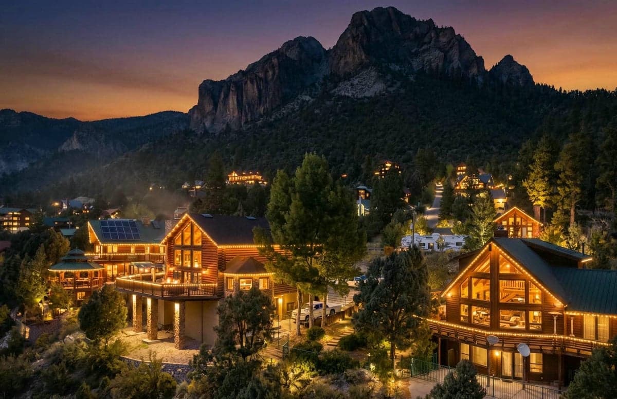
Strategic Assessment of Mount Charleston, NV
Workable tactical position. Some exposure to population density or targets, but generally defensible in a crisis.
What does the Strategic Assessment tell us?
Our Strategic Assessment grades tactical survivability of an area. Major population centers, military targets, fallout zones, natural disasters, and border exposure all drive risk — lower exposure means a more defensible position in a crisis.
This is heavily inspired by Joel Skousen's Strategic Relocation book. Highly recommended you checkout the book ($)What does this tell us?
Our Strategic Assessment grades tactical survivability of an area. Major population centers, military targets, fallout zones, natural disasters, and border exposure all drive risk — lower exposure means a more defensible position in a crisis.
This is heavily inspired by Joel Skousen's Strategic Relocation book. Highly recommended you checkout the book ($)Strategic Pillars

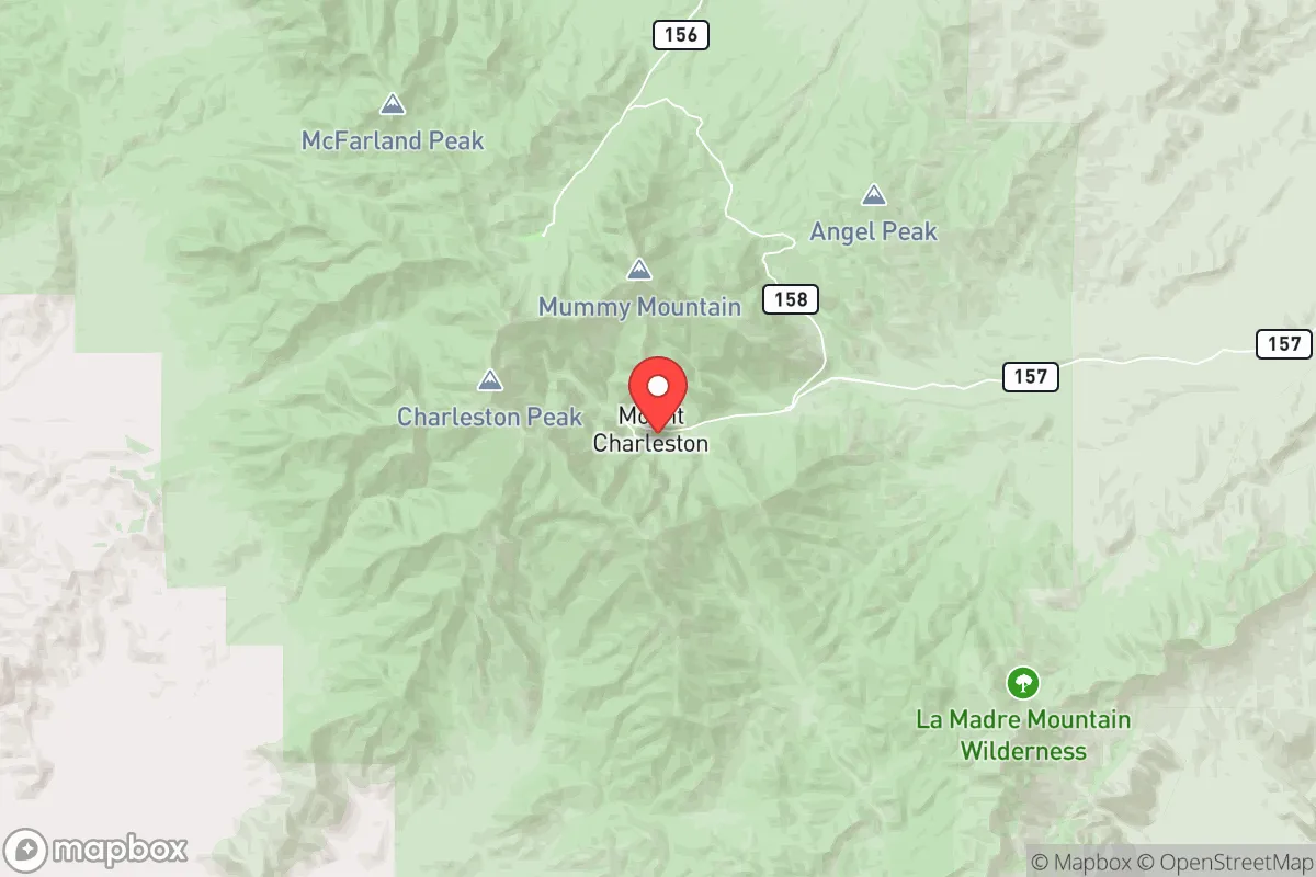
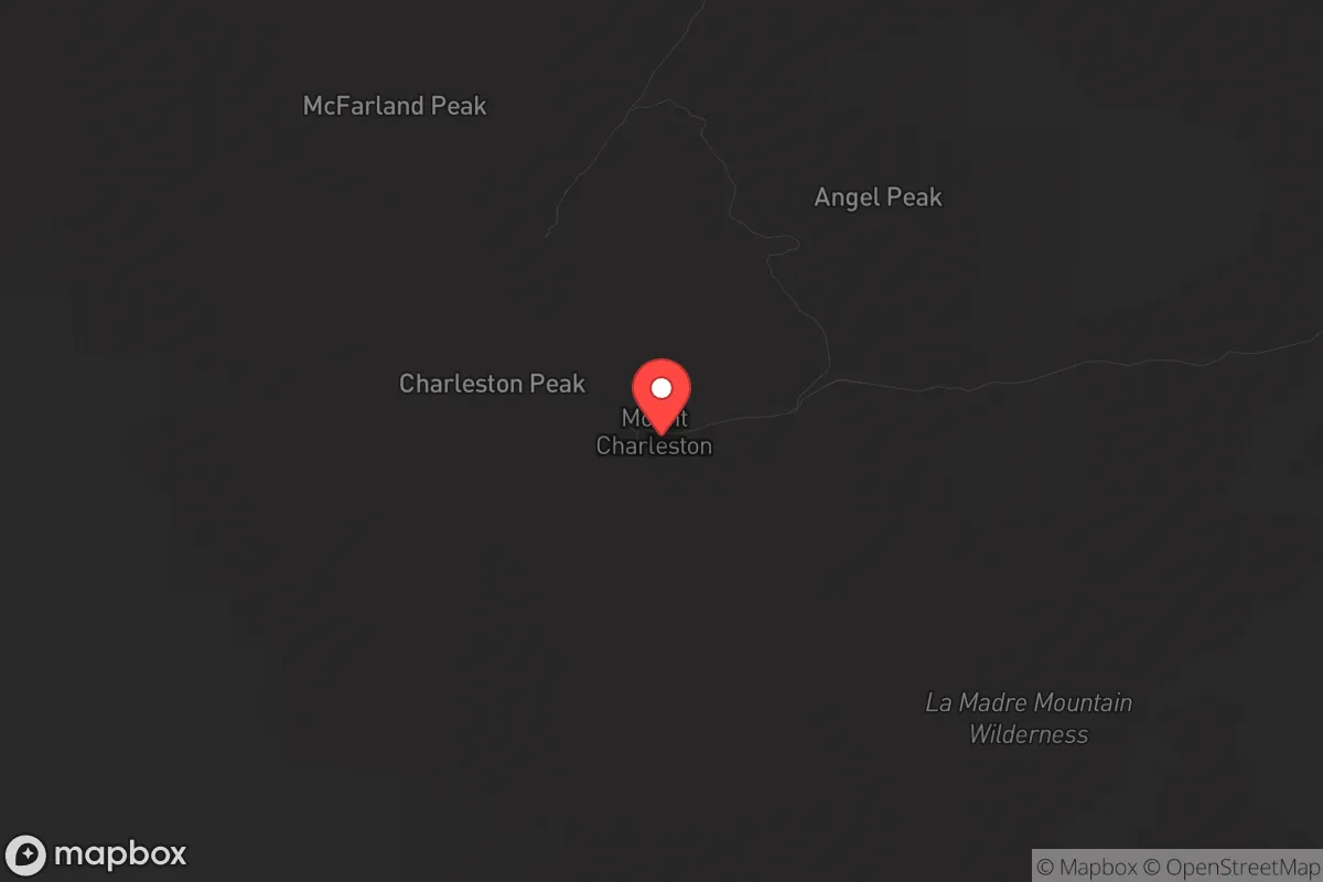
Key Distances
Regional Safe Places
Below is our recommended "safe zones" in Nevada and the surrounding area based on our strategic heuristics. For most people, it's unrealistic to live in a “safe zone” full-time due to work, family or other personal reasons. They tend to be more rural. However, many of these areas are perfect for second homes and retreat properties that double as a vacation home or even a short-term rental.
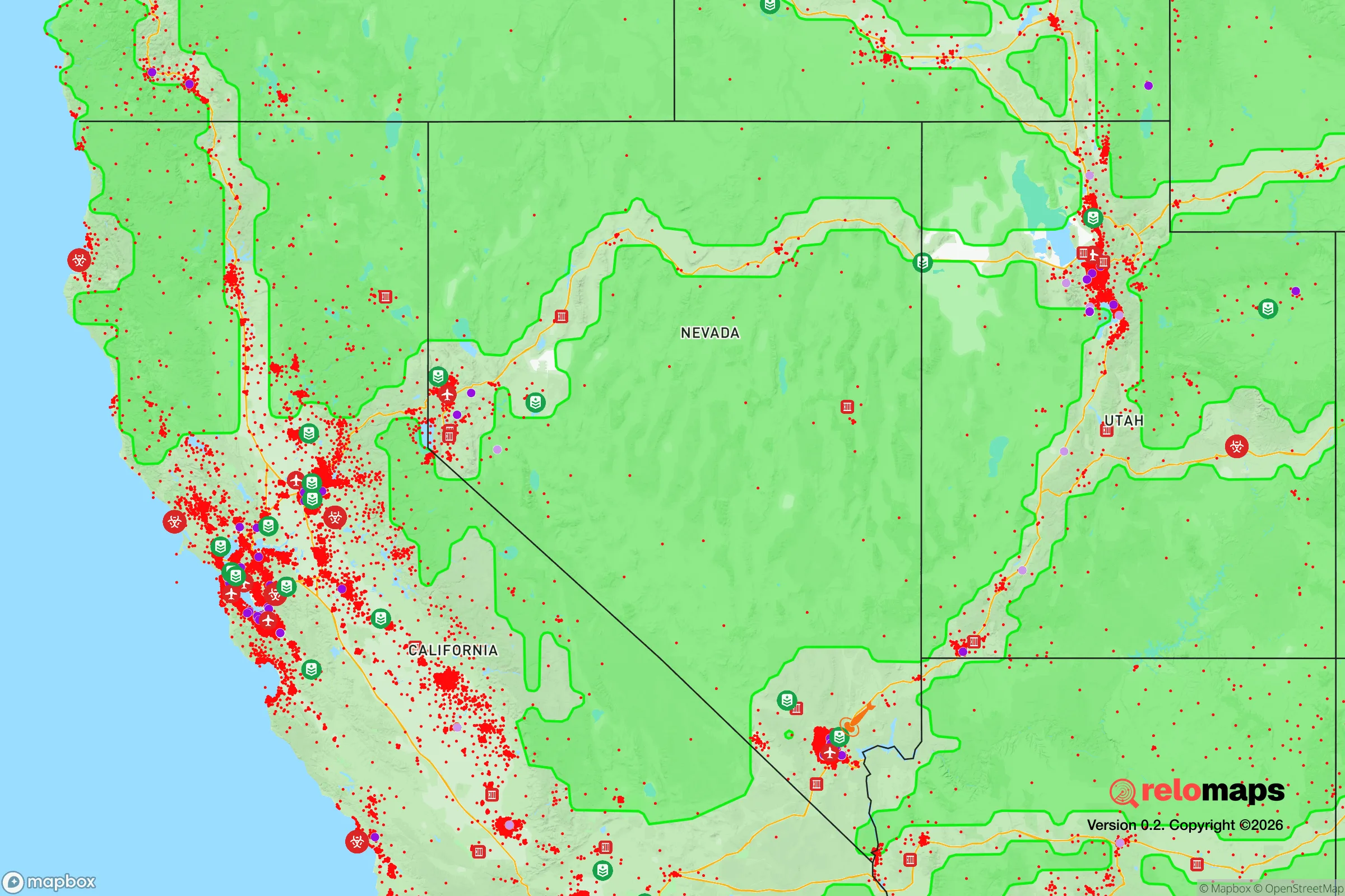
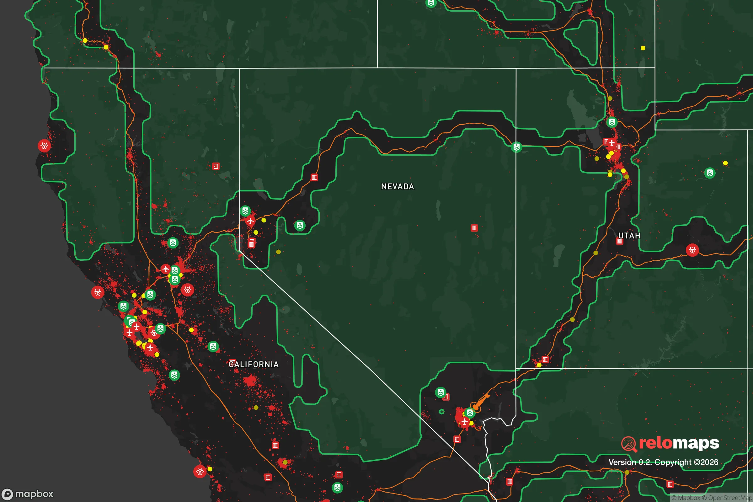
Important Note: For informational purposes only. This does not mean nothing bad ever happens in the green zones. Please use common sense. This is based on public data and modeled with AI. We tried to take a conservative approach but mistakes happen. We update this regularly as new information becomes available.
Solar Generator Recommendations
Backup power matters more here than in safer locations. We've picked three solar generators across budgets and capacity tiers — start with the budget unit if you only need a few essentials, or step up if you want to run a fridge and HVAC for days at a time.

Jackery Portable Power Station Explorer 300
Budget OptionPower on the Go: Weighing only 11 lbs, it's convenient to set up and store with book-sized foldable solar panels

BLUETTI Portable Power Station AC180
Designed for both indoor and outdoor scenarios, AC180 is highly capable as it has a robost capacity and continuous output power.

EF ECOFLOW DELTA Pro Ultra Power Station
Upgraded PickEcoFlow DELTA Pro Ultra is a whole-home energy system designed to grow with your family. Integrated with the Smart Home Panel 2, it scales to meet your evolving energy needs — keeping your home powered, intelligent, and secure through every stage of life.
We earn a commission, at no additional cost to you.
Strategic Assessment Analysis
Mount Charleston, Nevada, offers a rare combination of high-altitude refuge and strategic proximity to critical infrastructure, making it a serious candidate for those prioritizing resilience in an unstable world. Sitting at roughly 8,500 feet in the Spring Mountains, this small community is a 45-minute drive from the Las Vegas Strip but exists in a completely different ecological and social reality. For a relocator concerned with civic unrest, mass casualty events, or large-scale disasters, the key question isn’t whether you can get away from everything—it’s whether you can get away from enough while still having access to what you need. Mount Charleston answers that question better than most suburban or exurban options, but it comes with hard trade-offs that demand honest assessment.
Geographic position and natural advantages for long-term survival
Mount Charleston’s primary strategic asset is its elevation and isolation within the Spring Mountains National Recreation Area. The community sits in a narrow canyon surrounded by the Humboldt-Toiyabe National Forest, with the nearest major population center—Las Vegas—lying 35 miles east as the crow flies. That distance is deceptive: the road up State Route 157 (Kyle Canyon Road) climbs over 5,000 feet in elevation, creating a natural chokepoint that would be difficult for any large, disorganized group to traverse. In a scenario involving civil unrest or a breakdown of order in the Las Vegas Valley, that climb becomes a significant defensive barrier. The area’s topography also provides natural cover from electromagnetic pulse (EMP) effects, as the surrounding peaks can shield some ground-level electronics from a high-altitude burst, though this is not a guarantee. The climate is a major advantage: summer highs rarely exceed 85°F, and winter brings reliable snowpack, which means a consistent water source during the spring melt. The forest itself offers timber for construction, fuel, and concealment, though building restrictions within the national forest boundary limit what you can do without permits. For a prepper, the ability to live off-grid in a temperate, defensible location within an hour of a major city’s resources is a rare combination.
Risks, exposures, and proximity to fallout-relevant landmarks
The most significant risk for Mount Charleston is its proximity to the Nevada National Security Site (NNSS), formerly the Nevada Test Site, located roughly 50 miles northwest of the community. While the NNSS is no longer conducting atmospheric nuclear tests, it remains an active facility for subcritical experiments, hazardous material storage, and emergency response training. In a scenario involving a nuclear detonation—whether from a state actor or a terrorist device—the prevailing winds in southern Nevada typically blow from the southwest, which would carry fallout away from Mount Charleston in most cases. However, a ground-level burst or a device detonated at the NNSS itself could produce unpredictable fallout patterns. The community is also within 40 miles of Nellis Air Force Base, a primary target in any major conflict. A strike on Nellis would likely produce significant electromagnetic effects and potential fallout, depending on the weapon type. The Las Vegas Strip, while not a military target, is a high-value symbolic target for terrorist attacks; a dirty bomb or conventional explosive event there would not directly threaten Mount Charleston, but the resulting panic and refugee flow could overwhelm the limited road access. The single road in and out—Kyle Canyon Road—is a two-lane highway that can be blocked by a single accident, rockfall, or vehicle breakdown. In a mass evacuation scenario, that road would become a parking lot. The area also faces natural risks: wildfire is a genuine threat in the dry summers, and the 2013 Carpenter 1 Fire burned over 28,000 acres in the Spring Mountains, forcing evacuations. Earthquake risk is low but not zero, as the area sits near the boundary of the Basin and Range province.
Practical resilience for a relocator: food, water, energy, and defensibility
Water is the most critical resource in any survival scenario, and Mount Charleston has a mixed profile. The community relies on groundwater wells and a municipal system operated by the Mount Charleston Water District, which serves roughly 350 year-round households. In a grid-down situation, those wells would stop pumping unless backup generators are in place—and the district has limited generator capacity. A prepper relocating here should plan for a minimum of 90 days of stored water, plus a means to collect and filter snowmelt or rainwater. The good news is that the area receives an average of 100 inches of snow annually, providing a reliable seasonal water source if you have the equipment to melt and treat it. Food storage is straightforward: the nearest grocery store is in the Las Vegas suburb of Summerlin, 25 miles down the mountain. In a crisis, that store would be stripped within hours. A serious relocator should bring at least six months of shelf-stable food, plus seeds for high-altitude gardening—the growing season is short (May to September), but cold-hardy crops like potatoes, carrots, and kale can produce. Energy is a challenge: the grid is reliable in normal conditions, but the single power line running up the canyon is vulnerable to wind, ice, and sabotage. Solar is viable, but snow cover in winter reduces output significantly; a hybrid system with a propane or diesel generator is the realistic baseline. Defensibility is the area’s strongest suit. The canyon’s narrow entrance, combined with the steep terrain on both sides, creates a natural funnel. A small group with basic firearms and observation posts could control access to the community for an extended period. However, this also means that if a hostile group does breach the canyon, there is no secondary escape route—the only way out is the way you came in. The community itself is small and tight-knit, with a strong culture of mutual aid among the year-round residents, but newcomers should expect a period of proving themselves before being fully accepted.
The overall strategic picture for Mount Charleston is one of high reward with equally high risk. It offers a defensible, temperate, and resource-rich environment within striking distance of a major city, making it ideal for someone who wants to maintain a foothold in the broader economy while having a retreat that can withstand most short-to-medium-term disruptions. The proximity to the NNSS and Nellis Air Force Base introduces a level of existential risk that cannot be mitigated by personal preparation alone—if a major exchange occurs, this area could be in the fallout path or subject to secondary effects. For the conservative prepper who values self-reliance, community, and natural barriers, Mount Charleston is a strong candidate, but only if you accept that your survival plan must account for the possibility of a catastrophic event originating from the very infrastructure that makes the area strategically valuable. The smart move is to treat it as a primary residence with a secondary bug-out location farther into the Great Basin—somewhere like Ely or Eureka—for the worst-case scenarios. In a world where the unthinkable is becoming increasingly thinkable, Mount Charleston buys you time, but not immunity.
* Values derived from national, state, county, city and local statistics and may differ in a specific area. Last updated: 2026-04-29T01:43:49.000Z
Narrative content on this page is AI-generated and may contain mistakes. Verify any details that matter before acting on them.
ReloMaps may earn a commission from affiliate links at no extra cost to you.