Photo: Wikipedia
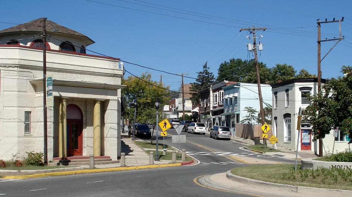
Strategic Assessment of Mount Rainier, MD
Multiple tactical vulnerabilities. Population density, target proximity, or disaster risk are likely compounding. A retreat property and exit planning is required.
What does the Strategic Assessment tell us?
Our Strategic Assessment grades tactical survivability of an area. Major population centers, military targets, fallout zones, natural disasters, and border exposure all drive risk — lower exposure means a more defensible position in a crisis.
This is heavily inspired by Joel Skousen's Strategic Relocation book. Highly recommended you checkout the book ($)What does this tell us?
Our Strategic Assessment grades tactical survivability of an area. Major population centers, military targets, fallout zones, natural disasters, and border exposure all drive risk — lower exposure means a more defensible position in a crisis.
This is heavily inspired by Joel Skousen's Strategic Relocation book. Highly recommended you checkout the book ($)Strategic Pillars

Key Distances
Regional Safe Places
Below is our recommended "safe zones" in Maryland and the surrounding area based on our strategic heuristics. For most people, it's unrealistic to live in a “safe zone” full-time due to work, family or other personal reasons. They tend to be more rural. However, many of these areas are perfect for second homes and retreat properties that double as a vacation home or even a short-term rental.


Important Note: For informational purposes only. This does not mean nothing bad ever happens in the green zones. Please use common sense. This is based on public data and modeled with AI. We tried to take a conservative approach but mistakes happen. We update this regularly as new information becomes available.
Solar Generator Recommendations
Backup power matters more here than in safer locations. We've picked three solar generators across budgets and capacity tiers — start with the budget unit if you only need a few essentials, or step up if you want to run a fridge and HVAC for days at a time.

Jackery Portable Power Station Explorer 300
Budget OptionPower on the Go: Weighing only 11 lbs, it's convenient to set up and store with book-sized foldable solar panels

BLUETTI Portable Power Station AC180
Designed for both indoor and outdoor scenarios, AC180 is highly capable as it has a robost capacity and continuous output power.

EF ECOFLOW DELTA Pro Ultra Power Station
Upgraded PickEcoFlow DELTA Pro Ultra is a whole-home energy system designed to grow with your family. Integrated with the Smart Home Panel 2, it scales to meet your evolving energy needs — keeping your home powered, intelligent, and secure through every stage of life.
We earn a commission, at no additional cost to you.
Strategic Assessment Analysis
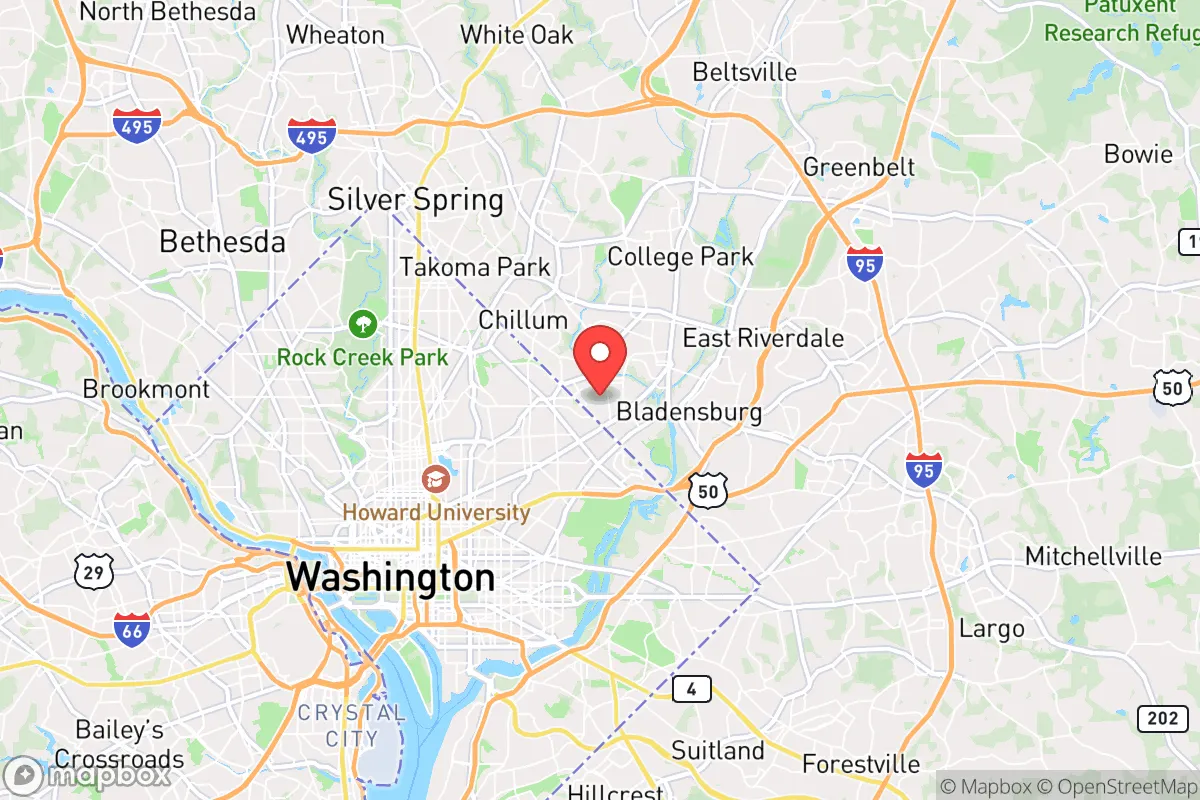
Mount Rainier, Maryland, presents a complex strategic picture for the conservative prepper. Its primary advantage is not raw wilderness but a paradox: it sits just outside the blast radius of the nation's capital while offering a dense, defensible urban grid that can be locked down. The city's location on a ridge above the Anacostia River floodplain gives it a natural elevation advantage over much of the surrounding Prince George's County, and its historic street layout—narrow, tree-lined, with limited through-roads—creates natural chokepoints. For the relocator who understands that true resilience often means being close enough to observe, but far enough to survive, Mount Rainier offers a unique foothold in a high-risk corridor.
Geographic position and natural advantages for a survival-minded relocator
Mount Rainier sits roughly five miles northeast of the U.S. Capitol, placing it on the edge of the primary target zone for a Washington D.C. decapitation strike. That proximity is a double-edged sword, but the city's elevation—averaging 150 feet above sea level—provides a slight but meaningful buffer against blast overpressure and fallout drift from a ground-level detonation. The area is part of the Atlantic Coastal Plain, with sandy loam soils that drain well, reducing the risk of post-disaster flooding that plagues lower-lying D.C. suburbs like Anacostia or Oxon Hill. The nearby Anacostia River and its tributaries (the Northwest Branch and Sligo Creek) offer water sources, though they are heavily urbanized and would require extensive filtration. The city's position on the Washington D.C. metropolitan area's northeastern rim means that in a grid-down scenario, escape routes north toward the Piedmont region (Montgomery County, Howard County) are accessible via U.S. Route 1 and the Baltimore-Washington Parkway, both of which are major arteries that would be contested but not immediately impassable. The natural advantage here is not isolation—it's proximity to multiple fallback zones while maintaining a defensible urban core.
Risks, exposures, and proximity to fallout-relevant landmarks
The primary risk is obvious: Mount Rainier is within the high-confidence fallout zone for a nuclear detonation on the National Mall. The prevailing winds in the D.C. area blow from the southwest roughly 60% of the year, meaning fallout from a Capitol strike would drift northeast—directly over Mount Rainier. The city is also within two miles of Joint Base Andrews, a primary military airfield that would be a secondary target in any coordinated attack. Beyond nuclear threats, the area faces risks from the Anacostia River's industrial legacy—the riverbed contains decades of heavy metal and chemical contamination from the Washington Navy Yard and nearby industrial sites. A major earthquake or flood could mobilize these toxins. The city's dense urban fabric—rowhouses, apartments, and narrow streets—means that a biological agent release or chemical spill could spread rapidly through the population. The nearby Washington D.C. Metro system (Mount Rainier is served by the West Hyattsville and Prince George's Plaza stations) is a vector for contagion and a potential target for sabotage. For the prepper, the exposure profile is high: this is not a retreat, but a forward operating base that requires constant situational awareness.
Practical resilience for a relocator: food, water, energy, and defensibility
Mount Rainier's practical resilience is mixed. The city's water supply comes from the Washington Aqueduct, which draws from the Potomac River—a single-point-of-failure system that would be compromised in a major event. However, the Anacostia River and its tributaries provide alternative water sources within a 15-minute walk from most homes, though they require heavy filtration (ceramic filters, UV treatment, or distillation) due to urban runoff and sewage overflows. The average lot size in Mount Rainier is 4,000 to 6,000 square feet, which is small but sufficient for a raised-bed garden or greenhouse. The city's community garden at 33rd Street and Bunker Hill Road is a public resource, but in a crisis, it would be contested. For energy, the grid is typical of the Mid-Atlantic—overhead lines prone to storm damage—but the area's solar potential is moderate (about 4.5 peak sun hours per day), enough for a small off-grid system with battery storage. Defensibility is the strongest card: the city's grid of one-way streets and dead-end alleys creates natural defensive positions. The Mount Rainier Police Department is small (roughly 20 officers), so in a prolonged breakdown, neighborhood watch or mutual-aid groups would be essential. The historic commercial corridor on Rhode Island Avenue offers potential for barter and supply caching, but it would also be a target for looting. The key takeaway: this is a location for the prepared, not the passive.
The overall strategic picture for Mount Rainier is that of a high-risk, high-reward outpost. It is not a retreat—it is a listening post and a fallback position for those who need to remain within striking distance of the D.C. power structure while maintaining the ability to withdraw. The city's elevation, defensible street layout, and proximity to multiple escape routes (north to the Piedmont, east to the Eastern Shore) make it viable for a relocator with a vehicle and a plan. But the risks are real: fallout exposure, water contamination, and the chaos of a metropolitan collapse. For the conservative prepper who understands that survival is about positioning, not isolation, Mount Rainier offers a strategic foothold—but only if you are ready to move, dig in, or fight. The smart play is to treat it as a temporary base, not a permanent sanctuary, and to have a secondary location in the Appalachian foothills pre-staged for the long haul.
* Values derived from national, state, county, city and local statistics and may differ in a specific area. Last updated: 2026-04-22T02:58:03.000Z
Narrative content on this page is AI-generated and may contain mistakes. Verify any details that matter before acting on them.
ReloMaps may earn a commission from affiliate links at no extra cost to you.