
Photo: Wikipedia
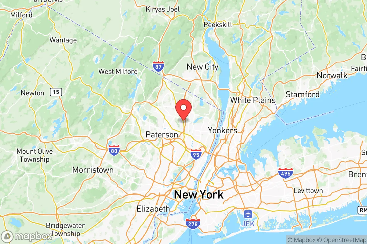
Strategic Assessment of Bergen County
High tactical risk. This location is likely close to major population centers, strategic targets, or sits in a high-disaster corridor. A retreat property and careful exit planning is required.
What does the Strategic Assessment tell us?
Our Strategic Assessment grades tactical survivability of an area. Major population centers, military targets, fallout zones, natural disasters, and border exposure all drive risk — lower exposure means a more defensible position in a crisis.
This is heavily inspired by Joel Skousen's Strategic Relocation book. Highly recommended you checkout the book ($)What does this tell us?
Our Strategic Assessment grades tactical survivability of an area. Major population centers, military targets, fallout zones, natural disasters, and border exposure all drive risk — lower exposure means a more defensible position in a crisis.
This is heavily inspired by Joel Skousen's Strategic Relocation book. Highly recommended you checkout the book ($)Strategic Pillars

Key Distances
Strategic Assessment Analysis
Bergen County, New Jersey, presents a complex strategic picture for the conservative prepper or survivalist. Its primary resilience lies in its economic density and infrastructure, but its location—jammed against New York City and studded with high-value targets—creates a risk profile that demands serious consideration. For the single individual or parent looking to weather civic unrest, mass casualty events, or large-scale disasters, Bergen County offers a mix of robust local resources and extreme proximity to fallout-relevant dangers that could turn the area into a liability within hours of a major event.
Geographic position and natural advantages for a strategic relocation
Bergen County sits in the northeastern corner of New Jersey, directly west of the Hudson River and Manhattan. Its geography is defined by the Palisades—a line of steep cliffs running north-south along the river—which provide a natural defensive barrier against any ground-level movement from New York City. The county is bisected by the Hackensack River and the Passaic River, creating a network of waterways that could serve as both water sources and obstacles. The terrain is hilly and wooded in the northern and western towns like Mahwah, Oakland, and Franklin Lakes, offering better concealment and defensible positions than the flat, densely developed eastern corridor. The Ramapo Mountains form the county's western border, providing a rugged, low-population buffer zone that connects to the larger Appalachian range. For a relocator, the northern and western towns—especially those near the Ramapo River or the reservoirs in the Ramapo Mountains—offer the best natural advantages: higher elevation, forest cover, and distance from the immediate blast zones of New York City. The county's water supply is a genuine asset, with the Oradell Reservoir and the Wanaque Reservoir (just over the border in Passaic County) providing significant freshwater capacity. However, the county's position as a bedroom community for Manhattan means that any major event in the city will send hundreds of thousands of people streaming across the George Washington Bridge and through the Lincoln Tunnel into Bergen County within hours, overwhelming local roads and resources.
Risks, exposures, and proximity to fallout-relevant landmarks
This is where Bergen County's strategic calculus turns sharply negative. The county is within the immediate fallout zone of multiple high-value targets. New York City—specifically Midtown Manhattan, just 10 miles east of Hackensack—is the single most likely target for a nuclear or radiological attack in the United States. The George Washington Bridge, the Lincoln Tunnel, and the Holland Tunnel are all critical infrastructure points that would be primary or secondary targets. Within Bergen County itself, the Hackensack Meridian Health system and the Bergen County courthouse complex in Hackensack are symbolic targets. The county is also home to Teterboro Airport, a major general aviation and cargo hub that could be a target for a smaller-scale attack or a secondary fallout source. The Port of Newark and Elizabeth—the busiest container port on the East Coast—lies just 12 miles south of Bergen County's border, and its destruction would create a massive industrial fallout plume. The ExxonMobil Bayway Refinery in Linden, New Jersey, is a major petrochemical target roughly 20 miles south, and prevailing winds from the southwest would push its fallout directly over Bergen County. For a prepper, the proximity to these targets means that any major event in the Northeast corridor would likely render large portions of Bergen County uninhabitable for days or weeks due to fallout, chemical plumes, or secondary fires. The county's dense population—over 950,000 people in just 247 square miles—means that evacuation routes (primarily I-80, I-287, and the Garden State Parkway) would become impassable within minutes of a major event. The Palisades Interstate Parkway offers a north-south route along the cliffs, but it's a narrow, winding road that would bottleneck quickly.
Practical resilience for a relocator: food, water, energy, and defensibility
For a relocator willing to accept the risk profile, Bergen County does offer some practical resilience advantages that are rare in the Northeast. Water access is strong: the Oradell Reservoir, the Hackensack River, and the Ramapo River provide surface water sources, and the county's numerous lakes (like Lake Tappan and Woodcliff Lake) offer additional supply. However, these sources are all vulnerable to contamination from upstream industrial sites or fallout, so any prepper would need a robust filtration system (reverse osmosis or ceramic filters) and a stockpile of purification tablets. Food security is mixed: the county has a surprising number of working farms in the northern towns—Mahwah, Oakland, and Franklin Lakes still have active agricultural operations—and the Bergen County Farmers Market in Hackensack is a year-round resource. But the county is heavily dependent on trucked-in food from the Hunts Point Terminal Market in the Bronx, which would be cut off immediately in a crisis. Energy infrastructure is a vulnerability: most of the county's power comes from the Bergen Generating Station in Ridgefield, a natural gas plant that is a target itself, and the grid is old and prone to failure. Solar panels with battery backup are a viable option for those in the northern towns with good southern exposure, but the county's tree cover limits solar efficiency. Defensibility is highly variable: the eastern towns (Hackensack, Teaneck, Englewood) are flat, dense, and indefensible—anyone there would be trapped in a suburban kill box. The western and northern towns (Mahwah, Oakland, Franklin Lakes, Wyckoff) offer better terrain: hills, forests, and winding roads that create natural chokepoints. The Ramapo Valley County Reservation and the Campgaw Mountain Reservation provide public land with cover and elevation, but they are not private property and would be contested in a breakdown. For a family, the best bet is a property in the far northwest corner of the county, near the New York state line, with a well, septic system, and a defensible perimeter. The Mahwah Township area, with its proximity to the Ramapo Mountains and the New York Thruway, offers the best balance of isolation and access to remaining infrastructure.
The overall strategic picture for Bergen County is one of high risk with conditional reward. For a conservative prepper who values economic opportunity and community infrastructure, the county's northern and western towns provide a defensible redoubt that is within striking distance of the resources of the Northeast—but only if you are willing to accept that you are living on the edge of a potential disaster zone. The county's proximity to New York City, Teterboro Airport, and the Port of Newark means that any major event will turn it into a refugee funnel and a fallout zone. If you are looking for a long-term survival location that can withstand a national crisis, Bergen County is a gamble: the natural advantages of the Ramapo Mountains and the water supply are real, but the target density and population pressure are overwhelming. For a single individual or parent who is willing to invest in serious preparation—a well-stocked bunker, a water filtration system, and a bug-out route into the Catskills—the county can work as a staging area. But for anyone seeking a truly resilient, low-risk relocation, the answer is to go further west, into Pennsylvania or upstate New York, where the target density drops and the defensible space expands. Bergen County is a place to be from, not a place to be in, when the lights go out.
* Values derived from national, state, county, city and local statistics and may differ in a specific area. Last updated: 2026-05-12T00:26:51.000Z
Narrative content on this page is AI-generated and may contain mistakes. Verify any details that matter before acting on them.
ReloMaps may earn a commission from affiliate links at no extra cost to you.