Photo: Wikipedia
Strategic Assessment of Cumberland County
Multiple tactical vulnerabilities. Population density, target proximity, or disaster risk are likely compounding. A retreat property and exit planning is required.
What does the Strategic Assessment tell us?
Our Strategic Assessment grades tactical survivability of an area. Major population centers, military targets, fallout zones, natural disasters, and border exposure all drive risk — lower exposure means a more defensible position in a crisis.
This is heavily inspired by Joel Skousen's Strategic Relocation book. Highly recommended you checkout the book ($)What does this tell us?
Our Strategic Assessment grades tactical survivability of an area. Major population centers, military targets, fallout zones, natural disasters, and border exposure all drive risk — lower exposure means a more defensible position in a crisis.
This is heavily inspired by Joel Skousen's Strategic Relocation book. Highly recommended you checkout the book ($)Strategic Pillars

Key Distances
Strategic Assessment Analysis
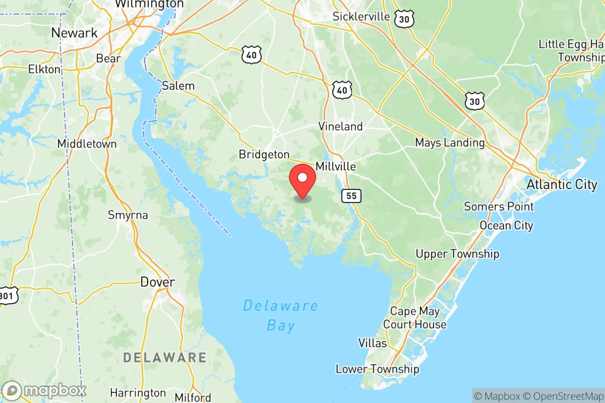
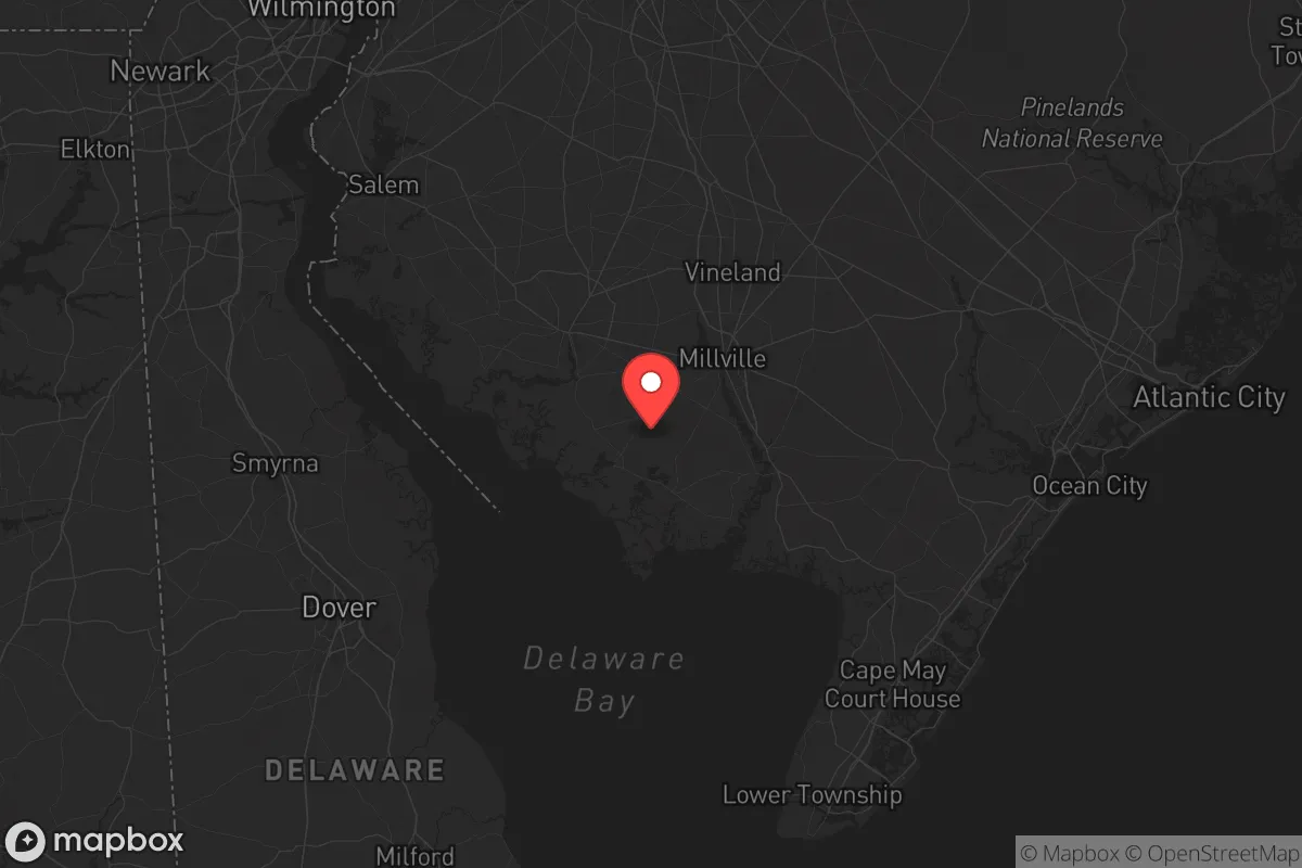
Cumberland County, New Jersey, sits in a strategic sweet spot that resilience-minded relocators should take seriously—far enough from the major urban cores to avoid the worst of cascading failures, yet close enough to access resources when things hold together. This is not a place for those seeking isolation in the mountains; it’s a low-lying coastal county with a working-class backbone, anchored by the cities of Bridgeton, Vineland, and Millville. Its position along the Delaware Bay and its proximity to the Philadelphia-Camden-Wilmington metro area (roughly 40 miles northeast of Vineland) create a unique mix of advantages and exposures that demand a clear-eyed assessment. For a conservative audience thinking about civic unrest, supply chain disruptions, or natural disasters, Cumberland County offers a blend of agricultural self-sufficiency and strategic depth—but only if you understand where the risks lie.
Geographic position and natural advantages for long-term stability
Cumberland County’s primary resilience asset is its agricultural foundation. The county is part of New Jersey’s “Garden State” heartland, with over 100,000 acres of farmland producing vegetables, fruits, and grains. In a scenario where grocery store shelves go bare, this isn’t just a nice-to-have—it’s a survival buffer. The area’s location on the Delaware Bay provides access to tidal fisheries and shellfish, adding a protein source that doesn’t depend on industrial supply chains. The Maurice River and the Cohansey River cut through the county, offering freshwater sources and potential for small-scale hydropower or irrigation. The terrain is flat to gently rolling, which makes it easier to manage defensible perimeters compared to mountainous terrain, though it also means less natural cover. The county’s position south of the Philadelphia metro means it’s not a primary target for civil unrest spillover from that city—most rioters and looters tend to stay closer to urban centers. The Delaware Memorial Bridge and the Commodore Barry Bridge are the main crossings into Delaware and points south, but they’re chokepoints that could be controlled or blocked in a crisis. That’s a double-edged sword: it limits your escape routes but also limits the flow of threats into the county.
Risks, exposures, and proximity to fallout-relevant landmarks
No strategic assessment is honest without naming the liabilities. Cumberland County sits within the Delaware Valley airshed, and while it’s not directly adjacent to Philadelphia’s refinery corridor, it’s downwind of the Paulsboro Refinery (about 20 miles north) and the Delaware City Refinery (about 15 miles west across the bay). A major industrial accident or terrorist strike at either facility could send a toxic plume across the county, especially with prevailing westerly winds. The Salem Nuclear Generating Station is roughly 25 miles northwest of Bridgeton—close enough that a catastrophic failure (however unlikely) would require evacuation or sheltering. The county itself has no nuclear plants, but the Hope Creek Nuclear Generating Station is also in the same complex. For preppers, that’s a non-trivial proximity risk. Flooding is the most probable natural threat: the county is low-lying, with much of its land at or near sea level. Hurricane Sandy in 2012 caused significant storm surge along the Delaware Bay shoreline, particularly in Port Norris and Bayside. Climate-driven sea-level rise will only increase that exposure over the next decade. On the plus side, the county is far from any major military base that would be a primary target in a conflict—Joint Base McGuire-Dix-Lakehurst is about 50 miles north, and Dover Air Force Base is about 40 miles west. That distance reduces the chance of being caught in a direct strike or a mass evacuation corridor.
Practical resilience for a relocator: food, water, energy, and defensibility
For a single individual or a family looking to hunker down, Cumberland County’s practical resilience is a mixed bag that requires active preparation. Food security is the strongest card: the county is a top producer of tomatoes, peppers, and blueberries in New Jersey, and there are dozens of small farms and CSA operations that can be tapped for direct purchases. The Vineland Produce Auction is a regional hub where local growers sell wholesale—useful for bulk buying and barter networks. Water security is decent but not automatic. The Cohansey Aquifer underlies much of the county and provides clean groundwater, but private wells are common in rural areas. In a grid-down scenario, hand pumps or solar-powered pumps would be essential. Municipal water systems in Bridgeton, Vineland, and Millville rely on surface water from the Maurice River and are vulnerable to contamination or treatment failures. Energy resilience is a weak point. The county is served by Atlantic City Electric, and power outages are frequent during coastal storms. Solar is viable—the area gets about 200 sunny days per year—but battery storage is a must. Natural gas is available in towns but not in outlying areas; propane tanks are common for heating and cooking. Defensibility is moderate. The flat, open farmland offers long sightlines but little cover. The best defensive setups are on the edges of small towns like Greenwich or Deerfield, where you can have a rural buffer with neighbors close enough for mutual support. The county’s population density is low (about 200 people per square mile), which reduces the risk of looting mobs but also means emergency services are spread thin. The Cumberland County Sheriff’s Office is professional but understaffed—you cannot rely on them for rapid response in a crisis.
The overall strategic picture for Cumberland County is one of calculated trade-offs. It’s not a fortress, and it’s not a remote bunker. It’s a working agricultural region with real assets—food, water, and space—but also real exposures to industrial accidents, flooding, and proximity to major urban corridors. For a conservative relocator who values self-reliance and community over isolation, this county offers a viable base of operations. The key is to pick your specific location carefully: avoid the flood-prone bayfront areas, stay away from the immediate downwind zones of the refineries, and invest in your own water and power systems. The towns of Millville and Bridgeton have higher crime rates and more urban problems, so rural pockets like Upper Deerfield Township or Lawrence Township are better bets. If you’re willing to put in the work—dig a well, install solar, stockpile supplies, and build relationships with local farmers—Cumberland County can be a solid fallback position. Just don’t mistake it for a safe zone. It’s a place to ride out the storm, not to hide from it.
* Values derived from national, state, county, city and local statistics and may differ in a specific area. Last updated: 2026-06-01T06:56:54.000Z
Narrative content on this page is AI-generated and may contain mistakes. Verify any details that matter before acting on them.
ReloMaps may earn a commission from affiliate links at no extra cost to you.