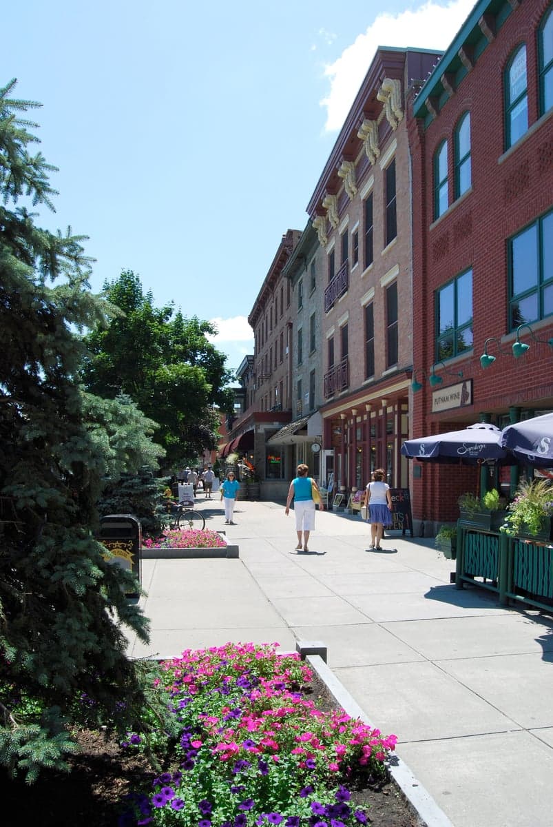
Photo: Wikipedia
Strategic Assessment of Saratoga County
Meaningful friction. Expect exposure to either population pressure, blast zones, or natural disaster risk. Consider buying a retreat property.
What does the Strategic Assessment tell us?
Our Strategic Assessment grades tactical survivability of an area. Major population centers, military targets, fallout zones, natural disasters, and border exposure all drive risk — lower exposure means a more defensible position in a crisis.
This is heavily inspired by Joel Skousen's Strategic Relocation book. Highly recommended you checkout the book ($)What does this tell us?
Our Strategic Assessment grades tactical survivability of an area. Major population centers, military targets, fallout zones, natural disasters, and border exposure all drive risk — lower exposure means a more defensible position in a crisis.
This is heavily inspired by Joel Skousen's Strategic Relocation book. Highly recommended you checkout the book ($)Strategic Pillars

Key Distances
Strategic Assessment Analysis
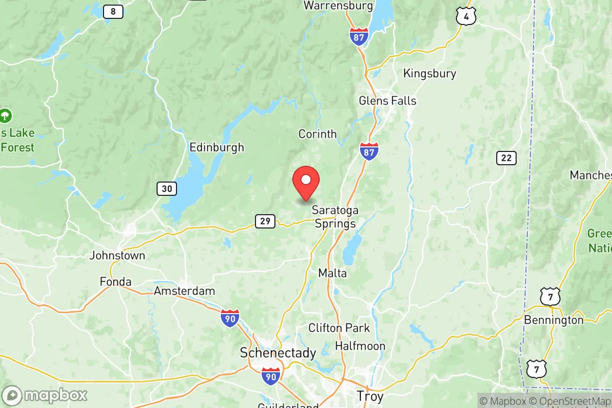
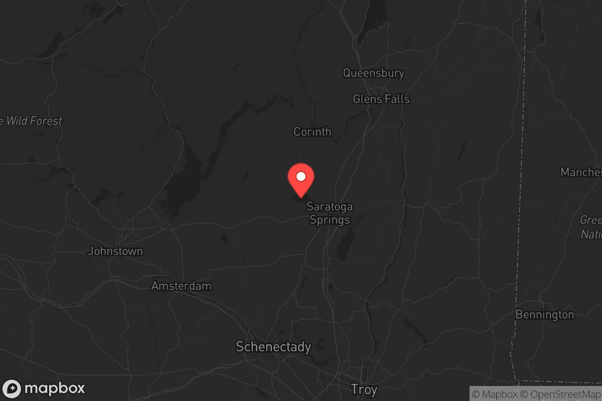
Saratoga County offers a compelling strategic position for those prioritizing resilience, sitting at a critical inflection point between the dense urban corridors of the Northeast and the more sparsely populated Adirondack wilderness. Its location roughly 30 miles north of New York’s state capital, Albany, places it outside the immediate blast and fallout zones of a major metropolitan target, yet close enough to access critical infrastructure and supply lines if they remain intact. The county’s historical role as a decisive battleground during the American Revolution is not lost on those assessing modern vulnerabilities; the terrain and river systems that once made it defensible still offer natural buffers today. For a relocator with a prepper mindset, Saratoga County represents a rare blend of accessible civilization and geographic insulation, provided one understands its specific exposures and limitations.
Geographic position and natural advantages for long-term security
Saratoga County is anchored by the Hudson River to its east and the foothills of the Adirondack Mountains to its north, creating a natural funnel that can be both an asset and a liability. The county’s roughly 810 square miles include significant forested areas, particularly in the northern towns of Corinth, Hadley, and Day, which offer dense tree cover, limited road access, and lower population density—ideal for a retreat or bug-out location. The Kayaderosseras Range and the Palmertown Range provide elevated terrain with natural observation points and defensible positions, while the numerous lakes, including Saratoga Lake, Lake George (just north in Warren County), and the Great Sacandaga Lake, offer reliable freshwater sources. The county’s position along the I-87 corridor (the Adirondack Northway) gives it a direct route north into the vast, low-population Adirondack Park, a massive 6-million-acre buffer zone that could serve as a secondary fallback area if Saratoga County itself becomes compromised. However, this same corridor is a double-edged sword: it also provides a direct route for refugees fleeing south from the Capital District or north from New York City, meaning choke points like the bridges over the Mohawk River and the narrows near Glens Falls could become critical control points during a crisis.
Risks, exposures, and proximity to fallout-relevant landmarks
The most significant strategic liability for Saratoga County is its proximity to the Albany-Schenectady-Troy metropolitan area, a population center of roughly 900,000 people that includes multiple high-value targets. The Port of Albany, located just 30 miles south, handles hazardous materials, including road salt, cement, and petroleum products, and sits along the Hudson River—a potential target for sabotage or collateral damage. The Albany International Airport is a dual-use facility with a significant Air National Guard presence, making it a plausible military target in a conflict scenario. Further south, the Knolls Atomic Power Laboratory in Niskayuna (Schenectady County) is a Department of Energy facility involved in naval nuclear propulsion research, which could be a fallout-relevant landmark if compromised. Within Saratoga County itself, the GlobalFoundries semiconductor fabrication plant in Malta is a high-tech industrial site that, while not a nuclear target, could attract cyberattacks or physical sabotage due to its role in national defense supply chains. The county also has a modest but real risk from natural hazards: the Hudson River and its tributaries are prone to ice jams and spring flooding, particularly in the towns of Mechanicville and Stillwater, which have experienced significant flood events in the past. For a relocator, the key takeaway is that Saratoga County is not a remote wilderness—it is within a 30- to 60-minute drive of several Tier 2 targets, and fallout patterns from a strike on Albany or Schenectady could easily drift north depending on prevailing winds.
Practical resilience for a relocator: food, water, energy, and defensibility
For a single individual or family looking to establish a resilient homestead, Saratoga County offers a mixed but workable picture. The county’s agricultural base is concentrated in the southern and central towns, including Malta, Stillwater, and Schuylerville, where you’ll find working farms, orchards, and livestock operations. The Saratoga Farmers’ Market is a year-round resource, but in a collapse scenario, local food production would likely be insufficient for the county’s 235,000 residents—meaning you’d need to secure your own supply chain or establish direct relationships with growers. Water is abundant: the county sits atop the Saratoga Aquifer, and surface water from the Hudson, Kayaderosseras Creek, and numerous lakes is generally clean but would require filtration or boiling post-event. The biggest vulnerability is energy: the county’s grid is served by National Grid, and while there are some hydroelectric facilities on the Hudson (like the Spier Falls Dam near Moreau), a prolonged outage would leave most residents dependent on backup generators or solar. The county’s terrain offers decent defensibility for a rural property: the northern towns have limited road access, with many dead-end roads and single-lane bridges that can be monitored or blocked. The village of Victory Mills and the hamlet of Rock City Falls are examples of small, tight-knit communities where neighbors know each other—a social resilience factor that cannot be overstated. However, the county’s popularity as a tourist destination (Saratoga Race Course, Saratoga Spa State Park) means that during a crisis, you could see a surge of transient populations fleeing the city, which could strain local resources and create security risks.
The overall strategic picture for Saratoga County is one of calculated trade-offs. It is not a remote survivalist paradise—it is a semi-urban county with real exposure to fallout from nearby military and industrial targets, and its position along a major north-south corridor makes it a potential funnel for displaced populations. However, for a relocator who values access to medical infrastructure (Saratoga Hospital is a solid regional facility), diverse economic opportunities (including the tech sector in Malta and traditional trades in the rural towns), and a politically mixed population that leans conservative in the northern and eastern towns, it offers a viable base of operations. The key is to avoid the dense suburban developments around Saratoga Springs and instead focus on the northern towns—Corinth, Hadley, Day, and Edinburg—where population density drops below 50 people per square mile and the Adirondack Park provides a literal backstop. If you can secure a property with a well, solar panels, and a defensible perimeter, Saratoga County can serve as a staging ground for either riding out a crisis or executing a planned retreat deeper into the mountains. Just don’t mistake its charm for safety—this is a county that requires active preparation, not passive optimism.
* Values derived from national, state, county, city and local statistics and may differ in a specific area. Last updated: 2026-05-12T04:53:08.000Z
Narrative content on this page is AI-generated and may contain mistakes. Verify any details that matter before acting on them.
ReloMaps may earn a commission from affiliate links at no extra cost to you.