
Photo: Wikipedia
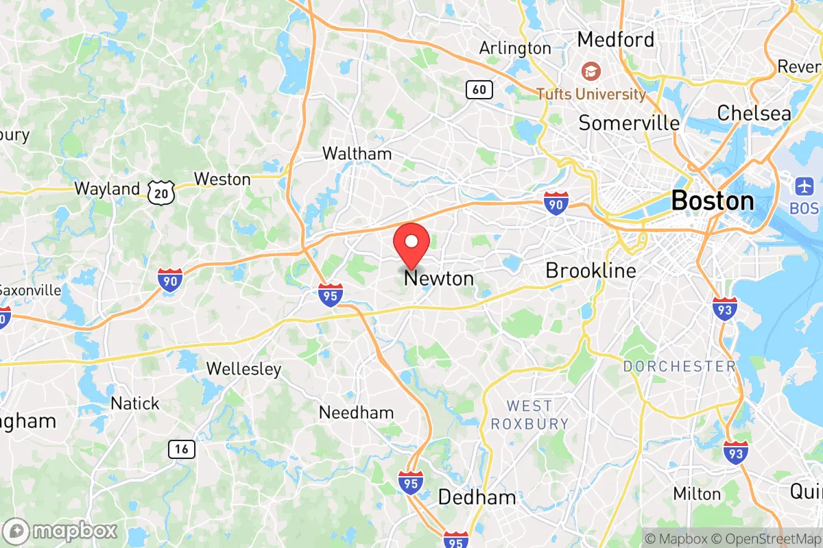
Strategic Assessment of Newton, MA
High tactical risk. This location is likely close to major population centers, strategic targets, or sits in a high-disaster corridor. A retreat property and careful exit planning is required.
What does the Strategic Assessment tell us?
Our Strategic Assessment grades tactical survivability of an area. Major population centers, military targets, fallout zones, natural disasters, and border exposure all drive risk — lower exposure means a more defensible position in a crisis.
This is heavily inspired by Joel Skousen's Strategic Relocation book. Highly recommended you checkout the book ($)What does this tell us?
Our Strategic Assessment grades tactical survivability of an area. Major population centers, military targets, fallout zones, natural disasters, and border exposure all drive risk — lower exposure means a more defensible position in a crisis.
This is heavily inspired by Joel Skousen's Strategic Relocation book. Highly recommended you checkout the book ($)Strategic Pillars

Key Distances
Regional Safe Places
Below is our recommended "safe zones" in Massachusetts and the surrounding area based on our strategic heuristics. For most people, it's unrealistic to live in a “safe zone” full-time due to work, family or other personal reasons. They tend to be more rural. However, many of these areas are perfect for second homes and retreat properties that double as a vacation home or even a short-term rental.


Important Note: For informational purposes only. This does not mean nothing bad ever happens in the green zones. Please use common sense. This is based on public data and modeled with AI. We tried to take a conservative approach but mistakes happen. We update this regularly as new information becomes available.
Solar Generator Recommendations
Backup power matters more here than in safer locations. We've picked three solar generators across budgets and capacity tiers — start with the budget unit if you only need a few essentials, or step up if you want to run a fridge and HVAC for days at a time.

Jackery Portable Power Station Explorer 300
Budget OptionPower on the Go: Weighing only 11 lbs, it's convenient to set up and store with book-sized foldable solar panels

BLUETTI Portable Power Station AC180
Designed for both indoor and outdoor scenarios, AC180 is highly capable as it has a robost capacity and continuous output power.

EF ECOFLOW DELTA Pro Ultra Power Station
Upgraded PickEcoFlow DELTA Pro Ultra is a whole-home energy system designed to grow with your family. Integrated with the Smart Home Panel 2, it scales to meet your evolving energy needs — keeping your home powered, intelligent, and secure through every stage of life.
We earn a commission, at no additional cost to you.
Strategic Assessment Analysis
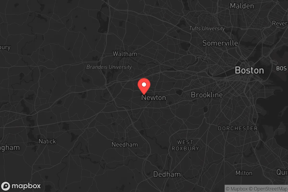
Newton, Massachusetts, presents a deeply contradictory picture for the conservative prepper or strategic relocator. On paper, its tree-lined streets, top-tier public schools, and historic housing stock suggest stability. In practice, its location within the Boston metroplex—just 7 miles from downtown—makes it a high-risk zone for the very scenarios you are trying to avoid: civil unrest, supply chain collapse, and proximity to high-value government and infrastructure targets. The city’s resilience is almost entirely dependent on the continued functioning of a fragile, dense urban system, which is precisely the kind of system that fails first and hardest during a crisis. For a single individual or family prioritizing self-reliance, Newton offers excellent peacetime amenities but demands a brutally honest assessment of its vulnerabilities when the lights go out.
Geographic position and natural advantages: The Boston bubble’s green edge
Newton occupies a unique geographic niche as the westernmost suburb of Boston, sitting along the Charles River and bordered by the more rural towns of Weston and Wellesley. Its 18 square miles are heavily wooded in parts, with the 1,000-acre Newton Commonwealth Golf Course and numerous conservation areas like Hemlock Gorge and Cutler Park providing pockets of green space. The city’s elevation is modest—roughly 100 to 200 feet above sea level—but it sits on a bedrock of granite and schist, which offers decent drainage and reduces flood risk compared to coastal communities. The Charles River itself is a double-edged sword: it provides a potential water source and a natural barrier to the east, but it also funnels traffic and people along its banks. For a prepper, the key natural advantage is the presence of the Blue Hills Reservation and the Middlesex Fells to the north and south, which offer limited hunting and foraging potential, though both are heavily trafficked and regulated. The real draw is the relative abundance of freshwater ponds—Crystal Lake and the Hammond Pond Reservation—which could serve as emergency water sources if municipal systems fail. However, the city’s dense suburban layout means that any natural advantage is immediately offset by the sheer number of neighbors who would also be competing for those same resources.
Risks, exposures, and proximity to fallout-relevant landmarks
This is where Newton’s strategic picture turns sharply negative. The city lies directly between two of the most high-value target zones on the Eastern Seaboard: Boston proper to the east and the Hanscom Air Force Base / MIT Lincoln Laboratory complex to the northwest. A major conventional or EMP attack on Boston’s financial district, Logan Airport, or the Port of Boston would place Newton well within the blast and fallout radius of a 10-kiloton device, and certainly within the civil chaos zone of any large-scale event. The city is also within 15 miles of the Pilgrim Nuclear Power Station in Plymouth (though it is decommissioned, spent fuel remains on site) and the Seabrook Station in New Hampshire, both of which are aging infrastructure that could become liabilities during a grid-down scenario. For the prepper, the most immediate concern is the city’s role as a primary evacuation corridor. Route 9, the Massachusetts Turnpike (I-90), and the Green Line light rail all cut through Newton, meaning that any crisis in Boston will funnel hundreds of thousands of panicked people directly through the city. This creates a choke point that could become a deathtrap for anyone trying to move east or west. Furthermore, Newton is home to the headquarters of several major corporations (e.g., Boston Scientific, TripAdvisor) and the Newton-Wellesley Hospital, which would become magnets for looters and desperate crowds during a breakdown of civil order. The city’s high property values also make it a target for organized crime and gangs seeking to exploit abandoned homes and businesses.
Practical resilience for a relocator: Food, water, energy, and defensibility
For a single individual or family looking to hunker down, Newton’s practical resilience is poor to moderate at best. The city’s water supply comes from the Massachusetts Water Resources Authority (MWRA) system, which draws from the Quabbin Reservoir—a 412-billion-gallon source that is 65 miles west. This is a robust system in peacetime, but it is vulnerable to sabotage, contamination, or pump failure during a crisis. A single point of failure at the Norumbega Reservoir in Weston could cut off water to all of Newton. Preppers should plan for at least two weeks of stored water per person, and ideally a Berkey or similar gravity filter for pond water. Food security is equally concerning: Newton has no significant agricultural land, and the few farmers’ markets are seasonal and dependent on supply chains. The city’s zoning laws are hostile to backyard chickens or vegetable gardens beyond ornamental use, though many homeowners ignore this. For energy, Newton is served by Eversource, with natural gas as the primary heating fuel. A prolonged grid-down event would leave most homes without heat in winter, as the gas distribution system relies on electric pumps. Solar panels are increasingly common, but battery storage is still rare. Defensibility is the weakest link. Newton’s street layout is a classic suburban grid with cul-de-sacs, offering multiple approach vectors and limited fields of fire. The average lot size is 0.25 acres, meaning neighbors are close enough to hear a gunshot but far enough to be suspicious. The Newton Police Department is well-funded and professional, but during a widespread collapse, they would be overwhelmed and likely retreat to protect the city center. For a relocator, the best defensive strategy is to choose a home on a dead-end street with a single egress, preferably backing up to a conservation area for a potential escape route. The city’s proximity to the Blue Hills and the Charles River also offers a potential bug-out location, but the river is too shallow for boat travel in most sections and the hills are heavily patrolled by state police.
The overall strategic picture for Newton is one of high peacetime quality of life offset by severe vulnerability during any major crisis. For the conservative prepper who values community, education, and a stable tax base, Newton delivers in spades during normal times. But the moment the grid goes down, the city becomes a trap: dense, resource-poor, and surrounded by millions of people who will be desperate and mobile. The best use of Newton is as a base of operations for a single person or couple who can maintain a low profile, stockpile supplies, and have a pre-planned bug-out location in western Massachusetts or New Hampshire. For a family with children, the risks likely outweigh the benefits unless you have the means to harden a home with a well, solar, and a defensible perimeter—which is nearly impossible given the zoning and HOA restrictions. If you are serious about long-term survival, look further west to the hill towns of the Berkshires or the North Country of New Hampshire. Newton is a beautiful place to live, but it is not a place to ride out the storm.
* Values derived from national, state, county, city and local statistics and may differ in a specific area. Last updated: 2026-05-01T10:33:13.000Z
Narrative content on this page is AI-generated and may contain mistakes. Verify any details that matter before acting on them.
ReloMaps may earn a commission from affiliate links at no extra cost to you.