

Photo: Wikipedia
Strategic Assessment of Niagara Falls, NY
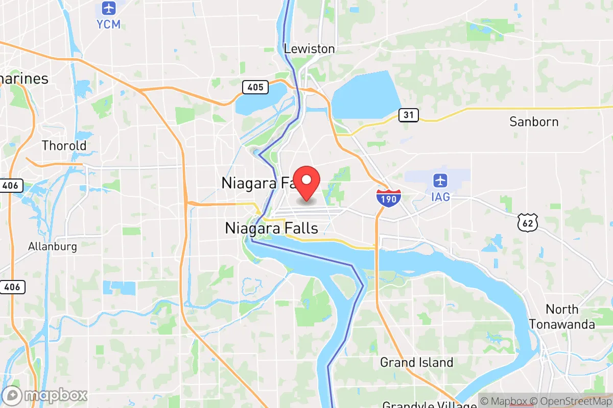
Multiple tactical vulnerabilities. Population density, target proximity, or disaster risk are likely compounding. A retreat property and exit planning is required.
What does the Strategic Assessment tell us?
Our Strategic Assessment grades tactical survivability of an area. Major population centers, military targets, fallout zones, natural disasters, and border exposure all drive risk — lower exposure means a more defensible position in a crisis.
This is heavily inspired by Joel Skousen's Strategic Relocation book. Highly recommended you checkout the book ($)What does this tell us?
Our Strategic Assessment grades tactical survivability of an area. Major population centers, military targets, fallout zones, natural disasters, and border exposure all drive risk — lower exposure means a more defensible position in a crisis.
This is heavily inspired by Joel Skousen's Strategic Relocation book. Highly recommended you checkout the book ($)Strategic Pillars

Key Distances
Regional Safe Places
Below is our recommended "safe zones" in New York and the surrounding area based on our strategic heuristics. For most people, it's unrealistic to live in a “safe zone” full-time due to work, family or other personal reasons. They tend to be more rural. However, many of these areas are perfect for second homes and retreat properties that double as a vacation home or even a short-term rental.


Important Note: For informational purposes only. This does not mean nothing bad ever happens in the green zones. Please use common sense. This is based on public data and modeled with AI. We tried to take a conservative approach but mistakes happen. We update this regularly as new information becomes available.
Solar Generator Recommendations
Backup power matters more here than in safer locations. We've picked three solar generators across budgets and capacity tiers — start with the budget unit if you only need a few essentials, or step up if you want to run a fridge and HVAC for days at a time.

Jackery Portable Power Station Explorer 300
Budget OptionPower on the Go: Weighing only 11 lbs, it's convenient to set up and store with book-sized foldable solar panels

BLUETTI Portable Power Station AC180
Designed for both indoor and outdoor scenarios, AC180 is highly capable as it has a robost capacity and continuous output power.

EF ECOFLOW DELTA Pro Ultra Power Station
Upgraded PickEcoFlow DELTA Pro Ultra is a whole-home energy system designed to grow with your family. Integrated with the Smart Home Panel 2, it scales to meet your evolving energy needs — keeping your home powered, intelligent, and secure through every stage of life.
We earn a commission, at no additional cost to you.
Strategic Assessment Analysis
Niagara Falls, New York, presents a complex strategic picture for the conservative prepper or survivalist. Its primary value lies not in its famous waterfalls, but in its position as a hardscrabble, post-industrial city that has already weathered decades of economic decline, making it less of a target for the kind of cascading collapse that would cripple more prosperous regions. The area offers a unique blend of natural defensive advantages and significant, non-negotiable exposure risks that demand a clear-eyed assessment before any relocation decision is made.
Geographic position and natural defensive advantages
The single most compelling strategic asset of Niagara Falls is its location on the Niagara River, which connects Lake Erie to Lake Ontario. This provides an immense, virtually inexhaustible supply of fresh water—the single most critical resource for long-term survival. The city sits at the terminus of the Niagara Escarpment, a natural ridge that provides elevated terrain and potential vantage points. The immediate region is characterized by a mix of farmland, forest, and the Niagara Gorge, which creates a natural barrier to the south. The proximity to the Canadian border is a double-edged sword: it offers a potential escape route or resupply corridor, but also introduces the complexity of international relations and border security during a crisis. The climate, with cold, snowy winters, acts as a natural population filter—those unwilling to endure harsh conditions will self-select out, reducing competition for resources in a collapse scenario. The area's relative isolation from major population centers like Buffalo (20 miles away) and Toronto (80 miles away) provides a buffer zone, but the city itself is not remote.
Risks, exposures, and proximity to fallout-relevant landmarks
This is where the analysis turns sobering. Niagara Falls is directly adjacent to one of the most critical infrastructure nodes in North America: the Robert Moses Niagara Power Plant and the Lewiston Pump-Generating Plant. These facilities, along with the international bridges (Rainbow, Whirlpool, and Lewiston-Queenston), are high-value targets for any adversary. A conventional or cyber attack on the power grid here would cascade across the entire northeastern US. Furthermore, the city is within the fallout plume radius of the Buffalo Niagara International Airport and the Buffalo harbor, both potential military or terrorist targets. The presence of the Niagara Falls Air Reserve Station, home to the 914th Air Refueling Wing, makes the area a legitimate military target. For the prepper, this means that while the natural resources are excellent, the man-made risks are severe. A mass casualty event at the falls themselves—a bridge collapse, a terrorist attack on the tourist crowds—would overwhelm local medical resources, which are already strained. The city's population is roughly 48,000, but it swells with millions of tourists annually, creating a massive, transient, and unpredictable population that could become a liability during a disaster.
Practical resilience for a relocator: food, water, energy, and defensibility
On the practical side, the area offers genuine strengths. Water is abundant and cheap, drawn directly from the Great Lakes system. The local water treatment plant is robust, but a prepper should still plan for filtration and storage. The surrounding farmland in Niagara County produces apples, grapes, and other crops, and there is a strong local farming community that would be essential for barter and food security. The cost of real estate is among the lowest in New York State, meaning a relocator can acquire a property with acreage, a well, and a septic system for a fraction of the cost of similar land in the South or West. Energy is a mixed bag: the city has cheap hydroelectric power from the NYPA, but that grid is the very target mentioned above. A prepper would need to invest in off-grid solar or a backup generator, as grid reliability is not guaranteed. Defensibility is poor within the city itself—dense, aging housing stock with limited chokepoints. However, the rural townships just outside the city limits (Lewiston, Youngstown, Sanborn) offer far better defensibility with larger lots, natural tree cover, and fewer entry points. The local population is a mix of long-term residents with a strong sense of community and a transient service economy workforce. The conservative-leaning areas are in the surrounding towns, not the city proper, which leans heavily Democratic. For a single individual or family, the key is to buy land outside the city limits, establish a self-sufficient homestead, and treat the city as a resource zone for barter and supply runs, not a place to live.
The overall strategic picture for Niagara Falls is one of high risk and high potential reward, but only for the disciplined prepper who understands the trade-offs. The water and low-cost land are unmatched in the Northeast. But the target-rich environment of the power plants, bridges, and tourist crowds means that a relocator cannot afford to be complacent. The smart play is to establish a base in the rural periphery, maintain a low profile, and have a bug-out plan that heads south or east away from the lakeshore. This is not a location for the faint of heart or the unprepared. It is a location for the strategic thinker who values resource security over population safety, and who is willing to accept the reality that the very infrastructure that makes the area livable also makes it a potential flashpoint. If you can handle the cold, the risk, and the need for constant vigilance, Niagara Falls offers a foundation. If you cannot, look elsewhere.
* Values derived from national, state, county, city and local statistics and may differ in a specific area. Last updated: 2026-04-19T08:28:46.000Z
Narrative content on this page is AI-generated and may contain mistakes. Verify any details that matter before acting on them.
ReloMaps may earn a commission from affiliate links at no extra cost to you.