Photo: Wikipedia
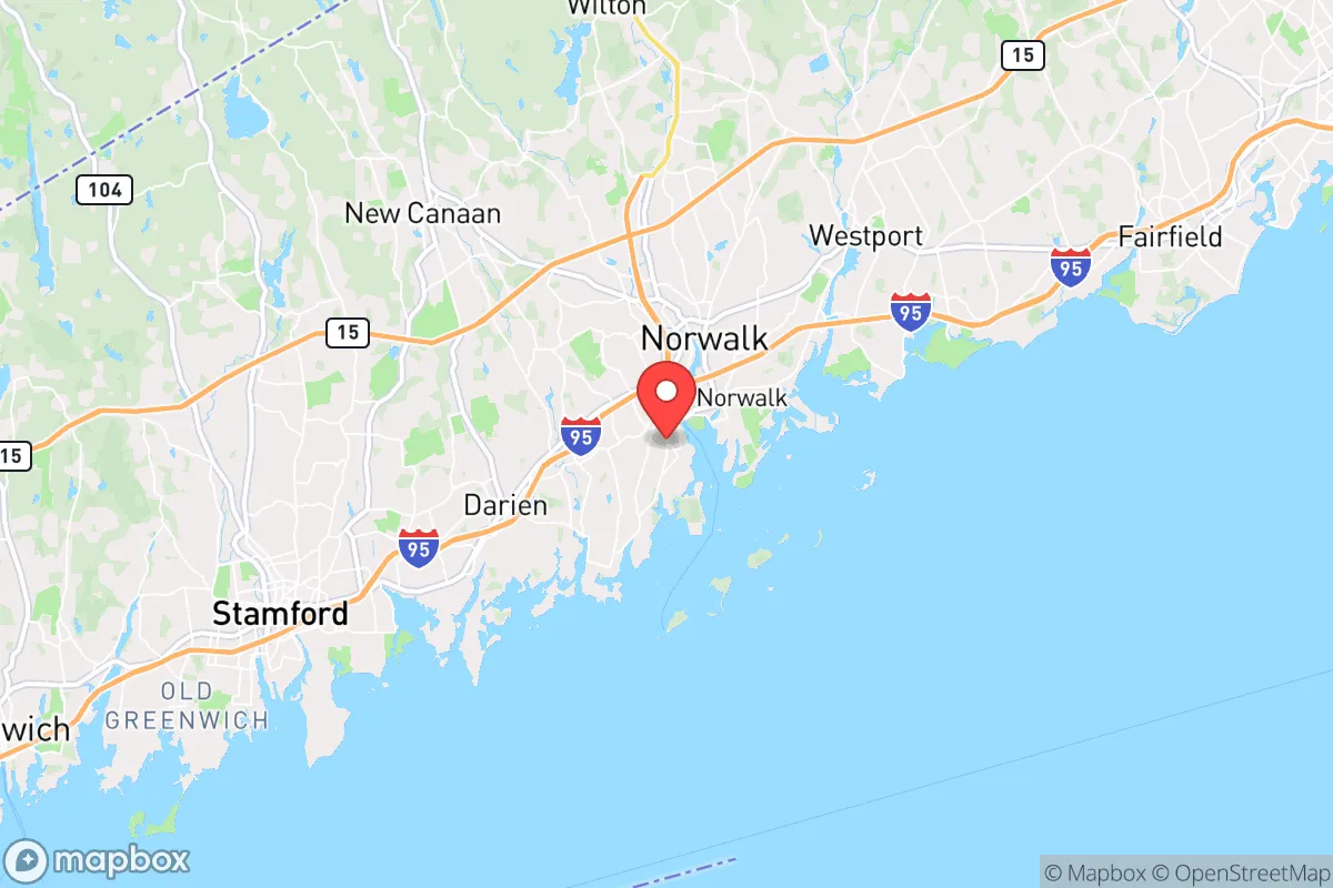
Strategic Assessment of Norwalk, CT
Multiple tactical vulnerabilities. Population density, target proximity, or disaster risk are likely compounding. A retreat property and exit planning is required.
What does the Strategic Assessment tell us?
Our Strategic Assessment grades tactical survivability of an area. Major population centers, military targets, fallout zones, natural disasters, and border exposure all drive risk — lower exposure means a more defensible position in a crisis.
This is heavily inspired by Joel Skousen's Strategic Relocation book. Highly recommended you checkout the book ($)What does this tell us?
Our Strategic Assessment grades tactical survivability of an area. Major population centers, military targets, fallout zones, natural disasters, and border exposure all drive risk — lower exposure means a more defensible position in a crisis.
This is heavily inspired by Joel Skousen's Strategic Relocation book. Highly recommended you checkout the book ($)Strategic Pillars

Key Distances
Regional Safe Places
Below is our recommended "safe zones" in Connecticut and the surrounding area based on our strategic heuristics. For most people, it's unrealistic to live in a “safe zone” full-time due to work, family or other personal reasons. They tend to be more rural. However, many of these areas are perfect for second homes and retreat properties that double as a vacation home or even a short-term rental.


Important Note: For informational purposes only. This does not mean nothing bad ever happens in the green zones. Please use common sense. This is based on public data and modeled with AI. We tried to take a conservative approach but mistakes happen. We update this regularly as new information becomes available.
Solar Generator Recommendations
Backup power matters more here than in safer locations. We've picked three solar generators across budgets and capacity tiers — start with the budget unit if you only need a few essentials, or step up if you want to run a fridge and HVAC for days at a time.

Jackery Portable Power Station Explorer 300
Budget OptionPower on the Go: Weighing only 11 lbs, it's convenient to set up and store with book-sized foldable solar panels

BLUETTI Portable Power Station AC180
Designed for both indoor and outdoor scenarios, AC180 is highly capable as it has a robost capacity and continuous output power.

EF ECOFLOW DELTA Pro Ultra Power Station
Upgraded PickEcoFlow DELTA Pro Ultra is a whole-home energy system designed to grow with your family. Integrated with the Smart Home Panel 2, it scales to meet your evolving energy needs — keeping your home powered, intelligent, and secure through every stage of life.
We earn a commission, at no additional cost to you.
Strategic Assessment Analysis
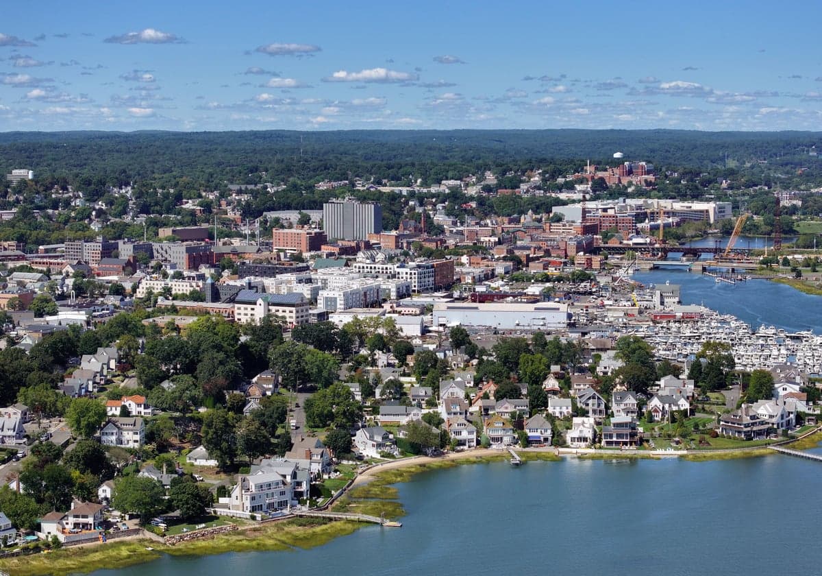
Norwalk, Connecticut, sits in a precarious strategic position that demands a hard-nosed assessment for anyone serious about preparedness. Its location along the Long Island Sound, roughly 45 miles from Manhattan, offers both economic opportunity and significant vulnerability. For the conservative prepper or survivalist, Norwalk presents a mixed bag: proximity to a major metropolitan area is a liability in any collapse scenario, but the city’s own infrastructure, access to water, and relative affluence provide some buffers that more rural areas lack. The key question is whether those buffers are enough to outweigh the risks of being a potential fallout zone in a crisis.
Geographic position and natural advantages for long-term survival
Norwalk’s geography is defined by its coastline, the Norwalk River, and a network of islands and inlets that create natural chokepoints. The city’s position on the Sound means access to tidal saltwater for fishing and potential desalination, though that requires energy and equipment most households won’t have. The Norwalk River watershed, which runs through the city, provides a freshwater source, but it’s heavily developed and subject to contamination from upstream runoff and industrial sites. The surrounding area includes the 8,000-acre Sherwood Island State Park and the Mianus River State Park, offering some wooded terrain for foraging, hunting, and temporary retreat—though these are not wilderness areas and would be quickly overrun in a prolonged emergency. The city’s elevation is low, averaging around 40 feet, with no significant high ground to provide a defensive advantage. The natural harbor and islands (like Sheffield Island) could serve as fallback positions for those with boats, but that requires maritime skills and assets most relocators don’t have. The real natural advantage here is the abundance of water and marine life, but it’s a double-edged sword: the same coastline that provides resources also makes Norwalk a target for sea-based evacuation or looting from New York City.
Risks, exposures, and proximity to fallout-relevant landmarks
This is where Norwalk’s strategic picture gets ugly for the prepper. The city lies directly in the shadow of New York City’s metropolitan blast zone—roughly 45 miles from Midtown Manhattan. In a nuclear exchange or major terrorist event targeting NYC, Norwalk would face significant fallout risk depending on wind patterns. The prevailing westerlies mean that a detonation in Manhattan could push radioactive debris directly over Fairfield County. Additionally, Norwalk is within 20 miles of Bridgeport’s industrial infrastructure, including the Bridgeport Harbor Station power plant and chemical storage facilities, which could become secondary targets or sources of toxic releases. The city itself hosts the Norwalk Hospital and the Maritime Aquarium, but these are not hardened facilities. More concerning: I-95 and the Metro-North railroad run directly through the city, making it a chokepoint for evacuation and a target for civil unrest. In a grid-down scenario, those transportation corridors become vectors for refugees fleeing NYC, and Norwalk’s police force of roughly 200 officers would be overwhelmed. The city’s dense suburban layout—with many neighborhoods of single-family homes on small lots—offers little defensible space. The Norwalk River Valley Trail and other green spaces provide escape routes, but they’re not concealed. The bottom line: Norwalk is too close to a primary target (NYC) and a secondary target (Bridgeport) to be considered a safe haven for anyone serious about long-term survival.
Practical resilience for a relocator: food, water, energy, and defensibility
Let’s get practical. For a relocator looking to hunker down, Norwalk’s resilience is a mixed bag. Food security is poor: the city has a handful of farmers’ markets and community gardens, but the vast majority of food comes via the same supply chains that would collapse in a crisis. The Stew Leonard’s and Stop & Shop distribution centers are nearby, but they’d be looted within hours. Local hunting is limited to small game (squirrel, rabbit) and waterfowl, but ammunition would be scarce. Water is more promising: the city draws from the Norwalk Reservoir and the Aquarion Water Company system, which serves much of Fairfield County. In a grid-down scenario, gravity-fed reservoirs might still provide water for a few days, but treatment plants would fail without power. A prepper with a Berkey filter or LifeStraw and access to the Norwalk River or Long Island Sound could secure drinking water, but the river is brackish near the coast and polluted upstream. Energy is a vulnerability: Norwalk is served by Eversource, and the grid is prone to outages from coastal storms (Hurricane Sandy knocked out power for days). Solar panels are viable but require battery storage, and natural gas lines are widespread but would fail if the grid goes down. Defensibility is the weakest link: the city’s layout—grid streets, dense housing, and multiple access points via I-95, Route 7, and the Merritt Parkway—makes it nearly impossible to secure a perimeter. A single-family home on a quarter-acre lot offers little standoff distance. The Norwalk Police Department is professional but small, and the Norwalk Fire Department would be stretched thin. For a relocator, the best bet would be to buy a property with a well, septic, and solar on the northern edge of town, near the New Canaan or Wilton border, where lots are larger and wooded. But even then, you’re still within a 30-minute drive of a major target.
The overall strategic picture for Norwalk is clear: it’s a high-risk, moderate-reward location for the conservative prepper. The economic opportunities and coastal resources are real, but they’re overshadowed by the city’s proximity to New York City and its vulnerability to fallout, civil unrest, and infrastructure collapse. If you’re looking for a place to ride out a short-term crisis (a week-long power outage or a localized storm), Norwalk’s infrastructure and community resources might suffice. But for a long-term collapse scenario—economic breakdown, nuclear exchange, or widespread civil disorder—Norwalk is a trap. The city’s population density, transportation corridors, and lack of defensible terrain make it a likely target for refugees and looters. The smart money for a relocator with a survivalist mindset would be to look further north and west, into Litchfield County or the Hudson Valley, where population density drops and natural resources are more abundant. Norwalk is a fine place to work and raise a family in normal times, but in a crisis, it’s a place to leave—not a place to dig in.
* Values derived from national, state, county, city and local statistics and may differ in a specific area. Last updated: 2026-04-30T03:22:21.000Z
Narrative content on this page is AI-generated and may contain mistakes. Verify any details that matter before acting on them.
ReloMaps may earn a commission from affiliate links at no extra cost to you.