
Photo: Wikipedia
Strategic Assessment of Norwalk, IA
Workable tactical position. Some exposure to population density or targets, but generally defensible in a crisis.
What does the Strategic Assessment tell us?
Our Strategic Assessment grades tactical survivability of an area. Major population centers, military targets, fallout zones, natural disasters, and border exposure all drive risk — lower exposure means a more defensible position in a crisis.
This is heavily inspired by Joel Skousen's Strategic Relocation book. Highly recommended you checkout the book ($)What does this tell us?
Our Strategic Assessment grades tactical survivability of an area. Major population centers, military targets, fallout zones, natural disasters, and border exposure all drive risk — lower exposure means a more defensible position in a crisis.
This is heavily inspired by Joel Skousen's Strategic Relocation book. Highly recommended you checkout the book ($)Strategic Pillars

Key Distances
Regional Safe Places
Below is our recommended "safe zones" in Iowa and the surrounding area based on our strategic heuristics. For most people, it's unrealistic to live in a “safe zone” full-time due to work, family or other personal reasons. They tend to be more rural. However, many of these areas are perfect for second homes and retreat properties that double as a vacation home or even a short-term rental.


Important Note: For informational purposes only. This does not mean nothing bad ever happens in the green zones. Please use common sense. This is based on public data and modeled with AI. We tried to take a conservative approach but mistakes happen. We update this regularly as new information becomes available.
Solar Generator Recommendations
Backup power matters more here than in safer locations. We've picked three solar generators across budgets and capacity tiers — start with the budget unit if you only need a few essentials, or step up if you want to run a fridge and HVAC for days at a time.

Jackery Portable Power Station Explorer 300
Budget OptionPower on the Go: Weighing only 11 lbs, it's convenient to set up and store with book-sized foldable solar panels

BLUETTI Portable Power Station AC180
Designed for both indoor and outdoor scenarios, AC180 is highly capable as it has a robost capacity and continuous output power.

EF ECOFLOW DELTA Pro Ultra Power Station
Upgraded PickEcoFlow DELTA Pro Ultra is a whole-home energy system designed to grow with your family. Integrated with the Smart Home Panel 2, it scales to meet your evolving energy needs — keeping your home powered, intelligent, and secure through every stage of life.
We earn a commission, at no additional cost to you.
Strategic Assessment Analysis
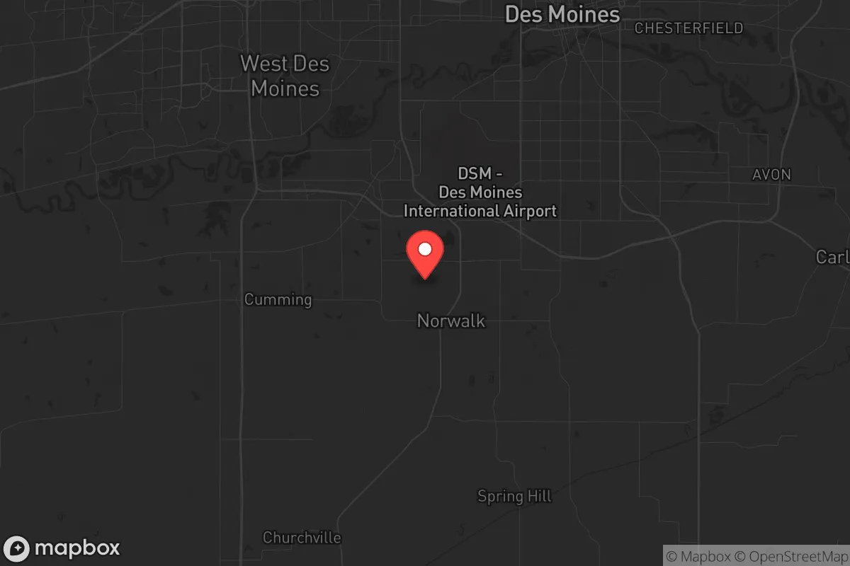
Norwalk, Iowa, sits in a strategic sweet spot that many relocators overlook: close enough to Des Moines to access its infrastructure and job market, but far enough to avoid the worst of a major urban collapse. The town’s position in Warren County, just south of the state capital, offers a blend of suburban stability and rural buffer that makes it a viable base for those thinking in terms of decades, not just next year. For a conservative-leaning individual or family prioritizing self-reliance and community cohesion, Norwalk presents a defensible, resource-accessible location with fewer of the glaring vulnerabilities found in larger metro areas.
Geographic position and natural advantages for long-term stability
Norwalk’s location is defined by its proximity to the Des Moines River corridor and the rolling terrain of southern Iowa. The area sits on the southern edge of the Des Moines Lobe, a region of relatively flat, fertile farmland that transitions into more wooded, hilly country as you move south. This gives Norwalk a dual advantage: access to rich agricultural soil for potential food production, and enough topographic variety to provide natural cover and defensible positions. The town itself is built on a ridge system that offers good drainage and avoids the floodplain issues that plague parts of Des Moines proper. Groundwater is generally reliable here, with the Jordan Aquifer underlying much of central Iowa, though well depths vary. For a prepper, the key takeaway is that Norwalk sits on a geologic sweet spot—stable, well-drained, and with enough elevation to avoid the worst of river flooding. The surrounding countryside is a patchwork of corn and soybean fields interspersed with hardwood timber, offering both concealment and raw materials for construction or fuel. The area’s natural advantages are modest but real: moderate climate, decent water availability, and a landscape that doesn’t funnel threats into a single chokepoint.
Risks, exposures, and proximity to fallout-relevant landmarks
The biggest risk for Norwalk is its proximity to Des Moines, roughly 12 miles north. In a scenario involving civil unrest, a major terrorist event, or a nuclear detonation at a high-value target like the Iowa State Capitol or the Des Moines International Airport, Norwalk would be within the moderate fallout zone depending on wind patterns. The Des Moines metro area is home to roughly 700,000 people, and a collapse there would send a wave of refugees south along Highway 5 and Highway 28—both of which run directly through Norwalk. The town’s position on the edge of the urbanized area means it would be a natural choke point for traffic fleeing the city, which could turn into a security liability. Additionally, the nearby Des Moines River and its tributaries could become contamination vectors if upstream industrial sites or wastewater treatment plants were compromised. There are no major military bases or nuclear power plants within 50 miles, but the presence of fertilizer plants and chemical storage facilities in the broader region (e.g., the CF Industries plant in Sergeant Bluff, 200 miles west) means that a large-scale industrial accident could affect air quality or water supplies. For a relocator, the calculus is clear: Norwalk is not a remote bunker location, but it is far enough from the worst-case epicenters to give you a fighting chance if you have a plan for the first 72 hours.
Practical resilience for a relocator: food, water, energy, and defensibility
Food security in the Norwalk area is strong by Midwestern standards. The surrounding farmland is some of the most productive in the world, and a motivated individual could secure a small acreage within a 15-minute drive of town for gardening, livestock, or even a small orchard. The local soil is primarily loam with good drainage, suitable for corn, beans, and most vegetables. Water is the bigger question: Norwalk’s municipal water comes from the Des Moines Water Works, which draws from the Des Moines and Raccoon Rivers. In a prolonged grid-down scenario, that supply would be vulnerable to contamination or disruption. A well on your property is the gold standard here, and many rural properties in Warren County already have them. Drilling a new well runs $5,000–$10,000, but it’s a one-time investment that pays off in any long-term disruption. Energy-wise, the area has decent solar potential—Iowa averages about 200 sunny days per year—and wind is a viable supplement, though zoning in Norwalk proper may restrict turbine installation. For defensibility, the town’s layout is a mixed bag. The newer subdivisions on the north and east sides are typical suburban sprawl with multiple entry points, which is hard to secure. Older parts of town, closer to the original downtown core, have a more compact street grid and natural chokepoints at the railroad crossings and bridges over the river. If you’re looking for a property that can be hardened, focus on the southern or western edges of town, where lots are larger and the road network is sparser. The local sheriff’s office and police department are professional but small—about 10 officers for the town—so don’t count on them for anything beyond routine response. Community resilience is decent: Norwalk has a strong church presence and a history of volunteer firefighting, which suggests a population that can organize under stress.
The overall strategic picture for Norwalk is one of calculated risk. It’s not a remote survivalist retreat, and it won’t shield you from every threat. But for a conservative relocator who wants to stay connected to a functioning economy while maintaining a credible backup plan, it offers a rare balance. You get the jobs, schools, and medical access of a Des Moines suburb without being trapped inside the blast radius of a major urban target. The farmland, water access, and community fabric give you the raw materials for a resilient lifestyle, provided you invest in the right infrastructure—well, solar, and a defensible property layout. If the country holds together, you’re in a pleasant, growing town with good schools and low crime. If things go sideways, you’re in a position to ride out the first wave and adapt. That’s about as honest an assessment as you’ll get for any location in the lower 48.
* Values derived from national, state, county, city and local statistics and may differ in a specific area. Last updated: 2026-04-29T21:58:29.000Z
Narrative content on this page is AI-generated and may contain mistakes. Verify any details that matter before acting on them.
ReloMaps may earn a commission from affiliate links at no extra cost to you.