
Photo: Wikipedia
Strategic Assessment of Miami County
Meaningful friction. Expect exposure to either population pressure, blast zones, or natural disaster risk. Consider buying a retreat property.
What does the Strategic Assessment tell us?
Our Strategic Assessment grades tactical survivability of an area. Major population centers, military targets, fallout zones, natural disasters, and border exposure all drive risk — lower exposure means a more defensible position in a crisis.
This is heavily inspired by Joel Skousen's Strategic Relocation book. Highly recommended you checkout the book ($)What does this tell us?
Our Strategic Assessment grades tactical survivability of an area. Major population centers, military targets, fallout zones, natural disasters, and border exposure all drive risk — lower exposure means a more defensible position in a crisis.
This is heavily inspired by Joel Skousen's Strategic Relocation book. Highly recommended you checkout the book ($)Strategic Pillars

Key Distances
Strategic Assessment Analysis
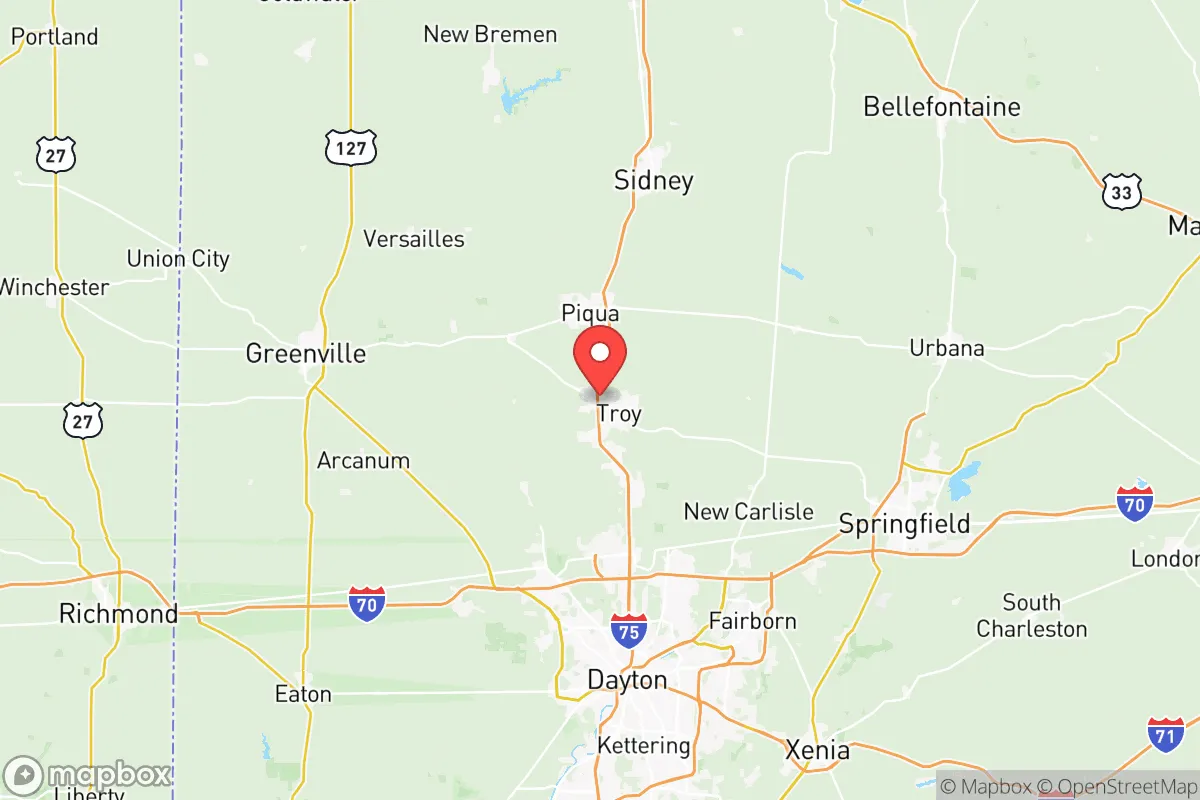
Miami County, Ohio, offers a strategic balance of Midwestern stability and practical self-sufficiency that appeals to relocation-minded readers prioritizing resilience. Anchored by the cities of Troy, Piqua, and Tipp City, the county sits along the I-75 corridor roughly 20 miles north of Dayton and 70 miles west of Columbus, placing it within a day’s drive of major Great Lakes and Ohio River logistics hubs while remaining far enough from dense urban centers to avoid their worst vulnerabilities. Its agricultural base, manufacturing history, and relatively low population density—about 108,000 residents across 410 square miles—create a foundation for a household-level preparedness strategy that doesn’t require remote wilderness living.
Geographic position and natural advantages for long-term stability
Miami County’s location in western Ohio’s till plains gives it flat, fertile land that has supported farming for generations, a clear asset for anyone serious about local food security. The county is drained by the Great Miami River, which flows through Troy and Piqua, providing a surface water source that, while requiring treatment, is more reliable than deep-well aquifers in drought-prone regions. The area sits atop the Buried Valley Aquifer, one of Ohio’s most productive groundwater systems, meaning well-drilling is feasible for rural properties—a key consideration for off-grid water planning. Elevation is modest, averaging 850–950 feet, but the terrain is gently rolling rather than flood-prone bottomland; the 1913 flood that devastated Dayton was a historical anomaly, and modern levees along the Great Miami in Troy and Piqua have held reliably since. The county’s position in USDA Hardiness Zone 6a supports a long growing season (about 170 frost-free days) for staple crops like corn, soybeans, and wheat, plus orchard fruits and vegetables. Winters bring snow and occasional ice storms, but power outages are typically measured in hours, not days, thanks to a robust grid maintained by Dayton Power & Light and local cooperatives. For a relocator, the natural advantages boil down to: abundant groundwater, arable land, and a climate that doesn’t push infrastructure to its breaking point.
Risks, exposures, and proximity to fallout-relevant landmarks
No resilience assessment is honest without weighing man-made and natural risks, and Miami County has specific exposures that a prepared relocator should map. The most obvious is the I-75 corridor, a major north-south freight route that carries hazardous materials daily—tankers of propane, ammonia, and gasoline pass through Troy and Piqua, and a derailment or truck accident near the CSX rail line that parallels the highway could trigger evacuation zones. The county is also within 50 miles of Wright-Patterson Air Force Base near Dayton, a primary U.S. Air Force research and logistics hub that, while not a nuclear weapons storage site, is a high-value target in any conflict scenario. Fallout risk from a strike on Wright-Patterson would be moderate: prevailing winds from the west-southwest would carry debris northeast toward Springfield and Columbus, placing eastern Miami County (Tipp City, West Milton) in a secondary plume zone. Closer to home, the Duke Energy Stuart Station coal plant in Aberdeen, Ohio, about 30 miles southeast, and the J.M. Smucker Company facility in Orrville (100 miles northeast) are industrial sites, but neither poses the catastrophic risk of a nuclear plant—the nearest commercial reactor is Davis-Besse near Toledo, 120 miles north, well outside the 50-mile emergency planning zone. Natural hazards are less dramatic: tornadoes are the primary threat, with Miami County averaging 2–3 touchdowns per decade, and the 2019 Memorial Day outbreak that hit Trotwood and Dayton missed the county by 10 miles. Flooding along the Great Miami is managed by the Miami Conservancy District, which operates five dry dams upstream; the system has prevented over $1 billion in flood damage since 1922. For a relocator, the risk profile is moderate—industrial traffic and a nearby military base are real concerns, but no single catastrophic exposure dominates the landscape.
Practical resilience for a relocator: food, water, energy, and defensibility
Miami County’s practical resilience for a household aiming for self-sufficiency is strong, especially compared to suburban sprawl or exurban bedroom communities. Food security is the standout: the county has over 1,200 farms covering 70% of its land area, with direct-to-consumer options like the Troy Farmers Market (May–October) and Piqua’s Community Garden network. For a relocator, buying a 5–10 acre parcel near Fletcher or Casstown puts you within walking distance of working farms that sell beef, pork, eggs, and produce year-round. The Miami County Food Bank in Troy is a backup, but the real advantage is the ability to barter or purchase directly from neighbors—a social resilience factor that urban areas lack. Water is equally favorable: the Buried Valley Aquifer yields 500–1,000 gallons per minute for municipal wells, and rural properties with private wells typically see 10–20 GPM at depths of 60–120 feet. A hand pump or solar-powered well pump is a straightforward upgrade. Energy is more mixed: the grid is reliable, but natural gas pipelines from the Marcellus Shale region run through the county, and a disruption could affect heating for homes that rely on gas furnaces. Solar potential is moderate—Ohio averages 3.5–4.0 peak sun hours per day, enough for a 5 kW system to cover baseline needs, but winter cloud cover requires battery storage or a backup generator. Wood heating is viable: the county’s 30% forest cover (mostly oak, hickory, and maple) provides ample firewood, and wood stoves are common in older farmhouses. Defensibility is the weakest link: the county is flat and open, with few natural chokepoints. A rural property with a long driveway, a pond for water, and a clear line of sight to the road offers better security than a subdivision lot in Troy or Tipp City. The Miami County Sheriff’s Office has 60 sworn deputies, a ratio of 1 per 1,800 residents—adequate for routine patrols but thin for widespread civil unrest. For a relocator, the practical takeaway is that food and water are easy to secure; energy requires upfront investment; and defensibility depends on choosing the right parcel.
The overall strategic picture for Miami County is one of moderate resilience with clear trade-offs. It avoids the extreme risks of coastal hurricane zones, wildfire-prone forests, or urban collapse scenarios, while offering a genuine agricultural base and groundwater abundance that many inland counties lack. The proximity to Wright-Patterson Air Force Base and the I-75 hazardous materials corridor are the primary man-made exposures, but they are manageable with a 20–30 mile buffer east or west of the interstate. For a relocator who values community ties, local food networks, and a slower pace without sacrificing access to Dayton’s hospitals (Miami Valley Hospital, 25 minutes from Troy) or Columbus’s supply chains, Miami County is a solid choice. It is not a bug-out location for doomsday preppers—it is a place to build a sustainable, prepared life within a functioning Midwestern community. The key is to buy land with a well, a south-facing roof for solar, and a woodlot, and to get to know the farmers at the Troy market before you need them.

* Values derived from national, state, county, city and local statistics and may differ in a specific area. Last updated: 2026-08-19T02:46:19.000Z
Narrative content on this page is AI-generated and may contain mistakes. Verify any details that matter before acting on them.
ReloMaps may earn a commission from affiliate links at no extra cost to you.

