Photo: Wikipedia
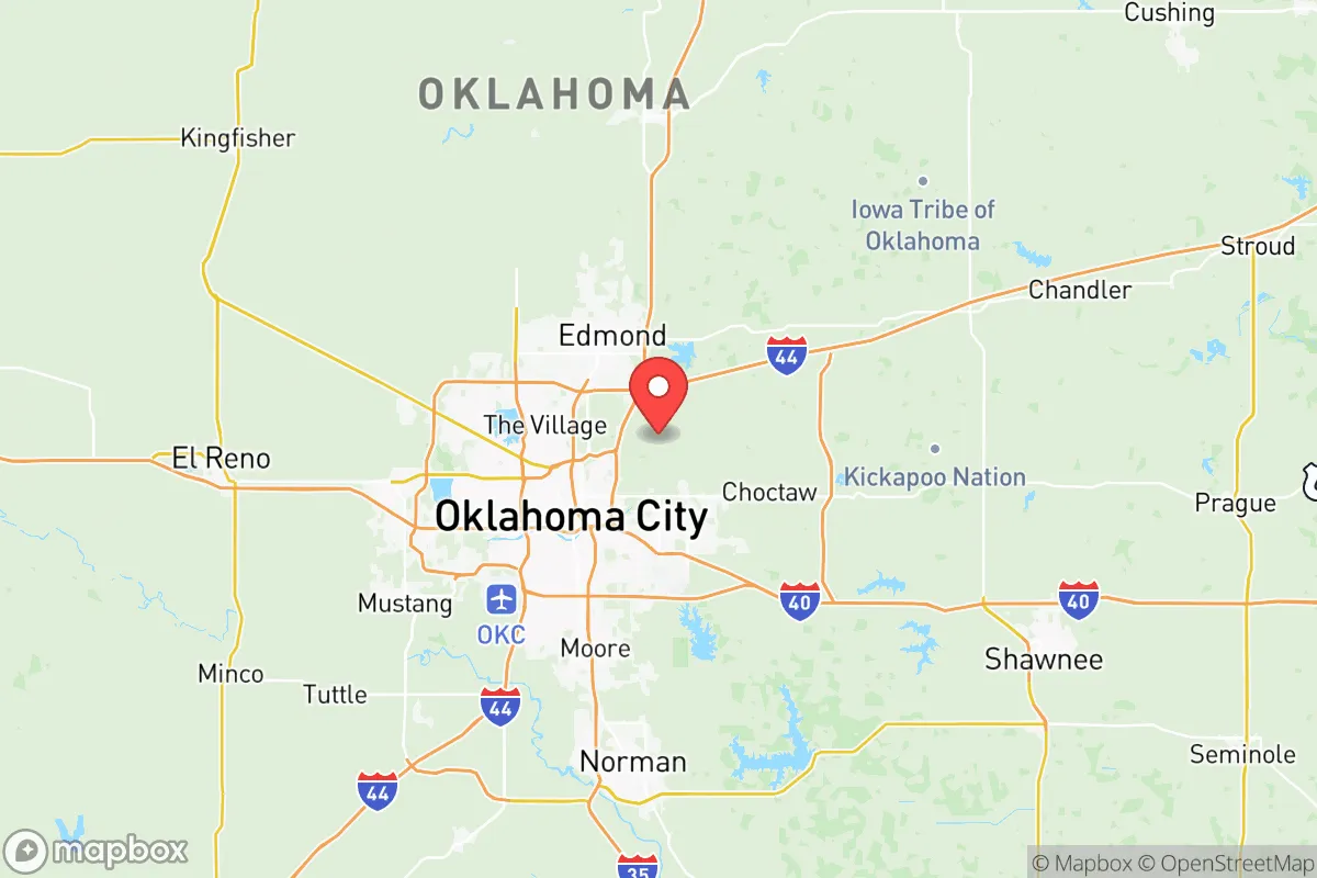
Strategic Assessment of Oklahoma County
Multiple tactical vulnerabilities. Population density, target proximity, or disaster risk are likely compounding. A retreat property and exit planning is required.
What does the Strategic Assessment tell us?
Our Strategic Assessment grades tactical survivability of an area. Major population centers, military targets, fallout zones, natural disasters, and border exposure all drive risk — lower exposure means a more defensible position in a crisis.
This is heavily inspired by Joel Skousen's Strategic Relocation book. Highly recommended you checkout the book ($)What does this tell us?
Our Strategic Assessment grades tactical survivability of an area. Major population centers, military targets, fallout zones, natural disasters, and border exposure all drive risk — lower exposure means a more defensible position in a crisis.
This is heavily inspired by Joel Skousen's Strategic Relocation book. Highly recommended you checkout the book ($)Strategic Pillars

Key Distances
Strategic Assessment Analysis
Oklahoma County, anchored by Oklahoma City, presents a mixed strategic picture for the conservative prepper or survivalist. Its central location in the nation's heartland offers genuine resilience against coastal threats, but the county's own urban core and critical infrastructure create significant vulnerabilities that require careful mitigation. For the relocator prioritizing self-sufficiency and security, the county is less a sanctuary and more a staging ground—a place where you can leverage regional advantages while actively avoiding the fallout zones that come with a major metropolitan area and its military and industrial assets.
Geographic position and natural advantages for long-term survival
Oklahoma County sits at the crossroads of Interstates 35, 40, and 44, which is a double-edged sword. On one hand, this makes supply movement and evacuation routing possible in multiple directions—north toward Kansas, south toward the Red River, or west into the Texas Panhandle. On the other hand, these same arteries make the county a natural chokepoint for any mass movement of people during a crisis. The county's position in the central plains means it is far removed from the direct blast and fallout risks of coastal population centers like New York, Los Angeles, or Houston's refinery corridor. The nearest major military installation with strategic value is Tinker Air Force Base, located in the southeastern part of the county near Midwest City and Del City. Tinker is a major maintenance and logistics hub for the U.S. Air Force, which makes it a high-value target in any conflict scenario. The prevailing winds in Oklahoma generally blow from the south and southwest, meaning that fallout from a strike on Tinker would likely spread north and northeast, directly over the more densely populated parts of the county, including downtown Oklahoma City and Edmond. The county's terrain is mostly flat to gently rolling plains, offering little natural cover or defensible high ground. The North Canadian River (locally called the Oklahoma River) runs through the heart of the city, but it is a shallow, silted waterway that offers no meaningful defensive barrier. The area's natural advantages are its distance from coasts and its agricultural potential, not its topography.
Risks, exposures, and proximity to fallout-relevant landmarks
The primary risk for a relocator in Oklahoma County is proximity to multiple high-value targets within a 20-mile radius. Beyond Tinker Air Force Base, the county contains the Oklahoma City National Memorial site, a symbolic target, and the state capitol complex. More practically, the county is home to major energy infrastructure: the Cushing oil storage hub, while technically in Payne County to the north, is close enough that a strike there could send fallout or cause secondary effects (like refinery fires or chemical releases) that drift into northern Oklahoma County. Within the county itself, the Oklahoma City metro area has several large fuel storage facilities and the Will Rogers World Airport, which could be a secondary target. For the prepper, the density of the urban core—over 800,000 people in the county—is the biggest liability. In a grid-down or mass-casualty event, the population of Oklahoma City would become a desperate, mobile threat. The suburbs of Edmond, Moore, and Norman (the latter in Cleveland County but adjacent) would see massive internal displacement. The county's reliance on the electrical grid, natural gas pipelines, and water treatment plants means that any coordinated attack on infrastructure would cripple the area quickly. The risk of civil unrest is also elevated due to the county's political and demographic mix—while Oklahoma County leans conservative overall, Oklahoma City itself is a blue dot in a red state, and the potential for ideological conflict during a breakdown is real. The presence of the University of Oklahoma in nearby Norman adds another layer of potential instability from a large, transient student population.
Practical resilience for a relocator: food, water, energy, and defensibility
For the individual or family looking to establish a resilient homestead, Oklahoma County offers some practical advantages if you choose the right location. The county's agricultural land, particularly in the northern and eastern rural areas near Luther, Jones, and Harrah, can support small-scale farming and livestock. The growing season is long enough for most staple crops, and the soil, while heavy with clay in places, is workable. Water is a more serious concern. The county relies on surface water from reservoirs like Lake Hefner and Lake Overholser, both within the city limits, and from the larger Lake Thunderbird to the south. In a prolonged drought or contamination event, these sources would be contested. A private well is the best option, but groundwater in the county can be high in minerals and requires treatment. Energy resilience is achievable with solar, as the region gets ample sun, but the frequent severe weather—tornadoes, ice storms, straight-line winds—means any solar array must be robustly mounted and have battery storage. Natural gas is plentiful and cheap, making a backup generator a practical choice. Defensibility is the weak point. The flat terrain offers no natural chokepoints or high ground. A rural property in the county's unincorporated areas, like those near the Pottawatomie County line, can be made defensible with perimeter fencing, good visibility, and a well-stocked armory, but you will be relying on your own capabilities and a small network of like-minded neighbors. The county's law enforcement presence is concentrated in the urban core; rural areas will see minimal response in a crisis. The best strategy is to locate on the far eastern or northern fringe of the county, away from the major highways and the Tinker fallout zone, and to establish a deep pantry, water storage, and a community of trusted contacts.
The overall strategic picture for Oklahoma County is one of calculated risk. It is not a prepper's paradise—the urban density, the presence of Tinker Air Force Base, and the flat, indefensible terrain are significant negatives. However, for the relocator who cannot or will not move to the remote mountain redoubts of Idaho or Montana, Oklahoma County offers a middle ground: a place with a strong conservative culture, affordable land on the periphery, and a central location that allows for multiple escape routes. The key is to avoid the city and its suburbs entirely. Focus on the rural pockets east of Choctaw or north of Edmond, where you can build a self-sufficient life while staying close enough to the city for supply runs in normal times. The county's resilience is not inherent—it must be built, property by property, by people who understand that the government's response will be slow and that the urban population will be a liability, not a resource. If you can secure water, energy, and a defensible perimeter on the county's edge, Oklahoma County can serve as a viable base of operations. If you try to ride out a crisis inside the I-240 loop, you are betting against the odds. Choose your ground carefully, and prepare for the worst while hoping for the best.
* Values derived from national, state, county, city and local statistics and may differ in a specific area. Last updated: 2026-05-11T21:58:04.000Z
Narrative content on this page is AI-generated and may contain mistakes. Verify any details that matter before acting on them.
ReloMaps may earn a commission from affiliate links at no extra cost to you.