
Photo: Wikipedia
Strategic Assessment of Owatonna, MN
Strong survivability profile. Good buffer from population centers, with manageable environmental and tactical risks.
What does the Strategic Assessment tell us?
Our Strategic Assessment grades tactical survivability of an area. Major population centers, military targets, fallout zones, natural disasters, and border exposure all drive risk — lower exposure means a more defensible position in a crisis.
This is heavily inspired by Joel Skousen's Strategic Relocation book. Highly recommended you checkout the book ($)What does this tell us?
Our Strategic Assessment grades tactical survivability of an area. Major population centers, military targets, fallout zones, natural disasters, and border exposure all drive risk — lower exposure means a more defensible position in a crisis.
This is heavily inspired by Joel Skousen's Strategic Relocation book. Highly recommended you checkout the book ($)Strategic Pillars

Key Distances
Regional Safe Places
Below is our recommended "safe zones" in Minnesota and the surrounding area based on our strategic heuristics. For most people, it's unrealistic to live in a “safe zone” full-time due to work, family or other personal reasons. They tend to be more rural. However, many of these areas are perfect for second homes and retreat properties that double as a vacation home or even a short-term rental.


Important Note: For informational purposes only. This does not mean nothing bad ever happens in the green zones. Please use common sense. This is based on public data and modeled with AI. We tried to take a conservative approach but mistakes happen. We update this regularly as new information becomes available.
Solar Generator Recommendations
Backup power matters more here than in safer locations. We've picked three solar generators across budgets and capacity tiers — start with the budget unit if you only need a few essentials, or step up if you want to run a fridge and HVAC for days at a time.

Jackery Portable Power Station Explorer 300
Budget OptionPower on the Go: Weighing only 11 lbs, it's convenient to set up and store with book-sized foldable solar panels

BLUETTI Portable Power Station AC180
Designed for both indoor and outdoor scenarios, AC180 is highly capable as it has a robost capacity and continuous output power.

EF ECOFLOW DELTA Pro Ultra Power Station
Upgraded PickEcoFlow DELTA Pro Ultra is a whole-home energy system designed to grow with your family. Integrated with the Smart Home Panel 2, it scales to meet your evolving energy needs — keeping your home powered, intelligent, and secure through every stage of life.
We earn a commission, at no additional cost to you.
Strategic Assessment Analysis
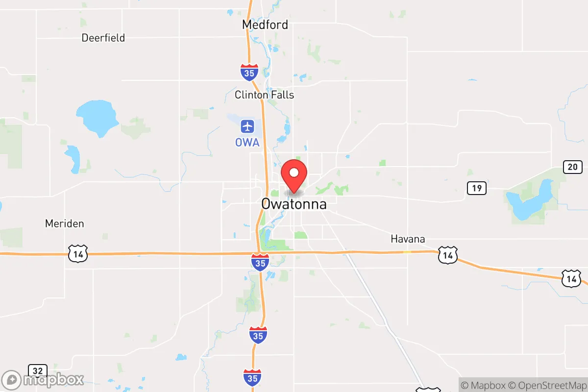
Owatonna, Minnesota, sits in a sweet spot for strategic relocation: far enough from the Twin Cities’ metro chaos to avoid the worst of civil unrest or fallout risks, yet close enough to access critical supply chains and medical infrastructure when things are stable. The city’s location along Interstate 35 and its position as the Steele County seat give it a logistical backbone that matters when you’re thinking about long-term resilience. For a conservative-leaning prepper or survivalist, Owatonna offers a blend of agricultural self-sufficiency, industrial capacity, and relative geographic insulation that’s hard to beat in the Upper Midwest—provided you understand its real vulnerabilities.
Geographic position and natural advantages for long-term survival
Owatonna’s geography is its first line of defense. Sitting about 60 miles south of Minneapolis-St. Paul, it’s close enough to tap into metro resources during normal times but far enough that a major event in the cities—whether a terrorist attack, grid collapse, or civil unrest—won’t immediately wash over the town. The surrounding Steele County is flat, fertile farmland, which means local food production is a realistic option. The Straight River runs through town, providing a surface water source that, with proper filtration, can supplement well water. The area’s groundwater is generally reliable, with the Jordan aquifer underlying much of the region. Winters are harsh—average January lows hit around 8°F—which acts as a natural barrier to mass migration from warmer climates during a crisis. Snow and cold slow movement, reduce visibility, and make unplanned travel dangerous, buying time for prepared residents. The lack of major military installations, nuclear power plants, or high-value infrastructure within 30 miles reduces the likelihood of Owatonna being a secondary target in a conflict scenario.
Risks, exposures, and proximity to fallout-relevant landmarks
No location is perfect, and Owatonna has real exposure points. The biggest risk is its proximity to Interstate 35, a major north-south corridor that would become a chokepoint during an evacuation or supply disruption. If the Twin Cities experience a mass casualty event—say, a dirty bomb or a coordinated attack on the Mall of America or the State Capitol—expect a wave of refugees heading south on I-35 within hours. Owatonna sits right in that path. The city itself has a population of about 26,000, but Steele County’s total is just over 37,000, meaning the local infrastructure (hospitals, grocery stores, fuel stations) would be overwhelmed quickly if 100,000+ people from the metro funnel through. There’s also the Prairie Island Indian Community’s nuclear plant about 50 miles northeast—within the 50-mile emergency planning zone. While a meltdown is unlikely, prevailing winds from the northwest mean fallout from a Prairie Island incident could drift toward Owatonna. The city’s industrial base includes a large Cargill facility and a Federated Co-ops grain elevator, both of which could become targets for looting or sabotage during civil unrest. Finally, the area sits in Tornado Alley’s northern fringe; an EF-3 or stronger tornado hitting the town center would be a localized but devastating event.
Practical resilience for a relocator: food, water, energy, and defensibility
For a single individual or family looking to hunker down, Owatonna’s practical resilience is mixed but workable. Food security is strong—Steele County is among Minnesota’s top producers of corn, soybeans, and dairy. Local farmers’ markets and CSAs operate from May through October, and the city has multiple grocery stores (Hy-Vee, Walmart, Aldi) for normal times. For long-term storage, the surrounding agricultural co-ops can supply bulk grains and feed for livestock. Water is the bigger concern: most homes in town are on municipal water drawn from wells, but that system depends on electric pumps. A grid-down scenario means you need a backup plan—either a private well with a hand pump or a rainwater catchment system. The Straight River is accessible but requires treatment for pathogens and agricultural runoff. Energy resilience is average. Owatonna’s power comes from Xcel Energy’s grid, which is vulnerable to ice storms and cyberattacks. Solar panels are viable (the area gets about 200 sunny days per year), but winter snow cover reduces output. Wood-burning stoves are common in rural homes, and propane delivery is reliable in normal times. Defensibility is the weak point. The city is laid out in a typical grid pattern with multiple entry points from I-35 and state highways 14 and 218. There are no natural barriers like rivers or hills to funnel traffic. A prepared relocator should look for property on the outskirts—preferably east or south of town, away from the interstate corridor—with good sightlines and a single access road. The local law enforcement presence is modest: the Owatonna Police Department has about 30 sworn officers, and the Steele County Sheriff’s Office covers the rest. In a prolonged crisis, response times would stretch to hours or days.
The overall strategic picture for Owatonna is one of cautious optimism for the prepared relocator. It’s not a hardened bunker location, but it’s not a death trap either. The agricultural base and distance from major targets give it a solid foundation for medium-term survival—say, 6 to 18 months of disruption. The real risk is the I-35 corridor turning into a funnel for desperate people from the Twin Cities. If you can secure a property with a private well, a wood stove, and a defensible perimeter, Owatonna offers a realistic base for riding out the worst of what’s coming. Just don’t expect to go it alone—build relationships with local farmers and gun owners before the SHTF. In a world where the cities are the first to burn, this small city in southern Minnesota is a place where you can still breathe, grow food, and keep your family safe—if you’re smart about it.
* Values derived from national, state, county, city and local statistics and may differ in a specific area. Last updated: 2026-05-04T02:48:29.000Z
Narrative content on this page is AI-generated and may contain mistakes. Verify any details that matter before acting on them.
ReloMaps may earn a commission from affiliate links at no extra cost to you.