Photo: Wikipedia
Strategic Assessment of Palmer, AK
Workable tactical position. Some exposure to population density or targets, but generally defensible in a crisis.
What does the Strategic Assessment tell us?
Our Strategic Assessment grades tactical survivability of an area. Major population centers, military targets, fallout zones, natural disasters, and border exposure all drive risk — lower exposure means a more defensible position in a crisis.
This is heavily inspired by Joel Skousen's Strategic Relocation book. Highly recommended you checkout the book ($)What does this tell us?
Our Strategic Assessment grades tactical survivability of an area. Major population centers, military targets, fallout zones, natural disasters, and border exposure all drive risk — lower exposure means a more defensible position in a crisis.
This is heavily inspired by Joel Skousen's Strategic Relocation book. Highly recommended you checkout the book ($)Strategic Pillars

Key Distances
Regional Safe Places
Below is our recommended "safe zones" in Alaska and the surrounding area based on our strategic heuristics. For most people, it's unrealistic to live in a “safe zone” full-time due to work, family or other personal reasons. They tend to be more rural. However, many of these areas are perfect for second homes and retreat properties that double as a vacation home or even a short-term rental.
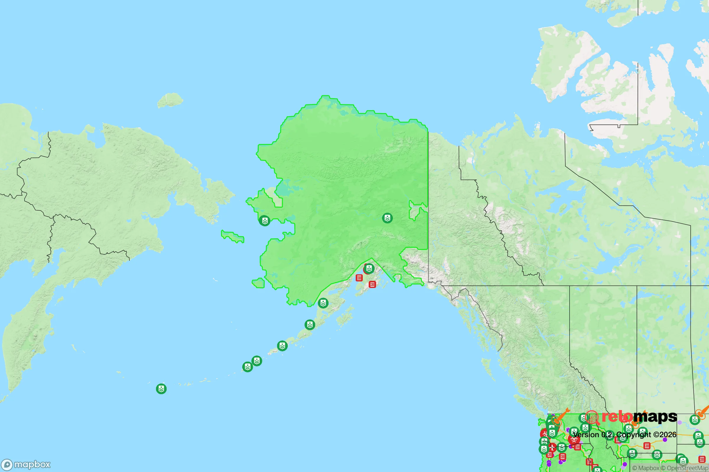
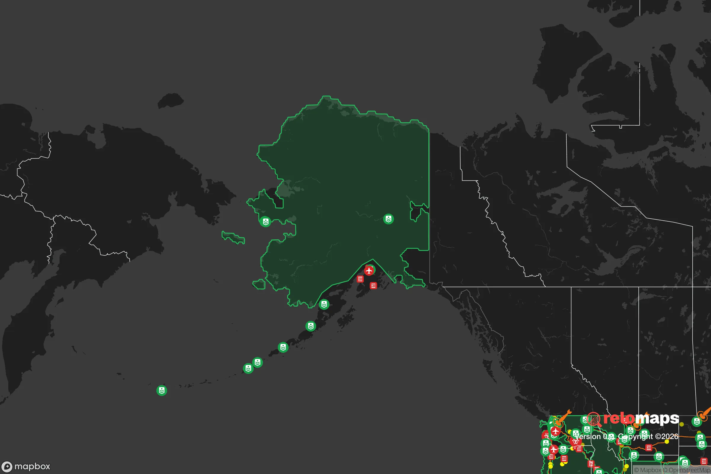
Important Note: For informational purposes only. This does not mean nothing bad ever happens in the green zones. Please use common sense. This is based on public data and modeled with AI. We tried to take a conservative approach but mistakes happen. We update this regularly as new information becomes available.
Solar Generator Recommendations
Backup power matters more here than in safer locations. We've picked three solar generators across budgets and capacity tiers — start with the budget unit if you only need a few essentials, or step up if you want to run a fridge and HVAC for days at a time.

Jackery Portable Power Station Explorer 300
Budget OptionPower on the Go: Weighing only 11 lbs, it's convenient to set up and store with book-sized foldable solar panels

BLUETTI Portable Power Station AC180
Designed for both indoor and outdoor scenarios, AC180 is highly capable as it has a robost capacity and continuous output power.

EF ECOFLOW DELTA Pro Ultra Power Station
Upgraded PickEcoFlow DELTA Pro Ultra is a whole-home energy system designed to grow with your family. Integrated with the Smart Home Panel 2, it scales to meet your evolving energy needs — keeping your home powered, intelligent, and secure through every stage of life.
We earn a commission, at no additional cost to you.
Strategic Assessment Analysis
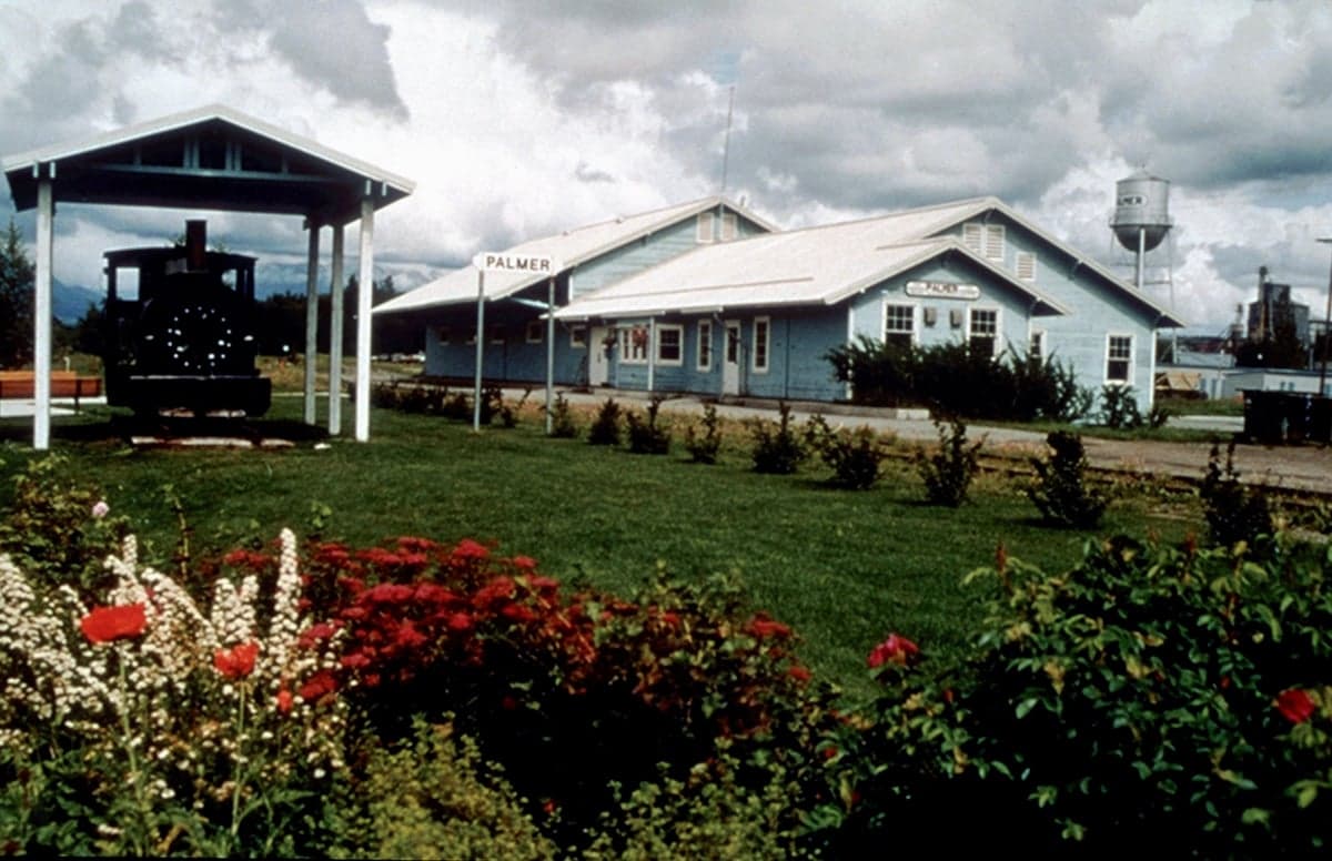
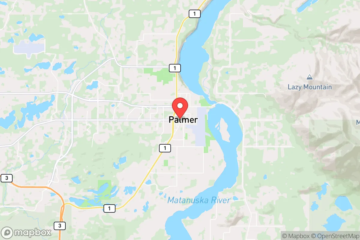
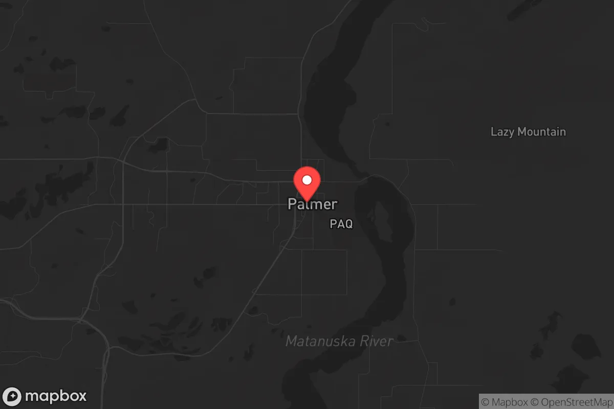
Palmer, Alaska, offers a rare combination of geographic isolation and practical self-sufficiency that makes it a serious contender for those prioritizing long-term resilience. Situated in the Matanuska-Susitna Valley, about 42 miles northeast of Anchorage, Palmer sits far enough from the state's largest population center to avoid the worst fallout of urban collapse, yet close enough to access critical supplies and medical infrastructure during stable times. For a conservative-leaning individual or family looking to weather civic unrest, economic instability, or large-scale disasters, Palmer's position as a regional agricultural hub, its access to fresh water, and its low population density create a strategic buffer that few other Alaskan towns can match.
Geographic position and natural advantages for long-term security
Palmer's location in the Mat-Su Valley is its single greatest strategic asset. The town is cradled by the Talkeetna and Chugach mountain ranges, providing natural barriers that slow movement and create defensible chokepoints. The Glenn Highway (AK-1) is the primary road link to Anchorage, and it can be monitored or blocked with relative ease if needed. Unlike the Kenai Peninsula, which has only one road in and out, Palmer has multiple secondary routes—including the Palmer-Wasilla Highway and the Old Glenn Highway—offering redundancy for evacuation or resupply. The surrounding terrain is a mix of boreal forest, farmland, and river valleys, which means ample cover and concealment for those who know how to use it. The Matanuska River runs through the area, providing a reliable water source that is less contested than the more developed Cook Inlet coastline. For a prepper, the ability to control access, maintain multiple egress routes, and leverage natural terrain for defense is invaluable. Palmer's elevation (roughly 240 feet) also keeps it above the worst of the valley's seasonal flooding, unlike low-lying areas like Willow or Houston.
Risks, exposures, and proximity to fallout-relevant landmarks
No location is without vulnerabilities, and Palmer has several that demand attention. The most immediate risk is its proximity to Anchorage—a city of nearly 290,000 people that would become a focal point for civil unrest, resource scarcity, and potential mass casualty events in a national crisis. In a scenario where Anchorage experiences a breakdown of order, Palmer would likely see an influx of refugees moving north along the Glenn Highway. The town's population of roughly 6,000 could swell rapidly, straining food, water, and medical resources. Additionally, Joint Base Elmendorf-Richardson (JBER) lies just 35 miles southwest of Palmer. While a military base can be a stabilizing force, it is also a high-value target for any adversary—whether foreign or domestic. In a major conflict or terrorist event, JBER could draw airborne or missile threats that would put the entire Mat-Su Valley at risk. Palmer is also within 100 miles of the Port of Anchorage, a critical logistics hub that would be a prime target for sabotage or attack. For those concerned with fallout from a nuclear detonation, prevailing winds in the region generally blow from the north and west, meaning that a strike on Anchorage or JBER could carry radioactive debris toward the valley. While Palmer is far enough to avoid immediate blast effects, the long-term contamination risk is real and should factor into any preparedness plan. Finally, the region's seismic activity—Alaska experiences more earthquakes than any other state—means that infrastructure like roads, bridges, and power lines could be compromised without warning.
Practical resilience for a relocator: food, water, energy, and defensibility
Palmer's agricultural heritage is a major draw for those serious about self-sufficiency. The Matanuska Valley is one of the few places in Alaska with deep, fertile soils capable of supporting large-scale vegetable and grain production. The Alaska State Fairgrounds, located in Palmer, host the region's largest agricultural events, and the surrounding area is dotted with farms producing everything from potatoes and carrots to hay and livestock. For a relocator, this means local food sources are not just theoretical—they are operational. The growing season is short (roughly 100 days) but intense, with long daylight hours in summer allowing for impressive yields. Greenhouses and cold frames extend the season significantly. Water is abundant: the Matanuska River and its tributaries provide year-round flow, and groundwater is accessible via wells at reasonable depths (typically 50–150 feet). The town's municipal water system draws from the river, but a private well with a hand pump or solar-powered backup is a wise investment. Energy is a mixed bag. Palmer is connected to the Railbelt electrical grid, which is powered by a combination of natural gas, hydro, and coal. This grid is vulnerable to disruption from earthquakes or fuel supply interruptions. However, the long daylight hours in summer make solar a viable supplement, and the surrounding forests provide ample firewood for heating. Many homes in the area already use wood stoves as primary or secondary heat sources. Defensibility is strong: Palmer's layout is compact, with a clear downtown core and residential areas that are easily observed from elevated positions. The surrounding mountains offer lookout points, and the road network can be monitored with minimal manpower. For a family or small group, a property on the outskirts—with a well, garden, and woodlot—provides a level of autonomy that is hard to find in the Lower 48.
The overall strategic picture for Palmer is one of high potential tempered by real, manageable risks. It is not a bug-out location for the unprepared—it requires planning, investment, and a willingness to adapt to a harsh climate. But for those who are serious about building a resilient life outside the shadow of urban collapse, Palmer offers a rare combination of agricultural capacity, defensible terrain, and relative isolation from the worst of America's likely flashpoints. The proximity to Anchorage and JBER is a double-edged sword: it provides access to supplies and medical care during stable times, but it also makes Palmer a potential pressure point in a crisis. The key is to treat Palmer as a base of operations, not a fortress. Build relationships with local farmers, learn the back roads, stockpile supplies for at least six months, and invest in redundant water and power systems. If you do that, Palmer can be a place where you not only survive but thrive—even as the world outside grows more uncertain.
* Values derived from national, state, county, city and local statistics and may differ in a specific area. Last updated: 2026-04-19T19:34:10.000Z
Narrative content on this page is AI-generated and may contain mistakes. Verify any details that matter before acting on them.
ReloMaps may earn a commission from affiliate links at no extra cost to you.