Photo: Wikipedia
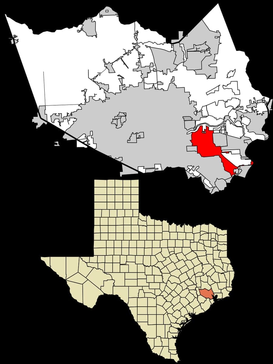
Strategic Assessment of Pasadena, TX
High tactical risk. This location is likely close to major population centers, strategic targets, or sits in a high-disaster corridor. A retreat property and careful exit planning is required.
What does the Strategic Assessment tell us?
Our Strategic Assessment grades tactical survivability of an area. Major population centers, military targets, fallout zones, natural disasters, and border exposure all drive risk — lower exposure means a more defensible position in a crisis.
This is heavily inspired by Joel Skousen's Strategic Relocation book. Highly recommended you checkout the book ($)What does this tell us?
Our Strategic Assessment grades tactical survivability of an area. Major population centers, military targets, fallout zones, natural disasters, and border exposure all drive risk — lower exposure means a more defensible position in a crisis.
This is heavily inspired by Joel Skousen's Strategic Relocation book. Highly recommended you checkout the book ($)Strategic Pillars

Key Distances
Regional Safe Places
Below is our recommended "safe zones" in Texas and the surrounding area based on our strategic heuristics. For most people, it's unrealistic to live in a “safe zone” full-time due to work, family or other personal reasons. They tend to be more rural. However, many of these areas are perfect for second homes and retreat properties that double as a vacation home or even a short-term rental.


Important Note: For informational purposes only. This does not mean nothing bad ever happens in the green zones. Please use common sense. This is based on public data and modeled with AI. We tried to take a conservative approach but mistakes happen. We update this regularly as new information becomes available.
Solar Generator Recommendations
Backup power matters more here than in safer locations. We've picked three solar generators across budgets and capacity tiers — start with the budget unit if you only need a few essentials, or step up if you want to run a fridge and HVAC for days at a time.

Jackery Portable Power Station Explorer 300
Budget OptionPower on the Go: Weighing only 11 lbs, it's convenient to set up and store with book-sized foldable solar panels

BLUETTI Portable Power Station AC180
Designed for both indoor and outdoor scenarios, AC180 is highly capable as it has a robost capacity and continuous output power.

EF ECOFLOW DELTA Pro Ultra Power Station
Upgraded PickEcoFlow DELTA Pro Ultra is a whole-home energy system designed to grow with your family. Integrated with the Smart Home Panel 2, it scales to meet your evolving energy needs — keeping your home powered, intelligent, and secure through every stage of life.
We earn a commission, at no additional cost to you.
Strategic Assessment Analysis
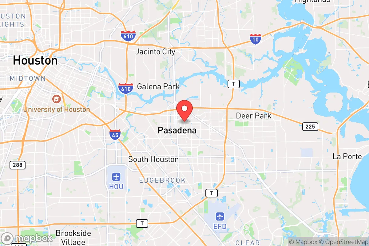
Pasadena, Texas, sits in a precarious strategic position that demands a clear-eyed assessment for anyone serious about long-term preparedness. Its location within the Houston metropolitan area offers immediate access to resources and infrastructure, but that same proximity to a major urban center, petrochemical complexes, and the Gulf Coast introduces significant vulnerabilities that a survival-minded relocator must weigh carefully. The area’s resilience is a double-edged sword: the economic engine of the Texas Gulf Coast provides jobs and supply chains, yet the concentration of industry and population creates a high-risk profile for civil unrest, industrial accidents, and natural disasters. For the conservative prepper, Pasadena is not a retreat—it is a forward operating base with serious exposure.
Geographic position and natural advantages for long-term survival
Pasadena’s geography is defined by its flat coastal plain, proximity to the Houston Ship Channel, and access to the Gulf of Mexico. The area sits at roughly 30 feet above sea level, which places it squarely in the flood-prone zone of the San Jacinto River and Galveston Bay watersheds. The natural advantages are limited but real: the region’s subtropical climate allows for year-round growing seasons, and the abundant rainfall—averaging around 50 inches annually—means water is rarely scarce. The nearby Brazos River and numerous bayous provide surface water sources, though all require treatment before consumption. The flat terrain offers no natural defensive high ground, but it does allow for easy movement and line-of-sight observation in a grid-down scenario. The area’s position along major transportation corridors—Interstate 45, State Highway 225, and the Gulf Intracoastal Waterway—means that resupply and evacuation routes are plentiful, though they would also be choke points during a crisis. For a relocator, the key takeaway is that Pasadena offers reliable water access and a long growing season, but the lack of elevation and dense urban sprawl severely limit defensibility.
Risks, exposures, and proximity to fallout-relevant landmarks
The most glaring risk for Pasadena is its location within the Houston–Sugar Land–Baytown metropolitan area, home to over 7 million people. In a civil unrest scenario, the sheer population density means that supply chains would collapse quickly, and the city would become a focal point for looting, violence, and resource competition. The petrochemical infrastructure along the Houston Ship Channel—including refineries in Pasadena, Texas City, and Baytown—presents a catastrophic hazard. A major industrial accident, whether accidental or targeted, could release toxic clouds, trigger explosions, or contaminate groundwater for decades. The proximity to the Port of Houston, one of the busiest ports in the nation, makes the area a potential target for sabotage or military action during a broader conflict. Additionally, the region’s vulnerability to hurricanes is well-documented: Hurricane Harvey (2017) dumped over 40 inches of rain on parts of Harris County, causing widespread flooding that stranded residents for days. For the prepper, these risks are compounded by the fact that Pasadena is within 20 miles of multiple high-value targets, including the Johnson Space Center, the Port of Houston, and major chemical plants. Evacuation routes would be clogged, and emergency services would be overwhelmed in any large-scale event.
Practical resilience for a relocator: food, water, energy, and defensibility
For a single individual or family looking to establish a resilient household in Pasadena, the practical challenges are significant but not insurmountable. Water is the most critical resource: while municipal water comes from surface sources like Lake Houston and the Trinity River, a grid-down scenario would cut off treatment and distribution. A prepper should plan for at least two weeks of stored water per person, plus a reliable filtration system (e.g., Berkey or Sawyer) and knowledge of local bayou access points. Food security is more feasible: the long growing season allows for three-season gardening, and the area has numerous feed stores and agricultural supply outlets. However, soil quality in the coastal plain is sandy and acidic, requiring raised beds or heavy amendment. Energy resilience is a mixed bag: the Texas grid has proven unreliable during winter storms (see Winter Storm Uri in 2021), so solar panels with battery storage are a wise investment. Natural gas is widely available, but a propane backup generator is more practical for extended outages. Defensibility is the weakest link. Pasadena’s suburban layout—with grid-pattern streets, minimal natural barriers, and high population density—makes it difficult to secure a property against determined threats. A relocator should prioritize a home on a corner lot with clear sightlines, reinforced doors and windows, and a plan for neighborhood mutual aid. Community is the real force multiplier here: forming a trusted network of like-minded neighbors can offset the lack of natural defensive terrain.
The overall strategic picture for Pasadena is one of calculated risk. It is not a bug-out location or a remote homestead—it is a working-class city with industrial muscle and urban exposure. For the conservative prepper who values economic opportunity and community ties over isolation, Pasadena offers a viable base of operations, provided that serious mitigation measures are in place. The key is to treat the area as a temporary hub rather than a final retreat: stockpile supplies, build local alliances, and maintain a vehicle capable of a rapid overland evacuation to the Hill Country or East Texas piney woods. In a world where the grid is fragile and civil order is uncertain, Pasadena demands constant vigilance—but for those willing to put in the work, it can be a place to ride out the storm rather than be consumed by it.
* Values derived from national, state, county, city and local statistics and may differ in a specific area. Last updated: 2026-05-03T04:48:54.000Z
Narrative content on this page is AI-generated and may contain mistakes. Verify any details that matter before acting on them.
ReloMaps may earn a commission from affiliate links at no extra cost to you.